4 The Crescent
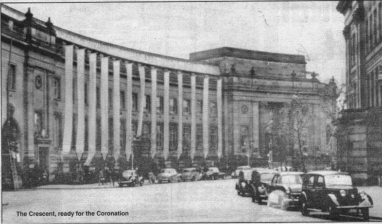
The Crescent ready for the Coronation in 1953
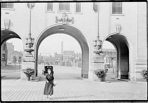
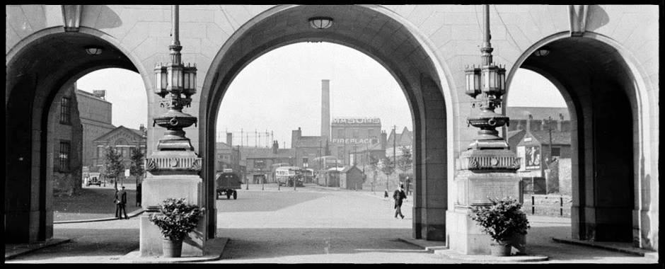
Right: Looking through the arches in Le Mans Crescent across to Moor Lane and Masons.
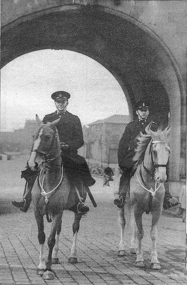
Inspector J H Lythgoe,who had served for over 33 years, on Periwinkle, the force’s youngest horse, with the section’s youngest member PC John Tomlinson ex Dragoon Guards on a more experienced horse. Periwinkle was often known as Perry, the other horse is Howdy (or How-do-you-do) according to respondents to a facebook posting.
Dorothy Bernal:- The chestnut on the right looks like Howdy who was at Firwood in the 60s.
Isabel Jackson:- Yes Dorothy it is Howdy and the horse on the left is Perry. She was so well-trained she even knew when the traffic lights changed!!
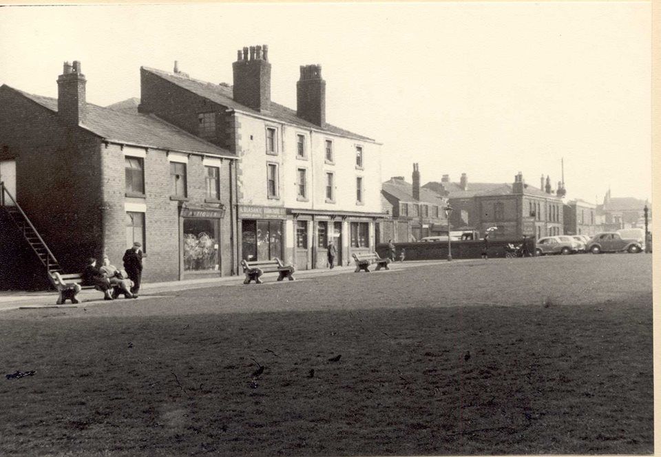
Above: The Crescent in the early 1950s?
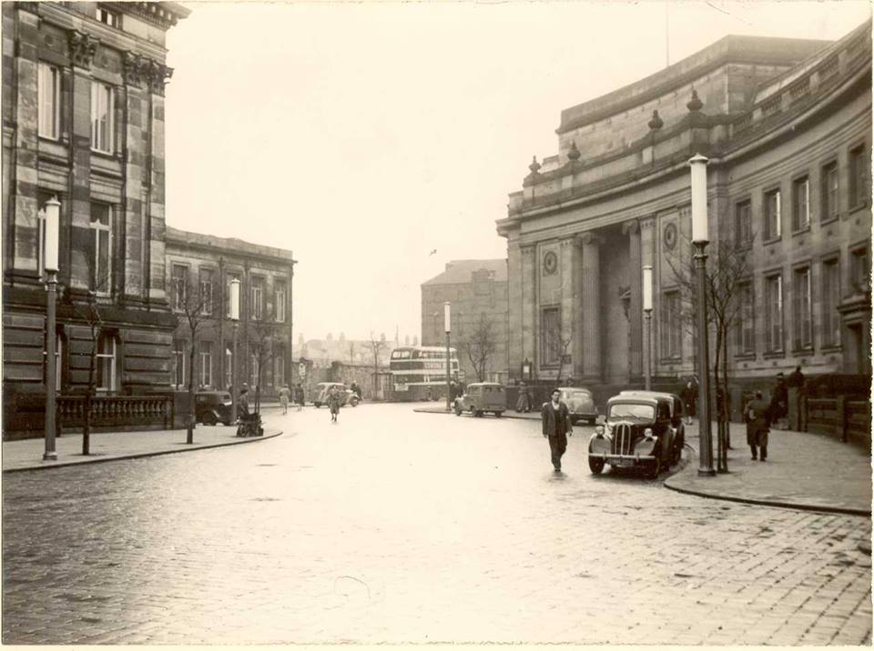
Above: probably 1950s again. When did we get those lamps? You will notice the Victoria Building where the Wellsprings now stands and to the front of the bus Magee's bonded warehouse immediately beyond Ashburner Street. Between those two, a row of houses has been demolished where some time later the Octagon Theatre (opened November 1967) will be built.
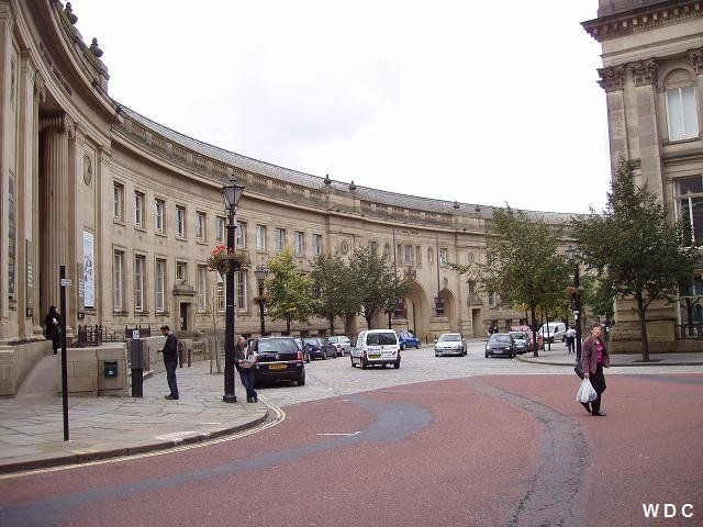
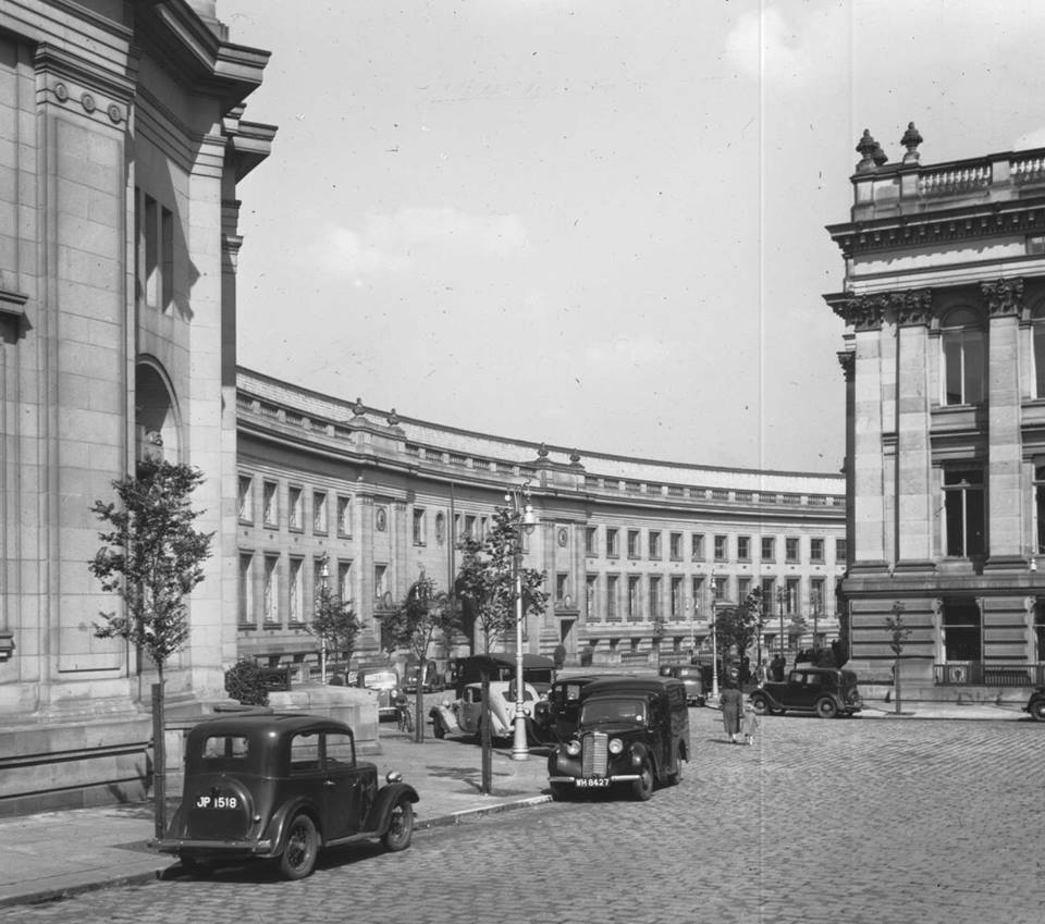
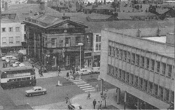
Above: (C)WDC much nearer the present time, September 2009, but still a pleasing lack of white paint on the road to organise parking.
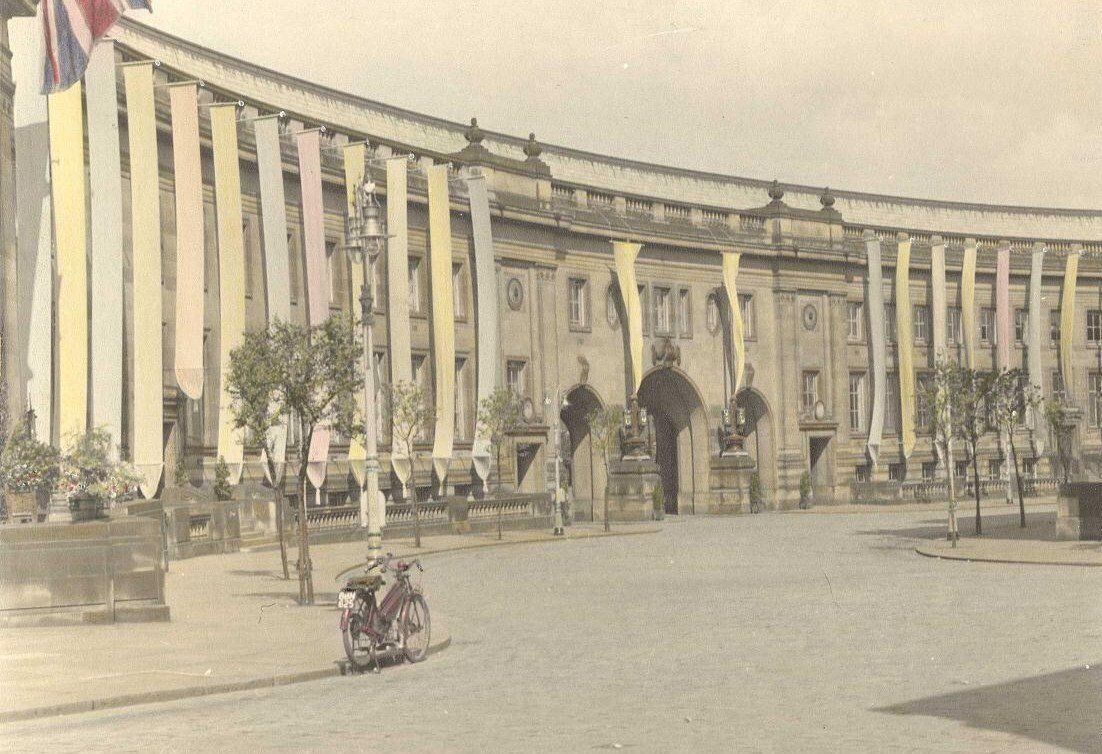
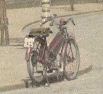
Above: a close up of the motorised bicycle parked by the pavement in the picture above.
left: Bolton Archives
Probably 1937 from the Humphrey Spender "Worktown" project.
You can see the gas works, Elim Chapel, Albion and Mason's fireplaces.
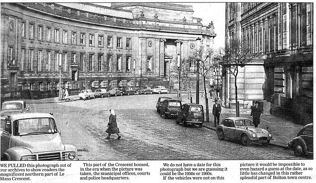
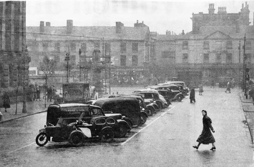
Left: c 1960. A typical view of the Crescent when parking was a little more informal.
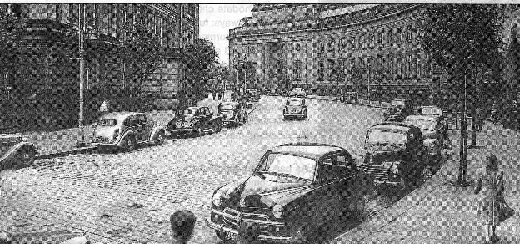
c 1950
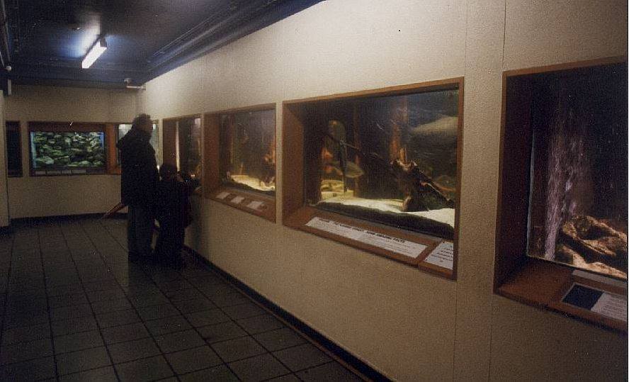
Above: And of course if you ascended the steps seen on the picture to the left you had access not only to the library but "Mum, can we see the fishes?"
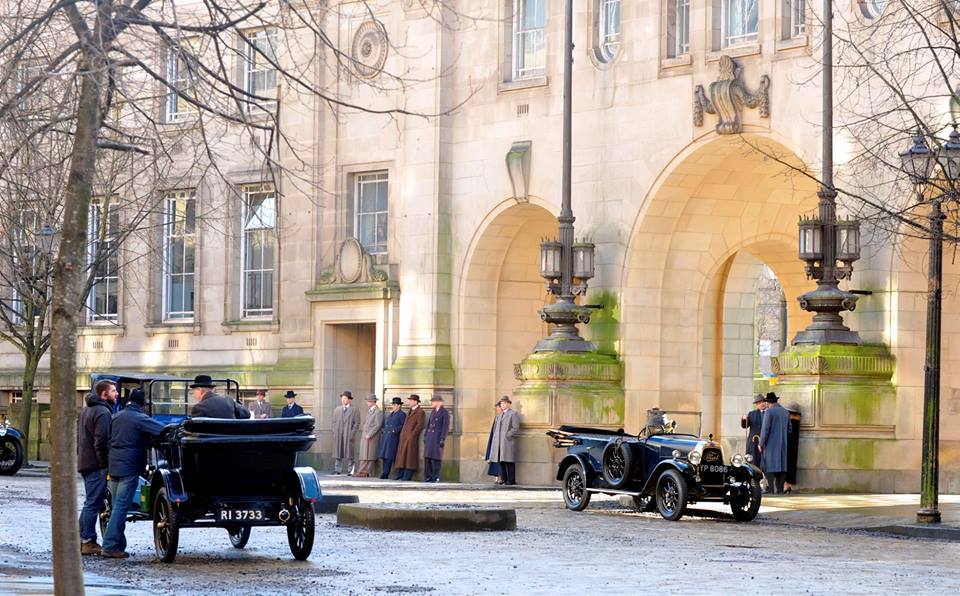
2015 A pause during the shooting of an episode of "Peaky Blinders", one of many films and TV series using our fine crescent as a back drop.
Now we take a large step back in time to look at Howell Croft before the Crescent was conceived.
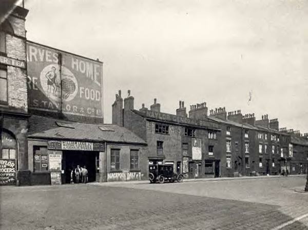
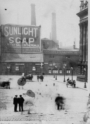
Right: This picture is probably earlier the buildings being in much better condition. They look due for demolition in the picture above. Now we have Sunlight Soap instead of Harvest Home Food, Naylor's was Naylor's Steam Printing and its wall has not been defaced by painted adverts.
We note the very stylish lamps which had been placed round the Town Hall, closer together than you might expect and with a larger one on the corner.
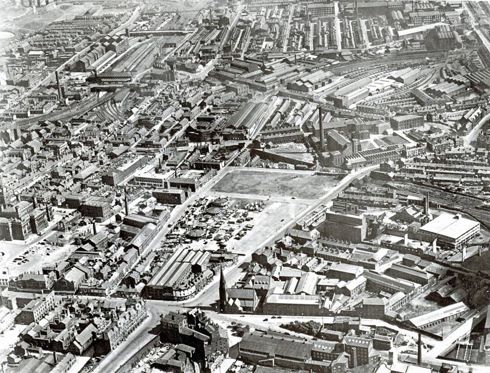
We look over the foreground buildings to see buildings and chimneys of the industrial complex between Moor Lane and Blackhorse Street, Iron and steel works, Brass works, Bessemer Furnace. This very old photograph has some damage and also suffers from people having moved during the fairly long exposure.
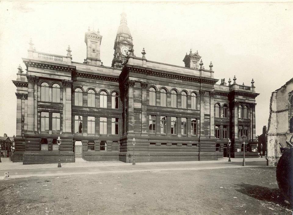
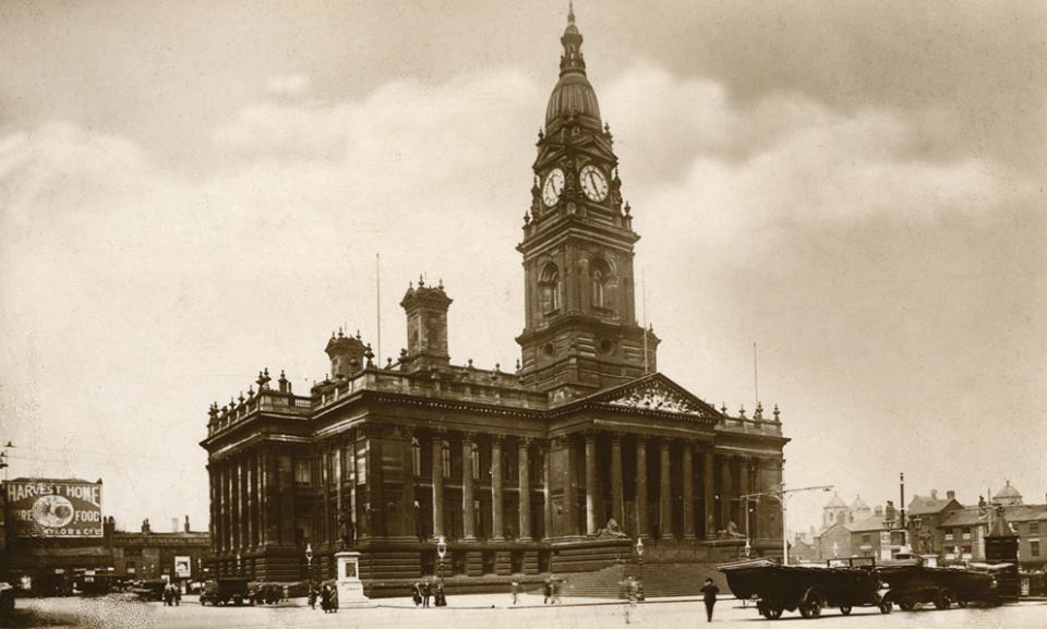
What a truly magnificent sight is presented by our Town Hall in around 1920 though its surroundings of Howell Croft and the north side of Victoria Square are rather less grand. You can however see the imposing domes of the Aspin Hall some way away.
At the side of the Town Hall we see that there was already quite some demand for car parking space.
And at the rear of the not yet extended Town Hall we look along Howell Croft to see the block of buildings in what we always knew as Howell Croft North, including Betty's Sweet Shop, which remained standing until demolished in 1968/9 to make way for Paderborn House. Beyond that we see the Aspinall Buildings with the Aspin Hall.
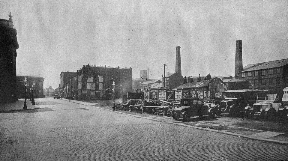
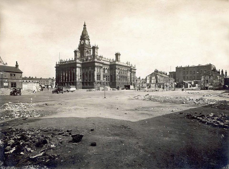
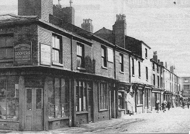
No-one is now likely to remember this. This is what was demolished to make way for the Crescent. At the left is roughly where the Library is now. At the opposite end of the block (to the right) is the Town Hall Tavern.
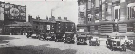
We have S Taylor, purveyor of tea coffee and groceries, William Lees a motor coach proprietor who runs daily trips to Blackpool - though this may have been in the Bolton Holidays, and Naylor General Printer whose wall is covered with painted advertisements few of which can now be read, but we make out Foster's Tailors, Furnishing and Workshop.
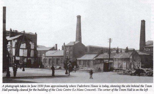
June 1930
Demolition of buildings behind the Town Hall in preparation for building the Crescent. Again we are looking at chimneys between Blackhorse Street and Moor Lane.
The gable end at left becomes a landmark for locating various other pictures. We are standing at the opposite back corner of the unextended Town Hall for the previous pictures.
Near the centre of the picture is a steam traction engine.
The demolished buildings to the right of the gable had been on Howell Croft. The buildings still standing are on Spring Gardens.
Viewed from slightly further back than the previous picture and turned slightly to the left to give a view along Howell Croft with the original back of the Town Hall on the left and the Spring Gardens Buildings and the gable end on Howell Croft to the right.
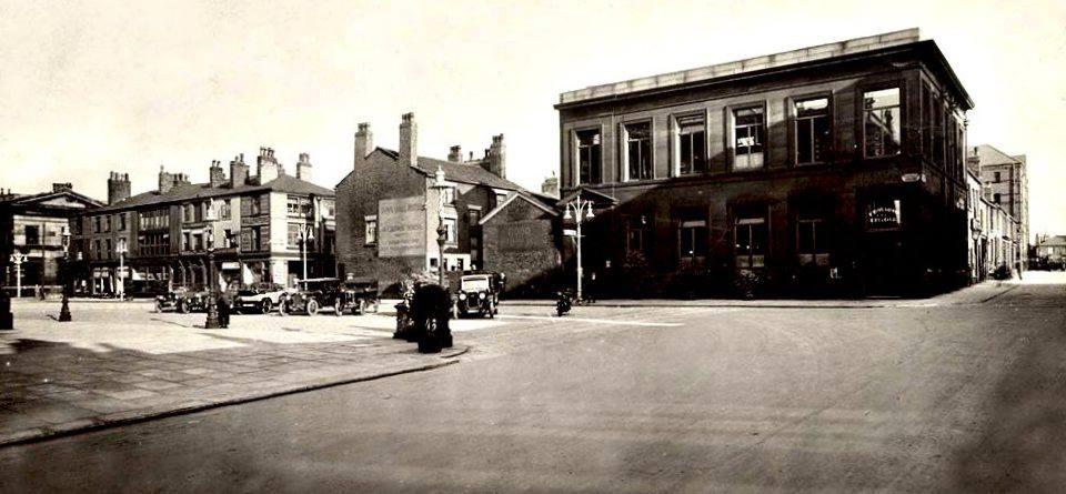
Just beyond the Town Hall is the Victoria Building, at one time the Victoria Restaurant (1948-1951) which remained until replaced by Wellsprings.
The rear of the unextended Town Hall. The gable previously mentioned is on the right and we are looking across Howell Croft.
To the right of the Town Hall you can see the gable of the Town Hall Hotel which was on the south side of the Square. To the left you can see the Commercial Hotel in its north-east corner.
The photographer is on Spring Gardens or Back Spring Gardens to survey the utter devastation that preceded the building of the Crescent and the Extension of the Town Hall. Note the gable end again on what is left of Howell Croft.
On the left we see the block of buildings including Betty's Sweet Shop which became Howell Croft North.
Then we see through to the shops on Victoria Square opposite the front of the Town Hall.
This picture is dated July 1930 "after the eradication of 'sub-standard' property".
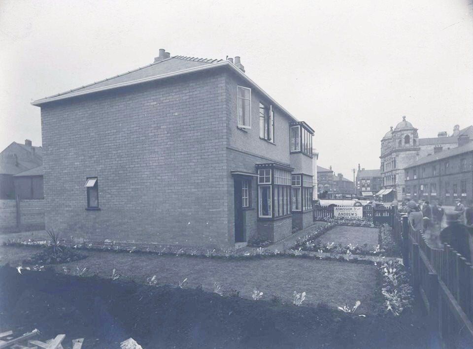
Civic Week 1928
This pair of semi detached houses was built apparently to show the inhabitants of Bolton what wonderful living accommodation would be available for them now that the Council had demolished all the slums they were used to living in. It was an advertisement for Andrews (hidden by plants) and you could look around for 3d (three old pence, a little over 1p of decimalised money but quite a decent sum in 1928). The two houses are different which is quite unusual for semis but was perhaps to show the different options available.
They are located at a position which today would be between the back corner of the Town Hall and the Magistrates Court steps.
Notice the Betty's Sweet Shop block leading to the Aspin Hall.
Across Deansgate is Central Street.
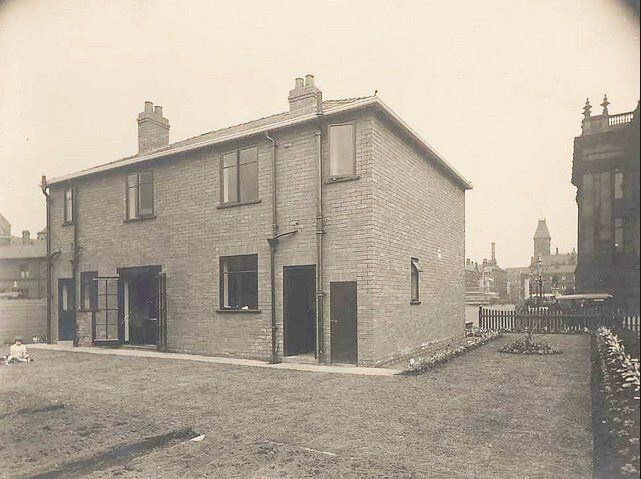
At the back these houses are plain and almost ugly. Again the two halves are different, on the right we have a coal hole, a back door and a plain window; on the left we have a back dook, a kitchen window and a French window. You seem to get a little girl with this one.
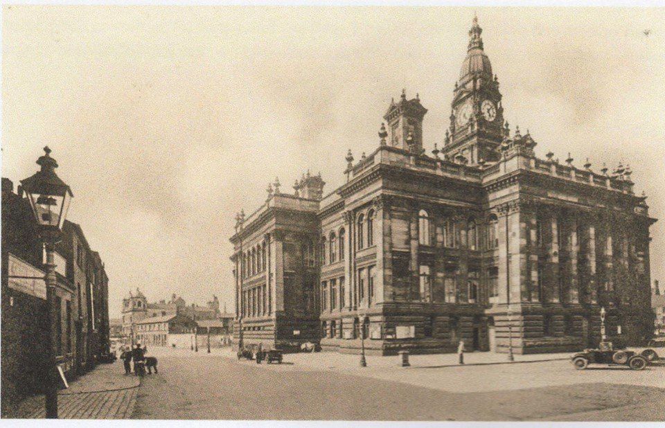
We are looking along the north side of the Town Hall to the Victoria Square shops on the corner of Hotel Street, the Gas Offices Tower and the Tillotson's printworks chimney.

1920s
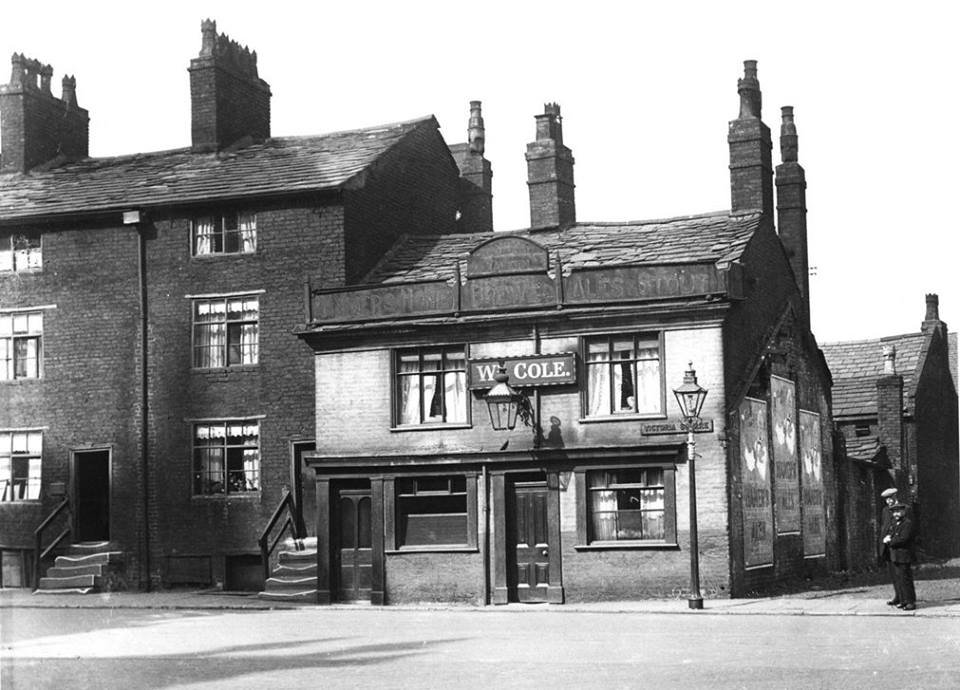
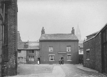
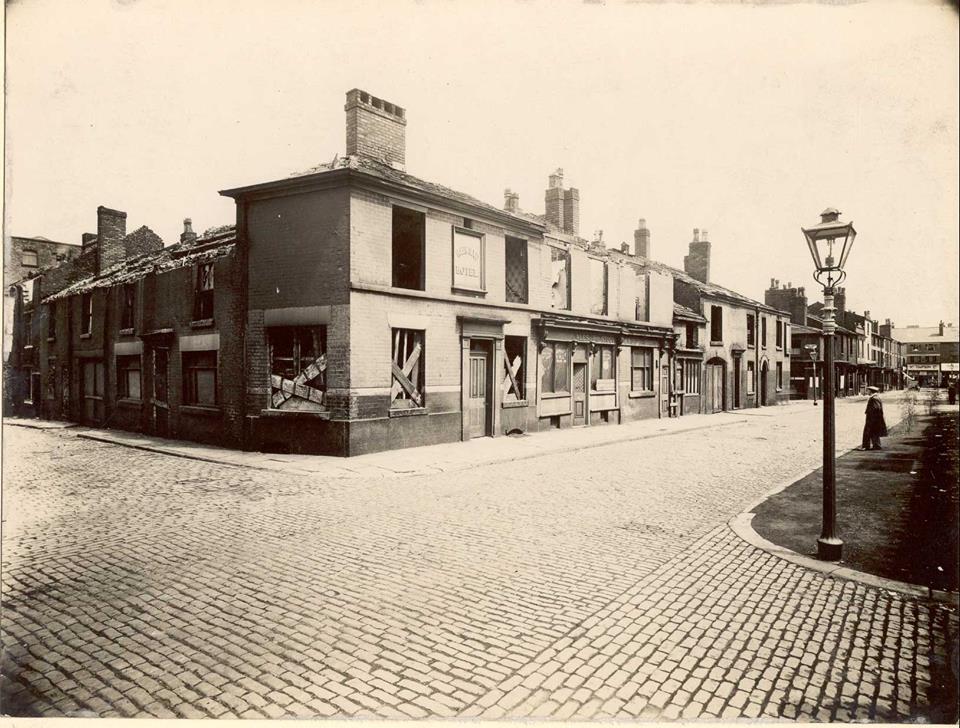
The Town Hall Tavern at the right-hand end of the block we saw earlier with the "Harvest Home Pure Food sign which is now the Crescent. Notice the street name is Victoria Square (not Howell Croft). The are was previously known as Town Hall Square which was a large open space stretching from this row of buildings to the shops behind the cenotaph. This pub is called the Town Hall Tavern; the (first phase, front half of the) Town Hall was built in 1873, either an existing pub was renamed some time after 1873 or an existing building became a pub at that time. It is somewhat
out of context with the adjoining weavers’ cottages and was probably built as a pub. The whole block was demolished to make way for the Civic Centre crescent in 1925.
1928 posted on Facebook by Peter Lodge
The unextended Town Hall is on the left hand edge, about half way up the picture. To its right is the area of demolition was have seen on previous pictures with our land mark gable end.
Then a jumble of properties around Queen Street before we reach the very clearly defined Blackhorse Street. To the right of this is the recently cleared area of the Bessemer Furnace and the iron and steel works occupied a this time by a fairground, a tradition that continued at Bolton Holidays and New Year until the 1960s. Below this the railway warehouses remain with the White Horse on the corner and above it the area that was to become the Ashburner Street market with New Street and the railway line behind it. Continuing to the right we see the gasworks and Flash Mills.
At the bottom, Spa Road, St Paul's, the fire station, the GPO and the Hippodrome.
Immediately behind Howell Croft and parallel with it were Spring Gardens, Back Spring Gardens and Queen Street. This picture was taken from the top end of Queen St, looking across to the Eagle and Child on Back Spring Gardens. The building on the left is labelled "Mission Hall & Ragged School" on an 1891 map. It is Queen Street Mission which retained that name after it moved to Central Street.
Grafitti even in those days!
The Queen Street Mission was originally founded in an old brass foundry in Collingwood Court off Deansgate by Mr and Mrs George Clough Barlow in 1873. A Sunday evening school and a free night school were held for children rescued from the streets. In 1874 a non-denominational Christian religious service for adults was commenced on Sunday afternoons and in 1875 a full time missioner was appointed. Five freehold cottages in Queen Street were purchased by the Mission in 1876. The Mission moved to Central Street in 1893.
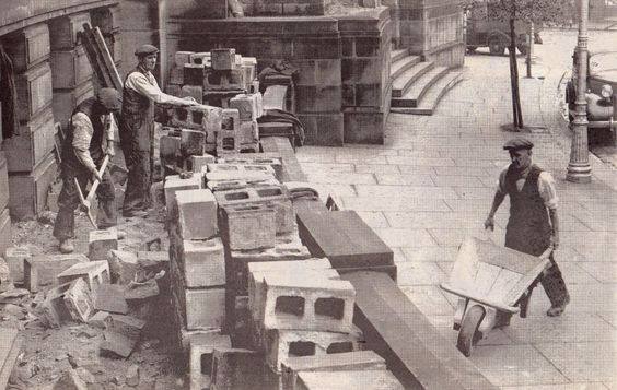
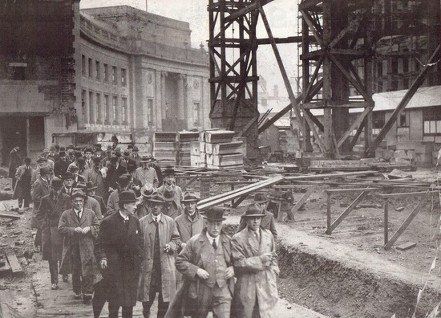
We've done with demolition; let's get building. Picture around 1933, the Magistrates Court and its steps are finished. I had not expected to see breeze blocks in our prestigious construction in1933. Picture from David Whenlock's collection.
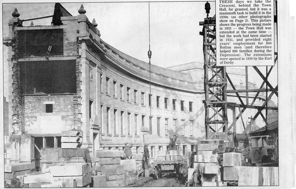
Work on the extension of the Town Hall and the building of the Civic Centre, (The Crescent, later Le Mans Crescent) started in 1931. These pictures are dated 1933.
c1934
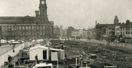
Work is well underway with the Crescent and with the Town Hall extension. You can see the old back or the Town Hall still intact in the middle of the new building. There is a startling contrast between the pristine whiteness of the new building and the smoke soiled blackness of the older part.Behind the clock tower is the still clean Oxford Street Co-op and also still clean is the building on the corner of Deansgate and Knowsley Street erected c1930. The lines of Old Hall Street and Howell Croft are clearly seen, now divided by the Town Hall. The Wholesale Market and Magee's bonded warehouse are at the bottom of the picture with Ashburner Street going almost all the way across.
In 1937 (38?) when the new library was completed at the south end of the Crescent it was necessary to bring all the books from the lending library in the Victoria Building (now Wellsprings) and the Reference Library in the Exchange Building into their new home.
A set of stepladders at the right edge are probably part of this operation.
We now explore the south end of the Crescent, south of the Town Hall and Howell Croft South
Sadly we have no information about this Trade display or exhibition except a date of the 1880s. The gable with two chimneys is or later became the Town Hall Hotel.
The strange structure above the buildings at the centre of the picture is probably the array of telephone wire supports we saw on an earlier page.
1920s The Town Hall Hotel (closed 1923) is now obviously that. The centre of this road seems to have been regularly used as a car park at that time. T
he Town Hall is immediately off picture on the left. We see the gable of the Town Hall Hotel and to its left the row of shops very familiar to people before the widening of Newport Street at the end of the 1950s.
Going forward on the right hand edge of the picture is Howell Croft South with a row of properties then the Magee's bonded warehouse and Great Moor Street in the far distance.
There are two stone buildings one on the left and one on the right, both of which used to be libraries: the Exchange Building at far left (still exists) and the Victoria Building on the corner (now replaced by Wellsprings).
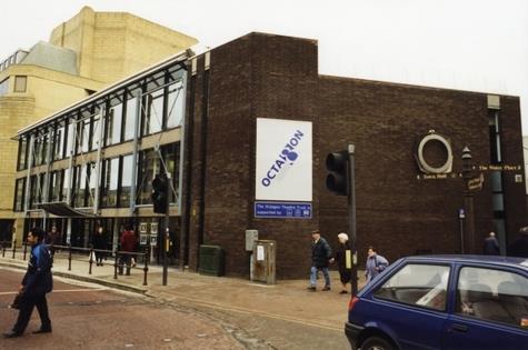
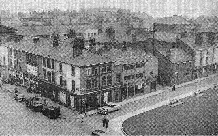
c1957 The left hand end of the block of shops on the previous picture, very familiar to many people of a certain age. They are about to be demolished for the widening of Newport Street and the redevelopment of the are which became the Octagon Theatre and the Octagon Car park.
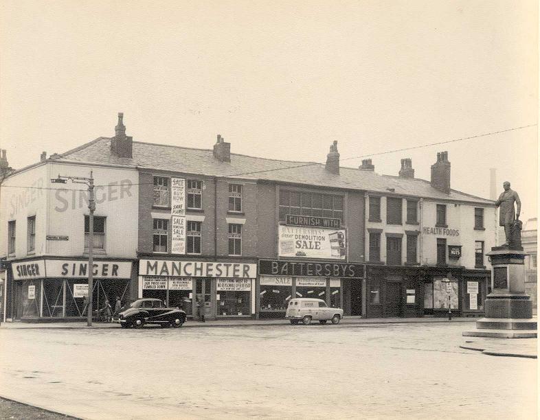
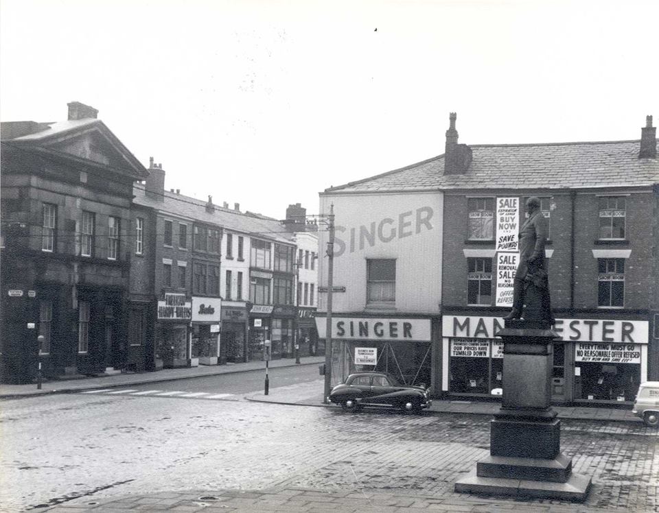
The same shops at the same time. (Same cars!) The corner of Newport Street and Victoria Square. Singers and Manchester Furnishers are having closing down sales before the demolition of this block and this side of Newport Street.
Manchester went to Deansgate between the GPO and the fire station.
The grand Exchange Building looks rather dark and forbidding.
Picture from the collection of Angela Thompson.
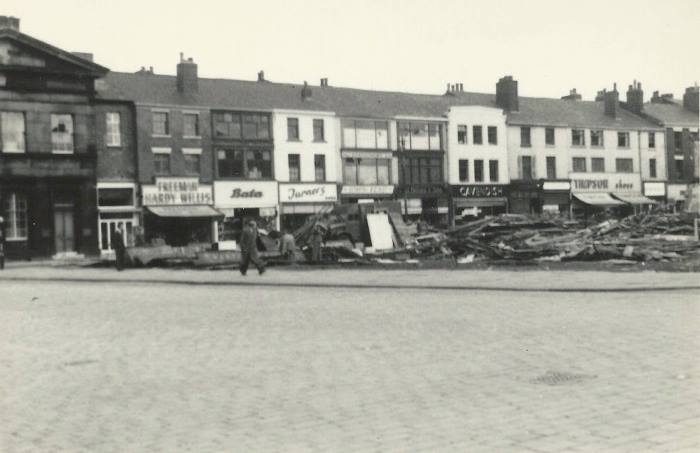
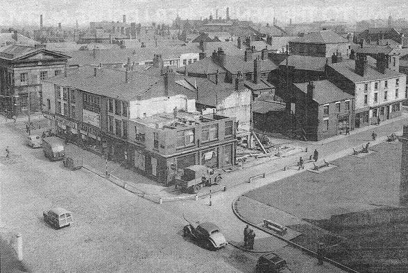
All demolished but no rebuilding started yet. We have a clear view through to the Great Moor Street crossroads with Shannon's then on to Trinity Church.
Look at those cars of the late 1950s! we have just passed the sudden transformation from black ones with mudguards to more modern shapes and lighter colours.
Picture posted on Facebook by David Whenlock.
Bolton News picture 1958.
Notice to the right that at this date no redevelopment has yet begun; the Arndale does not yet exist. We note the Commercial Hotel, the tower of the Gas Offices and the shops opposite the Town Hall known to generations of Boltonians.
That corner of Victoria Square and Newport Street is now occupied by a new building.
Back to the 1920s for that block of shops, the wallpaper shop on the corner of Old Hall Street South and the Town Hall Hotel originally called the Stork Tavern and renamed by the landlord Henry Grindrod before the Town Hall building was completed in 1873, the pub which had been in the middle of a block now finding itself on the end of the block close to the new Town Hall.
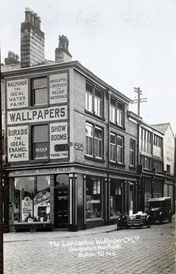
The wallpaper shop on the corner of Old Hall Street South. Picture from David Whenlock's collection.
<<<<< Picture posted on Facebook by Henry Lisowski.
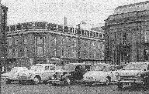
Probably 1960s.
Vehicles in same place but rather more modern than in the previous picture.
Here is the far end of the line of cars we saw just above. We can now see the front of the Town Hall Hotel as we look along Old Hall St South to the old wholesale market behind Howell Croft South. At the far end was a tram terminus, From 1947 to the right of the market roofs was the trolley bus terminus.
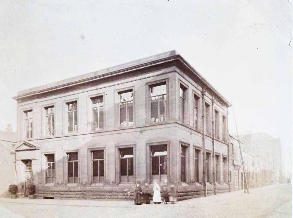
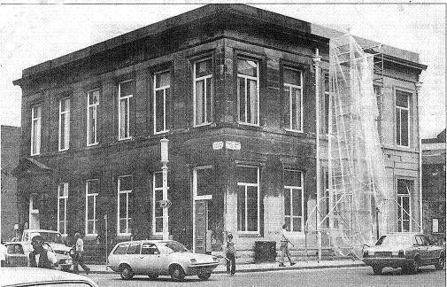
A very early picture of the Victoria Building. Victoria Square to the left, Howell Croft South forward on the right. Note that at the right hand end of the building we have a window whereas all other pictures have a door – so this dates it to before all the other pictures of this building.
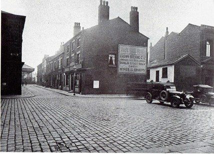
To the right, sadly very pale, we see houses along Howell Croft as far as Ashburner Street and then the solid mass of the Magee's bonded warehouse.
from the collection of Angela Thompson
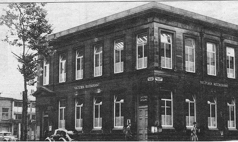
Victoria Building as the Victoria Restaurant which closed in May 1951 though this picture must be later in the 1950s because all the buildings between it andOld Hall Street have been demolished.
"This solid stone edifice at the southwest corner of Victoria Square was opened as a lending library in1893 and remained as such until the new Public Library in the Crescent was ready in 1938.
12th July 194 8the building opened its doors as the Victoria (Civic) Restaurant but closed in May 1951.Since then the building has housed National Insurance and local government offices before going full circle with the opening of the Bibliographic Services Unit of the Bolton Public Libraries Department.
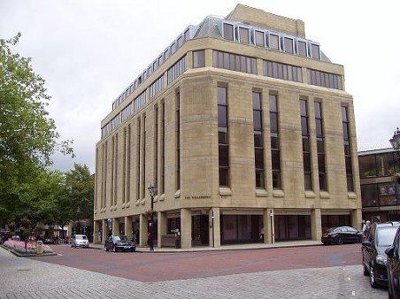
The Wellsprings building now stands on this spot.
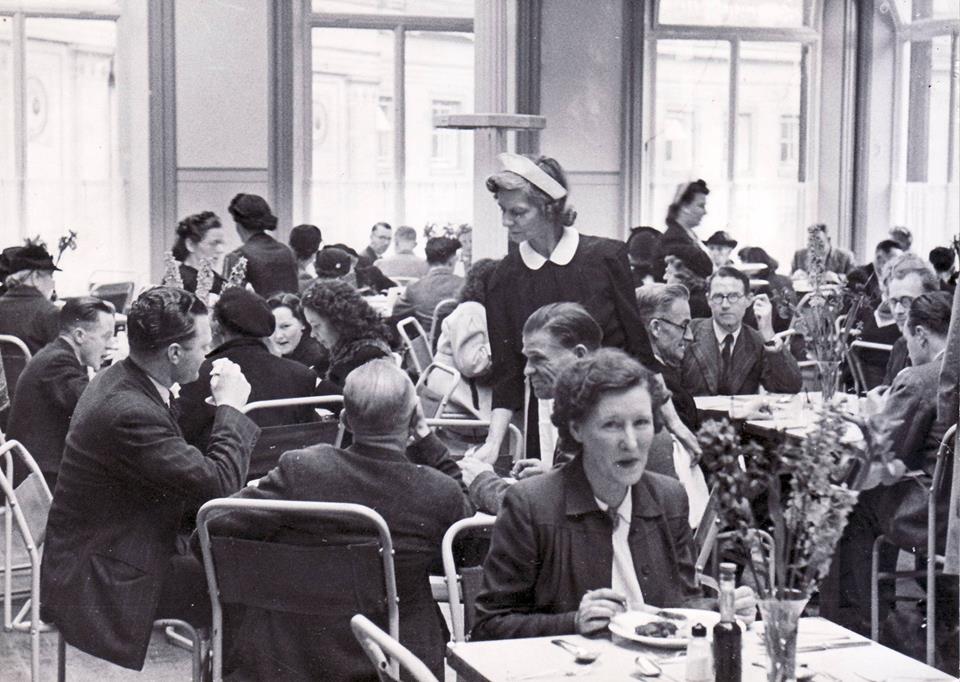
The Victoria Restaurant c1949
The entrance to the Library and part of the Crescent can be seen through the windows.
Picture posted on Facebook by Anne Littler
August 1979, Victoria House on the corner of Victoria Square and Howell Croft South. Workmen sandblasted the stonework in a belated spring-clean which cost more than £950.
(C)WDC September 2009
The Wellsprings
The lead occupant was Barclays Bank who latermoved out to the Mothercare building at which point the Bolton News moved in from their slightly out of the way building in Churchgate.
Shame as it is to lose the old buildings, this is not out of character with the neighbouring Crescent and it is perhaps more in keeping with the image of a modern progressive town than what it replaced.
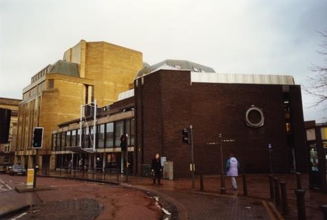
The Octagon Theatre is to the right.
April 1957 That block of shops once again ready for demolition but we are continuing our travel south. This is the corner of Victoria Square and Old Hall Street South. Old Hall Street once stretched from Ashburner Street to Deansgate but it was cut in two by the building of the Town Hall.
At far right, Ashburner Street is just off the picture.
The grassy area is the result of demolition twenty years earlier.
1957 an almost identical picture to the previous one but just a few weeks later. Demolition has starte though just at the moment Manchester and Battersby's seem still to be active.
The other end of the block with the Market Hotel on the corner of Old Hall Street North and Ashburner Street. If you turn left then immediately right you will be on Coronation Street with the building with the tall chimney on your left. The cars are parked on the Ashburner Street car park behind Howell Croft bus station.
Taken by Bill Shaw of Montrose Avenue in 1956 – does he mean 1957? This is Ashburner Street between New Hall Lane South and Newport Street. The pub is the Market Hotel, in the 1930s its landlord had been a friend of Bill Shaw’s family, Billy Eatock, a well known boxer who used to train other boxers in a room upstairs. The hotel was demolished in 1957. In those days carparks were just empty spaces – no charge.
BRUSHES is quite a landmark and can be seen on quite a few other pictures, helping to locate them correctly. It is opposite the end of Coronation Street and can be seen along its whole length.
A few years previously we could look across to that block from Howell Croft South close to where the Octagon Theatre would be built.
The Town Hall Hotel and some building to its left have been demolished giving a clear view to the Victoria Square shops above which the printworks (Tillotson's) chimney is visible.
Same view in 1957. All the property bounded by Newport Street, Old Hall Street and Victoria Square has gone and the whole block of premises opposite the front of the Town Hall, from the Exchange Building to Naisby's can be seen.
Into the picture on the right is Ashburner Street.
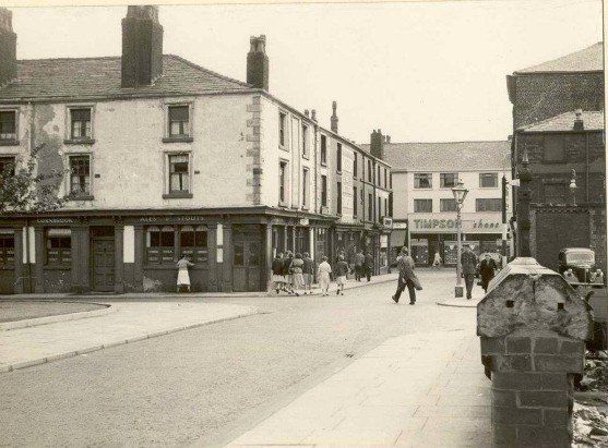
1946 Ashburner Street looking from the corner of Howell Croft South to Newport Street where Timpson's gives a clue to our whereabouts.
The Octagon Theatre now stands on this corner. Immediately to our right was the Magee's bonded warehouse now replaced by the Octagon multi-storey car park.
In the middle of the block is the Hole i' th' Wall public house. The white building towards the end of the street is the Market Hotel with Old Hall Street South to this side of it though it cannot be seen on the picture.
Ashburner Street with Old Hall Street on the left with the Market Hotel on the corner.
We have stepped back for a longer look down Ashburner Street. The thoroughfare across the picture is Spring Gardens which no longer exists. On the near corner is the Robin Hood Hotel separated by a sort of ginnel from he Founders Arms. The whole of this block is now the end wall of the Crescent, the side of the Library. To the left of the lamppost is Howell Croft South. Further away we have the Hole i' th' Wall and the Market Hotel. At the far end we can see Newport Street though the shop we know as Timpson's does not seem to bear that name at this time.
Back to Howell Croft South looking across the top of the lower part of Ashburner Street.
The new shops on Newport Street and Great Moor Street have been completed but we still have the Magee’s bonded warehouse, there is no Octagon and the Howell Croft bus terminus is still in use. No demolition yet at Dawes Street or Hick Hargreaves.
To the left of the bonded warehouse is the cafe at the corner of the bus terminus.
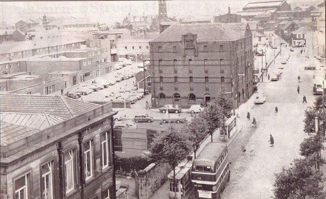
1964 The bonded warehouse in all its gloomy glory Beyond it we see the Daubhill and Deane bus terminus. Trolley buses have been discontinued. We see more clearly the little cafe at the corner of the bus station. The new Newport Street and Great Moor Street shops are now in place and the Wheatsheaf has been rebuilt. A large part of the scene is now covered by the Octagon car park.
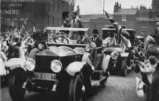
1921 The Prince of Wales pays a visit to Bolton. The motorcade is heading onto the Wholesale market. We are looking along the side of the bonded warehouse, across Ashburner Street with the Hole i'th' wall pub and the Town Hall behind.
Edward Albert Christian George An drew Patrick David was born 23 June 1894 during the reign of Queen Victoria. His father would later become King George V.
On 2 January 1936 at the age of 41 he became King Edward VIII but was never crowned, abdicating in December the same year "unable to bear the burden of office without the support of the woman he loved" or words to that effect, though in truth there was more to it than church and parliament refusing to allow the king to marry a divorcee, a foreigner, a woman without royal blood. The scandals involving Edward and Wallis Simpson put all the shenanigans of earlier royals into the shade. He was also too close to Hitler.
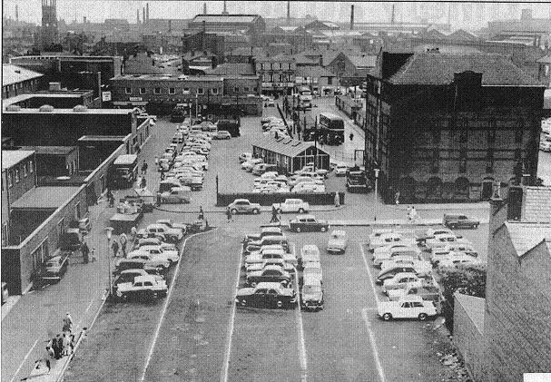
1961 - Name That Car
Howell Croft across the picture.
Ashburner Street crossing it with the bonded warehouse just on the left hand edge and Lever Chambers in the centre of the picture in process of having an extra storey added. The end of the library is at the right.
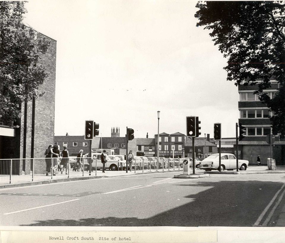
Howell Croft South. after trolley bus terminus closed, after Octagon had upper storey added. Where the cars are parked is now the site of the Octagon Multi-storey car park.