
cr4 Through the Town
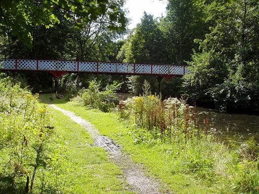

We soon reach Dobson Bridge which was the main access to the Park from town via Spa Road. This view is from upstream of the bridge. The area is normally well populated with ducks and geese. Dobson Bridge, built in 1878, was closed in 2003 because it had corroded and become unsafe. It was feared that the bridge would be demolished but repairs began 2009 as part of a multi-million pound refurbishment of the park (£500,000 for the bridge) and it was reopened 2010.
(C)WDC August 2012

Above - the approach to Dobson Bridge from Spar Road, corner nearest town.
Left - Coat of Arms on the pillar at one end of the bridge dated 1878
(C)WDC August 2012
Above - View downstream from Dobson Bridge
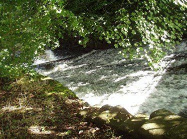
Left - A little way below Dobson Bridge: an inclined plane rather than a weir, which had raised the level upstream by about 10 feet. The purpose is probably to reduce the impact the water would have had on the river bed with a vertical drop.
(C)WDC August 2012
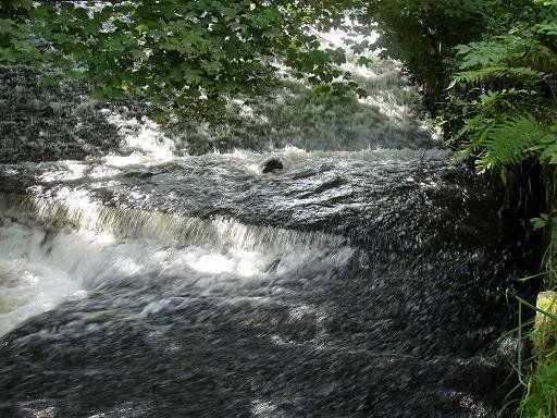
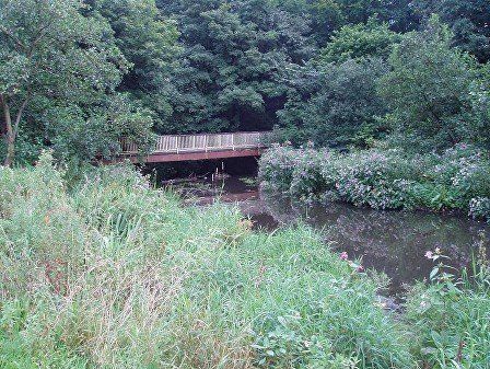
Further downstream a small weir.
(C)WDC August 2012
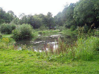
On the left (north) of the river are lodges, more remnants of the Croal valley’s industrial heritage.
Now a fishing pond, this lodge has existed for over a century but was silted up and foul until the substantial amount of work done on the area in early C21.
(C)WDC August 2012
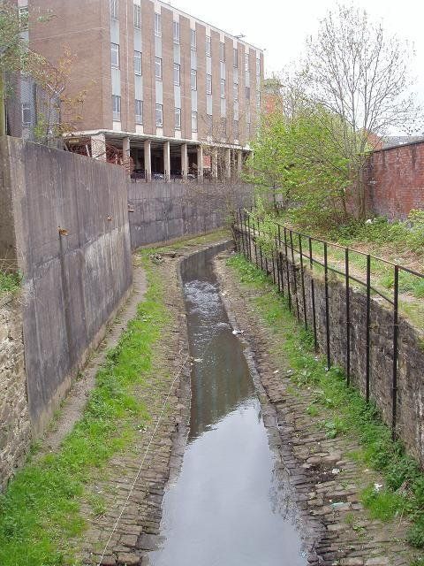
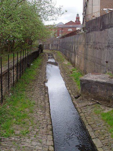
We are approaching the Town Centre now but it is still a very pleasant situation with mature trees and plenty of green. There are signs of Himalayan Balsam becoming a problem and it looks a little unkempt. Maybe this is the intention to provide the best habitats for a variety of wild life, though when this picture was taken in August 2012 some restoration work was still going on and maybe this area will be tidied up a little.
(C)WDC August 2012
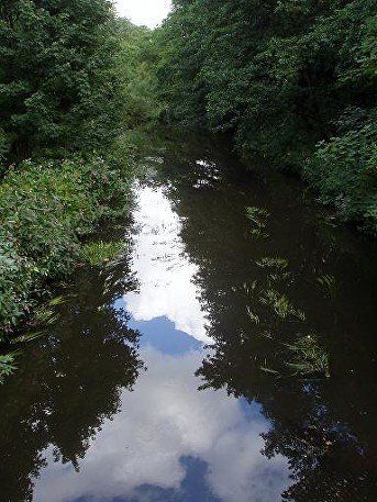
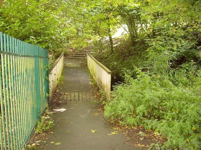
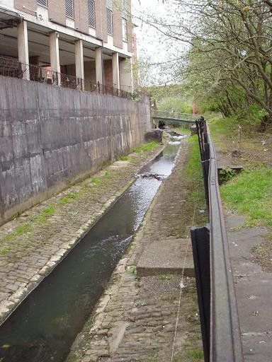
Upstream there are paths on both sides of the river but after crossing this bridge we have to take the right bank.
(C)WDC August 2012
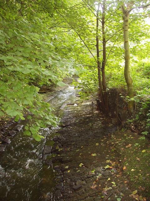
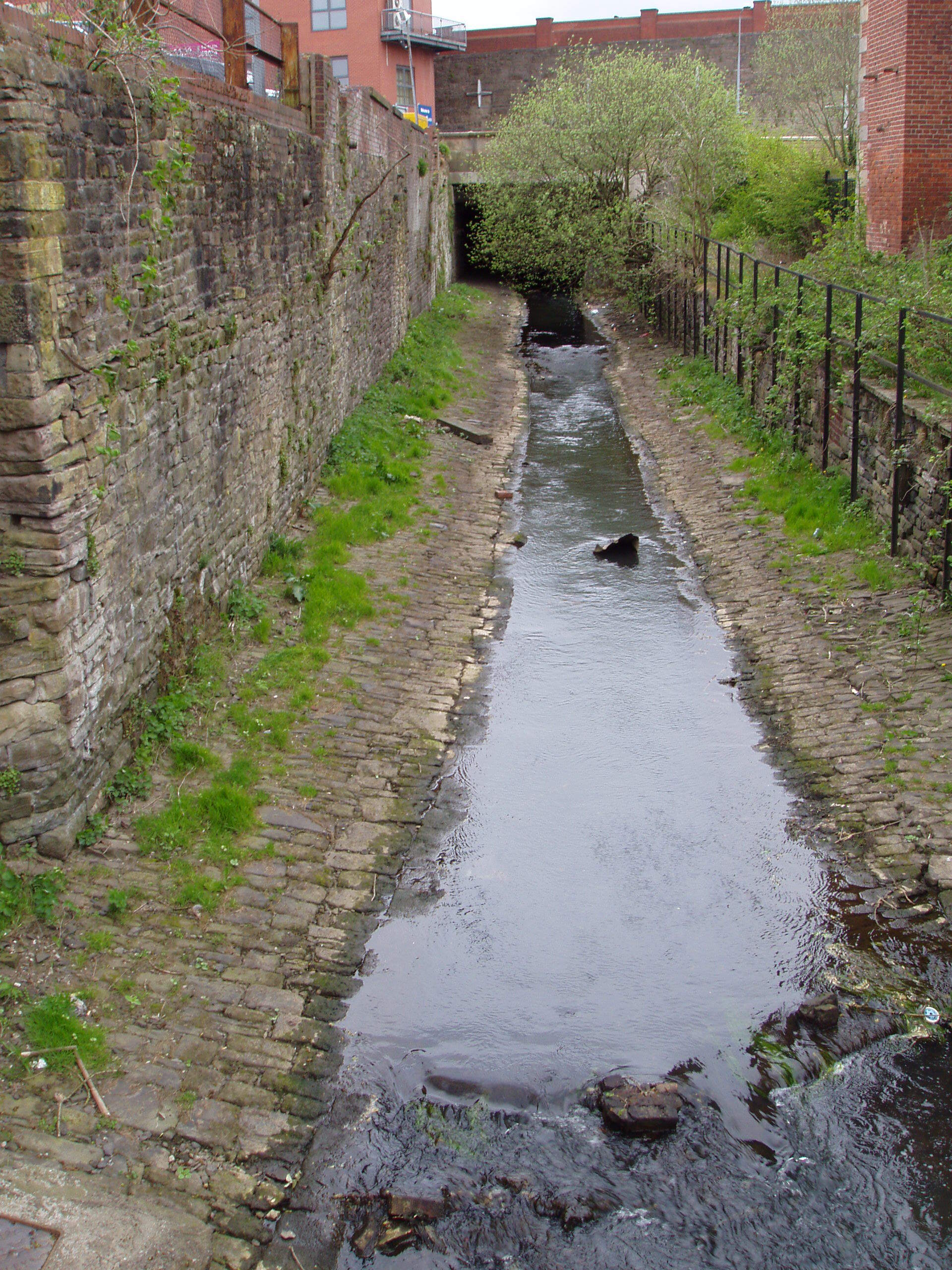
Above - The river is once again constrained by its cobbled channel and this is the last point for about three miles at which you will have any feeling about being in the countryside.
We are now at the town end of Spa Road behind Bolton Lads and Girls club and approaching Chorley Street.
(C)WDC August 2012
Left - This is the Chorley Street Bridge with the Chorley Street car park (now disused) on the left.
(C)WDC August 2012


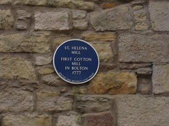
St Helena Mill built in 1777, is Bolton’s oldest surviving mill and is a Grade II listed building. At the present time it is used by the Probation Service. (C)WDC May 2013
It is said to have been on an island in the Croal. This is not strictly true but the river passed on one side and a goyt (supplying water to a water wheel) had been constructed on the other side. The mill was not initially called St Helena, but a relative of Robert Walker, the owner at that time, had been at Waterloo and suggested that this “island” should be called St Helena after the final place of exile of Napoleon.
It has been said that Samuel Crompton rented the upper floor of St Helena Mill while working on the Mule but since a prototype is known to have existed by 1779 and the mill was only built in 1777 this perhaps seems unlikely. Other accounts have Crompton working on the mule in his room above the front door of Hall i’ th’ Wood, then later hidden in the loft as machine breakers became a threat.

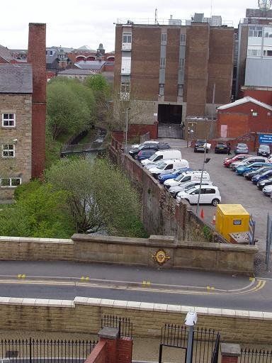
The mill viewed from the east with part of the High Level Bridge visible and Marsden House which replaced the old Fire Station towering above the scene. The top of the square mill chimney can just be seen above the brick part of the mill. We are on St Helena St.
(C)WDC May 2012
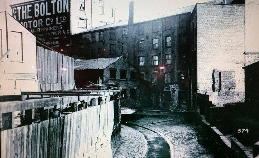
The River Croal now begins its journey through the historic industrial centre of Bolton. First we see it having passed under Chorley Street, passing alongside Salt Pie Yard and behind the Gipsy's Tent pub and alongside the Diamond Jubilee Building (previously Salt Pie Mill, which around1900-1930 was Bolton Motor Company and then for many years was the home of ESB motorcycles) heading towards the Marsden Road High Level Bridge and then the ancient St Helena Mill.
Do not think that this looks green and rural, it is just the jungle of Buddleia and weeds that often colonise land that is not looked after.
(C)WDC August 2012
Picture posted on Facebook by Peter Hampson.
This is taken from immediately downstream of Chorley Street, Great Bridge. The mill on the right of the river is Salt Pie Mill, on the extreme right is North Bridge Mill. After the left turn the river passes under the Marsden Road High Level bridge (built 1878). Behind the mill is the Gypsy's Tent pub, between the mill and the pub is Salt Pie Yard.
The left hand end of the mill, the higher part with "Bolton Motor Company" painted on the wall, is the Diamond Jubilee Building (built 1897) whose frontage is so prominent on Marsden Road at the Spa Road, Deansgate, Marsden Road junction. It was later occupied by ESB motorcycles for many years and in 2015 became a shop selling household fittings but it closed down less than a year later and is vacant at present (January 2017).
Presumably we have the Croal in the foreground. The background is the High Level Bridge (Marsden Road) and the arch is over St Helena Street.
From the High Level Bridge (Marsden Road) we see the Croal pass under the much older St Edmund’s St / Pool St Bridge before passing St Helena Mill (far left) and the GPO. The Market Place is on the sky-line.
Note the footbridge.
(C) WDC May 2013

St Helena Mill from just across the river.
Old picture of St Helena Mill. >>>>>

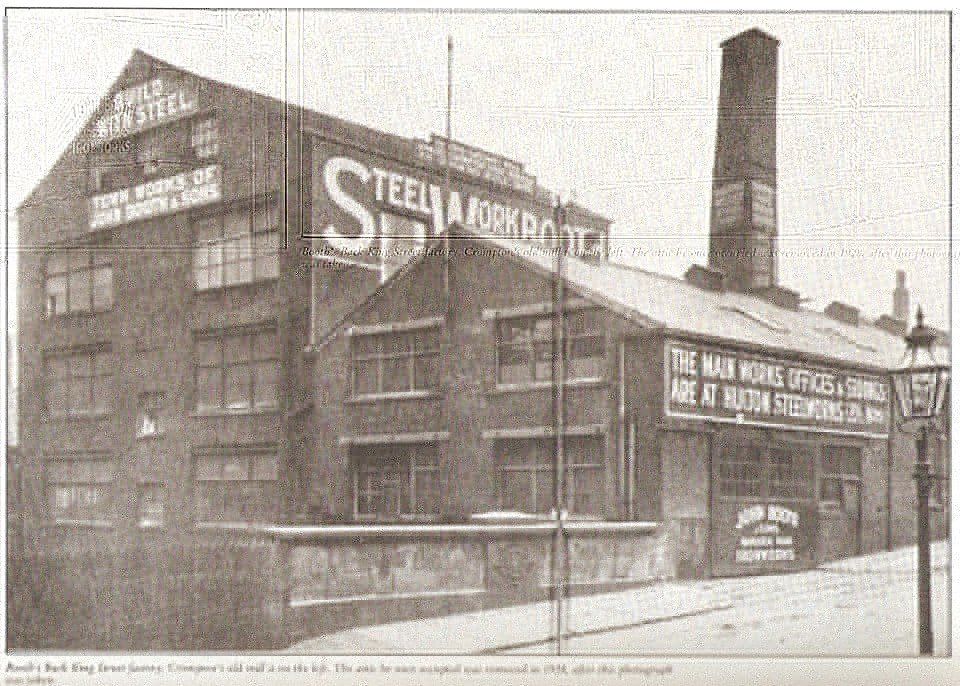
The bridge is the St Edmunds Street (formerly Grime Street) bridge under which the Croal flows. The mill is the Back King Street Mill that street being on the other side of the site to the left of the gables in the picture.
Crompton extended his spinning operations and became a tenant of the upper storey of a factory (built 1797) in Back King Street (between there and St Edmund’s Street) and installing there two mules of 360 and 220 spindles.
(The mill was taken over by John Booth and Sons, steel works, in 1894. Gordon Readyhough (Bolton Town Centre – A Modern History) says “For many years a board attached to the roof announced that ‘In this ancient Mill Samuel Crompton first worked his spinning mule 1800’ and Crompton’s tenancy is apparently mentioned in the mill deeds.” Note the ambiguity. Crompton first produced yarn from the Mule in 1780 so the “board” does not imply 1800 as when Crompton “first worked” the Mule, but that he worked it in that mill from 1800.)
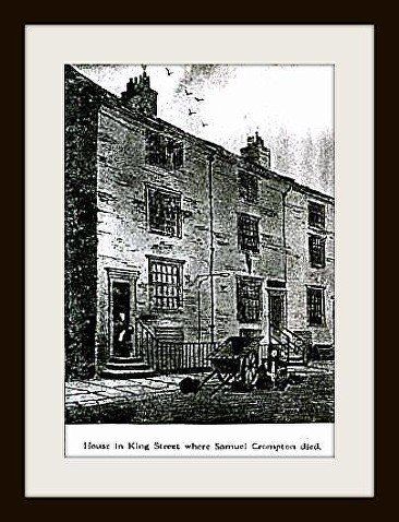
Samuel Crompton with his family moved into King Street in Bolton in 1790. Rate books show him at number 15 in 1800.
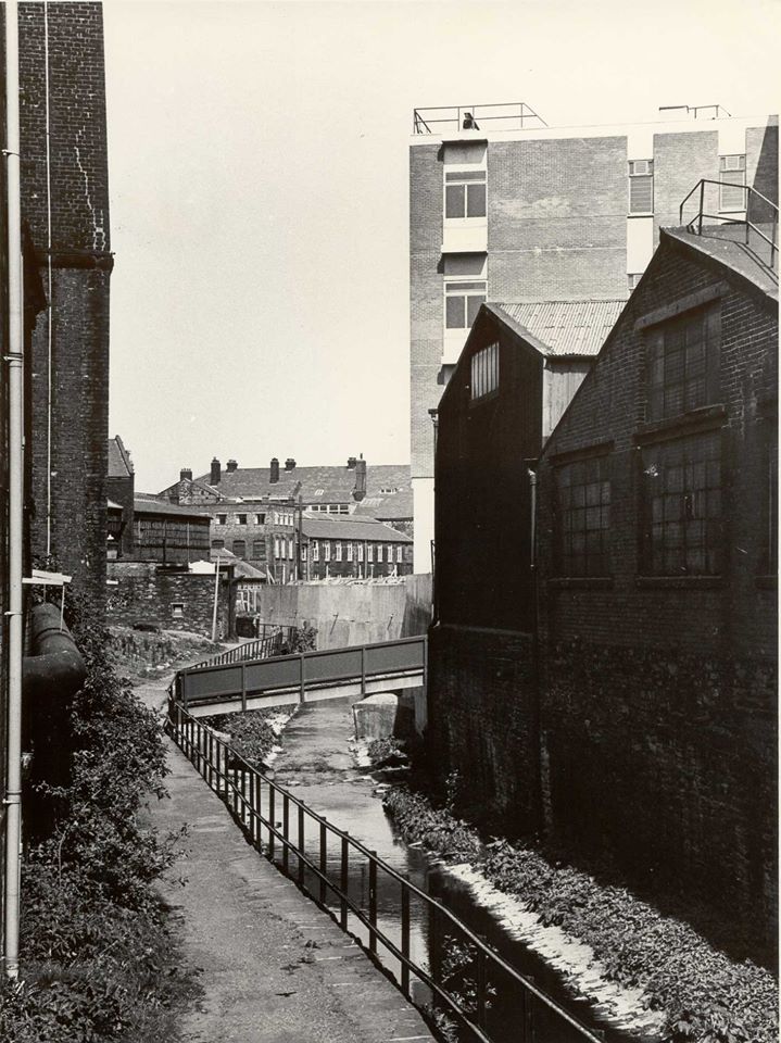
Now we must continue our stroll along the Croal itself. The footbridge is at the bottom of King Street and there is a good path onwards form there. On the left edge of the picture is the chimney ot St Helena Mill. The picture is recent enough to have the GPO telephone exchange on the right.
We look from the bottom of St Edmund Street / Pool Street downstream where we will continue our stroll, St Helena Mill is on the left, the GPO is ahead and to the right, St George's church is seen in the distance. A footbridge at the bottom of King Street is just visible beyond the white vans. (C)WDC May 2013
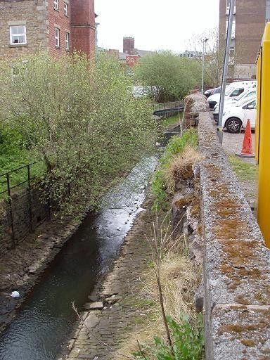
We look back upstream from that footbridge to St Edmunds Street bridge and the High Level.
(C)WDC May 2013

Picture posted on Facebook from a book, title not given, heading on this page is P44 Bolton and District.
1969 It names the bridge at the bottom King Street as Tanner's Bridge. It also notes that St Helena Mill was built in 1780 by Thomas Thweat. (Blackhorse Street had originally been named Thweates Street.)
And looking back upstream behind the GPO we see the King Street bridge which is used mainly to connect a Bark Street car park to Deansgate.
A longer view.
We look downstream from the King Street footbridge with the GPO above us on the right and the Victoria Hall on the skyline.

The next bridge is at the bottom of Central Street, Mick Buck’s Bridge once so-called after its builder but now replaced by a concrete bridge. We are looking downstream towards Victoria Hall with Central Street leading up to Deansgate on the right. The street had been called Water Street but at the amalgamation of Greater Bolton and Little Bolton this street was renamed to avoid confusion with the Water Street off Manor Street in Little Bolton. On the 1891 map it is called Idle Lane Bridge. It appears that a council member jokingly said – you might as well call Water Street Idle Lane as there is nothing but vagabonds and idlers down there – he seems to have been taken seriously. But the name was not kept and it became Central Street.
The Councillor may have been deliberately referring to an older name which had understandably been changed, the name Idle Lane seems to be much older than this event. Possibly Idle Lane, then Water Street, then Idle Lane again, then Central Street.
Further upstream, the Middlebrook was the boundary between Rumworth and Heaton. Now the River Croal becomes the boundary between Little Bolton to the north (left on this picture) and Great Bolton to the south and west (right on this picture).
On the next page we follow the Croal from Central Street past the Victoria Hall, under Knowsley Street and Bridge Street to Church Wharf.