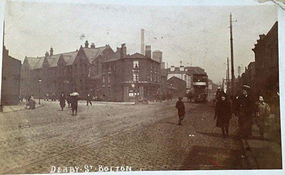
27 Derby Street
Britannia Hotel viewed from the western end of Crook Street, Derby St is to the left, in front the Britannia pub and Britannia garage, off the picture to the right is the junction with Deane Rd and Moor Lane. This was the headquarters of the Bolton Wanderers in its early days. The team had originally been formed by the young men of Christ Church just a little way up Deane Road from here but as always happens, the footballers become more and more associated with the football club and more and more distant from the church. When the vicar, entirely within his rights according to the rules from the founding of the club, insisted on attending the meetings of the football club they left the church and made the Britannia Hotel their headquarters which it was for some considerable time. James McKernan was signed by the Wanderers from Hibernian in 1881 and to get round the amateur/professional ruling they installed him as publican of the Britannia Inn.
The start of Derby Street with Deane Road up to the left. Moor Lane goes to the right from this junction.
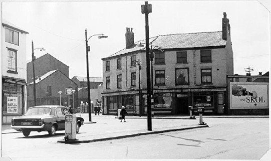
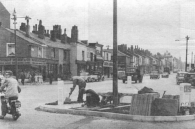
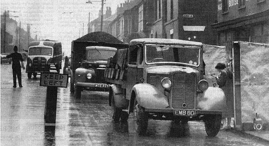
Are they taking up the tram-lines?
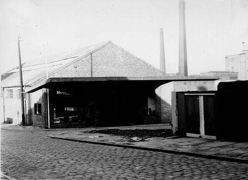
The Britannia Garage at one time had a large cut out of Britannia in the style of the old pennies. Query – was it actually the Britannia pub sign after that was demolished? I remember this but I have not found anyone to support me. The large building in the centre of the picture was Gregory and Porritt’s warehouse..
Between the garage and the warehouse is Bethel Street and between the warehouse and the hoarding is Liptrot Street.
Looking back towards Moor Lane. Gregory and Porritt’s warehouse.
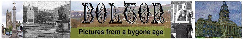
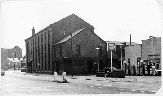
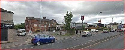
On the other side of the road (the left as we travel up Dobble) was the Derby Street Girls’ School. Behind the two parked cars is the Grey Man pub. We are approaching the point where Derby Street swings to the right (as the A579 to Leigh) with Great Moor Street off to the left. The right side of the picture is dominated by Mather Street Mill which has Fletcher Street on its other side. The top of the tower of Saint Peter and Saint Paul RC church on Pilkington Street can be seen.
A trolley bus is approaching us; they are one way at this point, down here, Moor Lane, Ashburner Street, Howell Croft terminus, Great Moor Street then across the middle of this picture to go up Derby Street.
Derby Street Girls’ School. This gate is in Crook Street and we are looking at the back of the school relative to the previous picture, looking across towards Fletcher Street Mill. After the school closed down it was used for a time as a Student Union building by Bolton Institute of Higher Education (Bolton University by then?) but was demolished when there was a wholesale reorganisation of the Trinity Way, Derby Street, Moor Lane junction.
Looking back to the Grey Man, a bland 1960s replacement of the original building with Derby Street swinging off to the left. The chimney is at Flash Mills and the top of the Town Hall clock tower can just be seen to its right. To the left a lot of clearance has taken place where the college, now university was built. The spire towards the left is St Paul’s Deansgate.
© Fred Hosker/ Jackie Nisbet
used by permission
The old Grey Man c1910. It is just possible to make out a horse trough close to the lamp post. It was a much more interesting and characterful building before it was rebuilt.
Derby Street from the Grey Man corner. We see Thomas Hough, Pikes menswear, Tower Furnishing. This block still remains (July 2020). Across Fletcher Street the block from Dr Ryan’s to Pilkington Street has been replaced by KFC and McDonald’s. Fletcher Street Mill (Mather Street Mill) on the left edge. Magee’s brewery tower just visible on the skyline.
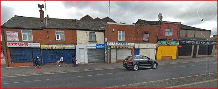
That block still exists but the shops have changed – though Bolton Bed Company is probably just a change of name from Tower Furnishing. The Dr Ryan’s block has been demolished and we now have KFC and MacDonald’s. The block above there which starts with SUBWAY which replaces Bolton Safety Glass and contains Modern Radio is original. The street before Subway was Pilkington Steet but is now the rerouted Fletcher Street (rerouted to make a junction with College Way (now University Way) opposite)
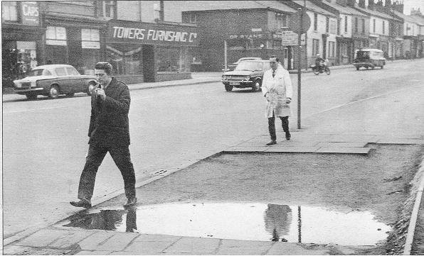
Bolton Institute, now University, on the right, the block on the left of Derby Street has Dr Ryan’s then the Good Samaritan pub. The picture was published by the Bolton Evening News to show the big puddle.
the block below Fletcher Street, Mather Street Mill gables above the roof line. c2018 (C) Google Streetview.
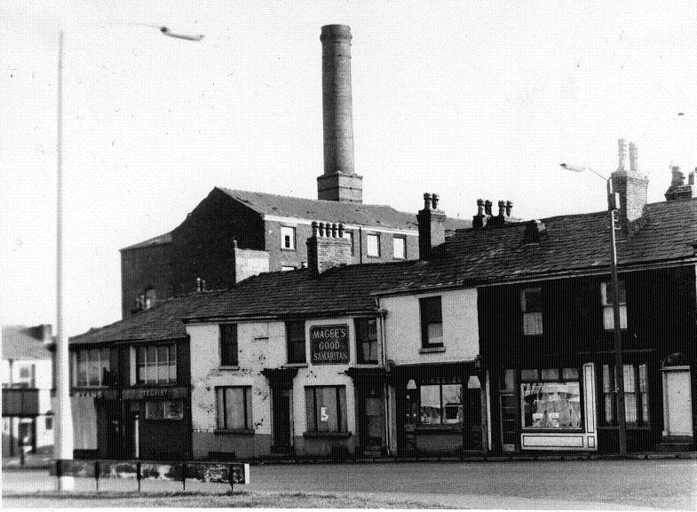
Moving up from Fletcher Street we see Dr Ryan’s then the Good Samaritan at 73 Derby Street and two doors up a typical butcher’s shop front. In 1932 the butcher was Joseph Hilton and he owned the house to the right as well.
This picture c1977. Mather Street Mill on Fletcher Street remains dominant,
© Fred Hosker/ Jackie Nisbet
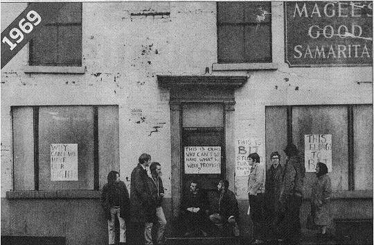
1969 The Good Samaritan has been closed for a year or two. There seems to have been some informal agreement between the Student Union and the powers that be that these premises would become a Student Union. This did not happen and eventually the whole block was demolished to make way for KFC and McDonalds.
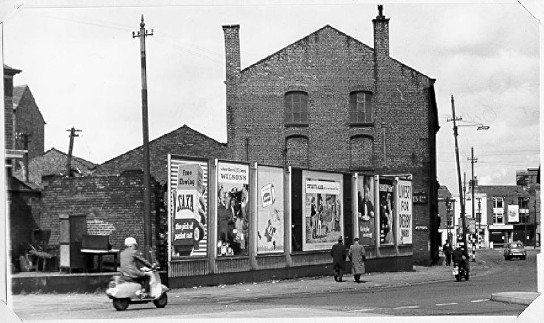
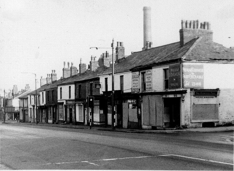
That block c1977. Brooks, Iron Jelloids and Hall’s Herbal Pills, Pram Corner all awaiting demolition.
© Fred Hosker/ Jackie Nisbet
From Dr Ryan to pram Corner has now all gone, House of Raja’s is now very visible in the Fletcher Street Methodist Sunday School, the church having been demolished some years previously.
The street by the blue car, now closed off was the original route of Fletcher Street. The next street is Pilkington Street, now renamed Fletcher Street
But the main theme is KFC and MacDonald’s.
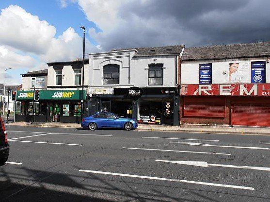
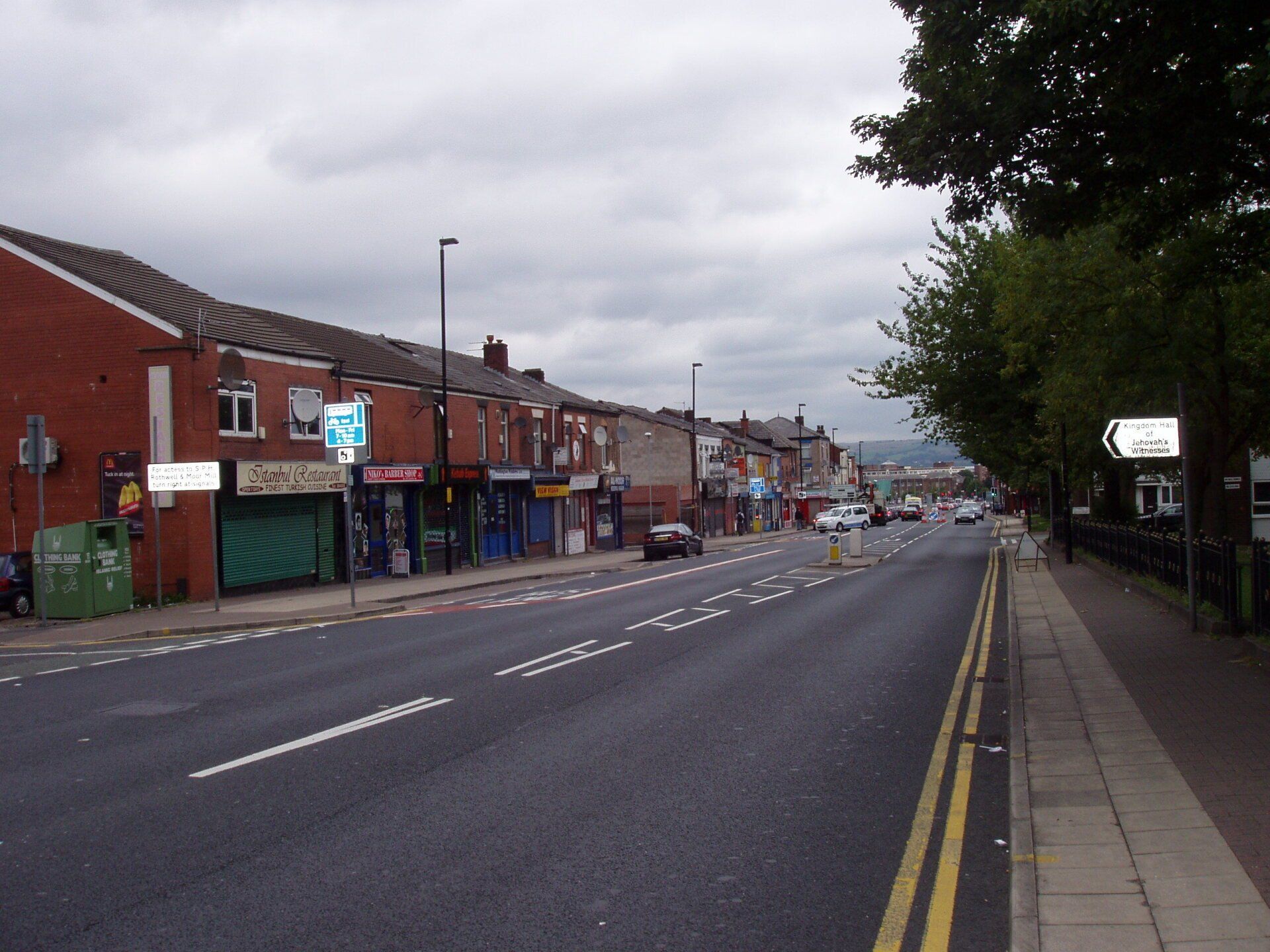
On the next corner for many years was Bolton Safety Glass (they still operate from the back street as National Windscreens) now replaced by SUBWAY. Picture probably around 2015, The MacDonald’s premises of course had a number of previous identities.
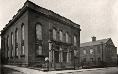
Fletcher Street Methodist Church and Sunday School.
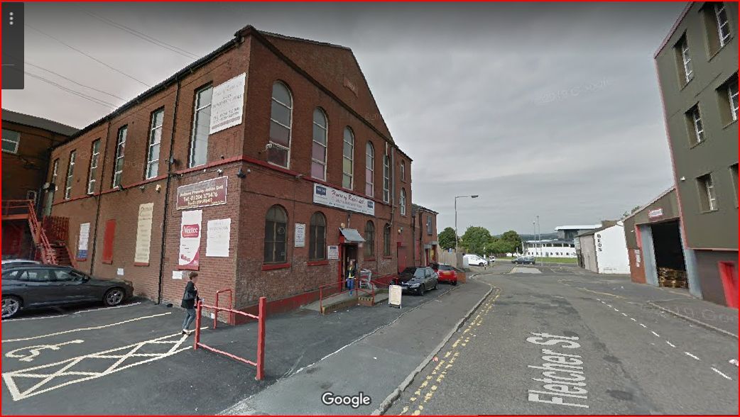
The Sunday School building still stands as House of Rajah's spices and Indian dresses and materials.

Click and navigate for full size
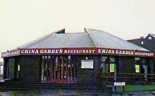
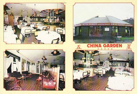
1 The restaurant was originally opened by Warburton’s – called Henry’s (after Henry Warburton). This was the fish restaurant with the fisherman in his yellow waterproofs outside.
Then it became the Roundhouse Restaurant...
2 ....then China Garden (picture posted by Michael Lever)
3 Card posted on Facebook by Pete Best.
Click and navigate for full size
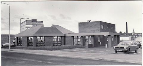
1 picture posted on Facebook by Anne Littler of the drive through round the back. This is probably still Henry’s. Note that the college multi-storey block is still there.
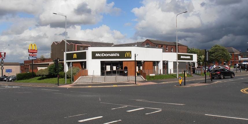
2 July 2020 © WDC Now it is MacDonald’s and has been for many years.
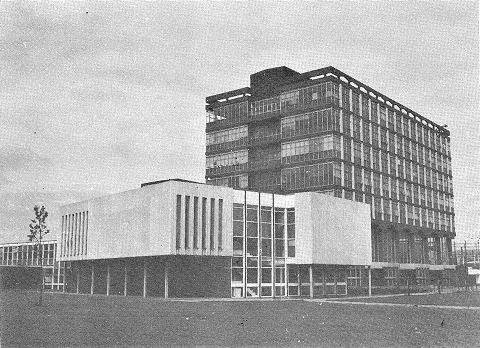
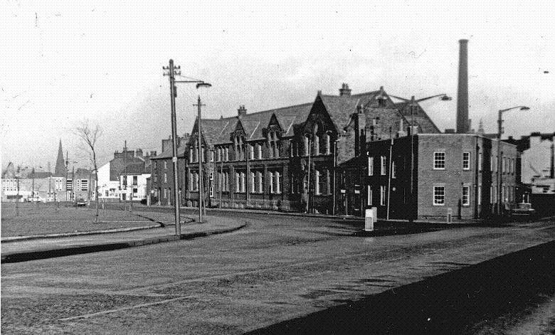
Meanwhile across the road - Bolton Institute of Higher Education in the 1970s
July 2020 (C)WDC
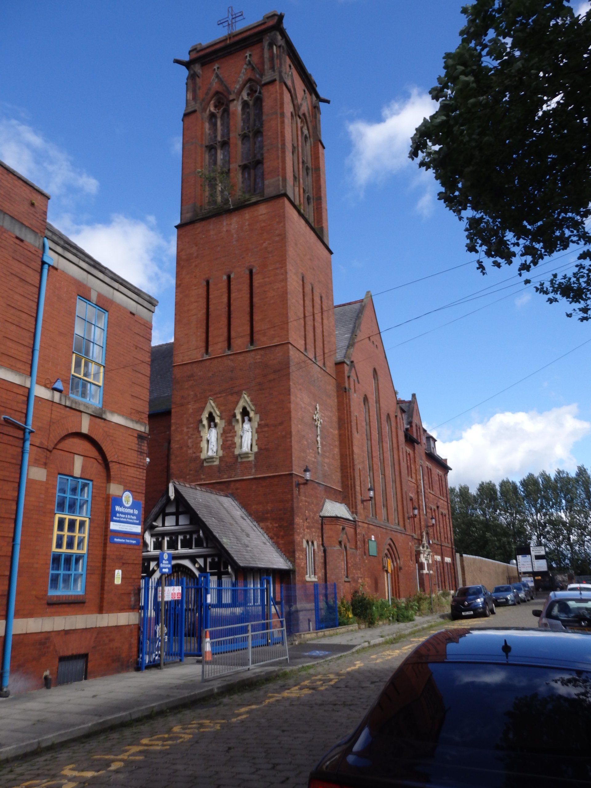
Saints Peter and Paul RC Church on Pilkington Street, behind MacDonald's. Closed in 2020.
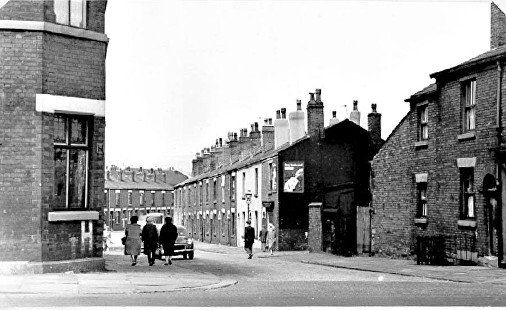
On the right hand side of Derby Street as you go up from town was James Street, long gone underneath the buildings of Bolton University. It was opposite Fletcher Steet and was a cut through to Deane Road and the Regent Cinema. This was a traffic census.
James Street, The two rows opposite had been demolished after a WWII bomb. Now these are about to be demolished.
Picture by Mr W Shaw.
looking down past James St to Derby St Girls' School,
picture posted on Facebook by Gene Watts.
After James Street was Kirk Street then John Street.
Looking down John St. centre right Baldwin St. Derby Arms on left corner is still there, everything else has been replaced by University Way and the University Campus. Behind us, across Derby Street is Pilkington Street.
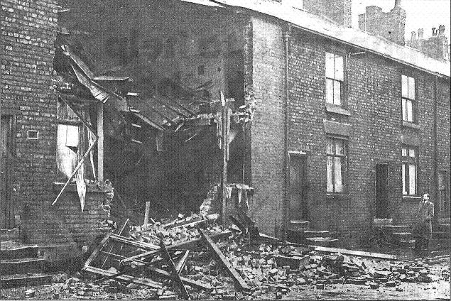
John St mystery house collapse reported by the Bolton Evening News.
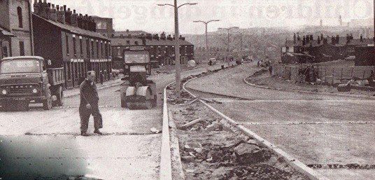
College Way, now University Way, being built replacing John Street
John Street, now University Way, July 2020 ©WDC
Derby Arms bleeding off the right edge (compare the coat of arms) at its original size. Next turn on the right is Norris Street.
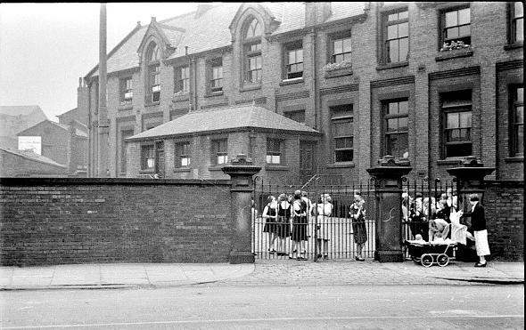
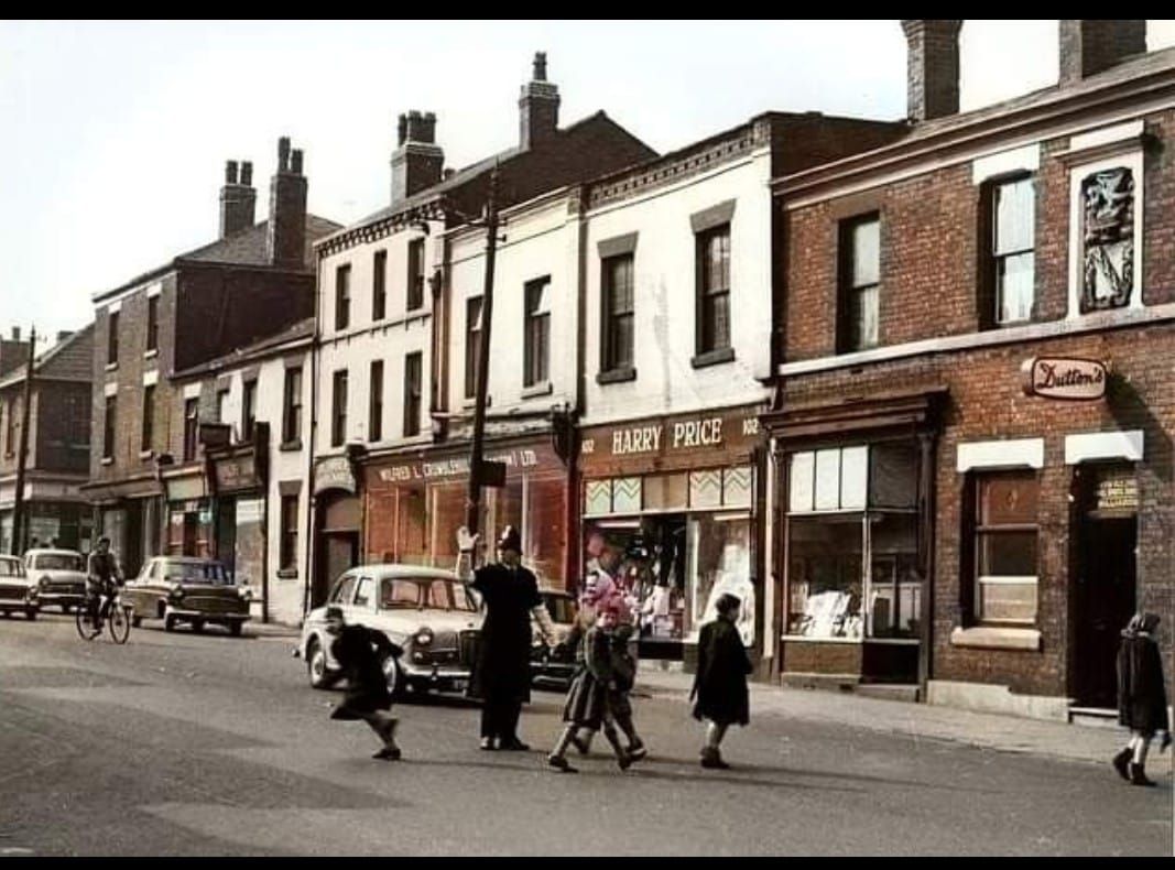
Policeman here is assisting children from SS Peter and Paul School, probably at home time though we have a least one young lad heading back in the school direction. The next picture shows the same crossing place at the other side of Derby Street.
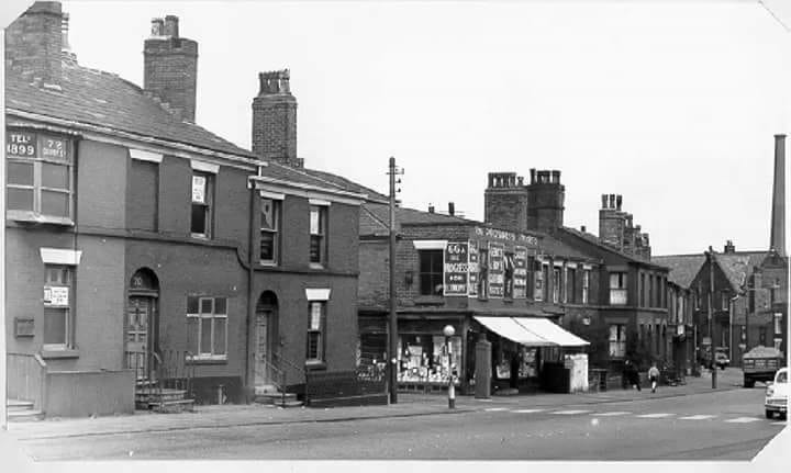
These buildings still stand but all the details which made this row so interesting have been removed or covered up. The details below the gutters have been removed and the archway at Crumblehulme's has been removed. The building on the corner of Norris Street is rather plain but looks much better in brick with the window lintels highlighted than today's bland all-over grey. But at least the block still has some shape with the buildings mostly retaining their original heights.
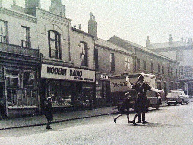
Derby Street, Modern Radio, Brabbin and Rudd, crossing Derby Street from SS Peter and Paul.. Next street is Shaw Street with the Lord Nelson on the corner.
Modern Radio well loved by generations moved to Farnworth ca2015 but closed down in 2021.
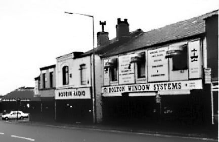
Above: That block in 1993. It still stands 2021.
Picture posted on Facebook by Michael Lever
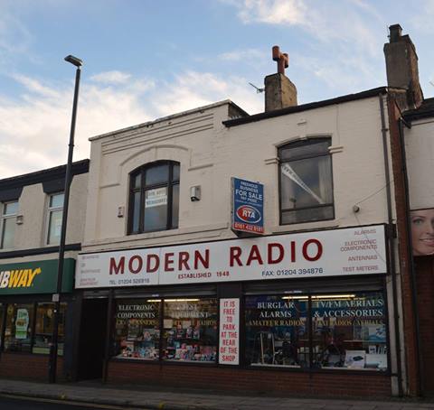
Right: 16Nov2015 Modern Radio shortly to move to Farnworth. Picture by Gene Watts
July 2020 ©WDC
Modern Radio has become Oodles Chinese Noodles
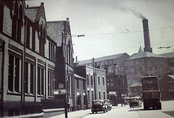
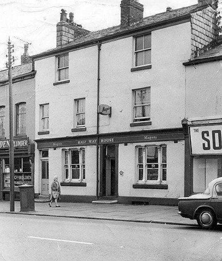
On the same side of Derby Street, The Halfway House was at 127-129 in between the junctions with Shaw Street and Rothwell Street. The pub dated back to the late-1840s. It got its name from the fact that it was roughly halfway up the hill from town to Daubhill possibly High Street, to be precise.
The pub was run by the Ashton family for a number of years. In 1841 Thomas Ashton ran a beerhouse in Back Rothwell Street which ran immediately to the rear of the Halfway House.
In 1859, Thomas Ashton and his wife Mary Ann were instrumental in the foundation of Bolton's first Co-operative Society. On 1 August 1859 a meeting took place at the Halfway House and a set of rules were formulated for the Great and Little Bolton Equitable Industrial Co-operative Society Limited. The rules were sent off to the Registrar of Friendly Societies and were returned with the society registered on 18th of that month. The Halfway House was subsequently taken over by Magee’s. It was owned by Greenall’s when it closed in 1970.
1949 If we take the next left turn from Derby Street we will find the Rothwell Street footbridge. This crosses the William Hulton / George Stephenson Bolton-Leigh railway opened in 1828. This ceased to be the main line in 1885 when the route was diverted but continued to service industry between Derby Street and Bridgeman Street until 1958.
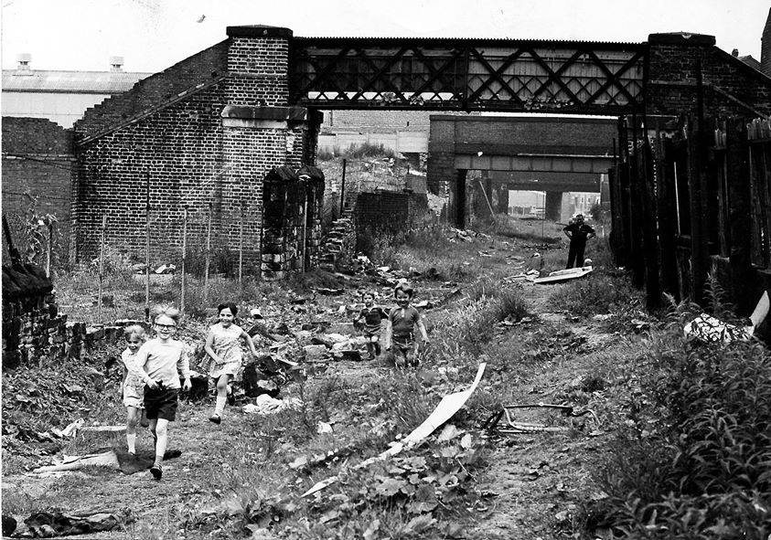
Although the railway ceased operation in 1958 the track bed and the bridges which had crossed the railway remained in place for some years. In 1973, Bolton Engineers Department and British Railways jointly decided to demolish the bridge linking the two halves of Rothwell Street. NB these bridges were across the ORIGINAL line of the railway still used up to 1958 as the High Street sidings branch supplying mills and also Magee’s Brewery with water from Burton on Trent, but no longer going through to Daubhill. The closest bridge is Rothwell St footbridge, then Shaw St bridge and Fletcher St bridge. Looking towards Lecturers Close (ie away from Daubhill, towards town).
<<<<< 1969 Rothwell Street footbridge Picture posted on Facebook by Michael Lever
Aboce: Cutting from Susan Garraway's collection
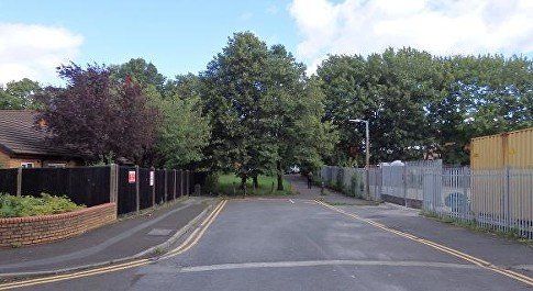
The footbridge has been demolished. The line of the railway to left and right can be seen behind the fence and bushes.
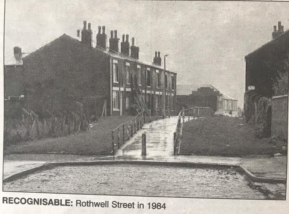
Above: July 2020 (C)WDC. Rothwell Street with the line of the railway to left and right. Weavers' Court is on the left.
July 2020 (C) WDC
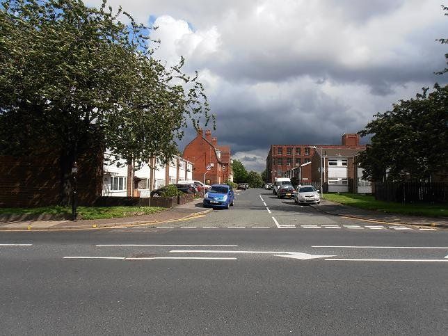
Rothwell Street from Derby Street.
On the opposite side of Derby Street, town to the right, Daubhill to the left.
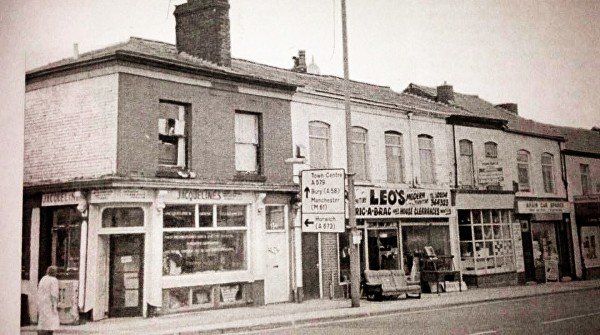
secondhand shops Jacqueline's and Leo's 1992.
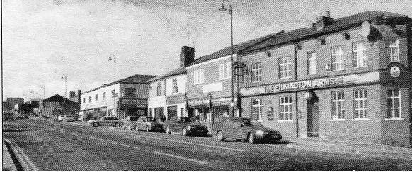
just up from Rothwell Street we see from Noble Street to the top of the hill. This is a rebuilt (1960s?) Pilkington Arms. Next is street is Emblem Street with Entwistle and Walker, later Thomson and Oakes on the corner.
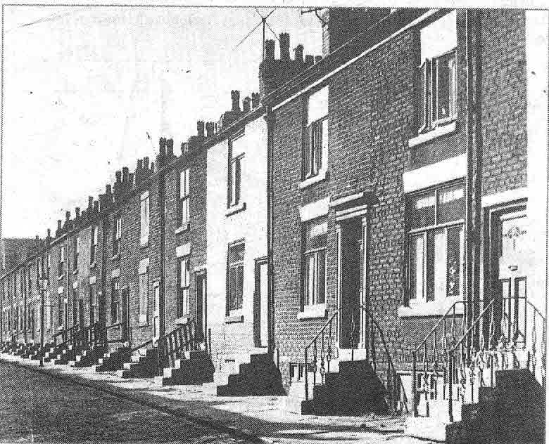
Noble Street in 1962
Noble Street looking towards Derby Street with the original Pilkington Arms on the corner. The houses look ready for demolition though the ones nearest us are still occupied.
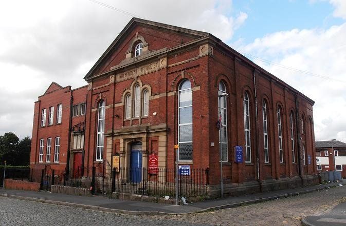
Noble Street Independent Methodist Church, built1872. Still standing and functioning in 2020.
July 2020 (C)WDC
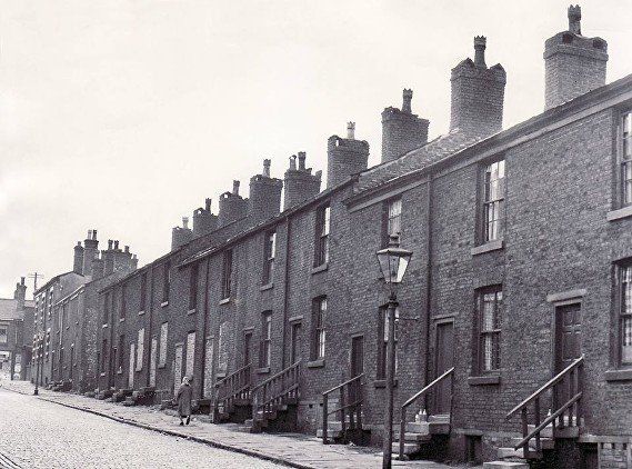
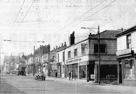
This is a nostalgic scene with a row of buildings that grew organically, all different, a bit of a hotch potch and yet all contextually appropriate and congruous. Streets like this are celebrated in olde worlde villages though admittedly the buildings there are more likely to be of sunlit golden sandstone than dour, smoke-stained brick. My own mental picture of this street is that it still looks like that, but sadly all the buildings on the right have gone. The ones on the left which are much less interesting, are mostly still there though there are a couple of small gaps and quite a few have had the frontage re-bricked and of course all the shop fronts have changed. The first street on the left is Noble Street, just beyond the Ford Anglia is Rasbottom Street. On the right just beyond the A35 is Rothwell Street, then the block with the Halfway House and the Lord Nelson.
July 2020 picture from the same viewpoint. It is clear that all the right hand side has been replaced by modern houses but you cannot see much because of the trees. ©WDC
July 2020 Immediately opposite Noble Street, Linslade Gardens. ©WDC
August 2013 (C)WDC
Looking back towards town from Noble Street.
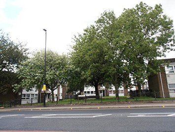
The block opposite Noble Street now occupied by a small new estate and some trees. Click to enlarge.
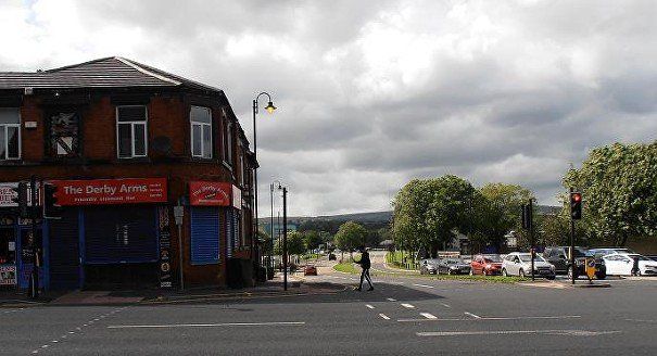
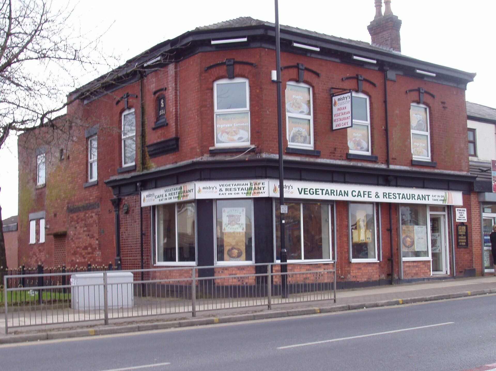
At its top side is the Albert Hotel now a restaurant though it has changed its style a number of times since this picture. To its left is Hammond Street. (C)WDC March 2013
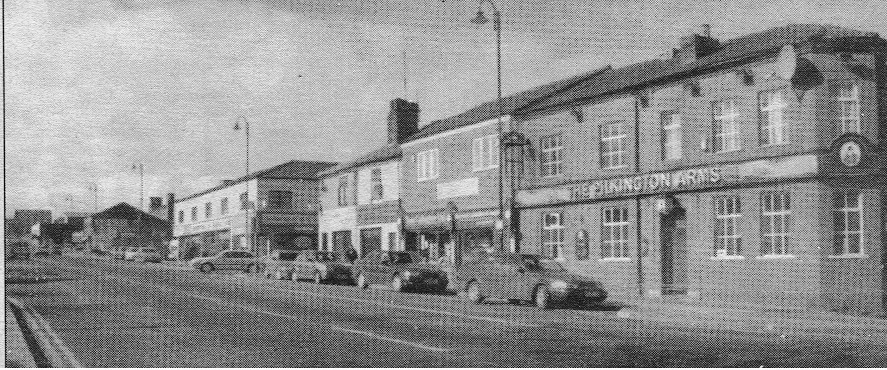

We continue our journey moving south west up Derby Street. We see from Noble Street to the top of the hill. This is a rebuilt (1960s?) Pilkington Arms. Next is street is Emblem Street with Entwistle and Walker, later Thomson and Oakes on the corner.
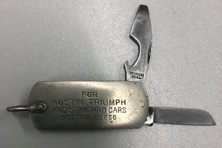
Aug 1957 Entwistle and Walker, with an A35 for sale. It was also HQ of or an agency for Bolton School of Motoring. Lidl now occupies that block. Looking further up the hill we see that Daubhill Congregational Church is still standing and there is not yet a mosque. In passing, notice the lampposts. These were originally the poles supporting the electrical supply for the trams and have been pressed into service to do the same job for the trolley buses and to carry the street lights at the same time.
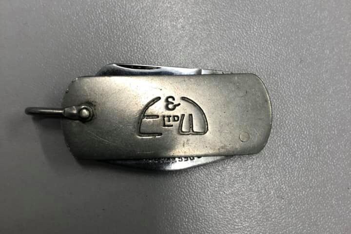
Aaron Brown showed on Facebook a handy little advertising give-away for Entwistle and Walkers.
Click and navigate for full size.
August 1999 – it is now Thompson and Oates. Beyond here is a space which later would be LIDL car park, LIDL store replacing the present building. Still no mosque. Derby Street Congregational Church seems to have gone but the School building is still there (and still remains July 2021). Modern lamp posts replace the old tram poles.
A quick look down Emblem Street before we proceed:
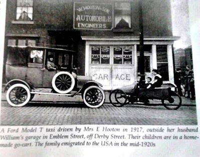
1917 W Hooton and Son garage, Mrs Hooton in their taxi; c1977 © Fred Hosker/ Jackie Nisbet
On the next page we will continue up Derby Street as far as Willows Lane where it becomes St Helens Road.