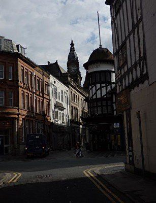
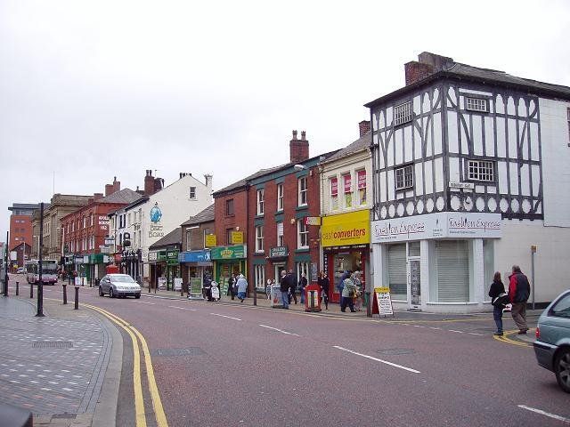
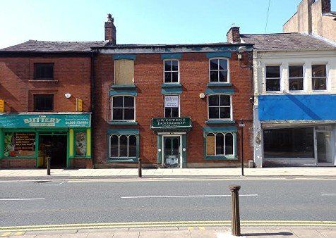
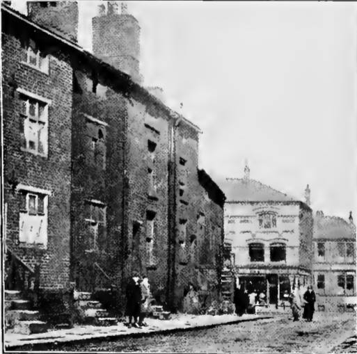
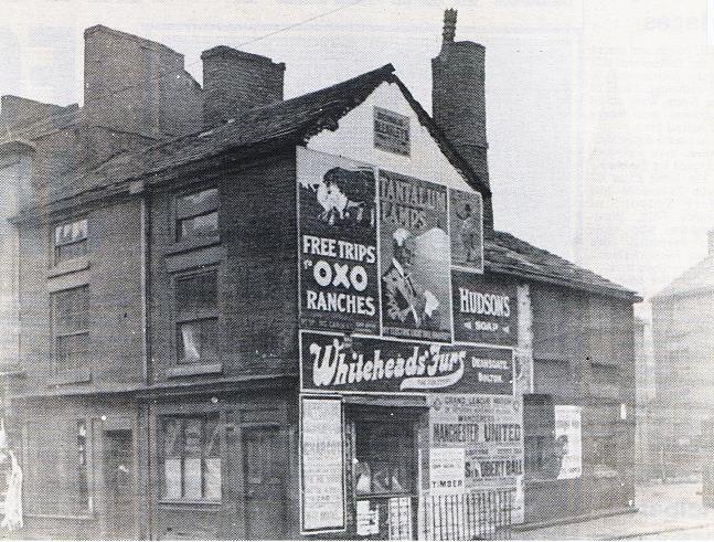
22 Deansgate


click on any picture to see it full size, navigate with <> sometimes click to zoom exit with X
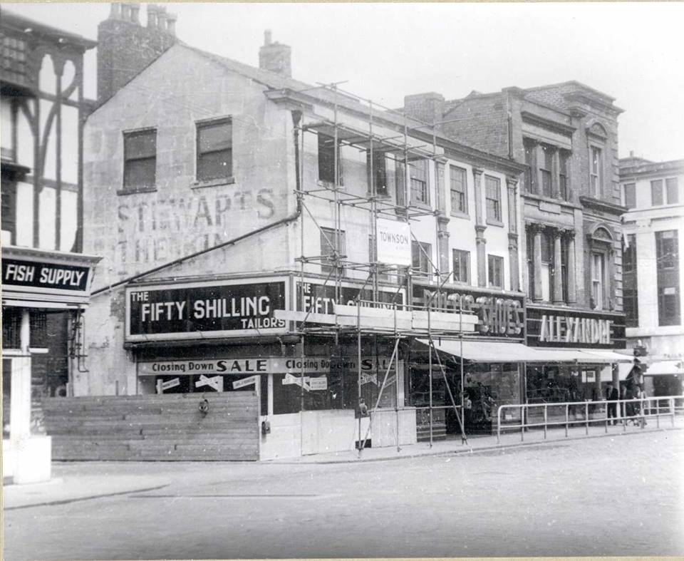
1 Knowsley House, spanking brand new c1929. On the right, corner of Oxford Street Paragon is having a Removal Sale prior to reopening on Knowsley Street down from Fifty Shilling Tailor (no extras). Then the Oxford Street corner will be redeveloped
David Whenlock postcard.
2 Knowsley House – fifty shilling tailor 1950s 60s?
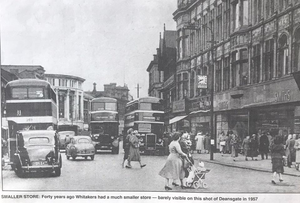
3 1931 The Oxford Street corner is close to completion forming what the caption calls Bolton's Oxford Circus.
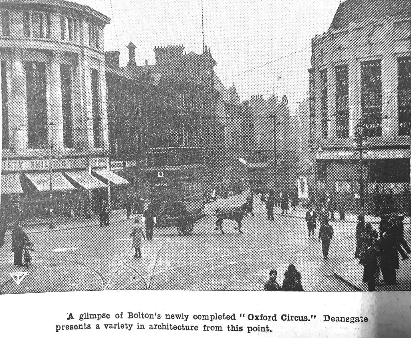
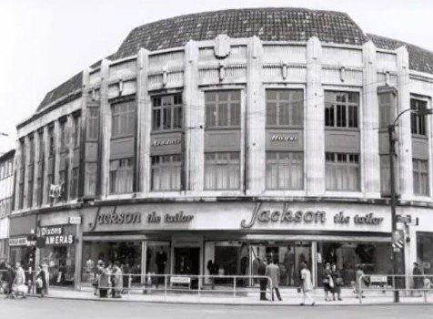
4 New suit corner! Alexandre, John Collier, Jackson the Tailor. David Whenlock postcard.
5 posted on Face book by Lisa D J Waring.
pre 1968 Corner of Deansgate Oxford Street, Arndale House.
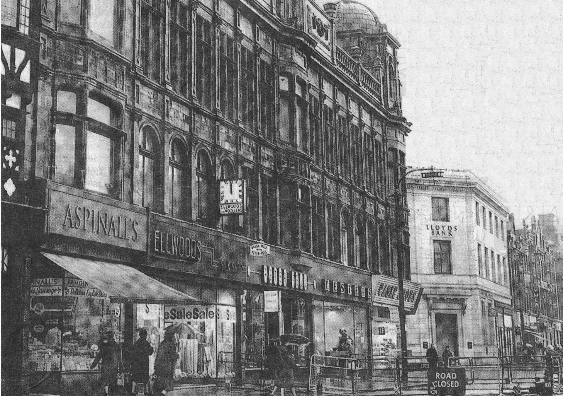
Comment from Mike Stephenson: Bit of history/mystery....the Arndale Centers were shopping "malls" built in the 60's by two blokes who combined their names Arnold and Chippendale, no really it's true. This building was obviously not Bolton's Arndale as that's where Crompton Place is as you know, so why is this building called the Arndale?
Comment from Peter Lodge: I have always assumed that either the offices of Arndale were located in here, or the council decided that owners of Arndale had actually done some good for the town of Bolton (what a laugh), and named the building in honour of them, in the same way that they name leisure centres after some 'here today gone tomorrow' Olympic competitor. The odd thing is that this photo pre-dates the opening of the Arndale centre.
6 posted by Barbara Ozwytch Crossley
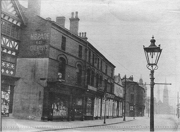
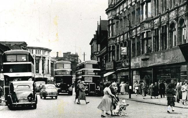
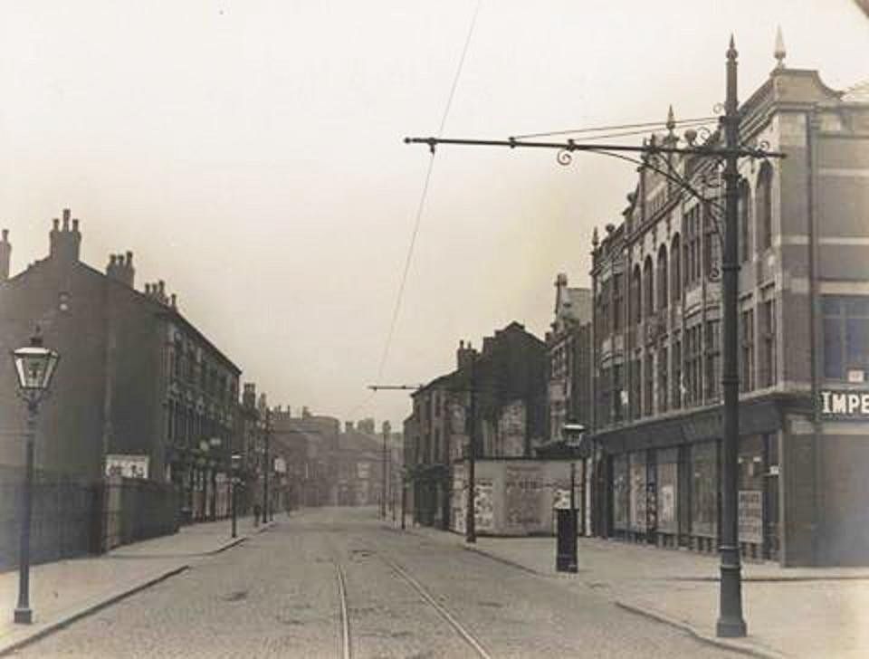
Deansgate looking east to the corner of Knowsley Street –Alexandre’s on near corner, Fifty(?) Shilling Tailor on far corner with Liverpool Victoria and Cooperative Insurance in the building.
The clock is probably at H Samuel’s. We see William’s Deacon’s Bank and a white marble fronted building (now Superdrug) with fancy work (which is no longer there) above the gutter line.
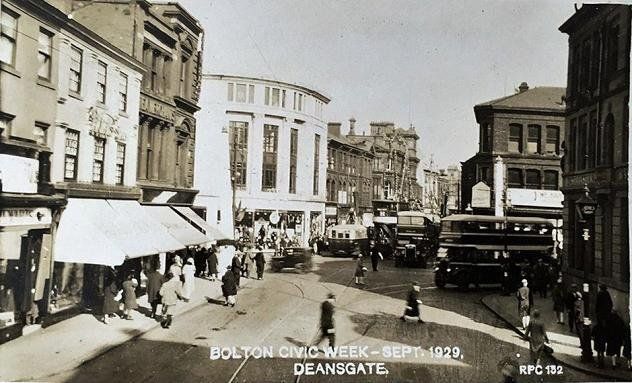
7 Posted by David Whenlock:
September 1929 Bolton Civic Week.
We see that Knowsley House has just been completed but work has not yet started on the Oxford Street corner. We note the fancywork on the white building roof beyond the bank.
8 24 September 2009 (C)WDC
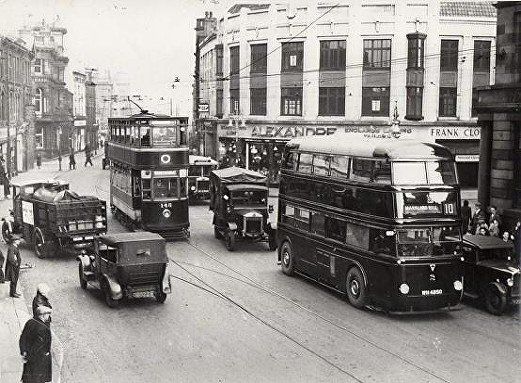

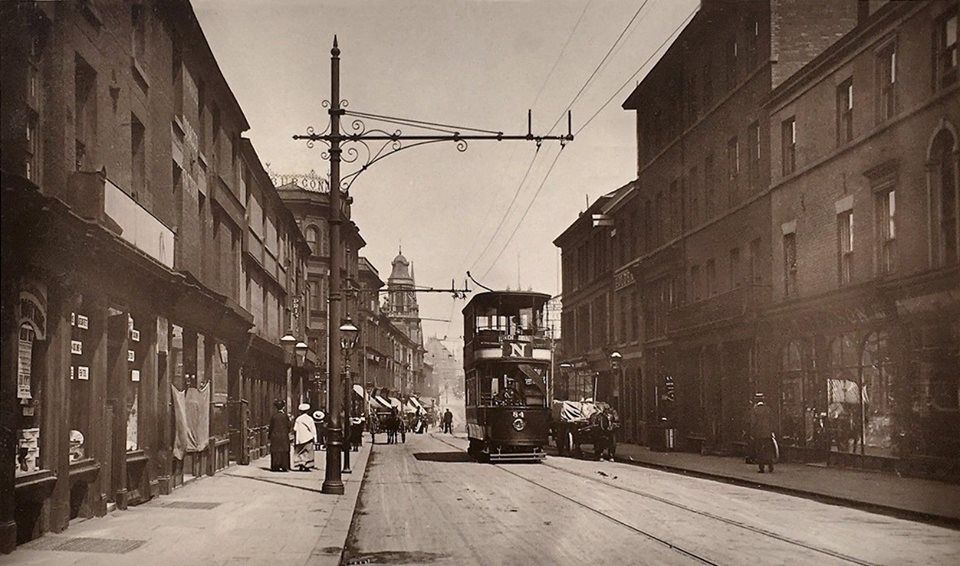
late 1930s interesting for the bus which looks like a trolleybus without the trolley. This was Bolton’s only AEC Q bus with the engine under-floor behind the front wheels. WH4850
Note Alexandre’s Tailors on the corner opposite where it was in the 1950s 60s.
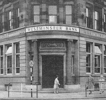
The west corner of Deansgate and Oxford Street, Westminster Bank which had previously been Parr’s Bank.
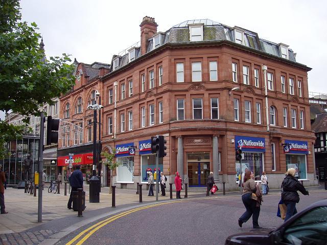
left: Sep 2009 (C)WDC. We have the steam engine and the statue of Fred Dibnah on Oxford Street. Parr’s Bank, Westminster Bank is now the Nationwide Building Society. The original building with its diagonal corner (not round like two other corners at this junction) originally stretched from the door just to the right of Curry’s to the drainpipe on Deansgate. More on this later
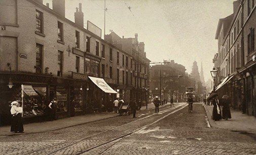
1907
Corner of Deansgate and Oxford Street, the Parr’s Bank building was set back from the existing shops in anticipation of their being demolished and rebuilt, Oxford Street having been widened. Parr’s Bank later becomes Westminster Bank and now Nationwide Building Society. On the bank building is “NS Kay” ?Kay and Foley photographers?
The building under the Town Hall clock is the George and Dragon, 13-15 Oxford Street, which closed in 1924 when the block was acquired by the Co-op and demolished 1924/5. The Oxford Street Co-op opened 1927 (1928?).
1907
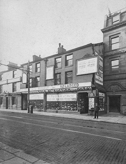
A more restricted photograph from a slightly more direct angle shows “?? Fittings to be offered for SALE BY AUCTION on OCT” and the white notices at the top of the windows has “...fittings in this shop are to be sold by auction on Oct 9th. We must clear the stock before then. HENCE THE SLASHING REDUCTIONS”. “These shops are to be enlarged and rebuilt for Adamson and Barlow”.
Woolworths opened here in 1912 and moved to Constantines on the corner of Deansgate and Bridge St in 1926, expanded down Bridge St 1959 closed 2009.
These two pictures are 1907 and are advertising the impending demolition and rebuilding.It appears that this section (four upstairs windows wide) was demolished and rebuilt in 1907 but the block leftwards from the pub to the corner was not demolished until 1924.
1962
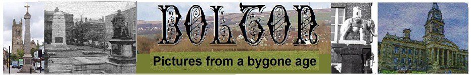
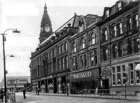
The Parr’s Bank building is at the right end of the block. Then the rest of the block, built 1927, has two separate buildings, the Oxford Street Co-op and the building occupied at the date by Whitaker’s. We see the new Newport Street shops beyond the Town Hall.
Posed on Facebook by Edward Thompson
Oxford Street 9 May 2013 ©WDC
The statue of Fred Dibnah is there but merges into the machine casing.
posted on Face book by Gene Watts.
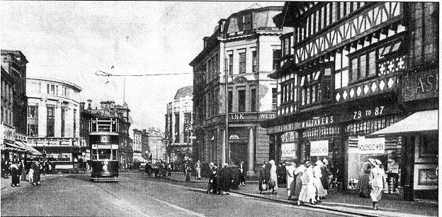
A fantastic view along Oxford Street from its corner with Deansgate. Some of the buildings on the left are still there. The gap beyond the first block is of course Victoria Square on the other side of which the Exchange Building can be seen.
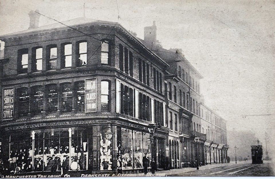
A very similar view on a David Whenlock postcard but now the shop on the corner is Manchester Tailoring Company and the next premises along Oxford Street is Holden's Vaults.
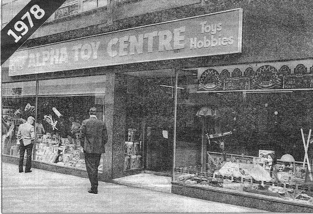
Just off Deansgate was Alpha Toys.
“A NEW toy shop which promised to be a paradise for children of all ages and one of the largest stores of its kind in Europe opened in Oxford Street, Bolton, in 1978. Alpha Toy Centre, already a familiar name in Bolton town centre with another shop in Bridge Street, aimed to provide a vast selection of toys and games all the year round with lots of displays to enable children to see the toys in realistic settings.
But in 1982 the success story had turned sour. William Thornton, the 38-years-old owner of Alpha Toys shut down his chain of shops and filed a petition of bankruptcy. He claimed he had a £1 million turnover at his Oxford Street, Bolton, shop but his Manchester store "bled me to death". Mr Thornton said: "My Bolton shop never lost money. My customers and staff have been great."
Mr Thornton claimed he was the first businessman to bring cut-price toys to the North which helped to bring down toy prices generally. Our picture today shows the Alpha Toy Centre in Oxford Street, a real "world of fantasy" for Bolton children in 1978.” (Bolton News)
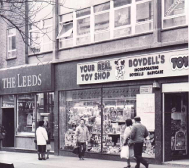
1992 The Boydell’s Toy Shop. Boydell's had been active elsewhere in Bolton and took up this town centre position after Alpha closed.
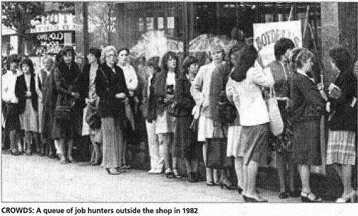
Oxford Street job hunters at Boydell’s 1982
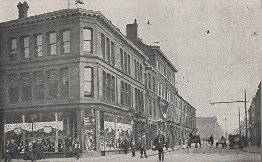
A look along Oxford Street from the corner of Victoria Square. Burgon's were a bit over the top with their roof top sign and the tram wire gantry is quite decorative too.
Comments from Peter Lodge:- The Palatine building still has its top storey and is occupied by Burgon's store. This backs up my theory that Burgon's temporarily moved to the corner of Deansgate and Howell Croft while this was being dismantled, and then moved back around 1909. The shop between the bank and the George and Dragon is still there in this photo. It's not really clear but if you know what you're looking for you can see the boards high up on the wall between the pub lamps. This was demolished 1907/8, but I've no idea if the boards were a permanent feature, or a temporary one to advertise the auction prior to demolition, so it's not clear if it's 1907 or earlier. The tram no 84 was delivered in 1903, so the photo is 2 years either side of 1905.
Tate's (no.14) is on the right with its strange upstairs window configuration (still there today) suggesting it was once 2 different shops. You can see the sign closer to Deansgate for 'Holden's Vaults’ which was the alternative name for the Higher Nags Head, which had its main entrance on Deansgate.
Posted by Peter Lodge. Similar view but showing the shops on the left more clearly, slightly later since the Palatine Building has now lost its top storey. Also the premises in line with one another now terminate at the George and Dragon so the shops beyond have been demolished. Parr's Bank and the rebuilt shops are set back by between 6 and 10 feet so it is not easy to see beyond the pub but the far corner of the pub can be seen. However the Bank and the new buildings tower above the pub and we seem to be able to see the gable of the new building.
Now we return to Deansgate
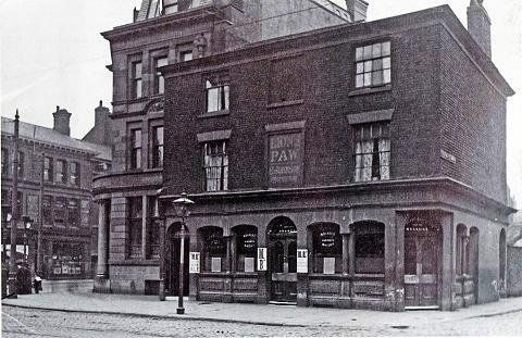
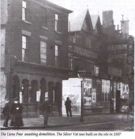
Parr’s Bank is clear on the corner but the main subject of the picture is the Lion’s Paw which had previously been the Four Horse Shoes. Then in 1907 it was rebuilt and renamed the Silver Vat. Note that Parr’s Bank is built further back than the pub in preparation for its rebuilding and the widening of Deansgate.
On a wider but very poor quality version of this picture we see a bit more of Old Hall Street North to the right of the pub and the site where Whitaker’s is being built. The hoardings have an advertisement for a “moving” sale at Whitaker’s which at this time is at the other end of the block at the corner of Howell Croft North.
Lion’s Paw, Whitaker’s (construction almost complete) and Pare’s Chemist. Note that Whitaker’s has been built further back than the Lion’s Paw and the chemist, anticipating the widening of Deansgate. The pub will shortly be demolished. We see the SALE sign pointing to the premises occupied by Whitaker's at this time.
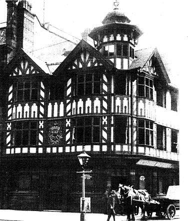
The Silver Vat, was built to match the Whitakers building in 1907. This picture is immediately before the building was demolished in 1927. Parr’s Bank then extended its building to occupy the whole block between Oxford Street and Old Hall Street. Note that Deansgate is to the left and Old Hall Street North is into the picture on the right.
24 Sept 2009 ©WDC
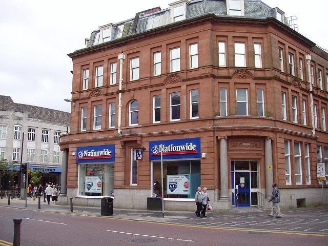
The extended building now occupied by Nationwide; you cannot see the join, IT’S BEHIND THE DRAINPIPE.
Sept 2009 ©WDC
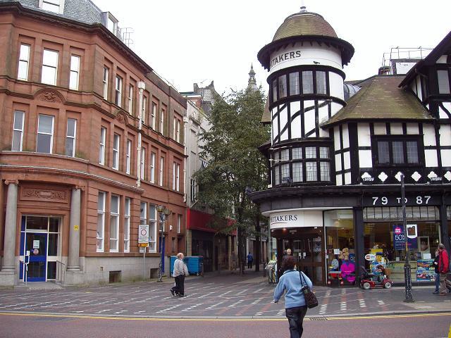
Old Hall Street and Whitaker’s .
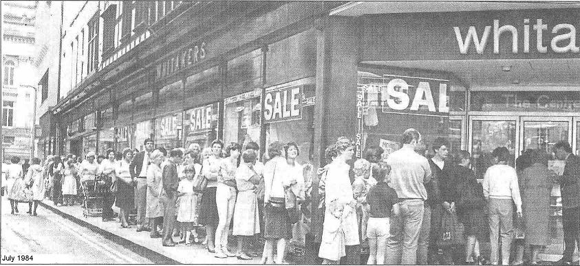
Old Hall Street North July 1984; a queue of 200 bargain hunters had formed outside Whitaker’s by 9.00am. By lunchtime over 1000 people had gone through the doors.
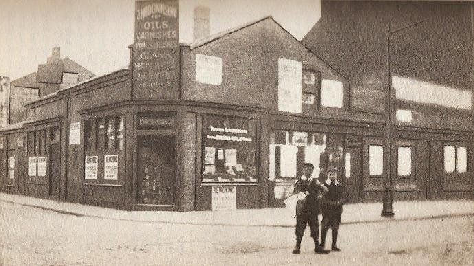
Old Hall Street North corner with Deansgate before Whitaker’s was built, c1900 – J Hodgkinson oils, varnishes, glass, paints, brushes, ? & cement Merchants. This building preceded Whitaker’s and has posters “removing” so is likely to be 1906/7
View from Ridgway Gate across Deansgate c1925; we see the Silver Vat, demolished 2 yrs after this picture, the far buildings on Old Hall Street are being demolished to make way for the Oxford Street Co-op.
c 1950 same as the previous picture except 25 years later and the back of the Oxford Street Co-op can be seen. Note the black and white building, the Fleetwood Fish Stores on the right.
20 Sept 2016 almost no change since the 1950s.
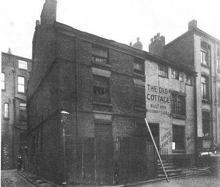
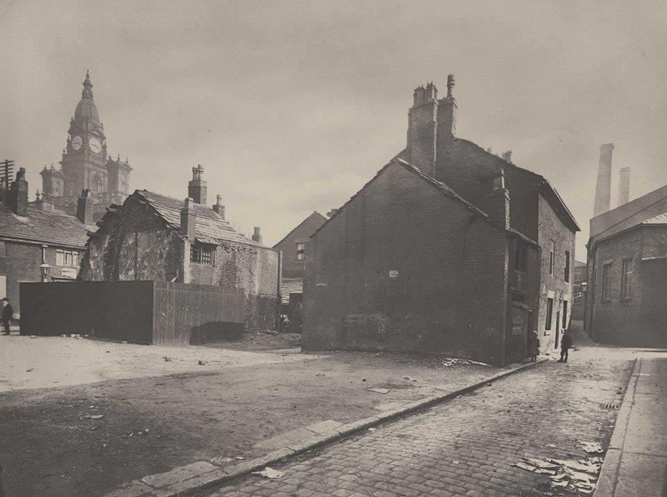
Georgian buildings in Ridgway Gates, The Old Cottage built 1777
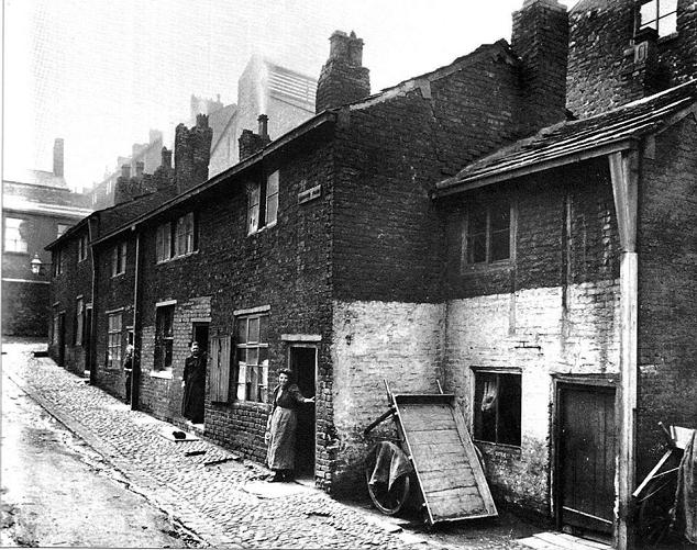
Right: Ridgway Fold 1895. Down from Ridgway Gate, approximately where the back of the Victoria Hall is. The tall buildings in the background about 1/4 in from the left and 1/4 down from the top are Velvet Walks. The Croal is just behind the viewer. The building behind the houses is Albion Foundry.
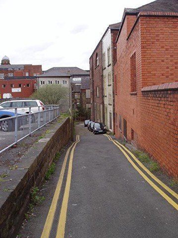
9 May 2013, Ridgway Gate, behind the Victoria Hall, goes down to the Croal and gives access to cellars under the Market Hall and once passed under Knowsley Street to Brook Street. Ridgway Fold was down here.
two pictures right >>>>>>>>>>>>>>>>>>>
Velvet Walks 1927, west of Ridgway Gate and higher up than Ridgway Fold.
Albion Court off Central St.just west of Ridgway Gate 1920s/30s named from the nearby foundry and remembered in the name of the public House on Moor Lane.
Posted on Facebook by Edward Thompson.
May 2013 ©WDC - At the bottom of Ridgway Gate, just lower than where Ridgway Fold was, the River Croal passes under Knowsley Street and now also under the Market Place.
Return again to continue along Deansgate.


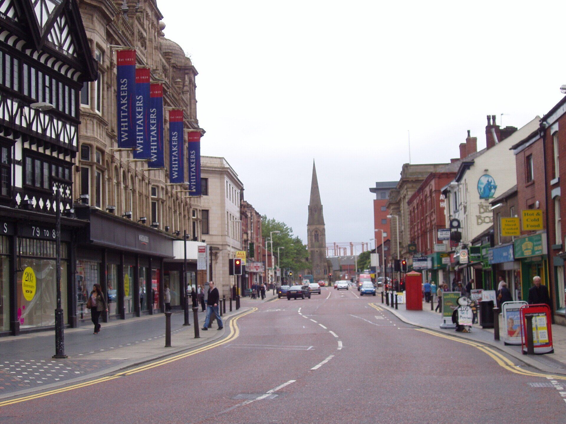
Whitakers and the Aspinall Building, looking along Deansgate to St Paul’s Church.
From the collection of David Whenlock
The same view August 1998 ©WDC
Sweetens Bookshop
Gas holders still there
Marsden House (fire station site) has been built.
Aug 1998 ©WDC
Deansgate; Max Spielman on the near corner of Ridway Gate, Foto Express replaces Fleetwood Fish, Sweeten’s Bookshop, Gibson’s Sports, Blue Boar, Apollo House, GPO
A pleasing hotch-potch of totally unrelated buildings of various dates.
This whole block was demolished in 2021 as part of the redevelopment of land from Deansgate down to the River Croal.
24 Sep 2009 ©WDC Some changes to the businesses but no change to the buildings
1959 A very familiar view of that side of Deansgate and the corner of Ridgway gates with Podmores; the King’s Arms still a public house, later Chapter and Verse, then Sweeetens Book Shop but currently empty; Fleetwood Fish.
Whitakers and the Aspinall Building, looking along Deansgate to St Paul’s Church. From the collection of David Whenlock
The same view August 1998 ©WDC
Ridgway Gates was named after John Ridgway, bleacher and dyer, owner of much property thereabouts and on the site of Market Hall. The Victoria Hall’s Walker Memorial Hall is on the site of Ridgway Gates Wesleyan Methodist Chapel (opened by John Wesley 16th April 1777 which was the start of the Methodist group which later became Bolton Central Mission at Victoria Hall) which had its last service in March 1900 following the opening of Victoria Hall but continued to be used by the Methodist Central Mission until it was demolished in 1931 to make way for the Walker Memorial Hall.
Deansgate 1934, Knowsley House has now been built along with its mirror image (almost) on the opposite corner. Parr’s Bank now occupies the whole frontage between Oxford Street and Old Hall Street but you can see the old (dirty) and new (clean) parts of the Deansgate frontage.
1957 Deansgate with the Aspinall Buildings on the right.
Posted on Facebook by Susan Garraway
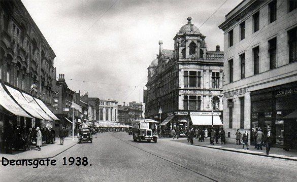
Deansgate 1938, A slightly longer view. The buildings remain essentially unchanged today though just about every business is different. Love the bus. Almost no traffic - love that too.
1957 David Whenlock picture
1966
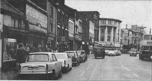
Looking back along Deansgate we have Podmores, well known to a whole generation of gardeners, The King’s Arms has by this date become Chapter and Verse, a Chrisitan bookshop and for a time headquartes of Operation Mobilisaton. On the corners of Knowsley Street are Alexandre’s and John Collier’s.

The pub dated back to the 18th century but closed in 1962. It became the Operation Mobilisation headquarters around 1964 with a bookshop as part of their outreach. The bookshop traded as Send the Light Trust and was later named as Chapter and Verse in May 1974. After OM left in 1980 (the bookshop moved to St George’s Road just up from Vernon Street) the Preston
Above, click and navigate
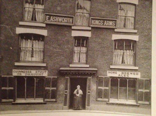
1 King’s Arms 86 Deansgate with Elizabeth Ashworth, the licensee of the King's Arms, pictured c1900.
2 Somewhat later, Home brewed ales has gone and now beer from Shaw's Brewery is supplied. Hampson's to the right.
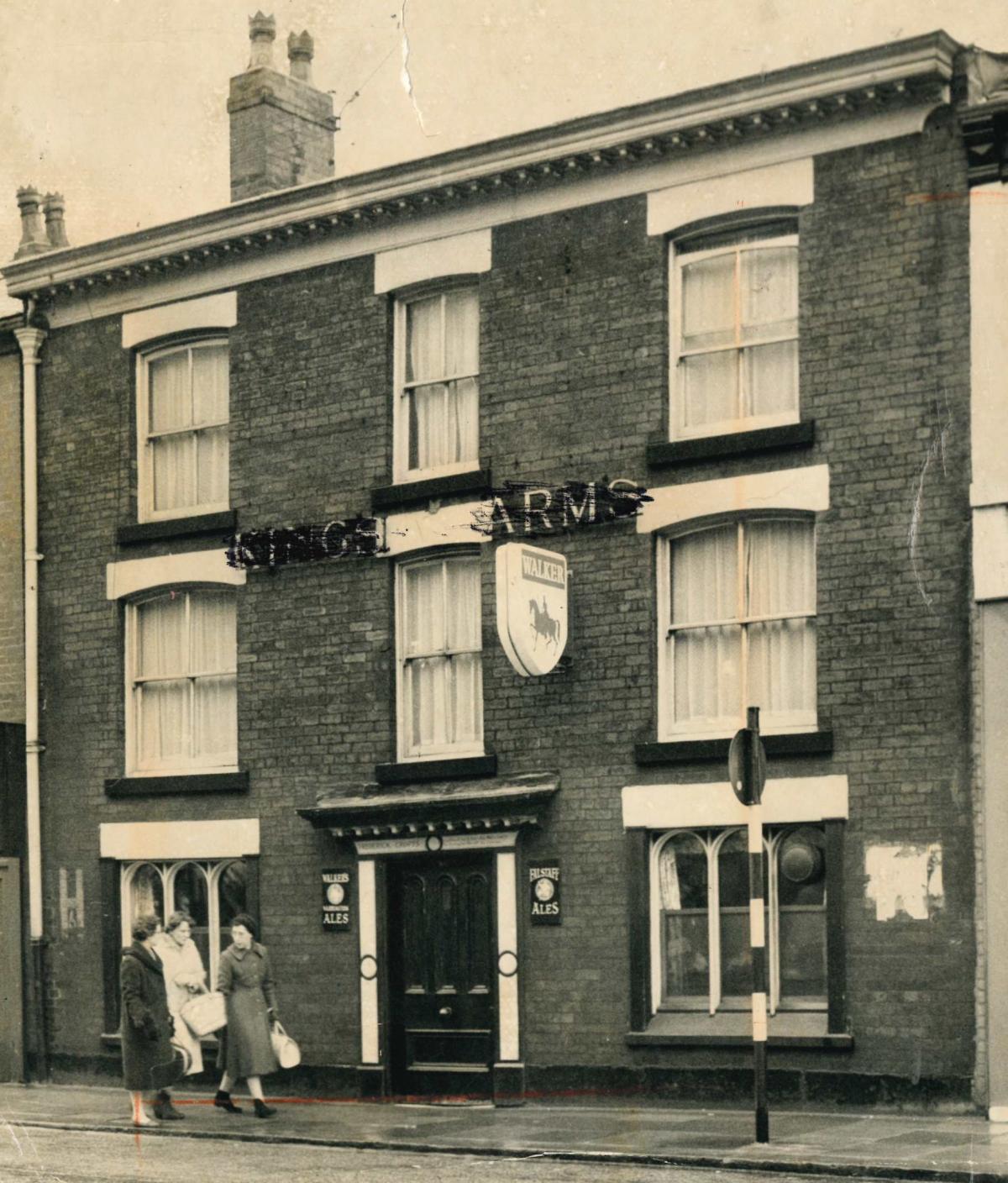
3 c 1950 Walker's
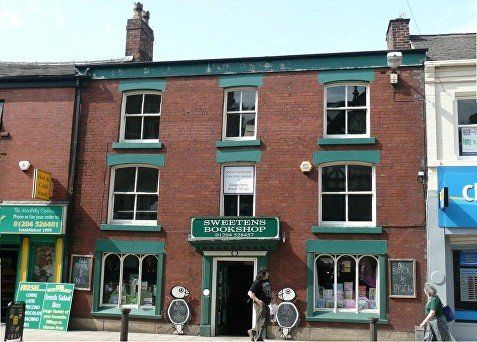
4 The building as Sweeten’s Book shop on its last day of trading – from flickr
left. 23 May 2016 ©WDC
The King’s Arms in a very sad condition. It had remained empty since the bookshop closed. It disappeared in the clearance of 2021.
firm of Sweeten’s reopened the premises as a (secular, general) very popular book shop in December 1980. Two of Sweeten’s employees bought the shop in 1997. The shop was Bolton’s final independent bookseller but it closed in 2011.
(Includes some information from http://lostpubsofbolton.blogspot.co.uk/)
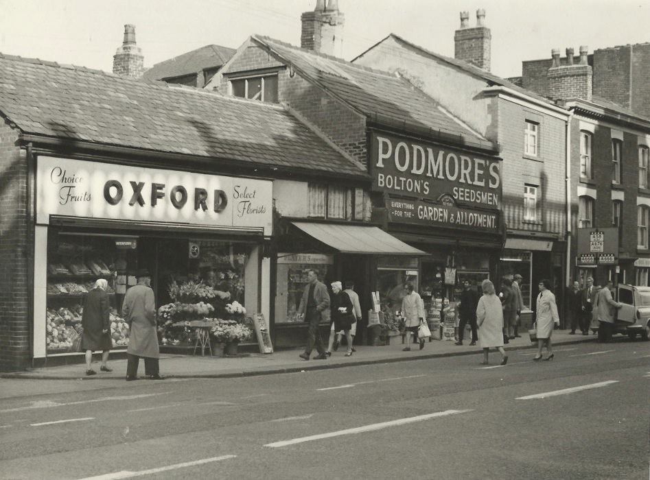

Picture from David Whenlock looking back to the King's Arms. This will probably awaken some memories; Oxford Florists, Podmore’s well-known to and well-visited by most of Bolton’s gardeners, The King’s Arms is behind the road sign.
From Whittakers towards St Paul’s, totally changed by the 1950s that we might remember. The low building at the end of the block is on the corner of Howell Croft North and was occupied by Whitaker’s before they moved into the black and white building.
1968
This is more how we remember it, again looking from Whittakers, along that block, Whittakers expanded the whole way along so all these shops closed, when? 1980s?
This block was built in 1912, now in line with the new Whitaker's building so that Deansgate could be widened, by Edmund Aspinall who made his money in pork butchery and whose shop is on the picture.
Upstairs, under the dome, was a well-known and well-used dance hall called the Aspin Hall (notice the play on words).
Aspinall became mayor of Bolton 1923-4 .
Sept 2009 (C)WDC
A similar view in more recent times.Whitaker's has taken over the whole of the Aspinall Building.
Back in time for this look in the other direction along a busy Deansgate. BEN picture, early 1960s (before 1968 and SELNEC buses)
above ©Bolton Council Humphrey Spender “work town” photograph 1937
Shoppers on Deansgate opposite Aspin Hall and Lloyd’s Bank.
<<<< Moving our viewpoint again a little further back and stepping further back in time: Postcard of Deansgate 1938 almost all the buildings on the picture still stand.
In 2021 part of the row on the left in the distance was demolished for redevelopment.
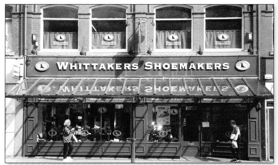
24 Sep 2009 (C)WDC from similar position, the long established firm of Whittaker’s shoe makers.
May 2016 (C)WDC Deansgate with Howell Croft North on the right and Central Street on the left.
Whitaker's has now been taken over by Beale's
A similar view from a little before 1928, Whitakers and the Aspinall Buildings are there but Knowsley House has not yet been built. The buildings on the left still stand in 2021. The hoardings on the right are probably around the building of Lloyds Bank
1883? Buildings which preceded the Aspinall Building on the corner of Deansgate (to the left) and Howell Croft North (on the right). They are obviously due for demolition very shortly.
These buildings are six feet further forward into Deansgate than their neighbours to the left (clear on 1849 map).
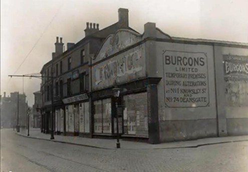
On the next two pictures we have what looks rather like a temporary building (which housed Burgon's then Whitaker's).which replaced the higher building on the corner.
If you look at the picture 7 frames above you see the block including Pare's chemist looking west from Whitaker's mock Tudor to the temporary building.
If you look at the picture 2 frames down you will be looking east from the temporary building to Pare's chemists (note the slight bend in the block, check the windows).
In those two pictures you are clearly seeing the same block of premises but it bears no resemblance to the premises on THIS picture. So these houses were demolished and rebuilt (further back) around 1883 only to be demolished again in 1912 for Aspinall's building.
Whitakers's occupied this corner before moving into their mock Tudor building at the other end of the block.
Were they elsewhere previous to this - perhaps even in the building that the Tudor style premises replaced.
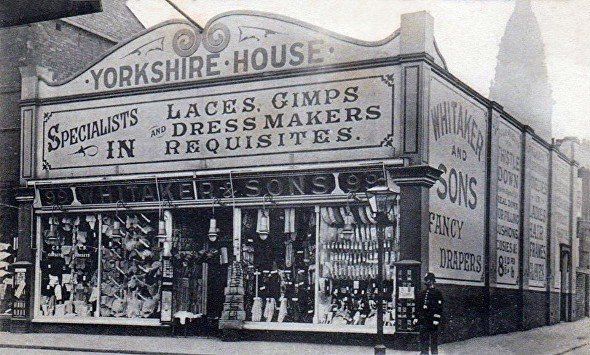
Why Yorkshire House ?
Corner of Deansgate and Spring Gardens / Howell Croft North.
Burgon's also occupied this rather temporary looking building while their other premises (on the corner of Deansgate and Knowsley Street) were altered.
Is this alteration the removal of the upper storey?
Moving west across Spring Gardens we have a shop on the corner then the Hand and Banner Hotel. Note James Hart's "old original pork shop, 117 Deansgate", then some demolition.
The Hand and Banner was on the site of the house of Mr John Oakey. The house was described as including a croft, garden orchard at the rear ans a s garden before the house It formed one of the most desirable residencies in the neighbourhood of Bolton.
Oakey was a Puritan. One of the four ministers slain in Bolton during the civil war was slain in Mr Oakey's house by the Earl of Derby's people and the females of his respectable and pious family were selected as victims to endure the worst excesses of a brutal soldiery. Despite this, it is said that Oakey acted as a Good Samaritan and soothed the last moments of his chief political foe, the Earl, and arranged that his body was not thrown into a common grave in the Bolton churchyard but transferred to Ormskirk for a decent burial.
Picture and text from Denis McCann.
Deansgate with Spring Gardens on the left at an oblique angle. Howell Croft divides from Spring Gardens just off picture going at right angles to Deansgate.
Burgon’s shop is just seen on the left.
The Hand and Banner can be seen on Deansgate set forward of the corner shop
The Hippodrome is just visible on the right..with the grand looking Queen's Arms (closed 1907) to this side of it.
The building on the right of the picture is the corner of Deansgate and Spring Gardens seen on the previous picture. Then we have Spring Gardens going off to the right with Howell Croft to the left of the building in the centre. This area was demolished 1910. The chimneys are for the Bolton Iron and Steel Company and the Bessemer Furnace between Moor Lane and Blackhorse Street. © Bolton Archives.
This picture shows the left hand end of the block in the previous picture but looking the other way to Deansgate and across to Central Street. Both buildings at the right of the picture are still standing.
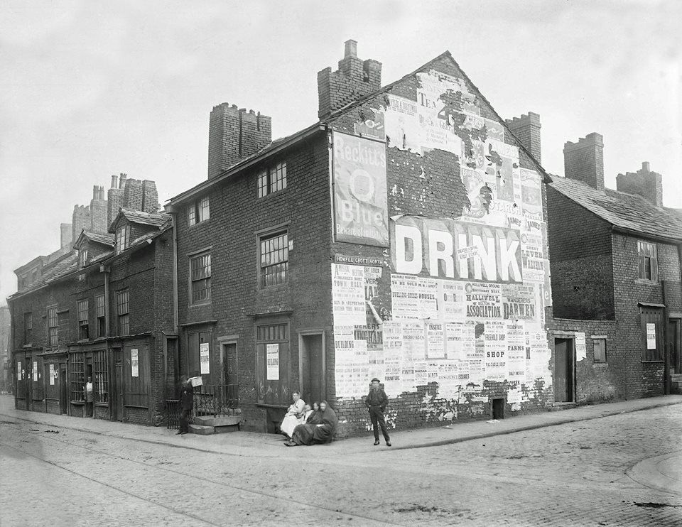
This picture is captioned Slide no 28 - condemned property in Howell Croft North in T H Mawson's 1916 book of lectures "Bolton as it was and as it might be.". His excessive criticism of Bolton at the time and his over-exuberant plans for the future seemed not to go down too well with the Town Council.
2020 view into Central Street (Google)
1909
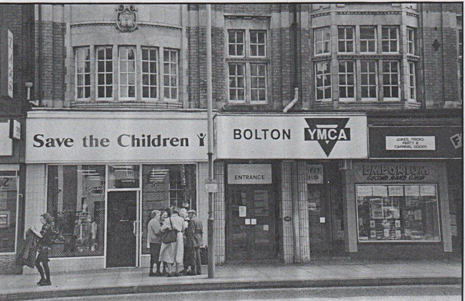
Go a little further along Deansgate, this is Back Spring Gardens opposite the GPO, the street itself disappeared and the row of shops including the YMCA and the Christian Book Shop (was Wesley Owens then CLC then independent) stood there until 2021 when the YMCA decided to build premises more suitable to their present needs.
Back Spring Gardens - about 200 yards away from Deansgate more or less behind what was for many years the ambulance station.
This was quite a long street from Deansgate to Great Moor Street. The tiny bit between Lever Chambers and the site of the Odeon remains.
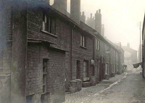
Back Spring Gardens.

1908
Posted on Facebook by Gene Watts
Back Spring Gardens looking down past the Druid Arms, we would see the YMCA building facing us now (pre 2021), and the Hippodrome further along Deansgate towards the right.
Queen Street is to the left of the Hippodrome.
Behind Hamilton's Excursions could have been the site of the Queen's Arms.
On the near side of Deansgate to our right the GPO is about to be built.
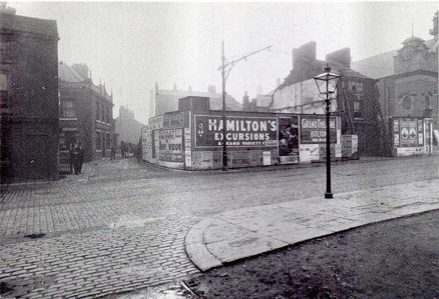
Posted on Facebook by Tom Openshaw. Druids Arms, Back Spring Gardens, 1908
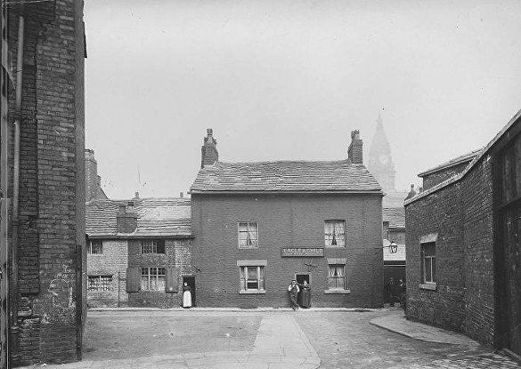
picture taken from top of Queen St, looking across Back Spring Gardens to the Eagle and Child. The building on the left is -Mission Hall & Ragged School – according to the 1891 map. It is Queen Street Mission which moved prior to this area being cleared to Central Street though it retained the name “Queen Street Mission”. We note the chalk grafitti even in those days.
Queen Street c1910 The building is the Eagle and Child.
1994 posted on Facebook by Gene Watts
We are lookng across Deansgate to where Back Springs Gardens used to be.
Two shops in the YMCA building. demolished 2021.
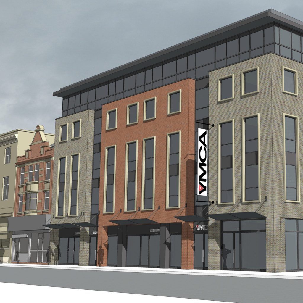
The YMCA has been active in Bolton since 1884 and has occupied this building since it was first built.
Bolton News: In January 2021 a £6.1million project in collaboration with Blackburn YMCA was commenced. Called the Y-pad it will have 40 units of accommodation.
Above: Artist's impression of the new building (C)YMCA
left: March 2020(C)WDC
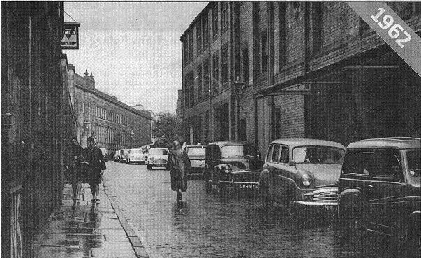
August 1962
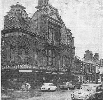
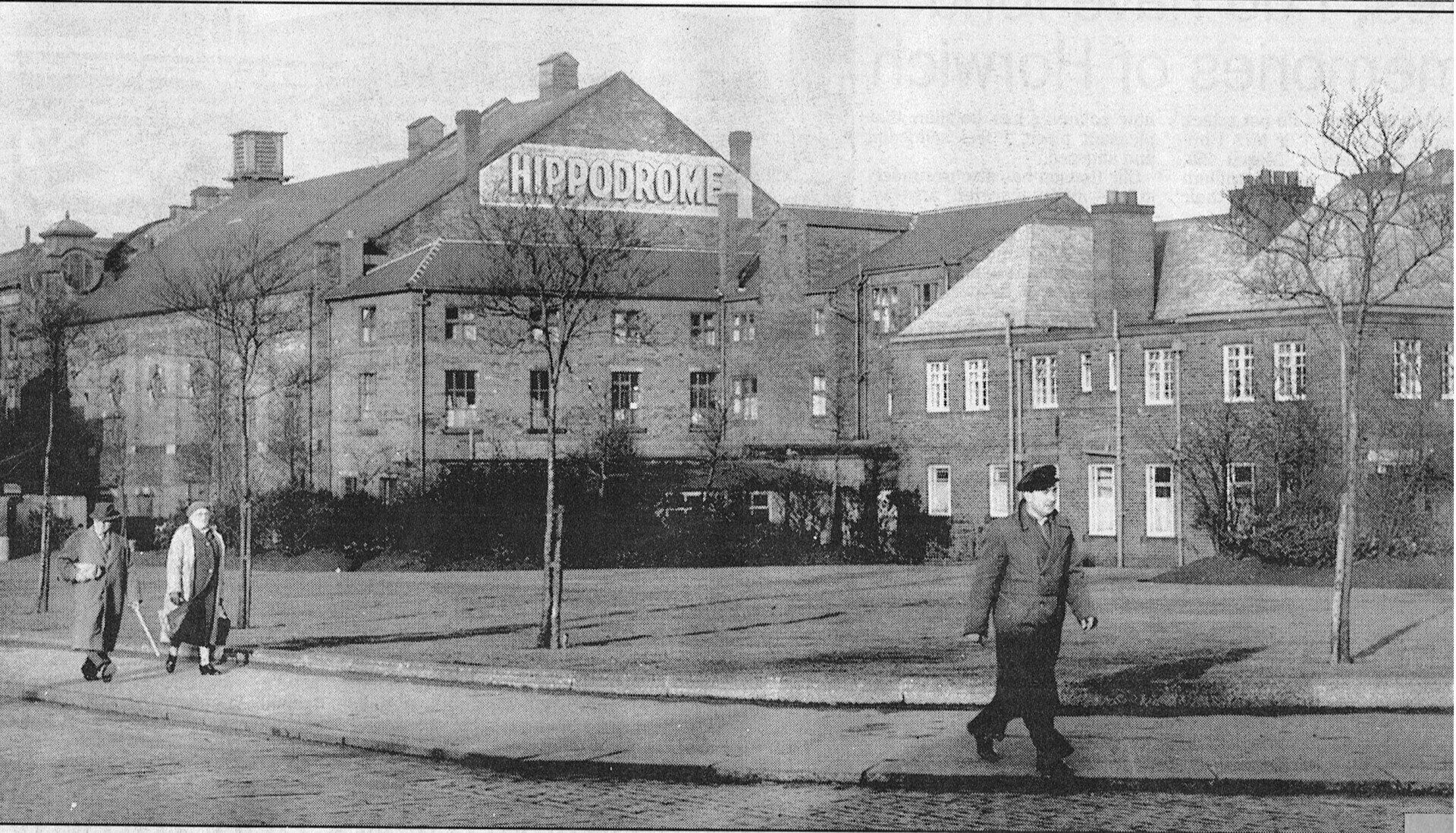
The YMCA building to the left, we can see the boys' department side entrance, and the Hippodrome to the right.
The back of the Crescent can be seen up the street.
Bolton Evening News picture.
1934 posted on Facebook by David Whenlock
Queen Street: this very substantial building like a pair of semis still stands behind the Crescent though Queen Street itself has been slightly realigned and joined with Back Spring Gardens. It was used for many years as the Probation office.
The large bulk further down the street is the Hippodrome and beyond that is the GPO on the other side of Deansgate.

Click on an image and navigate
The Bolton Empire Theatre, built for Thomas Hay. It was a large good looking building, built opposite the Post Office on Deansgate. The building's façade had a large central entrance with two floors above featuring large central windows, with a grand pediment high above. At first floor level were two oval ornamental windows each side, and at each corner of the front façade was a domed tower, surmounted by a flag pole. The roof was pitched and does not seem to have had a fly tower over the stage.
It is recorded that within a month of opening part of the variety performance contained a section showing early cinematic film.
Eight years later in 1916 the Empire changed hands and became a full time Cinema, being taken over by the H. D. Moorhouse chain of cinema's, and now renamed 'The Hippodrome', under the Bolton Entertainment Co Ltd. By the late 1920's British Thomson-Houston sound equipment had been installed.
The Hippodrome continued as a cinema up until the early 1940's when it returned to theatrical use, becoming the home of the Bolton Repertory Theatre. Repertory productions continued until 1961 when the Theatre finally closed. The Theatre was later demolished, and a car park made of the Theatre's site. (Frank Ashton) --- Note the theatre was built BEFORE the GPO. ---- Note a health centre was built here before the car park.
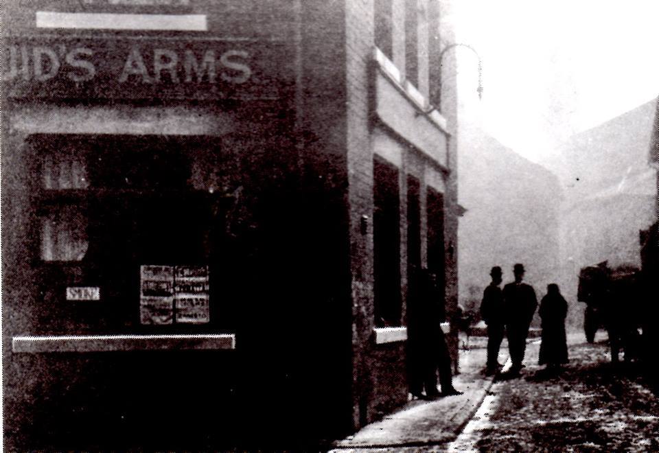
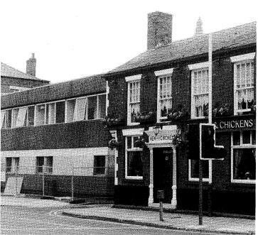
1 A very familiar view for many Boltonians. To the right the Hen and Chickens with the King's Head Hotel to its right
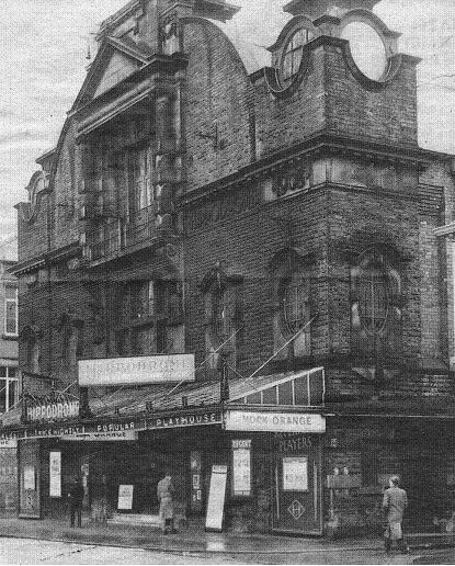
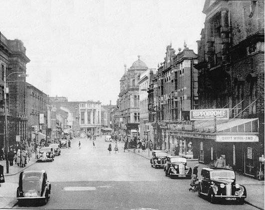
2 The Hippodrome. The Hen and Chickens is now on its own the King's Head having been demolished.
3 The Hippodrome now has a glass shelter for the queues. Repertory Platers are mentioned on the permanent boards. Today's performance is "Mock Orange" by Peter Blackmore, a comedy for nine cast members published in 1960.
4 The Hippodrome as the New Empire Theatre opened in August 1908
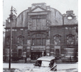


1 In the stone work below the circular window on the right is HIPPODROME which would not have been there when it first opened and 1908. There is a white mark on the stone work at the left which is on all pictures except the very earliest.
2The Hippodrome interior - posted on Facebook by Edward Thompson
3 Programme with Herbert Evelyn (Bolton Archives) My Grandma kept lodgers at her house in Grosvenor Street. She had various actors with her from time to time but one couple lived with her for many years, Herbert Evelyn and Mrs Evelyn, stalwarts of the Hippodrome Repertory Company.Herbert was still living there, Mrs Evelyn having died some years earlier when my Grandma died and it took a lot of hard work to persuade him that he then needed to move somewhere else.
4 c1950 A look back along Deansgate from near the Hippodrome and GPO to Aspen Hall and John Collier’s.
A Quiet Weekend - a comedy - the ordinary and extraordinary adventures of a British family and their various guests during a weekend in their country cottage: the son and his socialite flirt hated by his adoring cousin, the local magistrate salmon poaching. and so on. A play by Esther McCracken which became a film in 1946. Looking at the cars, it may well be the film that is being shown.
Just beyond the Hippodrome notice the embellishments of the roof line of the YMCA building. All this fancywork was removed some time before it was demolished in 2021.
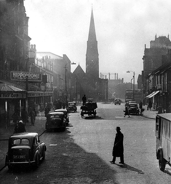


The Hippodrome on the left as we look along Deansgate towards St Paul’s Church. April 1952 B.E.N.
A slightly longer view of Deansgate taking in the grandeur of the GPO with Kingsgate to this side of it.
The first street on the right is Central Street with the sun coming from the south (left) along Howell Croft.
The Hippodrome site was occupied by a health centre opened in January 1972.
The Hen and Chickens was open and thriving before Covid-19 in 2020.
We are looking back along Deansgate from opposite the Hippodrome. On the right the street is Queen Street, named in honour of Queen Charlotte wife of King George III. Then we have the YMCA probably newly built and further back than the original building line to allow for the widening of Deansgate. Notice again its roofline embellishments. The block further away is on the original building line and is about to be demolished.
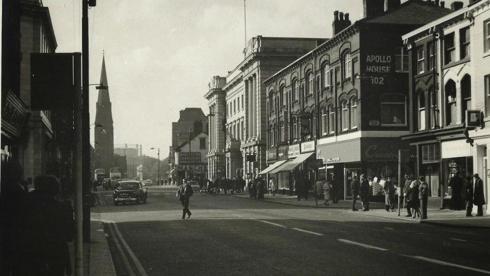
On the left we have the empty space waiting for Bolton's splendid GPO to be built so this picture is a little before 1913. Then beyond King Street we have the handsome and sturdy building which at some time had Apollo House written on its opposite end and which has Whittaker's shoe shop near its middle.
A true Bolton Institution!
Picture posted on Facebook by Edward Thompson.
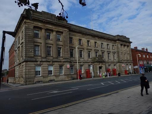
1935. The GPO on Deansgate opened in 1916, the building is pretty much the same as now but the GPO left this building in 2020 and it is being converted to flats.
The GPO had previously moved its counter operations in November 1969 when it moved to the newly built (later named) Paderborn House. Services later moved back to the traditional site. (Was this when Registrar moved to Mere Hall, Motor Taxation was discontinued and Whitaker's moved into the ground floor?)
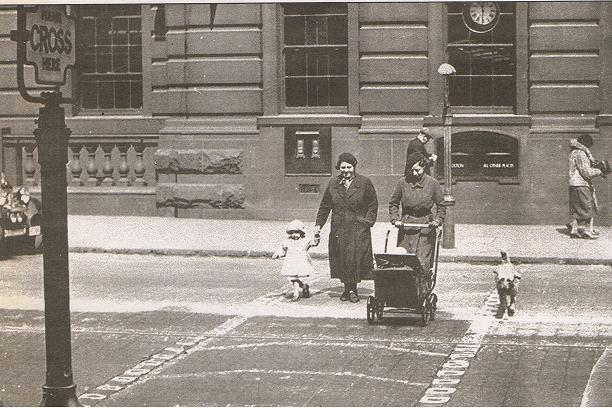
This is Bolton’s first Belisha crossing, the studs are in place but the beacons have yet to be erected. A Belisha beacon is an amber-coloured globe lamp atop a tall black and white pole, marking pedestrian crossings of roads in the United Kingdom, Ireland and in other countries (e.g., Hong Kong, Malta) historically influenced by Britain. It was named after Leslie Hore-Belisha (1893–1957), the Minister of Transport who in 1934 added beacons to pedestrian crossings, marked by large metal studs in the road surface. These crossings were later painted in black and white stripes, and thus are known as zebra crossings. Legally pedestrians have priority (over wheeled traffic) on such crossings.
20th September 2016 (C)WDC
March 2018, the post office proposed to move its services in Bolton Town Centre from the present GPO building, 124 Deansgate, to retail premises at 12 Oxford Street also offering Confectionery, Tobacco & News. It was said that this was part of the continuing modernisation of the Post Office branch network. The official notice continued: The vast majority of our 11,600 Post Office branches, large and small, are successfully operated in this way and we believe this is the best approach to keep Post Offices in main shopping locations and at the heart of communities. What was not said was that the Post Office had sold the Deansgate premises some years ago and was at present renting them from a property firm in Jersey. Clearly the premises are too big for the current retail operation and presumably this move will vastly reduce the rent the Post Office is paying, yet another example of the move some years ago for firms to monetise assets which has lead to a number of closures (including Beales) when businesses fail to negotiate a rent reduction with the present owners. There are worries by people including our MP that the shop premises in Oxford Street will be too small to cope with the number of customers though it will have six serving positions. It is also seen as a loss to Bolton as a whole that we will no longer have a grand prestigious GPO.
2021 Work is well underway to preserve the front but convert the building into flats.
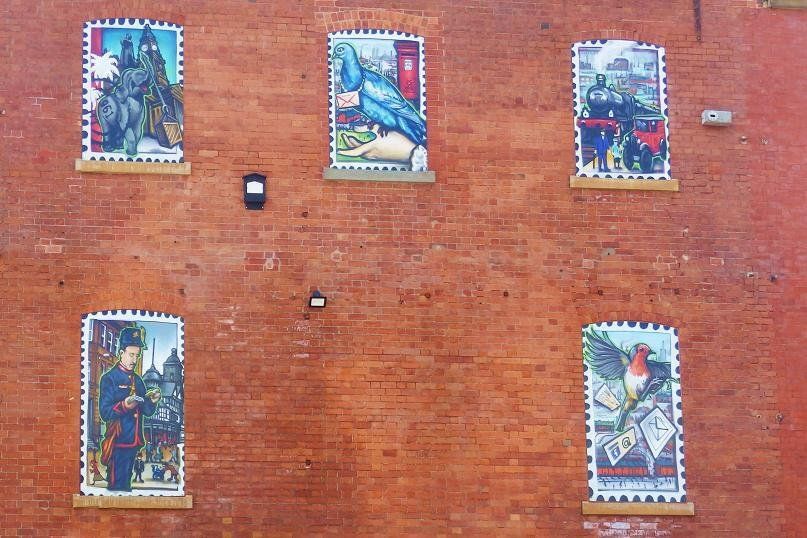
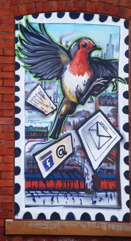
(C)WDC July 2021 A view of the rear of the GPO building as the redevelopment into apartments is almost complete. These murals reflecting both Bolton and the building's postal origin, by Kelzo (Tony Brady) and Entise (Evan Barlow) were unveiled 12 June 2021
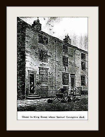
King St off Deansgate where Samuel Crompton died having lived there for the last few years of his life – demolished 1973
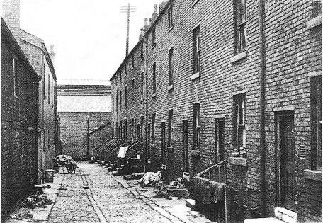
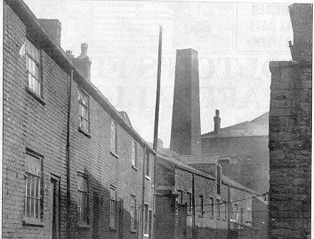
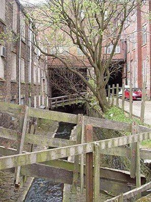
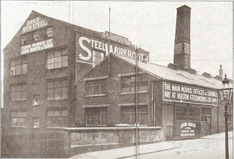
John Booth’s steel works, its address is Back King Street but that is behind the works relative to our viewpoint. The street we are on with the bridge over the River Croal is St Edmund’s Street. Booth’s headquarters was out of town at the junction of St Helens Road with Hulton Lane.
“Build with steel” “Town works of John Booth and Sons”. This picture is from a book (?) and I only have access to this fairly poor copy. The original had a caption “Booth’s Back King Street foundry. Crompton’s old mill is on the left. This ... in 1938 after this photograph .....”.
Does “Crompton’s old mill” mean St Helena Mill? – I have seen a statement that Samuel Crompton occupied that mill but have never seen any evidence and have doubts. I am pretty sure he never owned it.
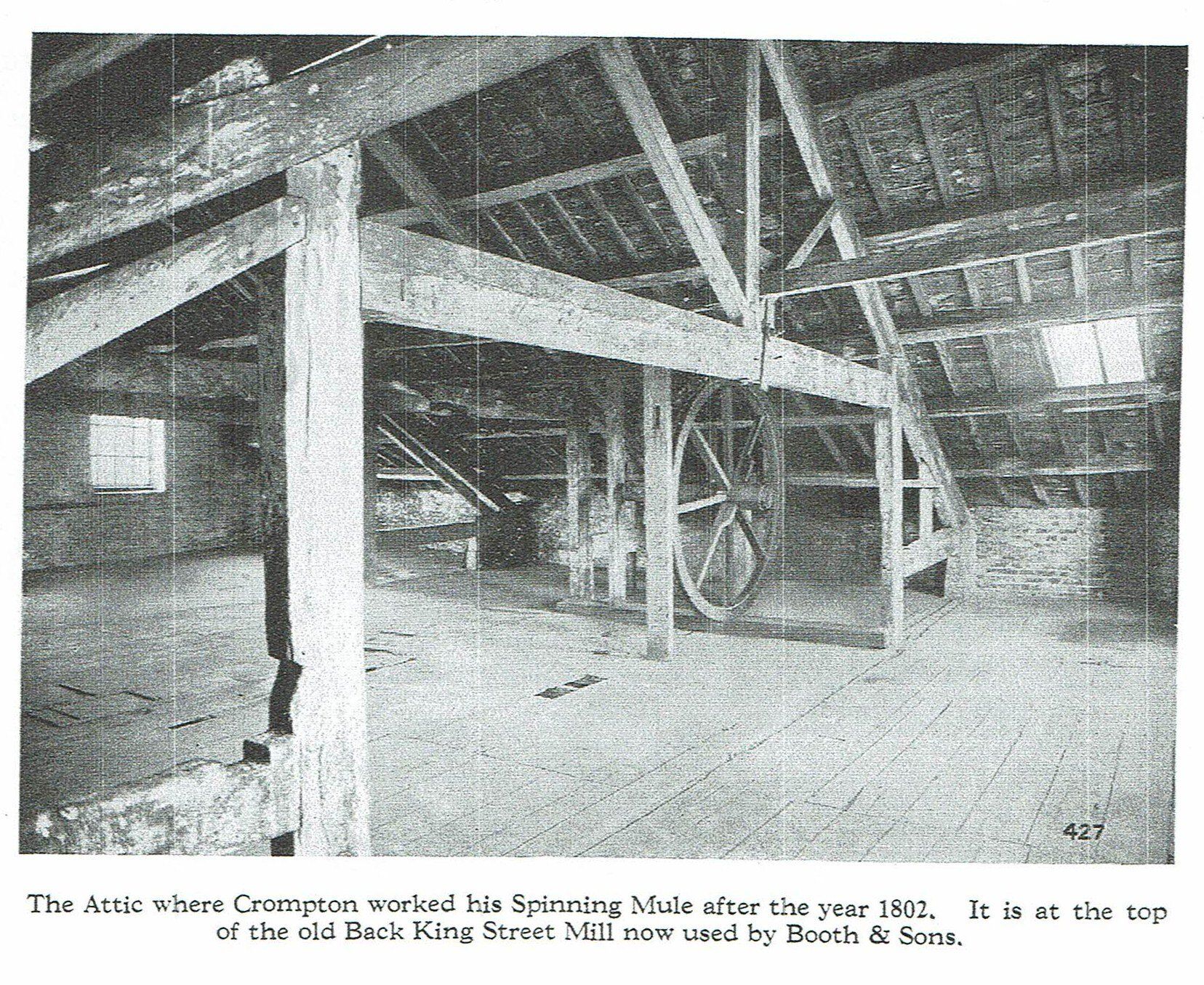
Gordon Readyhough (Bolton Town Centre – A Modern History) says “Crompton rented the top floor of a factory (owned by John Booth and sons from 1894). For many years a board attached to the roof announced that ‘In this ancient Mill Samuel Crompton first worked his spinning mule 1800’ and Crompton’s tenancy is apparently mentioned in the mill deeds.”
The attic of the Back King Street Mill
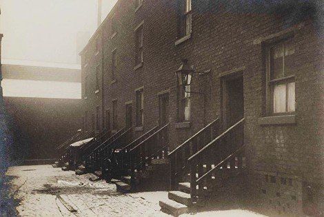
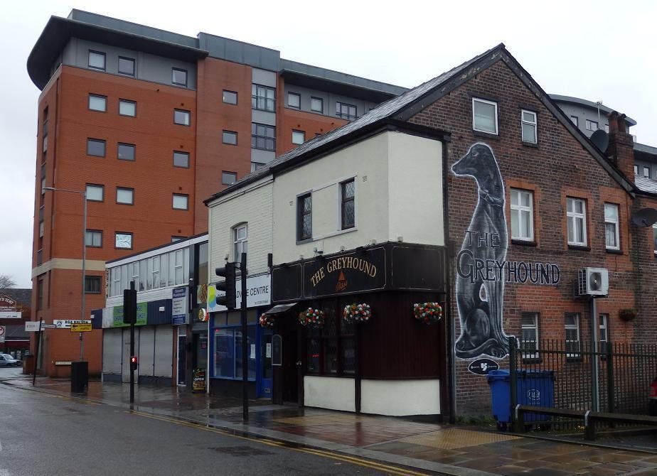
c1957 King Street goes down the west side of the GPO. This corner of Deansgate and King Street is where Manchester stores moved to from Victoria Square. We see the block to the left (west) of the GPO which is presently (2018 and some years prior) a car park. Further left still we see the corner of the Greyhound pub. The narrow street to the right of the Greyhound is Back King Street.
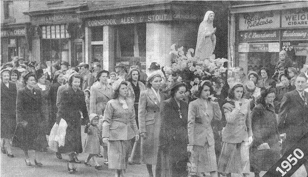
1950 Deansgate, a little west of the GPO. The statue of Our Lady carried by women members of the St Edmund’s procession in May 1950. Behind the parade – the Greyhound pub and Beardsworth’s hairdressers.
March 2020 (C)WDC
The Greyhound pub and some "street art". The block to its right as far as the GPO is now a car park..
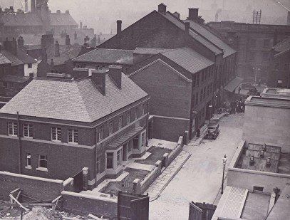
The scene is dominated by Marsden House which replaced the old fire-station.
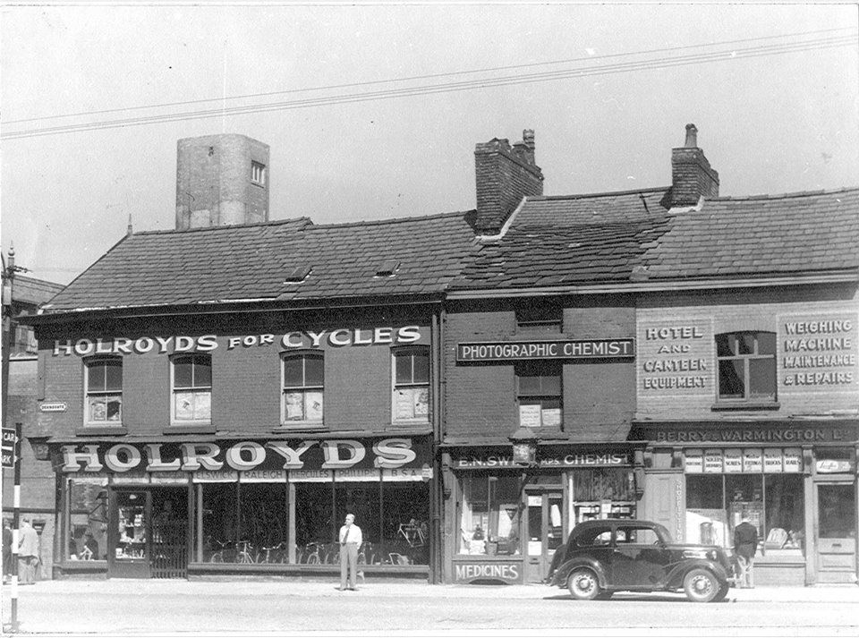
Deansgate west of King Street and the GPO. St Edmund’s Street is to the left of Holroyd’s. The fire station tower is visible above the roof. Not the ornamented one originally built.
The buildings in the picture overlap with the previous picture.
Earlier, and certainly on the 1891 map, St Edmund's Street was called Grime Street.
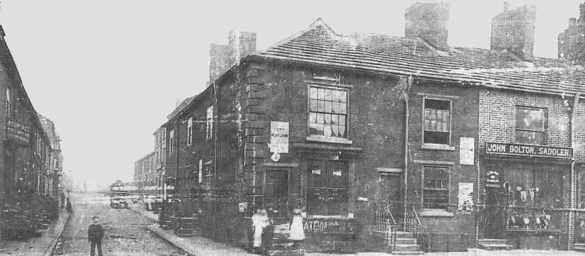
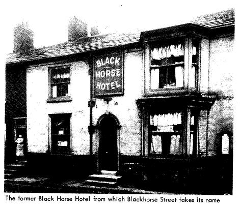
On the other side of Deansgate we have Blackhorse Street. On the front we see John Bolton 155 Deansgate, and on the left into the picture P Critchley 1 Blackhorse St.
Black Horse c1920
The Black Horse Hotel was located on Blackhorse Street and dated back to the late-eighteenth century.
Blackhorse Street was initially known as Thweat Street and was named after James Thweat, whose surname was often spelt Thweats or Thwaites. He opened one of Bolton’s first cotton mills in King Street just across Deansgate from here. Isaac Dobson lived at the pub shortly after he arrived in Bolton in 1789 and while he was resident there it became a meeting point for some of the town’s most prominent business people - many of them owning the brass works, iron works etc between this street and Moor Lane.
Isaac and Benjamin Dobson, Peter Rothwell and Benjamin Hick, formed ‘the Black Horse Club,’ where they met informally but no doubt talked business and local politics. Samuel Crompton, who at this time lived in King Street would sometimes meet with them. He seems to have been was famed for "sitting with his one glass of ale and seldom speaking, except when directly addressed, and then always briefly and to the point.”
In Crompton's later years of poverty the Black Horse Club members contributed money to give Crompton an annuity of £63 15s.
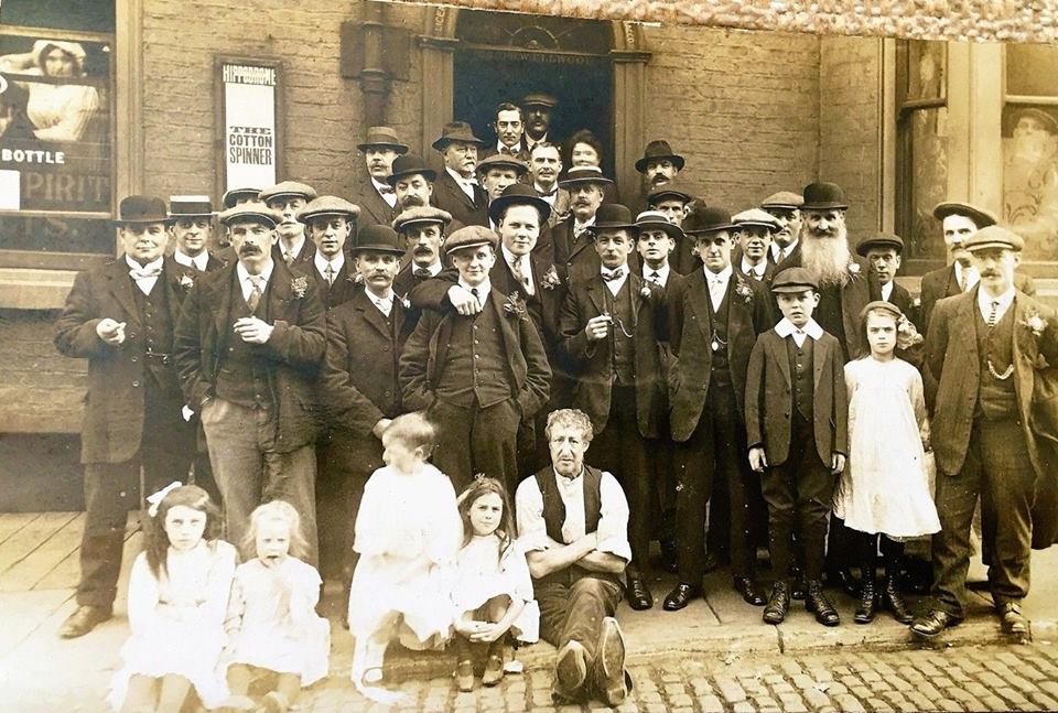
All dressed up and (presumably) somewhere to go. The Black Horse Hotel. Picture from David Whenlock.
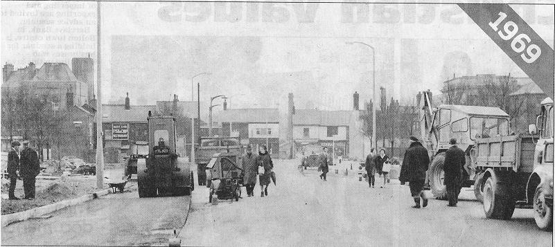
March 1969
Blackhorse Street widened; Greyhound pub, West End chippy
1958 Blackhorse Street, just below Cheadle Square looking at the back of the Hippodrome and the Social Services / Probation building on Queen Street.
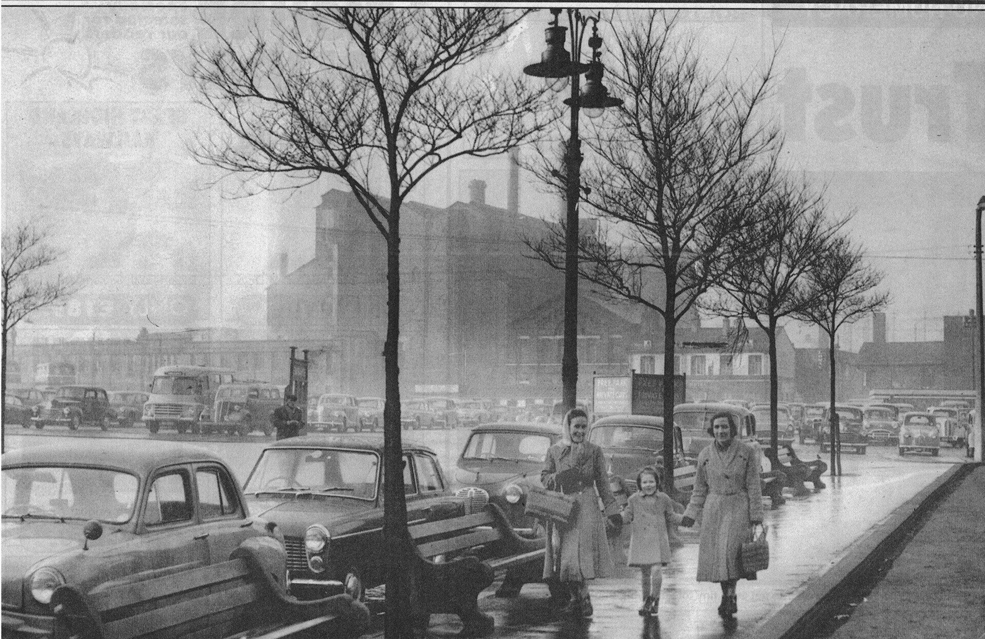
1960 from Cheadle Square looking across the car park (pre engineered bus station) to Moor Lane and the Gas works and the Elim Church. Jubilee Court has now been built there. We also see the Albion pub where many holiday coaches used to stop to avoid bus station fees.
From Blackhorse Street looking across to Cheadle Square, the rear of the Crescent and the back of Queen Street.
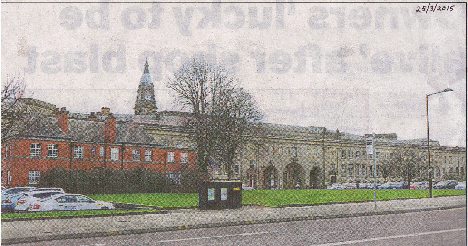
In March 2015 the Bolton News labeled this "a view that might disappear if BMBC has its way". This of course was a comment on the latest plans for the use of the now disused bus station which involved the construction of a "Student Village".
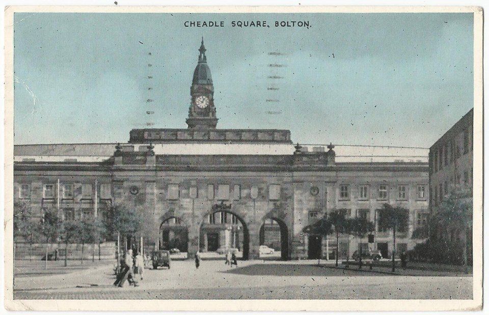
1957 postcard of Cheadle Square looking through the arches of Le Mans Crescent.
Posted on Facebook by Andrew Hodson
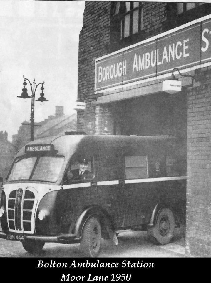
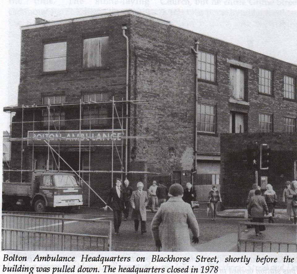
The old Ambulance Station on the corner of Cheadle Square, exiting onto Blackhorse Street. The service was moved from here to the Royal Bolton Hospital site in 1978.
A previous ambulance garage had been on Coronation Street. Before that the ambulance service was a single vehicle belonging to the Fire Service.
1950
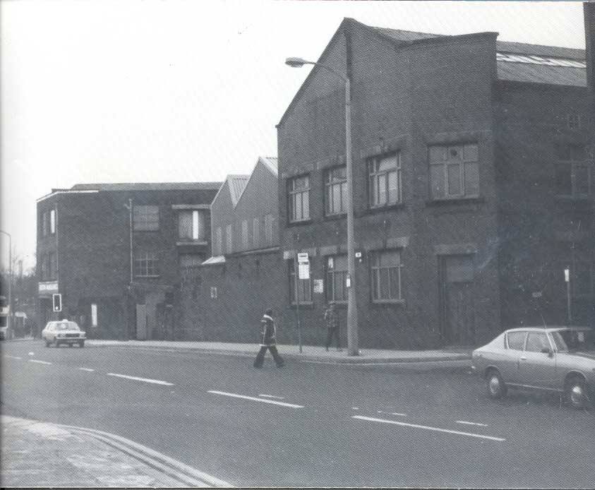
A bit further up Blackhorse Street with the Ambulance building to the left. >>>>>>>>
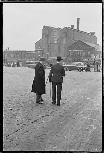
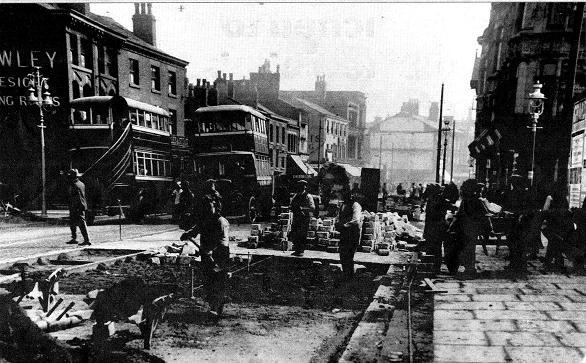
Looking across the empty space that not too many years previously had been the centre of Bolton's heavy industry. We seem to have the snapper snapped. One of the gentlemen is probably Humphrey Spender taking a picture for his Worktown project in 1937. Who borrowed his spare camera is not known.
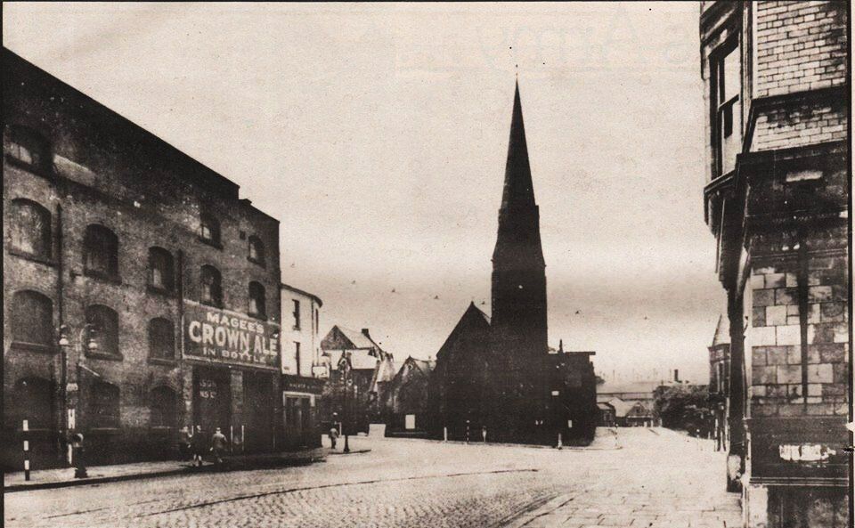
From the bottom of Blackhorse Street we look west along the last bit of Deansgate. On the left we have warehouses associated with the Bolton Leigh railway or possibly with the Bessemer Furnace, Iron Works and Brass Works. They were finally demolished in the 1960s. Immediately beyond them the White Lion is on the corner. Directly opposite a short bit of Spa Road / Chorley Street is called White Lion Brow.
Here is St Paul's church which has been a feature of all the Deansgate pictures looking in this direction and we see along Spa Road. Moor Lane is on the left. Marsden Road High Level Bridge is on the right.
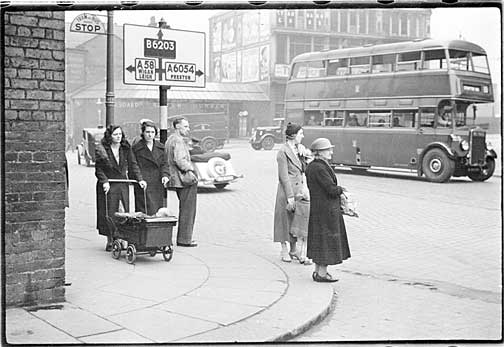
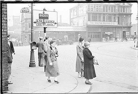
Aug 1937 Humphrey Spender “Worktown” photo.
Behind the bus is the Diamond Jubilee Building so-called for Queen Victoria’s celebrations in 1897. This is the old Salt Pie Mill; it has a new frontage on Marsden Road; how much more of the old mill was rebuilt at this time is unclear.
Aug 1937 Humphrey Spender “Worktown” photo.
The Bolton Motor Co Ltd occupied the building for many years but in more recent times it was well-known as the home of ESB motor cycles.
The Gypsy's Tent can be seen to the left of the road sign.
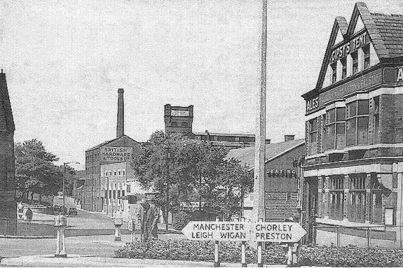
At the end of Deansgate we have White Lion Brow, the junction of Deansgate, Moor Lane, Marsden Road and Spa Road. On the corner of Spa Road is the Gypsy’s Tent at one time including “Romany’s”. This was converted into flats in 2017/8 after bring empty for a number of years. Then beyond Chorley Street was have the Navada Skating Rink and further away still, British Hardware and Tools.
On the next page we look at the fire station on this corner go across the High Level bridge and a bit further, then explore Spa Road.
The above is probably a Humphrey Spender picture of 1937. We have the Gas Works with its line of offices along Moor Lane and the gas holders in the distance, the Elim Chapel and the Albion Hotel.