
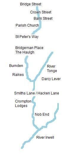
cr6 Haulgh and Burnden
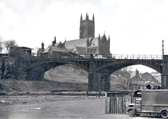
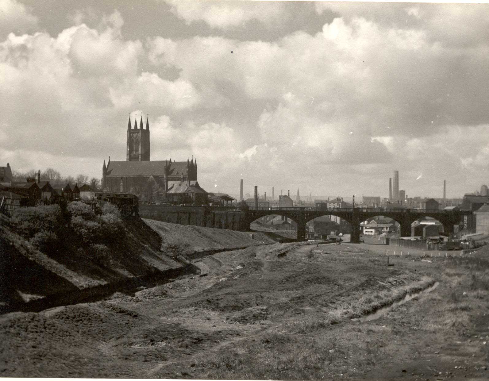
We look back again towards Church Wharf and note how the Parish Church was built high on a spur of land above the river valley.
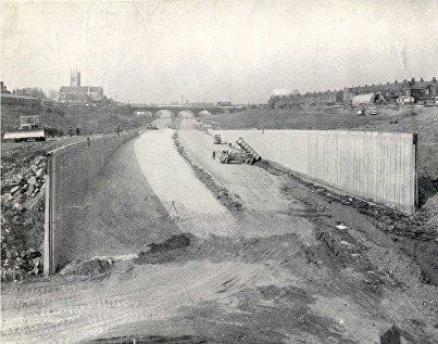
And just a few years later as work on St Peter's Way begins. The river is to the left below the grassy bank.
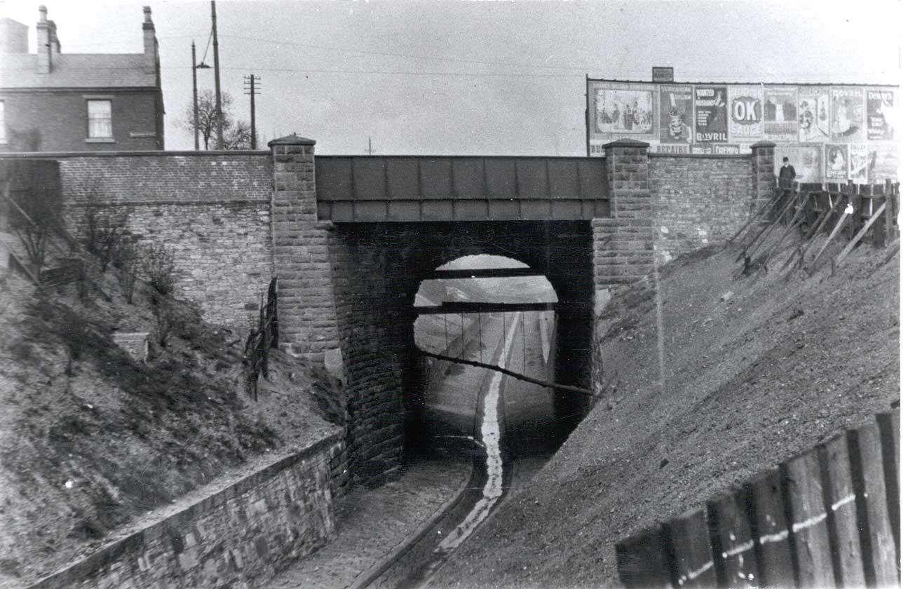
The buildings seen below the arch are on Churchbank.
Will they ever clear up this mess?
Picture by David Evans
(C) David Evans
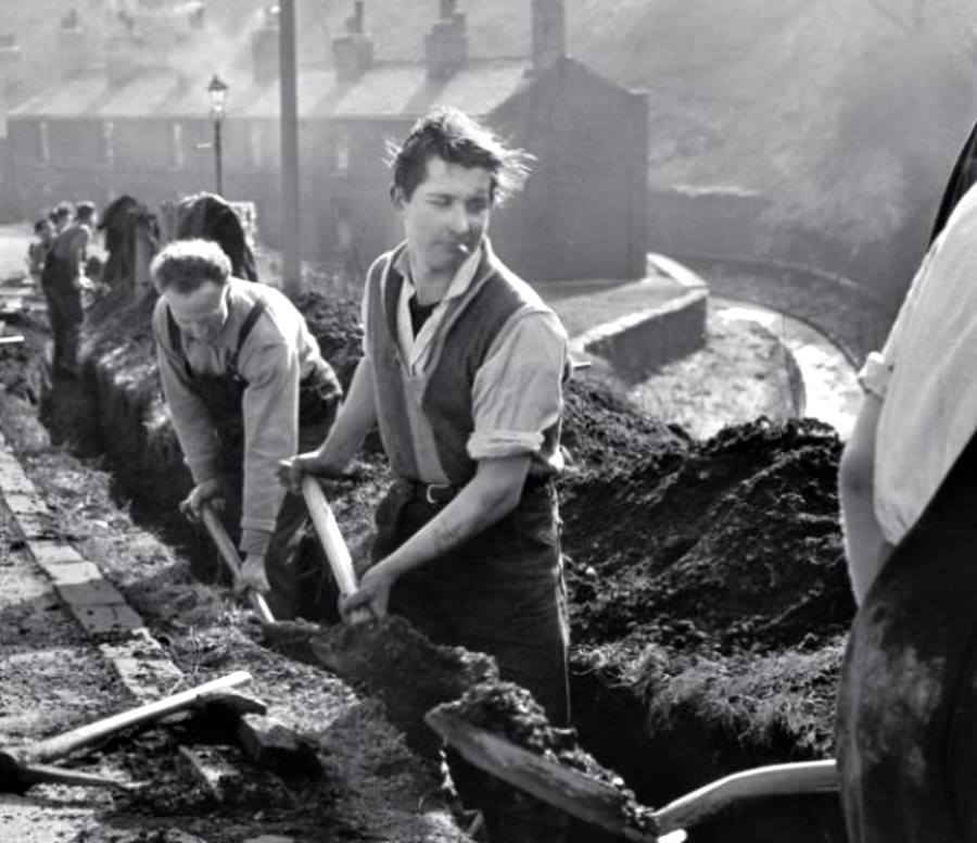
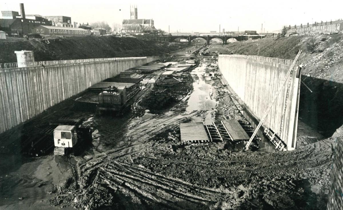
Dorset Street. A good picture of utter chaos on the road with the muddy morass of the Croal Valley during the construction of St Peter's Way. The River Croal has already been culverted under the left-most arch of the viaduct. The Parish Church overlooks the scene from its spur of land above the valley and Winter Hill is hazily in view in the distance. The buses are in Bolton's later colour scheme, not SELNEC or First Bus.
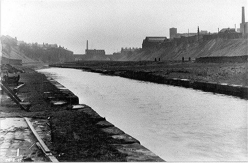
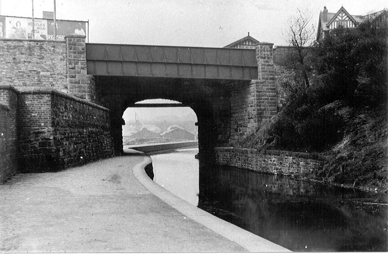
Looking once more in our direction of travel many years ago when the canal still had water. The River Croal is at the foot of the earth banking on the right.
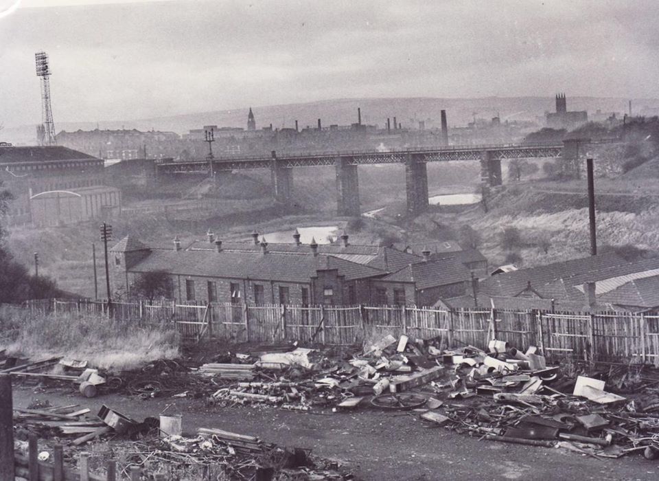
In the distance we see the canal bridge and the river bridge at The Haulgh and the chimney of Springfields paper mill.
Looking towards the Haulgh Bridge, the Croal has just been culverted in preparation for the construction of St Peter's Way. The original two bridges are still there with the Croal passing under the right (west) one and the canal no longer going under the left (east) one.
The flood lights of Burnden Park can be seen beyond the chimney.
The building at the left was, I believe, a "motorcycle shop on legs".
Posted on Facebook by Edward Thompson.
Looking back from the Haulgh Bridge (Bridgeman Place / Bradford Street) with the Croal snaking along the banking on the left and the canal having been filled in and left desolate.
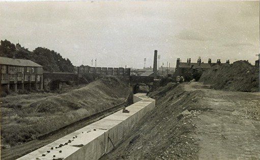
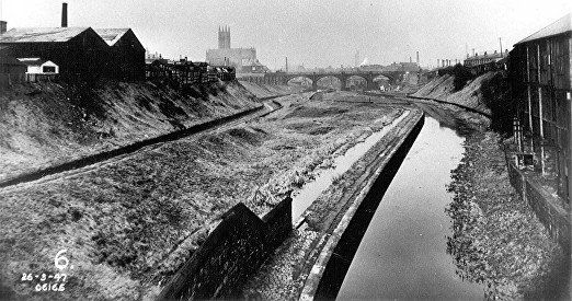
Zoomed out, somewhat earlier, 1947, the canal still has water.
A similar view from Haulgh Bridge during the construction of St Peter's Way.
Posted on facebook by Angela Thompson. The river is now below ground close to the banking at the left.
This is what we see in 2013. There is no sign of the river though ironically up on the left where the new hotel has been built, is River Street. This view is from the Haulgh bridge down from Bridgeman Place.
(C)WDC August 2013
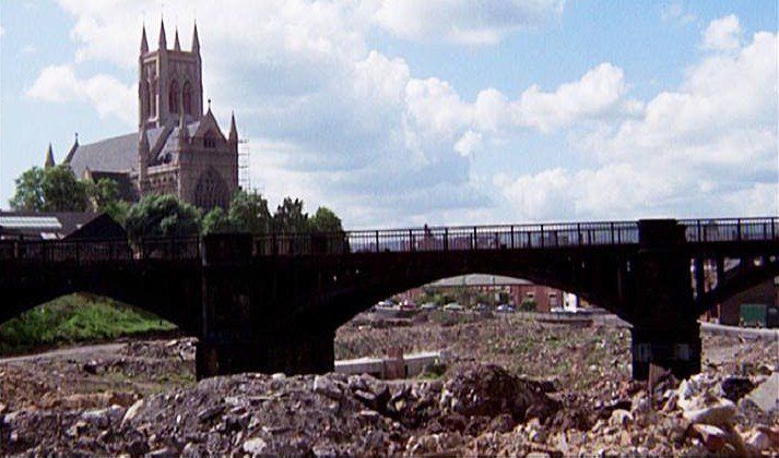
There are more pictures of the culverting of the Croal and the construction of St Peter's Way at the bottom of the page.
Here is Bridgeman Place pictured 1949 with the Miners’ Union building on the left, going on to the Haulgh and Bradford Street. At the lowest part of the road are the Haulgh Bridges which cross the Bolton canal and the River Croal. Now St Peter’s Way goes under the road. Toys R Us (closed c2019) and other outlets are to the right and the river does see the light of day again after its journey under St Peter's Way.
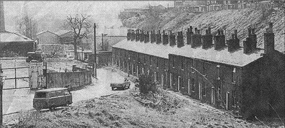
Remember the long view from Church Wharf to Haulgh Bridge a few pictures ago with that dark rectangle sitting up on the skyline? Well that was the advertising hoardings seen on the above pictures. At the bottom of Bridgman Place were actually two bridges, the first one you reached was over the river and the second over the canal. These two pictures do not quite join together. There is a road between them down to a hamlet called Springfields, just a row of houses and some industrial works.
Above and left: We look from the bridge over the river down to Springfields. The houses on the top of the banking are on Westbrook Street and the bottom of Grosvenor Street which ran down the far side of the Technical College. On the left is the Springfields Paper Mill whose chimney we saw from afar.
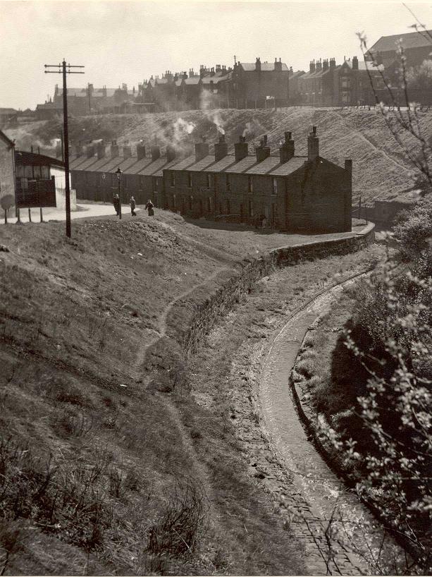
This picture had appeared in the Bolton Evening News in April 1982 with a report that Town Hall Planners had no objection to the Earl of Bradford's scheme to reuse this terrace of houses for cottage industries. The Earl, who owned the cottages, was objecting to a compulsory purchase order by which the council would demolish around 100 houses said to be unfit for habitation in the Rose Hill and Orlando area and earmark much of the area for housing but schedule Springfields for industrial use.
Note the communal privies.
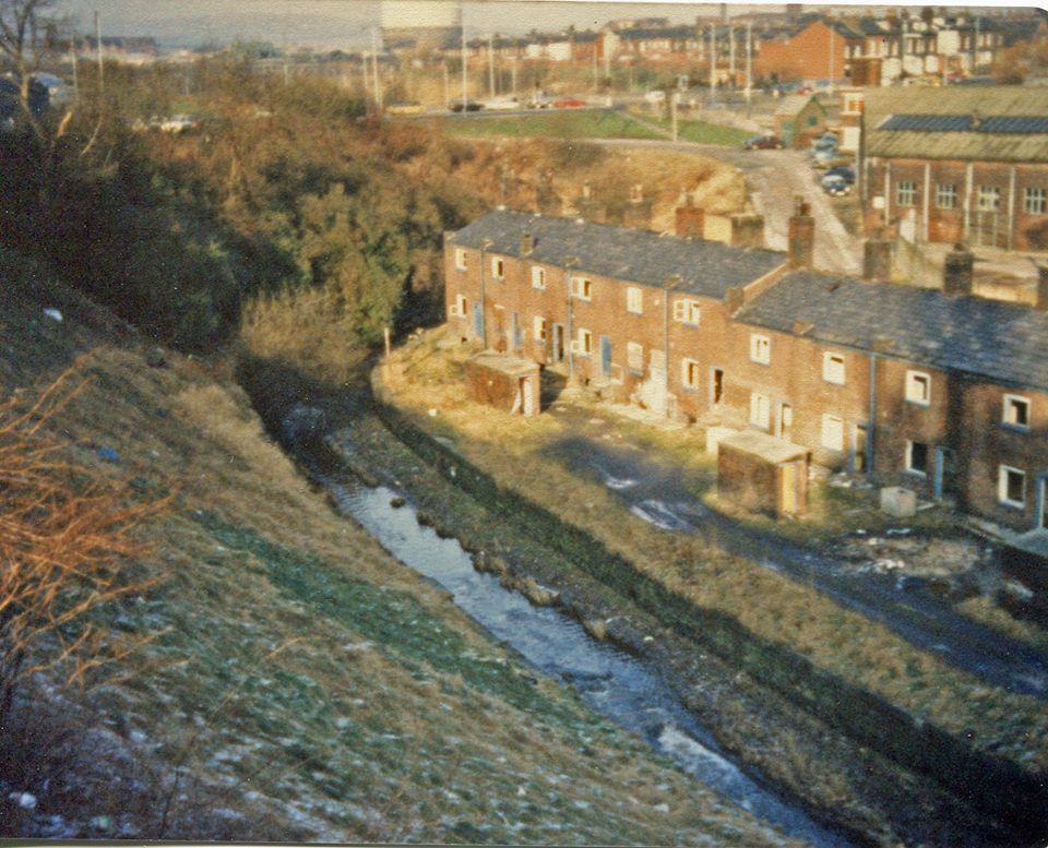
The Croal runs between the embankment and the houses.
Picture by Harold Crompton Robinson of workmen on the Hough Bridge overlooking Springfields.
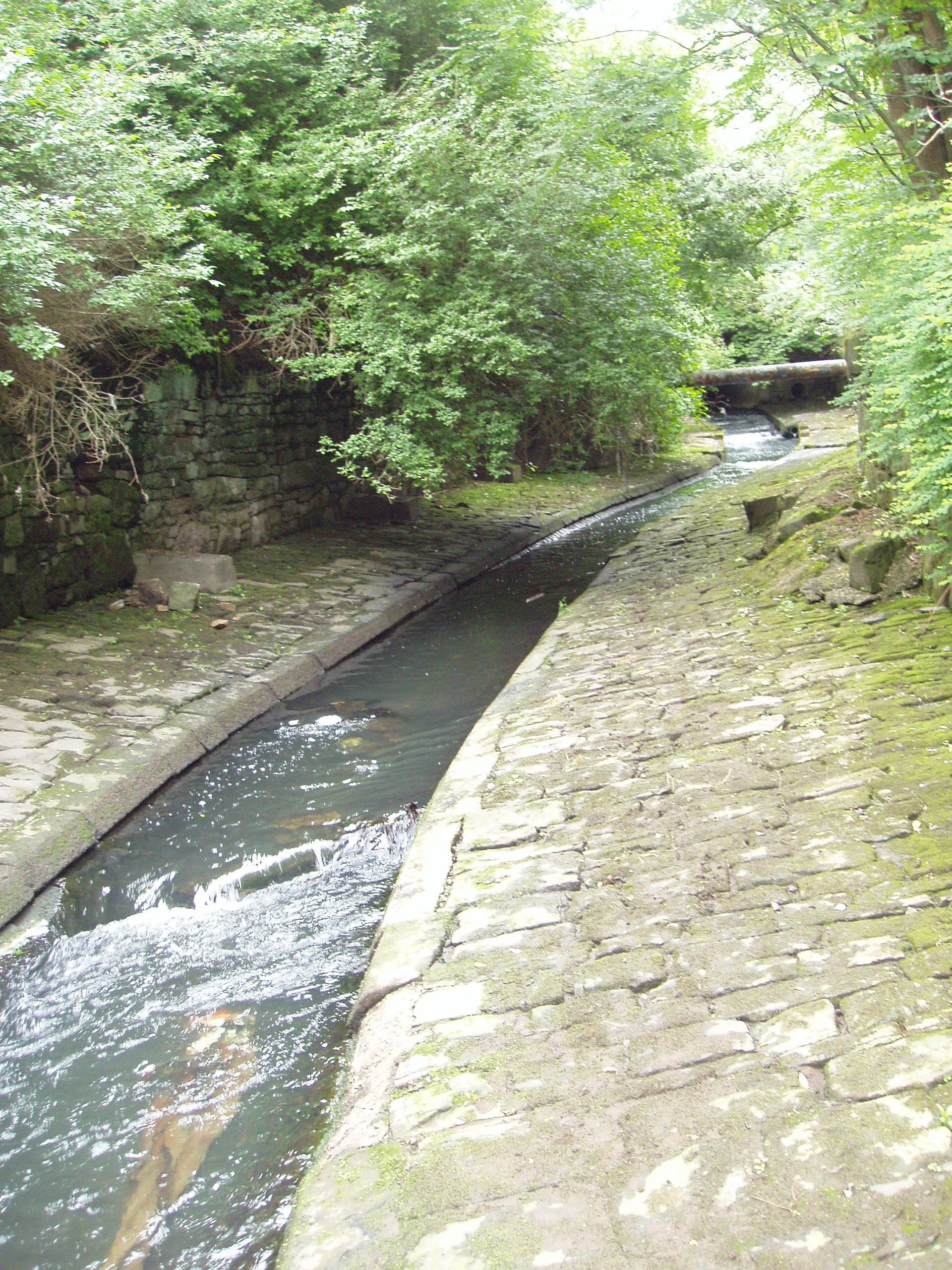
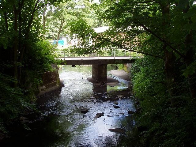
Left: the river emerges from under Haulgh Bridge (flowing towards us) after its half mile travel underground from Churchbank.(C)WDC July 2013 ^&v
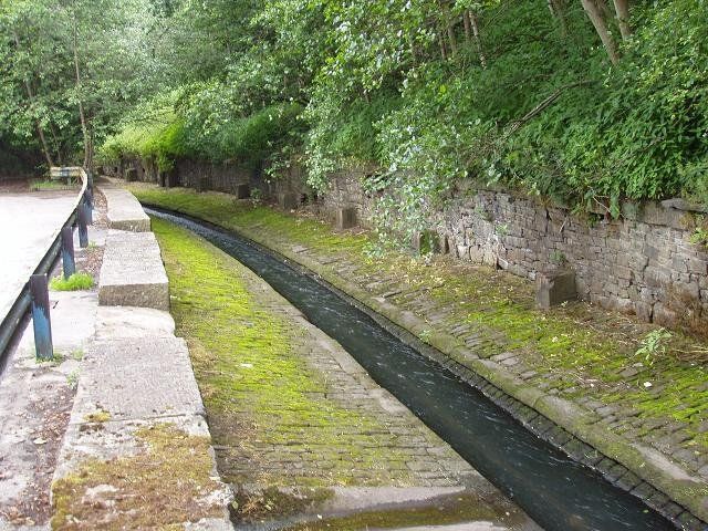
Above: then continues along the back of the Trinity Retail Park (was Toys R Us and Staples) along its original cobbled bed. (flowing right to left)
The Croal continues behind (what was ) Staples. (C) July 2013
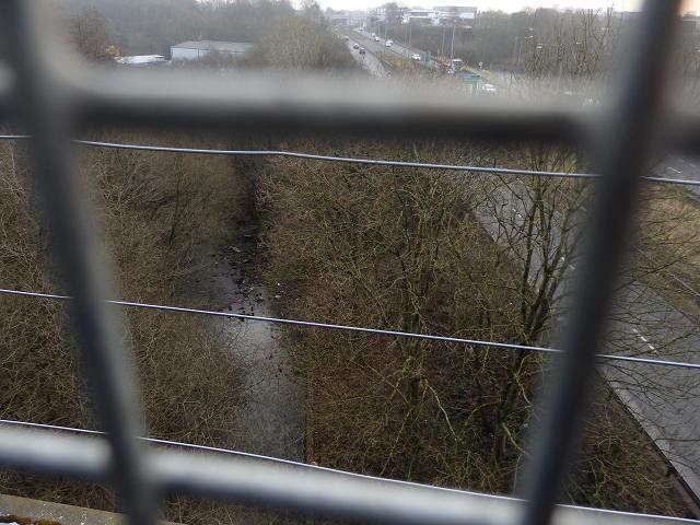
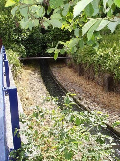
The Burnden Railway Viaduct is now part of a footpath and cycle route from Scholey Street off Manchester Road, across this viaduct and also the Tonge Valley viaduct to Top o' th' Gorses at Darcy Lever and the bottom of Leverhulme Park. From the viaduct we have this view of the river as it flows away from its latest culvert.(C) WDC 27 January 2017
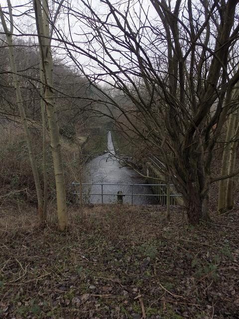
We are now just downstream of Trinity Retail, behind Burnden's ASDA - a bit of a scramble is involved getting here) and we see where the river once again goes undergroundfor a little way as it goes from the west to the east side of St Peter's Way. The river is flowing towards us with the culvert beneath our feet.
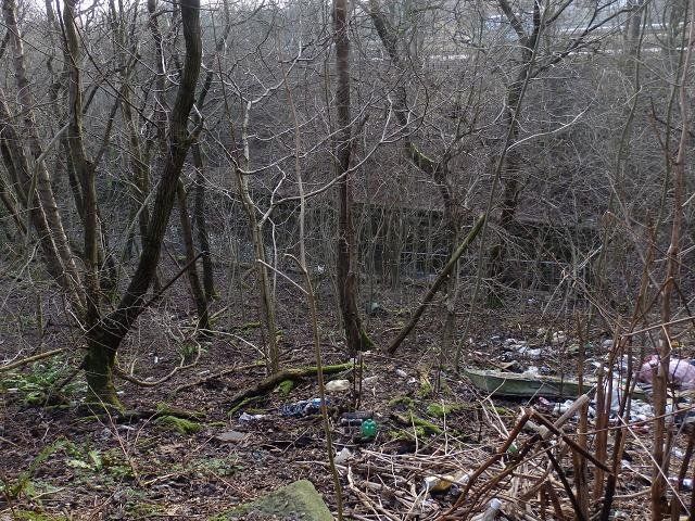
Below the viaduct as the river exits the culvert his is what we see. What is it with people?
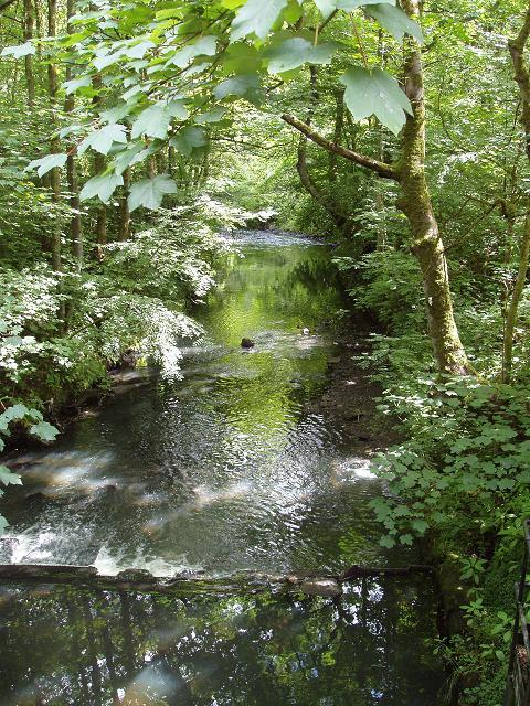
Downstream from here the Croal loses its cobbles and flows along a natural course towards the River Tonge.
<<<< And here it is just downstream from Raikes Lane and Bolton’s main waste disposal area and incinerator.
Above: The river passes through an industrial area. We are looking downstream towards the confluence with the River Tonge just fifty yards further on. (C)WDC July 2013
The next page takes us from Raikes to the end of our journey where the Croal meets the Irwell.
There are more pictures of St Peter's Way and the culverting below the buttons

1 looking across the site of the just demolished Bull and Wharf to the Church Wharf main road to Bury. The church on the skyline is St John's Latimer Street which closed in1970.
2 Preliminary work is starting on St Peter's Way We are among the demolished Church Wharf buildings and the river is still flowing along its original course.
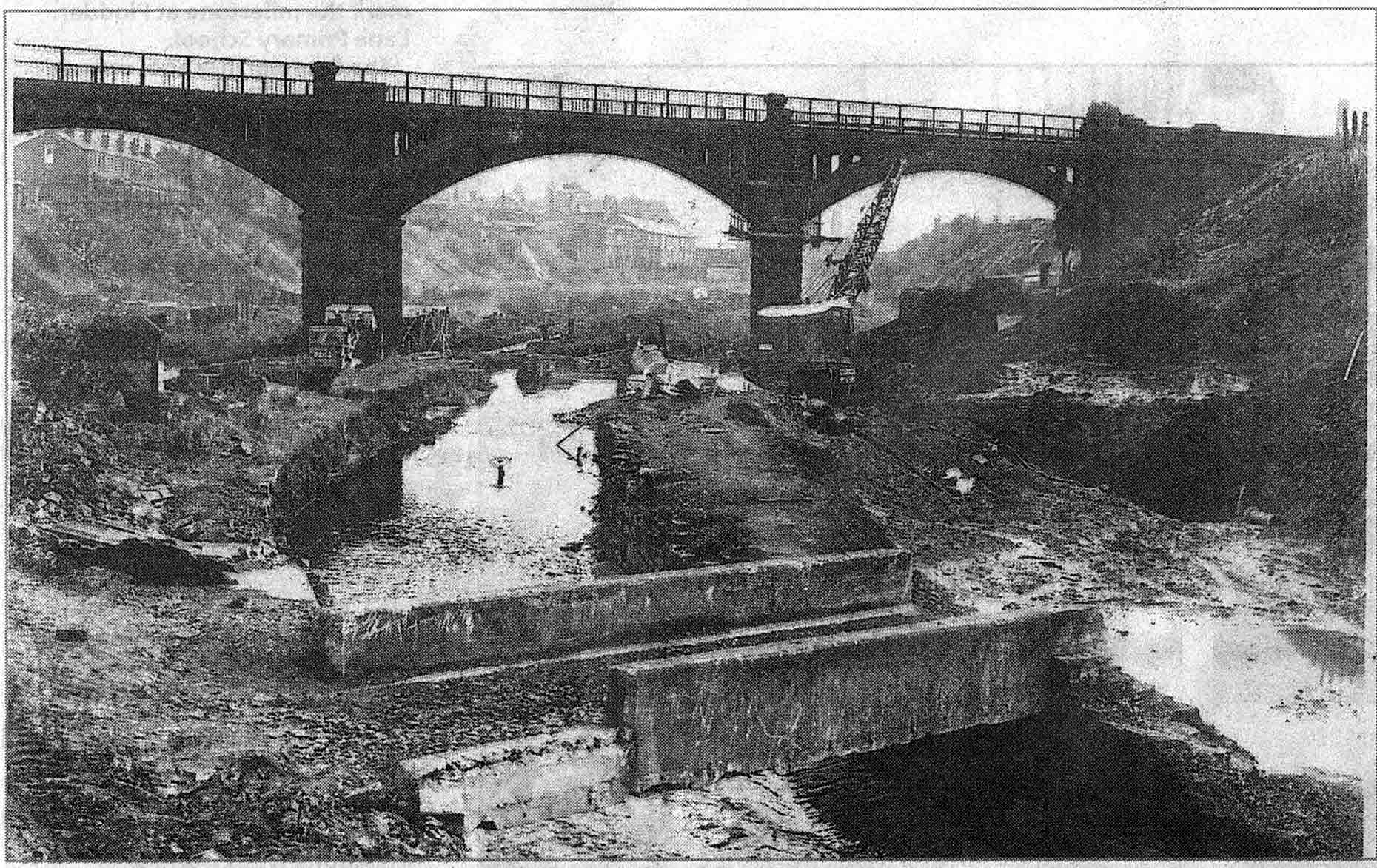
3 Picture supplied by Tom Openshaw. Similar to previous but we really are on the demolition site. The weir and sluice gate are still there. We look under the railway viaduct and can see as far as Haulgh Bridge.
4 Now we look back towards town from Haulgh Bridge as the sliproad on from Bridgeman Place is built.
5 Similar


1 1970. We are now looking at the Haulgh Bridge from the east (Manchester behind us). The concrete wedges will support the sliproad off to Lower Bridgeman Street.
2 We are looking at the same scene but looking towards Burnden Park where the floodlights can just be made out in the haze.
3. One of the 100 foot girders which will support the new Haulgh Bridge (Bradfors Street Bridge) arrives on site in February 1971.
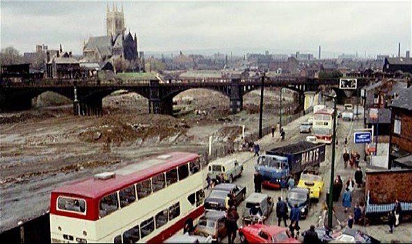
4 Back a little towards town, we see St Peter's Way finished but not yet in use going under the railway viaduct near the Parish Church.
5 1976 A forest of lampposts as we look from Burnden to the Burnden viaduct, to Haulgh Bridge (hidden by the viaduct) and on to the Parish Church.


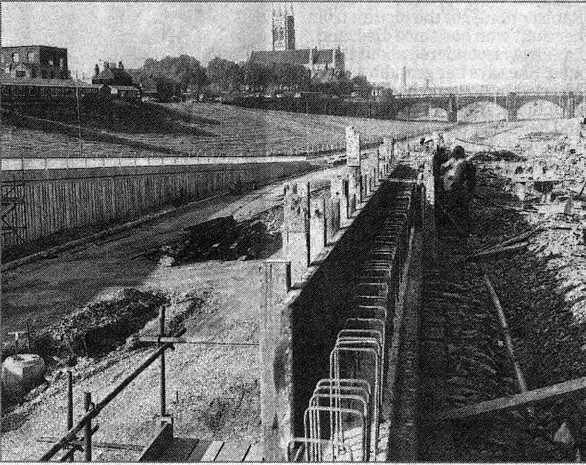
1 Between the Church Wharf railway viaduct and the Haulgh Bridge we see the concrete sections lined up for the culvert. The river is still flowing along its original course. It used to be close to the foot of the embankment on the left. Clearly the embankment has been cut back to allow the culvert to be placed here. It is not clear that this is its intended position and the river will be diverted into it. It looks too high but the more distant sections do look properly joined up.
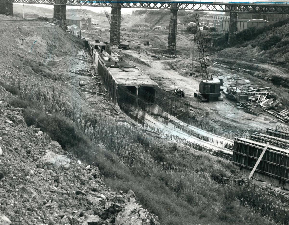
2 Further downstream, originally captioned "at Rose Hill". We are now just east of the Burnden railway viaduct.This culvert is not connected with the previous one. This one takes the Croal from the west side to the east side of St Peter's Way. It appears that the river is already flowing in its new channels even though they are not yet finished.
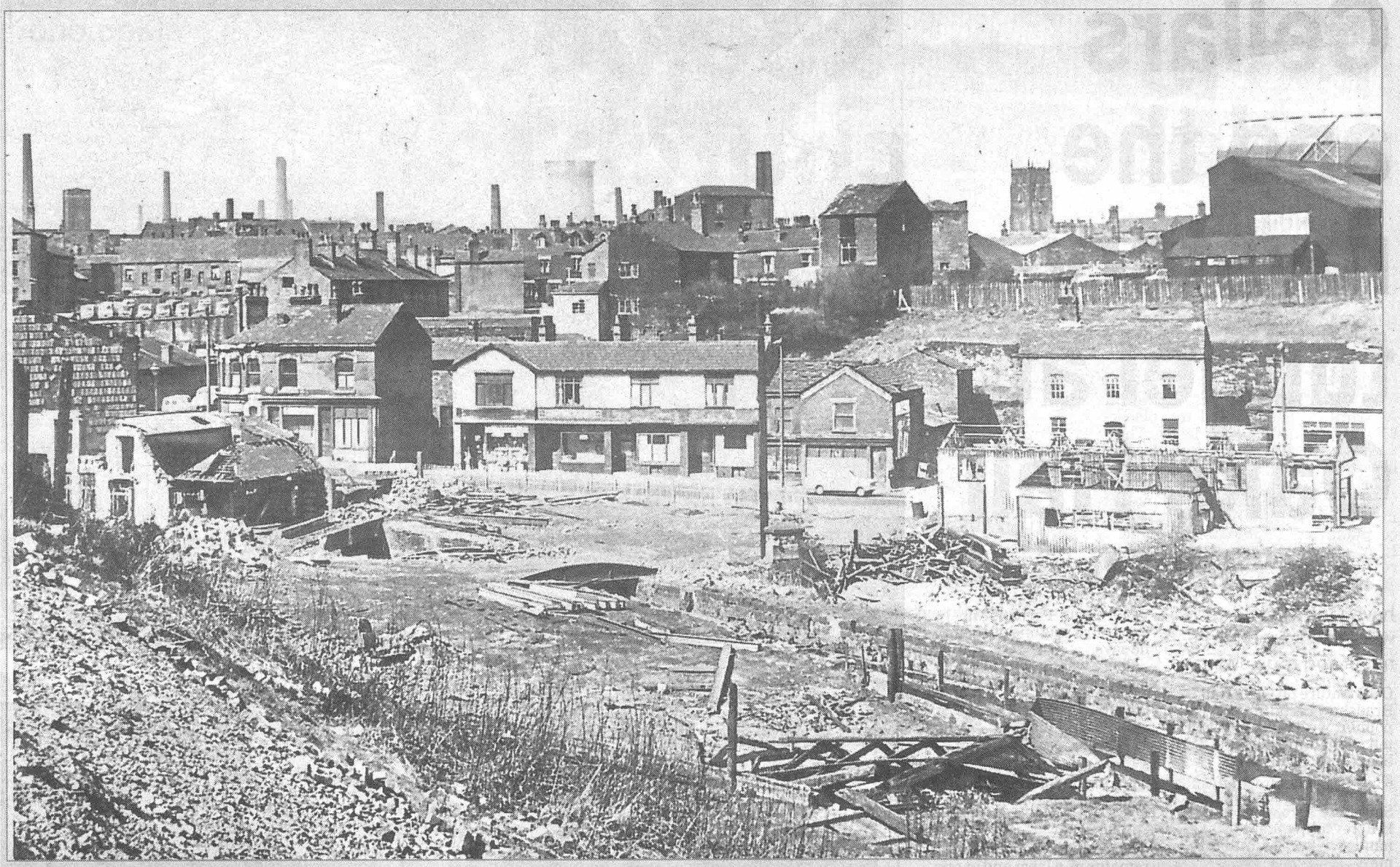
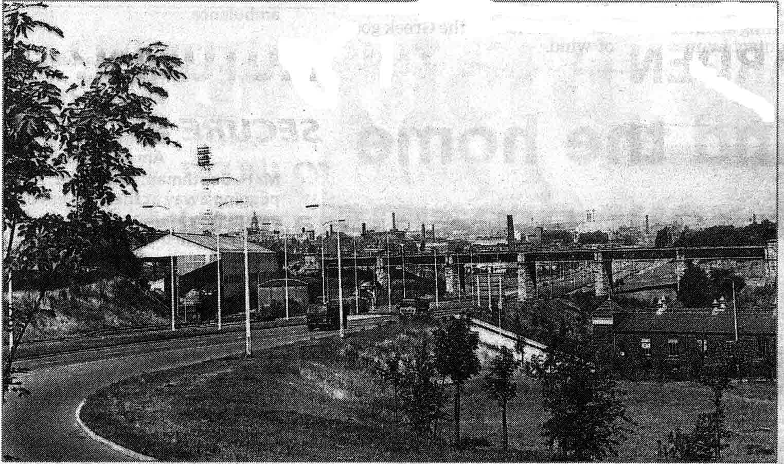
3 Raikes / Burnden before the construction of St Peter's Way. This is the Roberts Croupline factory. It was still operating there for a few years after traffic began to use the new road, a compact and intriguing little cluster of works to be glanced at as you sped past. I is not there now. You see the floodlights at Burnden Park, the Town Hall, Winter Hill, the Parish Church and quite a lot of chimneys.
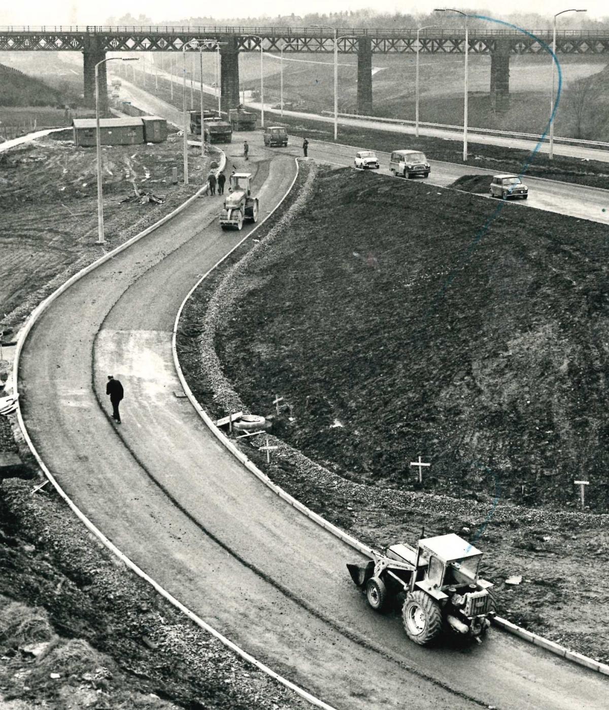
4 Raikes junction. The new road is complete. Roberts Croupline is still there
5 December 1971 Raikes junction just about finished. The greyhound stadium is still over the wall to the left at this time.


1 Raikes Lane itself joining the main carriageway
2 Looking towards Bolton from the Farnworth intersection
3 Probably Farnworth - original caption - work progressing on the Manchester Road skew bridge, December 1971.