
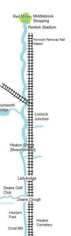
Bolton's River - Red Moss to Lostock
Rising in the shadow of Rivington Pike and Winter Hill is Bolton’s river. Many northern towns are famous for their cobbled streets but Bolton is possibly unique in having a cobbled river. It runs for about ten miles, down through Deane where it is known as the Middlebrook, through the Town Centre, and out towards its confluence with the Irwell near Moses Gate.
The town itself began its existence in the river valley with the Parish Church of St Peter in Bolton-le-Moors being built on a spur of land overlooking the river.
Unfortunately it is not actually possible to walk along the whole length of the Croal.
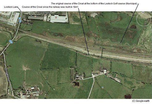
For its length from Lostock to some point on the edge of the town centre it is generally known as the Middlebrook from which the shopping centre is named. Some old maps show this watercourse as the River Croal below Haslam Park while others label it Middlebrook. There is little agreement as to where the name changes but the Croal Mill stands proudly alongside what most people would call the Middlebrook. However, probably from the top of Spa Road but most definitely downstream from Chorley Street it is the Croal.
The source of the Croal is Red Moss a site of special scientific interest (SSSI) between the M61 motorway and the old Horwich Loco Works. Lowland raised mire formerly occupied extensive areas of land in Greater Manchester and Merseyside, particularly on the floodplain terraces of the River Mersey, but is now rare both locally, nationally and in Europe. There are no undamaged lowland raised mires in Greater Manchester and Merseyside and Red Moss represents one of the few remaining examples of mire habitat bearing this type of semi-natural vegetation in these counties. Astley and Bedford Mosses, Highfield Moss and Red Moss are the best examples of lowland raised mire in this Area of Search. Red Moss is the best site in terms of the presence of peat-forming vegetation and hydrology. (Bolton MBC report). Pollen analysis has revealed the first peat deposits of the northwest's mosslands to be from around 8,000 years BC making Red Moss an impressive 10,000 years old (The Wildlife Trust for Manchester, Lancashire and North Merseyside)
"Middlebrook" derives from "Mickle Brook", earlier "mycel brok" meaning "Great Stream"
(see also foot of page)
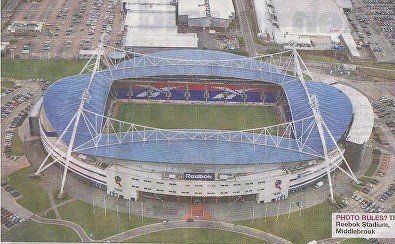
Photo clipped from the Bolton News
The Reebok Stadium,
then the Macron Stadium
now University of Bolton Stadium (Unibol)
Red Moss has been subject to inroads from farming and the Bolton – Preston railway to the south and the Horwich loco works to the north and more recently the Bolton Wanderers stadium and the Middlebrook Retail Park.
However Red Moss was in danger of complete destruction when Bolton Metropolitan Borough Council labelled it as a 'waste disposal site' in their Unitary Development Plan, though they admitted that it had “some degree of ecological value".
There was a considerable public outcry resulting in its being designated a SSSI in January 1995 a previous designation having been quashed. Bolton MBC were reluctant to drop their plans which could have brought in an income of £2million a year in partnership with UK waste but Bolton planning committee finally refused planning permission in April 1997 and UK Waste decided that it would not appeal.
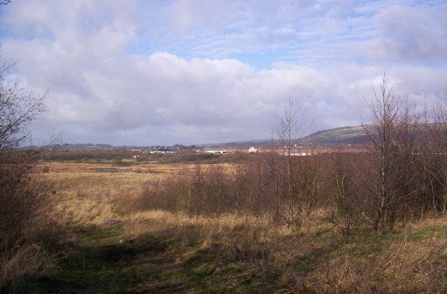
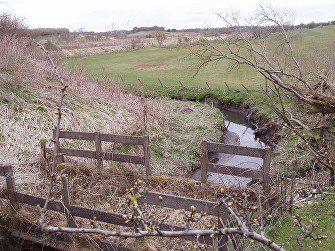
The Middlebrook drains from the southwest corner of the Red Moss close to Horwich Parkway Railway Station. It may have been known as Red Brook at this point and where it crosses Lostock Lane near the Railway was Red Bridge but evidence for this other than personal memory is not forthcoming. The Middlebrook skirts the south side of the British Aerospace site (De Havilland’s a long time ago) then approaches the railway at which point it begins its engineered route towards Bolton.
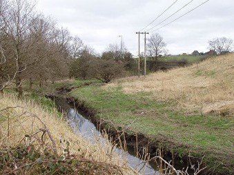
Looking downstream to Lostock Lane bridge.
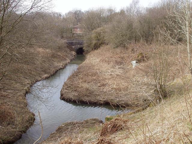
Looking downstream from Lostock Lane.
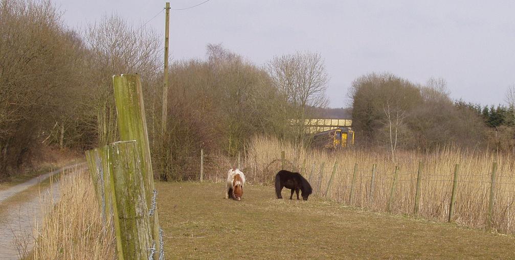
The Middlebrook leaves the railway and has a more natural look for a short distance as it reaches Lostock Station where its flow is supplemented by outflow from Rumworth Lodge. At Lostock the railway splits into the Preston and Wigan branches.
There are few opportunities for a clear view of the Middlebrook. Here it is immediately to the left of the train which is on the Wigan branch waiting for the Preston branch to clear.
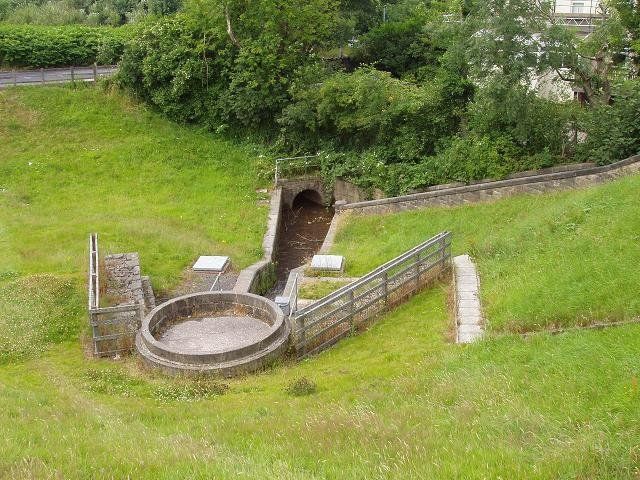
The Middlebrook which flowed between the two railway lines has passed under the Wigan branch and is flowing towards us. Water from Rumworth Lodge is coming up from the bottom left and the river flows out to the right under Rumworth Road (Lostock Junction Lane to the north to Chorley New Road, Tempest Road through Chew Moor to the south) past the station and the site of Rumworth Mill.
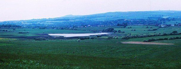
Rumworth Lodge from Wigan Road with Rivington Pike and Winter Hill..
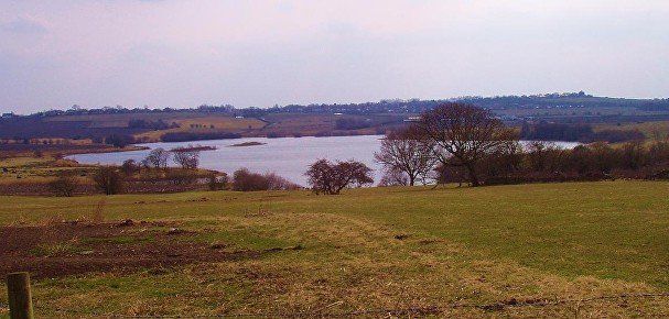
Rumworth Lodge from Junction Lane looking towards Wigan Road and the
Snydle water tower (now a house).
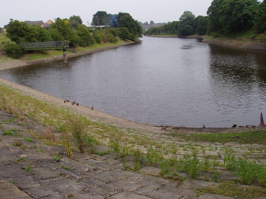
Rumworth Lodge at its northern end near the outflow to the Middlebrook
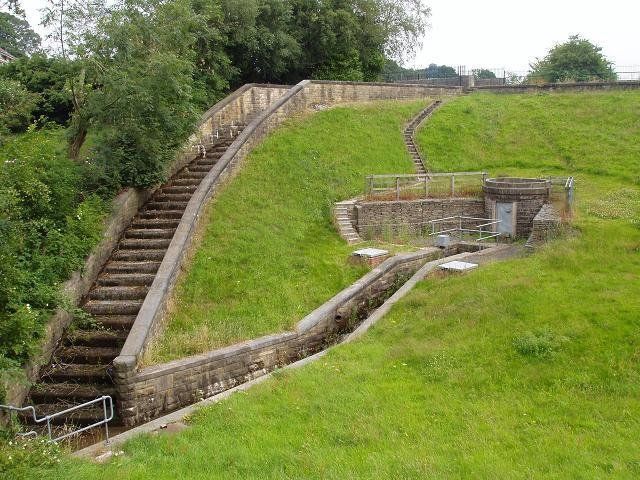
The overflow (steps) and the controlled outflow from Rumworth Lodge
The outflow simply went to the Middlebrook.
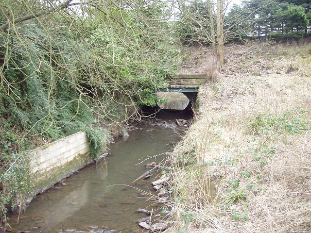
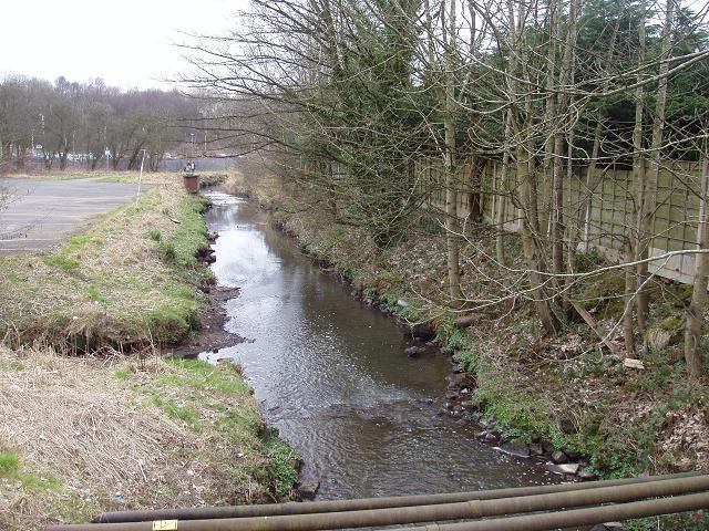
The river goes under the Lostock Road bridge.
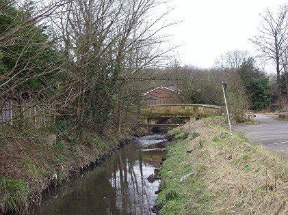
We are looking upstream to the Rumworth Mill bridge with the road bridge out of sight further on.
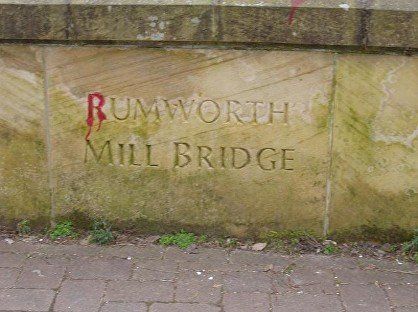
Carved in stone - Rumworth Mill is the true name of the mill though it was often known as Lostock Mill.
Looking downstream from Rumworth Mill Bridge.
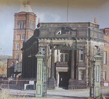
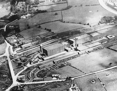
The Rumworth Mills (Lostock Mills) with the railway across the centre of the picture and the Middlebrook running alongside it. Rumworth Road crosses the railway with Lostock Junction Lane going off the top, Tempest Road to the bottom left and Junction Lane across the bottom of the picture. Junction Road originally ran from this point all the way to Deane reaching Wigan Road adjacent to St Mary's Church, Deane. It was made to cross Beaumont Road when this was constructed in the 1930s but has been split into two by the Ladybridge estate in the late 1960s. A gatehouse (pictured above) for the mill is down a short road from the corner of Rumworth Road and Junction Lane.
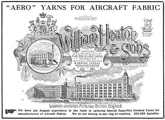
An advert from 1911 posted on Facebook by Denis McCann. We note that the mill complex is called Lostock Junction Mills.
Some useful information is to be found at http://www.stmarksbolton.webspace.virginmedia.com/wplostockjunctionmills.htm
"Middlebrook" derives from "Mickle Brook", earlier "mycel brok" meaning "Great Stream". This has surprised some people because they are aware of the supposed Scottish saying, "Mony a mickle maks a muckle" where mickle stands for little (not big) and muckle stands for much.
As Chamber's dictionary puts it - this is an absurd form of the original "Many a little makes a mickle" and also points out that "mickle" and "muckle are actually the same word.
The explanation appears to be as follows. It is well known how the vowels i and uh are confused. The Scottish are caricatured as pronouncing Jimmy as Jummy. In England too, the word spirit very often sounds like spurrit. So, perhaps under Scottish influence, the original "Many a little makes a mickle" (note that this has a symmetry with the pseudo-rhyme little / mickle) became "Many a little makes a muckle". Because "muckle" seems to have an affinity with "much" (though linguistically it doesn't) this form became the norm. However it has lost its symmetry and is not so easy to say. Moreover, the "l" on little is overwhelmed by the preponderance of "m"s so eventually symmetry is restored, but now by alliteration not rhyme, to give "Many a mickle makes a muckle". Muckle keeps its assumed association with much - and mickle is baby-talk for little - and that is how the saying survives today.
On the next page we follow the Middlebrook from Lostock Mills to Ladybridge.