
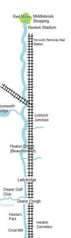
cr2 Lostock to Ladybridge
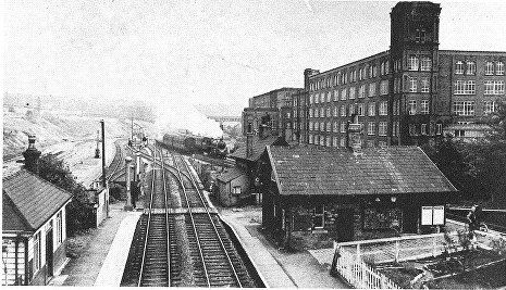
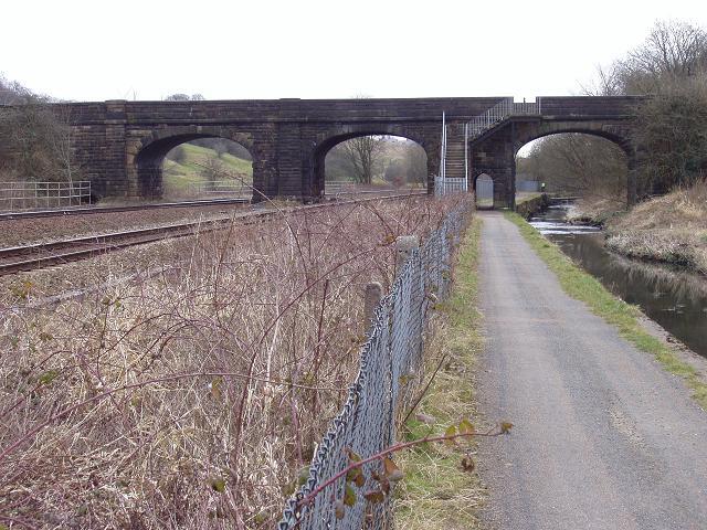
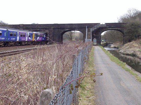
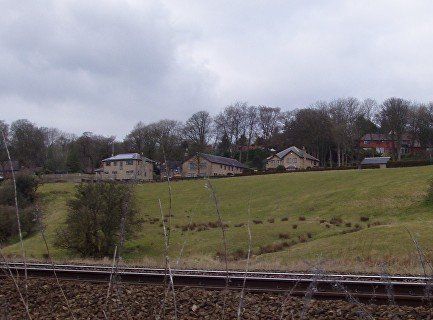
Lostock Station and Rumworth Mills. The Middlebrook runs alongside the railway in front of the mill. The station, thought to have opened in 1852, was closed on 7 November 1966 but reopened again on 16 May 1988 (as Lostock Parkway reflecting its use as a commuter station with a reasonably large car park, extended and improved in 2009 - though it quickly reverted to Lostock) though only with platforms on the Preston line.
Bolton News Then and Now
The junction at Lostock (Junction) Station - Preston line nearer, Wigan line further away.
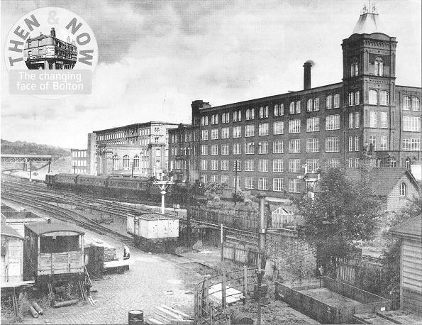
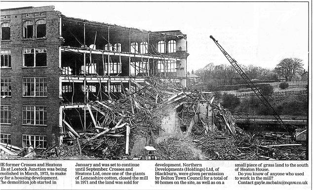
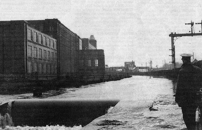
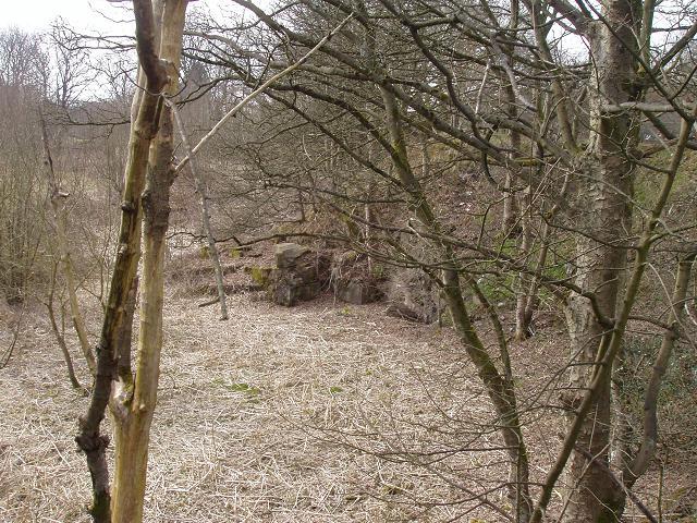
Top picture, the Lostock Junction Mills (Rumworth Mill) in it hey-day.
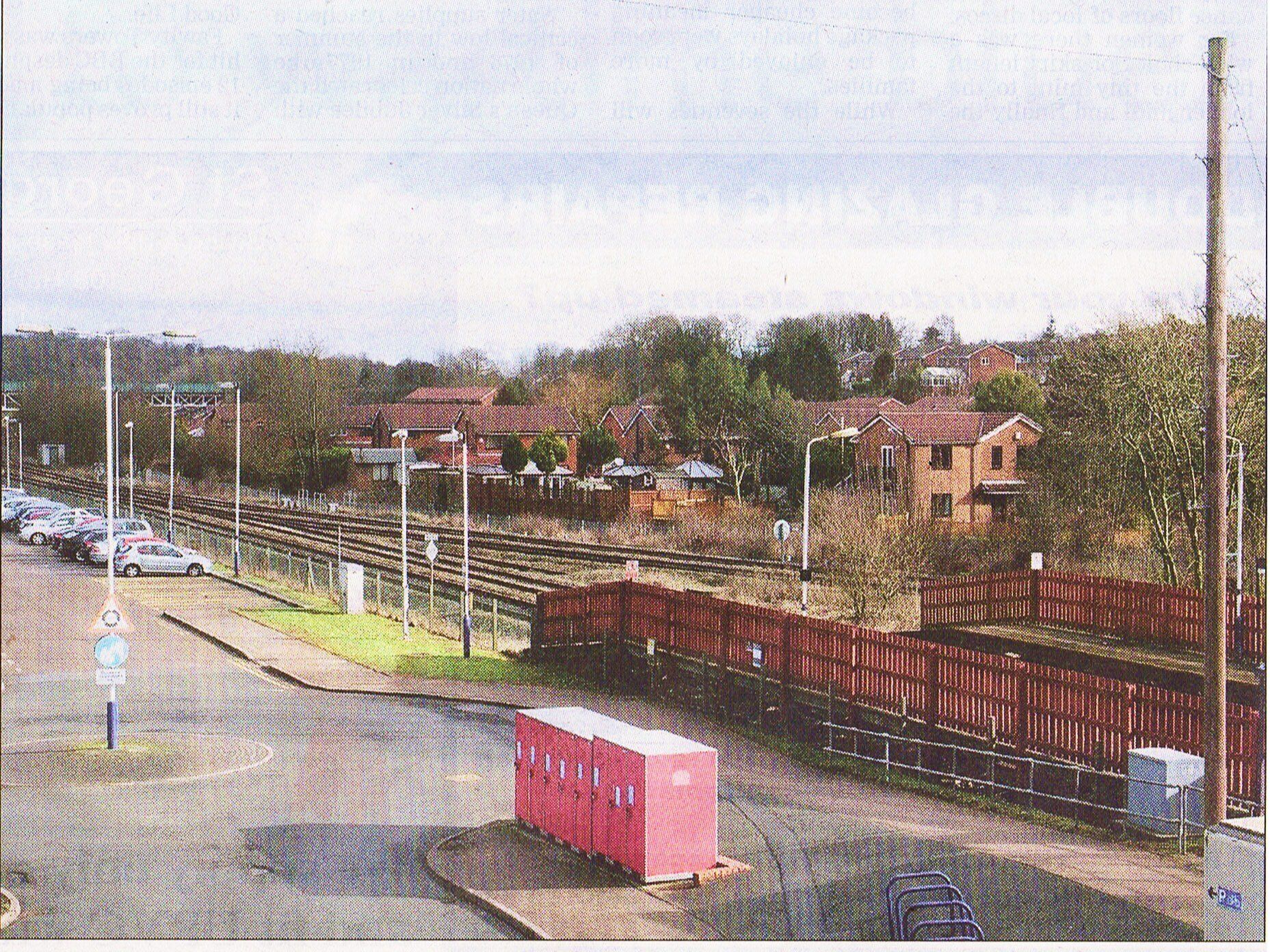
Bottom picture, the mill is long gone and replaced by a large housing estate.
Sadly consigned to history.
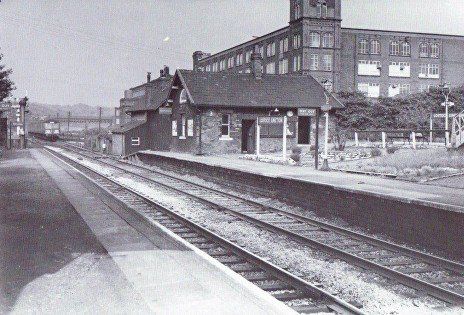
The mills closed in 1971 and this picture is March 1973.
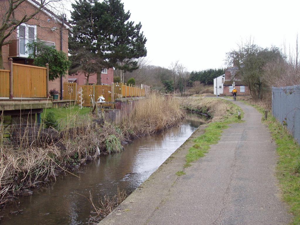
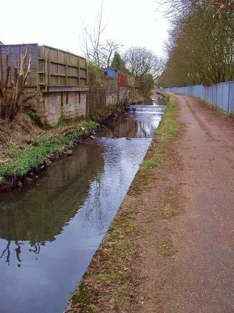
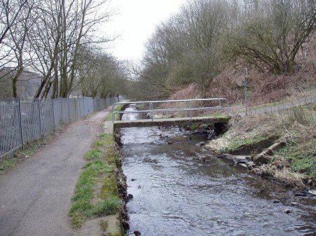
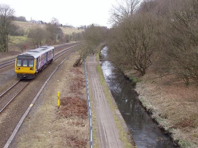
We walk 100 yards or so downstream then look back upstream with the housing estate which covers the mill site on the left. The station is just over the blue fence on the right. The white building is the Lostock Arms, now closed down (Summer 2013), sited next to the station and the road bridge.
(C)WDC March 2013
New Paragraph
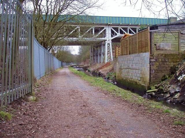
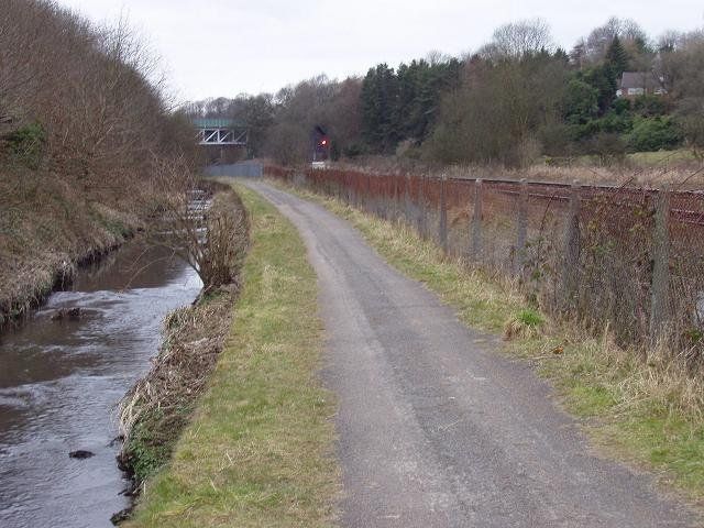
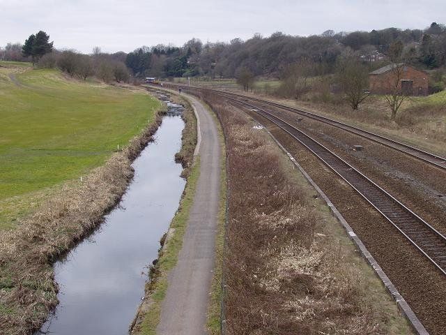
We look downstream from the same place. This “tow path” will now take us all the way to Spa Road, though as we approach Bolton it will become clear that it is more associated with the railway than the Middlebrook.
(C) March 2013
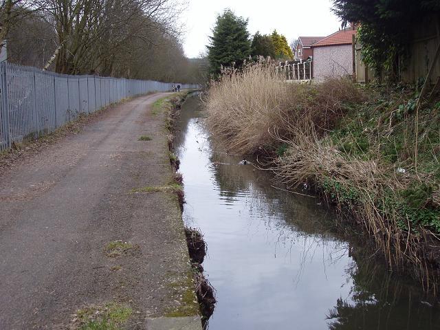
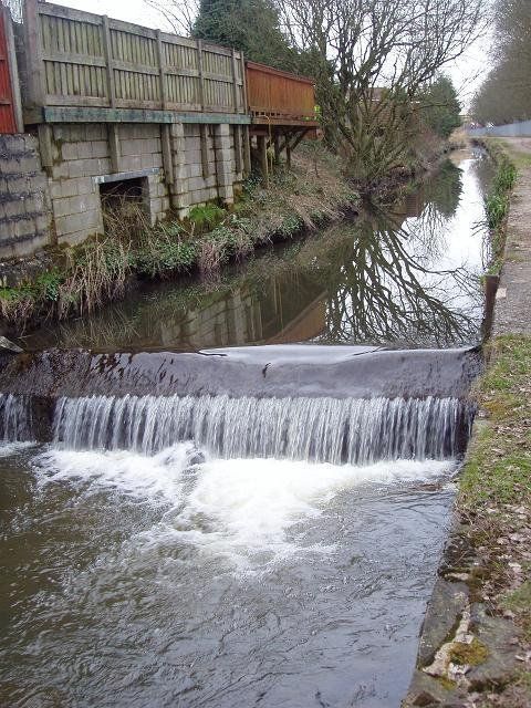
A number of small weirs would have been intended to keep the water level near the mill sufficiently high for water to be drawn from the river.
(C)WDC March 2013
Looking upstream from a little way upstream of Heaton Bridge (Beaumont Road)
(C)WDC March 2013
The Middlebrook flooded in 1939.
This happens every year or so.
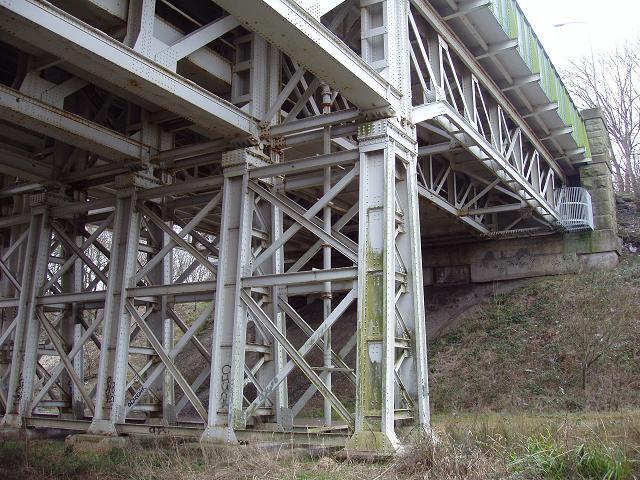
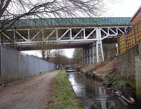
Continuing downstream (eastward) we reach the very substantial structure of Heaton Bridge (Beaumont Road) built in 1924 to carry a new road over the railway and the Middlebrook.
Beaumont Road is part of the Bolton ring road which isn’t and perhaps was never intended to be a complete ring. For many years it was cobbled with a strip of tarmac along the centre. It was not well used and was traditionally the place where learner drivers came for their first lessons. Not so now.
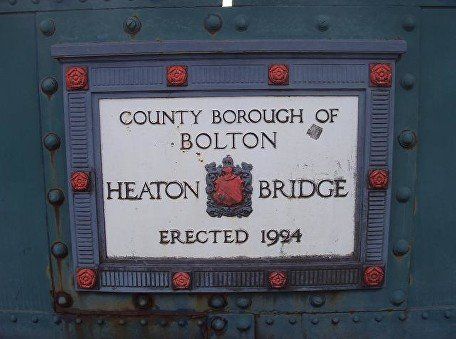
The name plaque on the bridge (one each side of the road).
(C)WDC March and April 2013 all the Beaumont Road pictures.
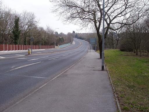
Beaumont Road, an uncharacteristically quiet moment caused by a coincidence of red lights just behind the photographer and just out of sight in the distance.
Immediately to the north of the bridge and the railway line was a quarry locally known as th’ underd foot, rather an exaggeration as its rocky walls were no more than twenty or so feet high. There was quite deep water in it and the local lads swam here and jumped into the water from the cliffs into the 1960s. It is now drained and filled in with just a hint of the cliff faces remaining. I am told (by Gene Watts) that there were pipes from here to the water supply troughs between the railway lines. Other people have talked of fishing here and often seeing a large pike.
The canalised Middlebrook continues its course east from Heaton Bridge. The footbridge on this picture leads to a path and steps taking you up on to Beaumont Road. The area on the right bank, including much of the land between Beaumont Road and Deane Clough is occupied by the Deane Golf Club to the south and Ladybridge Estate to the north. Ladybridge Lane crosses the golf course and comes out on the road which circumnavigates the housing estate.
(C)WDC March 2013
We look back (upstream) to the Heaton Bridge (Beaumont Road).
(C)WDC March 2013
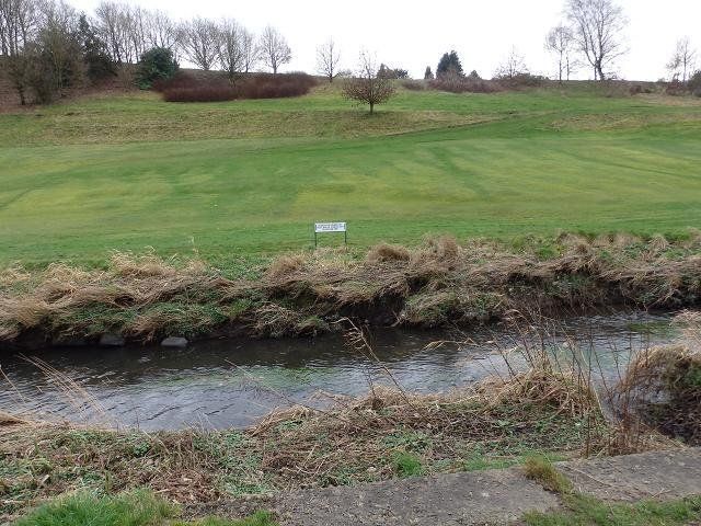
One of the Golf Club holes stretches much of the way along the river between Heaton Bridge and Lady bridge. (C)WDC February 2020
Ladybridge - presumably built around 1847 when the railway was laid. They built 'em good in those days.
The kids used to call this "Seccy Bridge".
"Firsy Bridge was Deane Clough.
""Thirdy Bridge" was Beaumont Road.
(C)WDC March 2013
Approaching Ladybridge
(C)WDC March 2013
"Des Res" just north of the Middlebrook at Ladybridge (C)WDC
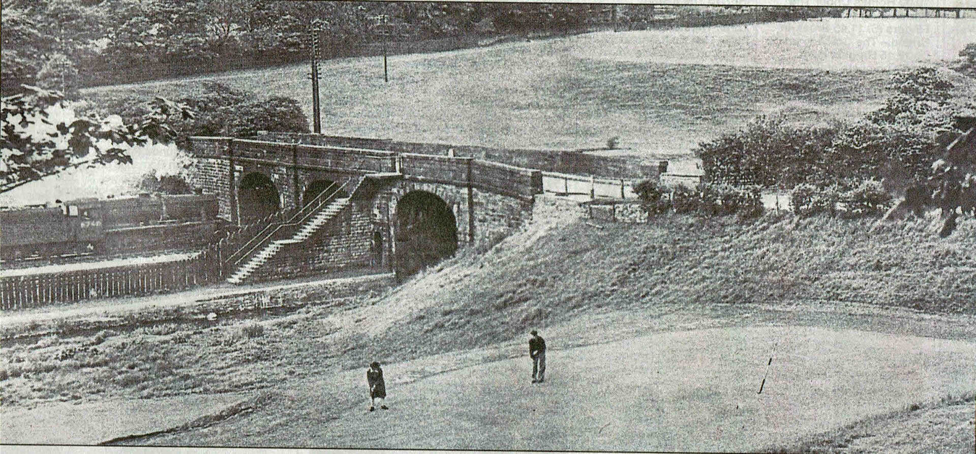
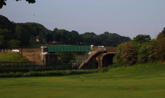
1940s view of Ladybridge from the bottom end of Deane Golf Club.
Similar view in June 2016 after the bridge was raised to allow electrification of the line.
(C)WDC


Click on any picture - navigate using < > - you might be invited to zoom in - exit with X
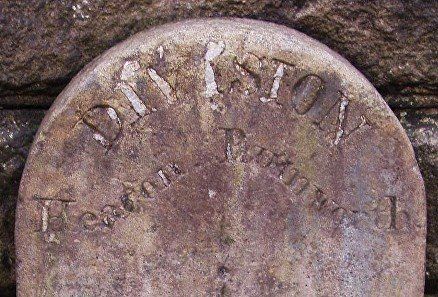
1 Looking north across the bridge towards Chorley New Road.
2 and 3 A boundary stone at the centre of the bridge indicates that the Middlebrook at this point divides Heaton (north and to the left) from Rumworth (south and to the right). Rumworth was a local government township which included Deane and Daubhill but never had any real existence of its own.
4 Ladybridge Lane heading towards the south.
Looking upstream (back the way we've come) from the bridge at Ladybridge Lane (C)WDC March 2013
On the next page we will proceed from Ladybridge through Deane to Queen's Park
Looking downstream (the way we are about to go) towards Deane Clough from the Ladybridge. (C)WDC March 2013