1762 Bolton and St Helens Turnpike
Early in the eighteenth century there were reports (in Parliament?) about the awful state of the roads on the route between Bolton and Leigh and on to St Helens and Liverpool. So in 1762 the Bolton and St Helens Turnpike Trust was formed to manage the road from some point out from Great Moor Street, through Leigh and Parr to St Helens, a distance of 17 miles 2 furlongs 44 yards. The Trust was charged under Act of Parliament to keep the route in good repair and was entitled to charge tolls (turnpike means tollgate).
Next, as the mills and accompanying terraced houses were built up towards Daubhill a decent road had to be built and because it crossed land owned by the Duke of Derby (the local government area around there is still Derby Ward) it was called Derby Street. Derby Street ends at the then Bolton boundary at Willows Lane which for some distance was the boundary between Bolton and Rumworth. This is the point at which the Turnpike started.
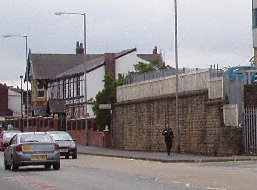
At some time the Bolton and St Helens Turnpike Trust road was rebuilt to a high standard. This involved removing a couple of severe inclines. The end of the Daub Hill was chopped off and the high stone wall near Bella Street built to support what remained. A large chunk of field was also excavated at Whitegate Farm to reduce the total climb over Deane Moor by about fifteen feet and again a retaining wall was built.
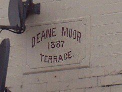
"Deane Moor" is verified by “Deane Moor Colliery” near Top o’ th’ Cow on the 1849 map and by Deane Moor Terrace at the top of Hulton Lane (entablature still visible on the pale gable); also called the “Great Moor” recalled by Great Moor Street; sometimes also called “Bolton Moor” eg by Lesley Gent, the 1849 map labels the whole of the area from Sweet Green (Trinity Church) up through Daubhill as Bolton Moor. Perhaps Bolton Moor is correctly applied to the area up to Daubhill (within the Bolton boundary) and it is Deane Moor west of that (being within the Parish of Deane).
(W S Shaw, in his pamphlet A CONCISE HISTORY OF THE BOLTON - LEIGH RAILWAY makes a tentative suggestion that the end of Daub Hill was cut off by the builders of the railway, but he has just shown that the Turnpike Trustees had refused to allow the level of the road at that time to be altered and in any case the lie of the land strongly suggests that it was the building of the turnpike that necessitated this excavation. That the stone wall retaining the hill is so similar to a wall at the top of Deane Moor also suggests this.)
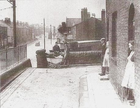
1948 houses on top of the Daub Hill. The site is now occupied by Park Cakes. We are looking west, up St Helens Road to the Stag's Head and Daubhill Station.
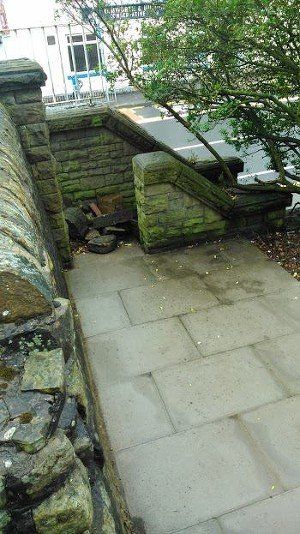
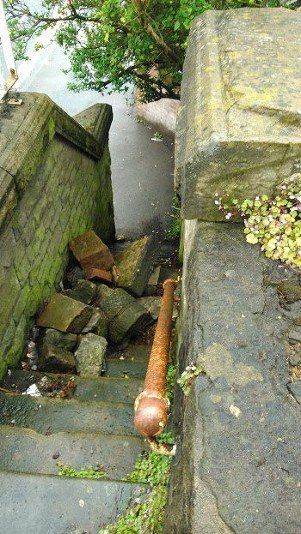
Fairly recent pictures by Peter Hampson showing the state of the steps. The steps are accessible but the top of the steps is blocked by the fence surrounding Park Cakes.
On the right is the path about three steps from the tops which used to lead off towards the north (left if you are going upwards) to some gardens.
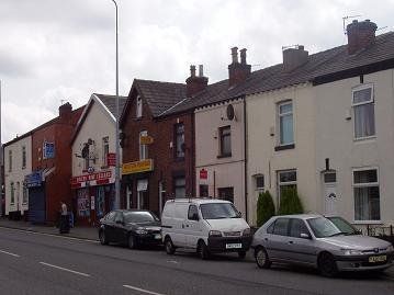
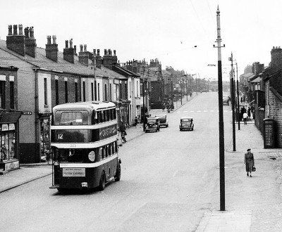
posted by Edward Thompson in I belong to Bolton Facebook Group. This is the crossroads of St Helens Road with Morris Green Lane and Deane Church Lane. The houses on the Daub Hill can be seen on the right. Note Wane's Butchers. Date probably late 1960s.
1952 looking west towards the Daubhill crossroads. Note the Daubhill Zion Methodist Church (where Spar was, McColl's is now), no traffic lights.