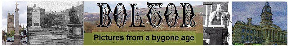
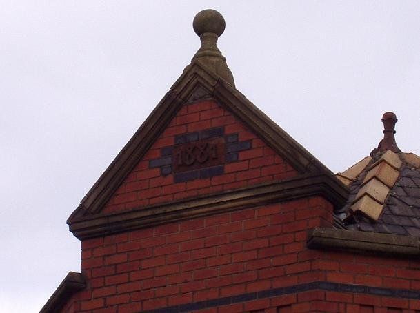
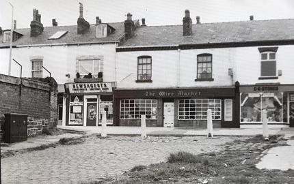
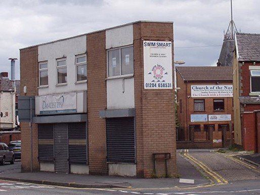
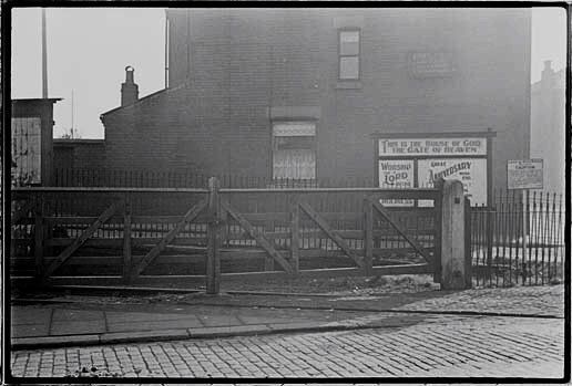
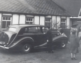
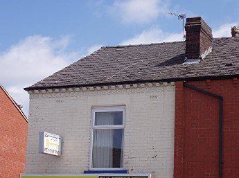
29 St Helens Road
Left - The first building up from Willows Lane, 2 St Helens Road, the Railway Hotel (later for a time, The Shamrock) 1970s.
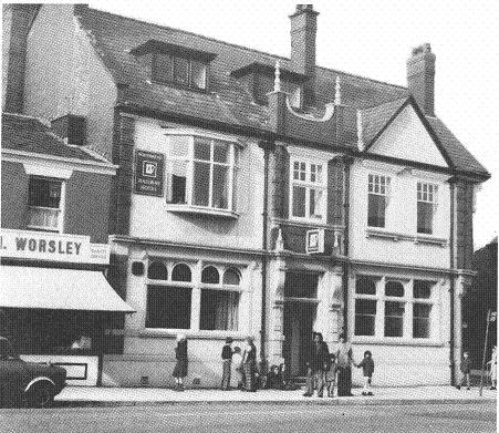
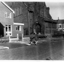
Above - A fairly recent picture; – why do we have to put up with this desecration of the urban landscape?
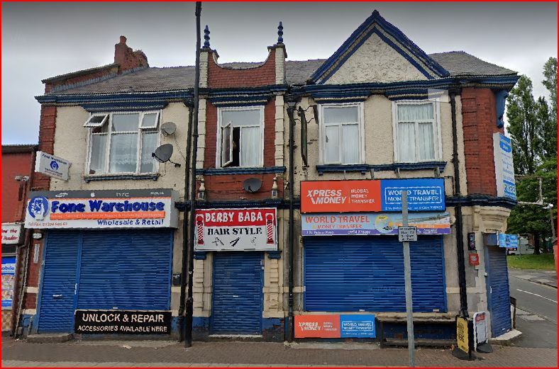
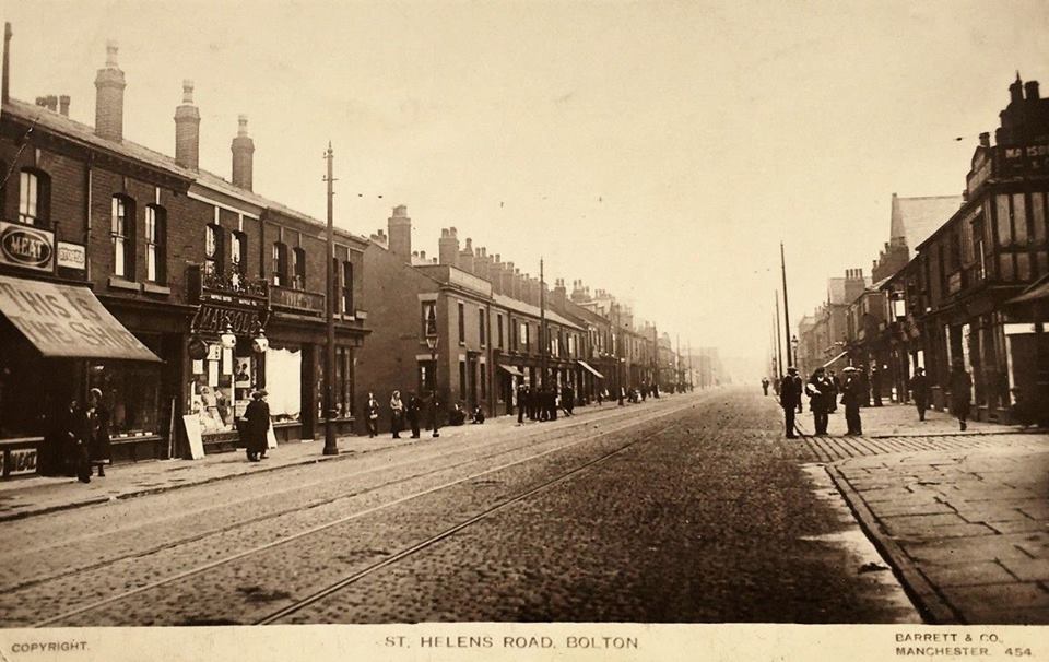
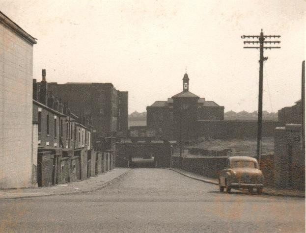
<<<< c1905 Derby Street, Willows Lane, open top tram, people posed all over the road. Such posing often happened though whether people ran into view when they saw a photographer, or whether the photographer asked them to pose is perhaps not known.
Below - St Helens Rd, looking beyond Willows Lane into Derby Street,
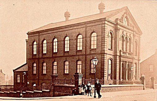
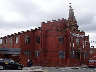
<<<< Daubhill Methodist Church usually known to the locals as Daubhill Wesleyan which might have been its name before the Methodist Union c1952 though it had in fact belonged to the Primitive Methodist denomination. Much later it became St Peter’s in the 1980s when there was a fashion for naming Methodist Churches after saints. Was this part of the movement towards the Church of England? St Helens Road Methodist (almost at Hulton Lane) and Melbourne Road Methodist did not fall prey to this fad. This picture posted on Facebook by Bob Calderley.
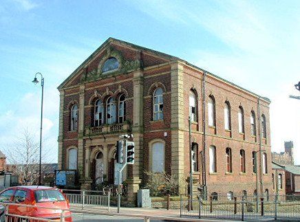
Picture taken some time after the Church closed in 2001. Swan Lane Mill can be seen in the distance.
© Mike Borrell.
Various plans for use of the building including development as a hotel were discussed but nothing ever came to fruition.
In the 1850s Methodists from Fletcher Street began to hold cottage meetings at 65 St Helens Road, the home of one Abraham Birchall but as the cause grew so rapidly they hired a room in John Tonge’s School at the bottom of Barrier Street (Shed Lane), services starting there on 18th August 1858. Further growth led to the use of a boiler-house of a weaving shed owned by Messrs. W. and J. Cooke for the infant Sunday School Class. In 1861 a small chapel and school was built on land occupied by 47-51 St Helens Road. In 1868 the school was transferred to a new building in Stamford Street leaving 47-51 available for the building of a church which was finally opened in 1886 with a capacity for 700 worshippers.
(Bolton Journal and Guardian of Friday, 23 October 1936,reproduced in
http://www.lan-opc.org.uk/Bolton-le-Moors/Daubhill/methodist/index.html )
© Barry Stanton
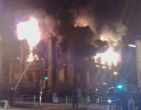
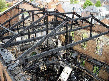
Arson attacks on 15th and 29th October 2003 caused considerable damage; a further attack on 3rd May 2009 left it gutted and in a dangerous state and it was demolished on the 7th May the site still remaining empty at the present time (July 2021).
© Fred Hosker/Jackie Nisbet c1977.
We see the Greens Arms, Adelaide Street and the Daubhill Methodist Church.
David Whenlock postcard posted 1925.
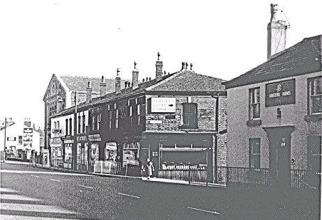
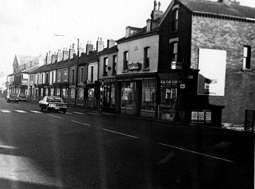
“This is the shop” Christopher Stott and sons butchers (15). No 17 is George Howarth Taylor then at no 19 Maypole grocers. There doesn’t appear to be a post office on the nearer corner of Adelaide Street but there was in 1932 and until quite recently before it moved a few doors down then mysteriously closed c2017. Adelaide Street, Greens Arms. All this block has been demolished and used to have Bolmoor and the Corporation print shop. It now has Olive Tree Primary School and offices for Lantor – the Lantor factory (Rumworth Mill) has been renamed Stirling and now displays the sign “nonwovens”. On the right, Venice Street with Marsden, Rigby and company pawnbrokers and clothiers. It is possible to see the turn into Randall Street and above it is the gable of the St George the Martyr’s primary school and Church Avenue is immediately beyond this.
Looking down Adelaide Street c1977. Shop on the left is probably the Post Office, the building on the right is the Green’s Arms. At the bottom of Adelaide Street is the Sunnyside Hotel, just visible if you look very closely.
© Fred Hosker/Jackie Nisbet

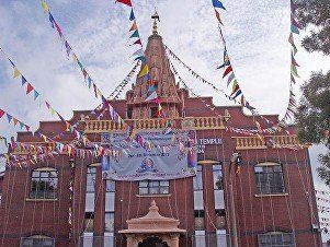
©WDC On the left almost at the top of Adelaide Street was the Daubhill Labour Club. The club relocated in 1972/3 to a new building, the Rumworth Hall, on St Helens Road between Prescott Street and Blackledge Street. The building was taken over as the Shree Kutch Satsang Swaminarayan Temple (Bolton) the first Swaminarayan temple to be established in the UK and Europe, officially opening in 1973. The original structure was demolished and rebuilt in 1993 being officially opened on 6 September 1993,
5 September 2013 A big Hindu festival with visitors from many countries celebrating 40th Anniversary of this temple’s inauguration.
Picture by permission of Olive Readey
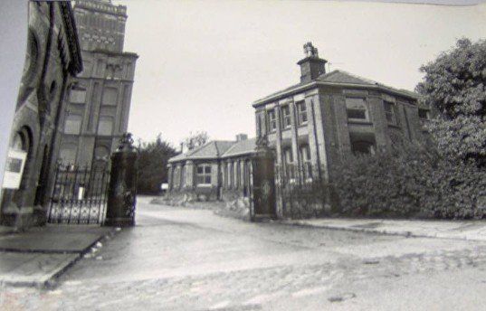
Adelaide Street and Sunnyside Mills, note the clock towards the right. This was “Bolton Bridge” where the 1828 railway crossed Adelaide Street before going down the cable assisted “inclined plane”. If a level crossing had been used that would have save over ten feet of height on the descent but the cable would have formed a permanent obstruction to traffic. If you needed cable assist anyway perhaps another ten feet was not important. This was the termination of the line after 1885. It is not clear quite what was part of Stephenson’s bridge and what was remodelled when the mill was built and this was where the mill’s coal was off-loaded. Lower down some bushes are at the main entrance to the Sunnyside site. Then we have the “continuation school”.
probably "Bolton Bridge" where the Bolton-Leigh railway crossed Adelaide Street from 1828 to 1885. It may have been changed somewhat because of its use as a coal terminal for Sunnyside Mills.
The railway was constructed 40 years before the mill was built so the mill did not influence the design of the railway.
By permission of Olive Readey; Adelaide Street, gateway to Sunnyside Mills. The "Continuation School" is at left.
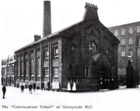
Sunnyside Continuation School; (Picture posted on Facebook by Gene Watts.) Adelaide St immediately the below railway. A child who had left school at the age of twelve to “go in tert’ mill” clearly needed its education to be continued. No doubt many aspects of the cotton processes and the way the mill worked would be taught as well as reading, writing and arithmetic.
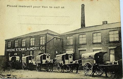
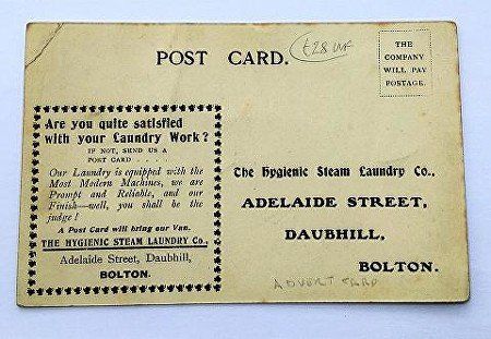
The Hygienic Steam Laundry at the bottom of Adelaide Street where we can remember Rutland Mills being situated. GT General Traffic is now on the site. David Whenlock postcard.
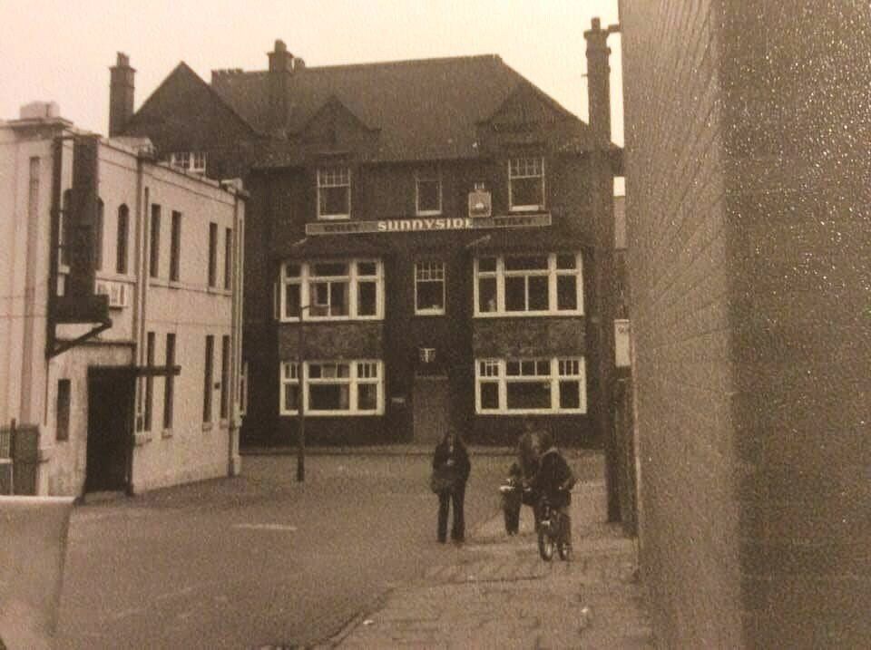
The bottom of Adelaide Street with Rutland Mills on the left and the Sunnyside Hotel facing us. This has been a residential home for a number of years. Turning right takes you up Ellesmere Road.
Picture posted on Facebook by Barry Stanton.
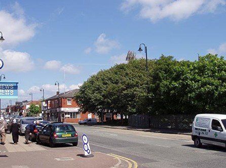
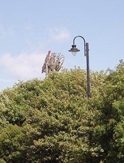
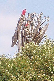
Corner of Adelaide Street where Greens Arms used to be. Children were asked to design a sculpture to be placed among the trees on this corner. It features a bird, presumably in a nest with shiny rubbish that some birds sometimes collect. Within two years of its being mounted here it was realised that the trees were growing and when they were in full leaf the sculpture was hidden. It was then raised about three feet.
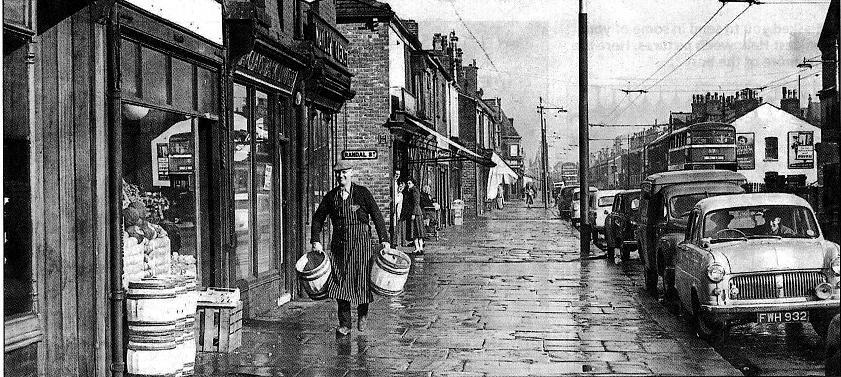
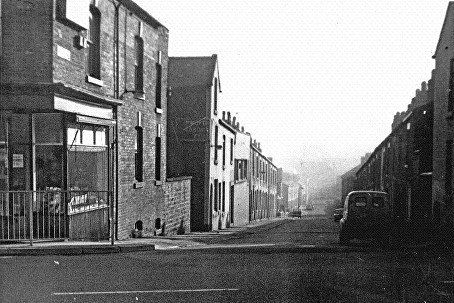
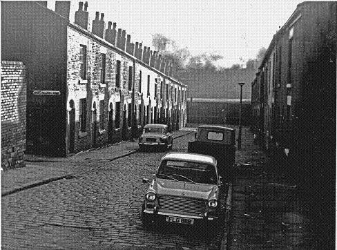
St Helens Road, Randal Street 1952-4
Man with barrels is Jack Hooton, the eldest of 13 children. He lied about his age to enlist in WW I. During WW II his wife “Aunt Nan” ran the shop. He was later a bookmaker at Bolton Dog Track. (BEN).
To the right of the shop is Barclay’s Bank then Naylor’s Chemists. To the left is an unidentified shop then the St George the Martyr Primary School.
Barclays and Naylors became Barclays (closed c2015). In the middle of the block we had Caldicott’s opticians (closed 2020) and Paul Dawson’s coin and medal shop (closed c2019). At the left hand end of the block the school was replaced by the new Co-op, moved from the corner of Croston Street.
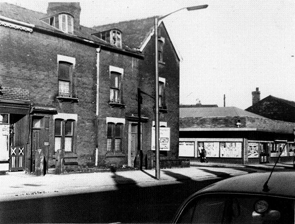
c1977 © Fred Hosker / Jackie Nisbet
The corner of Church Avenue with the new co-op. The Co-op was taken over by Hanbury’s. Then the Co-op organisation took over all the Hanbury’s shops. It became a Costcutter then a Nisa-local and has housed the post office since the one just below Adelaide Street suddenly closed.
The corner house was Dr Dennard’s. Although the building structure remains the surgery was replaced many years ago by Glenco Dry-Cleaners.
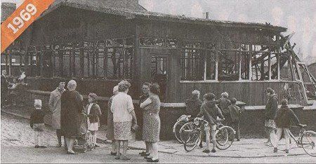
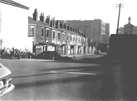
" It was a sad day for a local community, in June, 1969, when their church hall was burned down. The heat from the blaze which destroyed the Bolton church hall was so intense that it melted lead strip on windows on the opposite side of the street.
Paintwork on a fire engine was blistered while woodwork on houses 20 yards away was burned and windows were shattered.
The wooden hall, belonging to St George the Martyr's Church, in Church Avenue, Daubhill, was burned out in the fire.
Our picture shows the residents looking at the charred remains of the burned-out hall."
Reprinted in Bolton News 27 September 2014
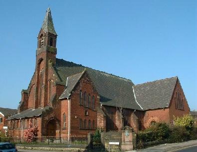
St George the Martyr's Church, Church Avenue started as a church and school in an iron building meeting the needs of a rapidly expanding Daubhill population and a lot of new housing in that area. The present building wa consecrated 6th March 1880. Interior changes were made in 1976 and 1988. On Sunday afternoons it had welcomed The Living Waters Malawian Church but that was discontinued in 2012 with two of its families joining the SGM fellowship. Rev Brian Branche works from SGM as a street pastor. (As at 2019)
SGM is not named after the Patron Saint of England but after George Marsh (1515-1555)
Marsh was born and lived much of his life in Deane but after the death of his wife went to Cambridge University. Lancashire, probably including Deane, was a Catholic area though Bolton itself was a hot spot of Protestantism It is thought that Marsh turned to the reformed faith in Cambridge. Nicholas Ridley, Bishop of London, ordained him Deacon in 1552. For a time he was a Chaplain to the King but returned to Lancashire when Queen Mary I ushered in the Counter-Reformation.
A warrant for Marsh's arrest on the grounds of heresy was issued by Edward Stanley, third Earl of Derby. Marsh turned himself in to Justice Barton at Smithills Hall rather than being arrested at his mother's house. During his "examination" it is said that Marsh stamped his foot so hard while refusing to relinquish his faith that he left a footprint in the stone floor - which can still be seen there.
Marsh was then imprisoned and tried in Lancaster and Chester and was given one last chance to recant while tied to the stake at which he was about to be burned, at Boughton just outside Chester city centre.
For full size pictures, click on any picture, navigate with <>, there is sometimes an option to zoom, exit with X.
1 c1977 © Fred Hosker / Jackie Nisbet Roseberry Street and the Church
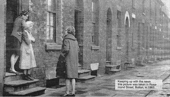
2 Parallel with Roseberry Street is Rosamond Street and this typifies life in 1963. The street with terraced houses still remains but no longer with steps up to the doors and cellars. Much of the right hand side (north) of the street has been replaced with modern houses.
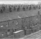
3 Back Daisy Street.
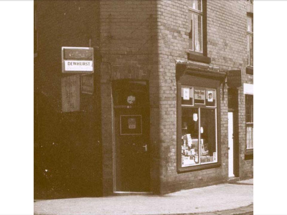
4. Traditional typical “corner shop” on Daisy Street. (Daisy St is beyond Croston Street)
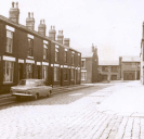
5 1975. The picture is taken on Willis Street (behind the church) with Dijon Street on the left and Croston Street going left and right at the next corner. Lever's rope works in background.
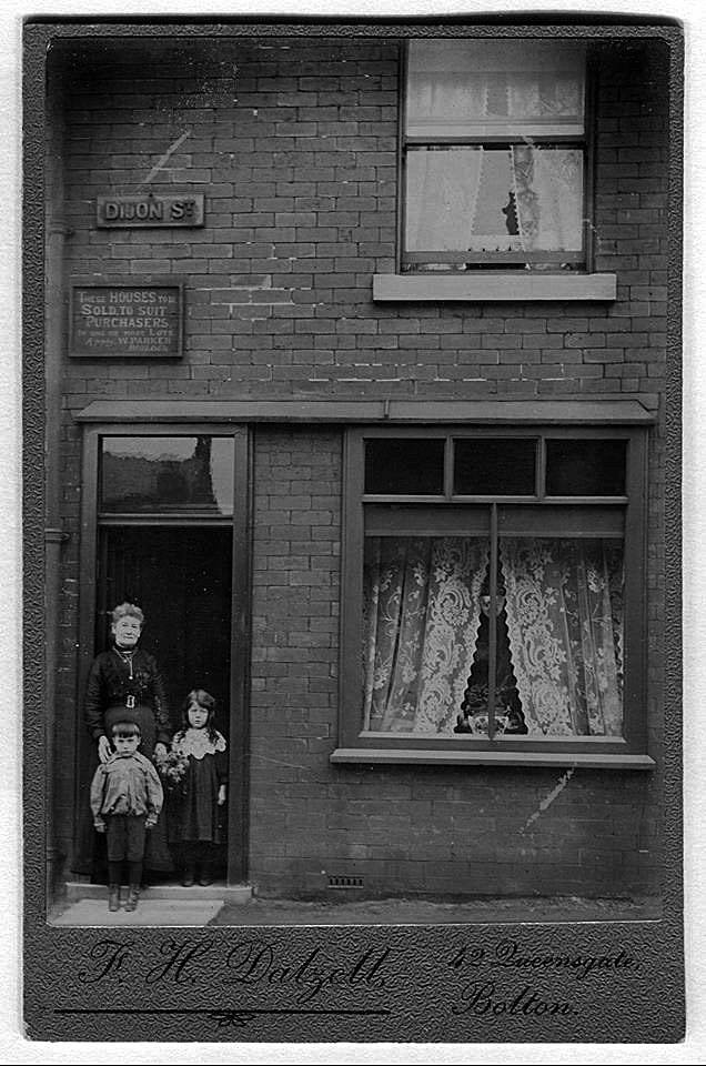
6. Dijon Street. The left had side going up (west side) was built some time before the houses opposite. The notice reads, “These houses to be sold to suit purchasers in one or more lots. Apply W Parker .
The state of the pointing suggests that these are perhaps not newly built houses and the sign board is not in a pristine state. Why has this picture been taken? Is it for advertising? Is it proud home owners who have just moved in?
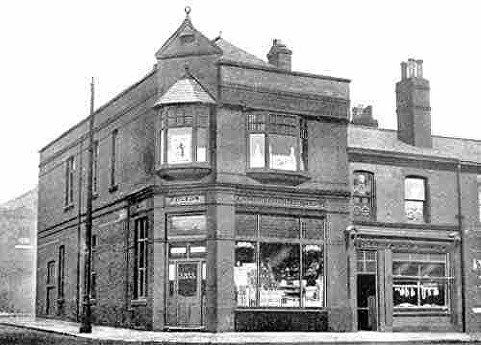
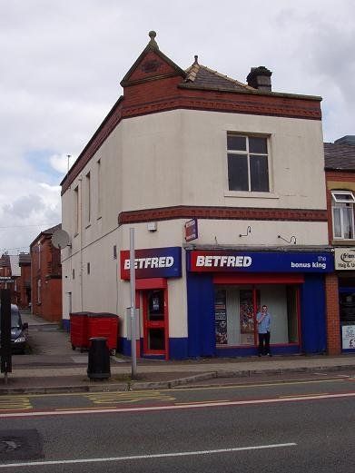
Back onto St Helens Road and the corner of Croston Street. Bolton Co-op Branch number 3
with a butchers next door and a boot and shoe department on the opposite side of the road. The shoe shop is long gone but this building dating from 1881 at the bottom of Croston Street still stands as Bet Fred.
(C)WDC August 2013, left and above
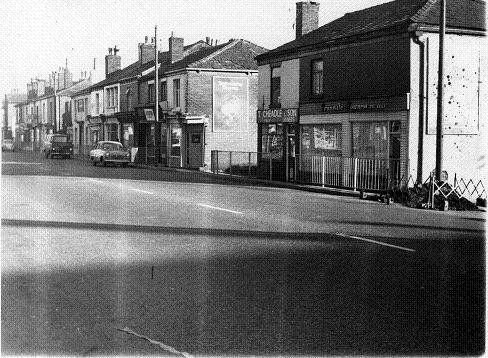
Back to the south side of SHR. The first block up from Adelaide Street with Stamford Street at the near end. The Greens Arms can be seen and Daubhill Methodist further down.
c1977 © Fred Hosker / Jackie Nisbet
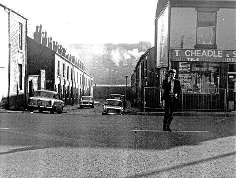
c1977 © Fred Hosker / Jackie Nisbet. The next few blocks , Stamford St, Bright St,Wagon & Horses, Joseph St, Barrier St (aka Shed Lane)
© Fred Hosker / Jackie Nisbet Joseph Street. At this time I cannot believe the man is talking into a mobile phone! In fact he has a cigarette in his right hand and appears to have a camera hung round his neck being steadied by his left hand. Guess he is Mr Hosker Jnr.
© Fred Hosker / Jackie Nisbet
Joseph Street.
For full size pictures, click on any picture, navigate with <>, there is sometimes an option to zoom, exit with X.
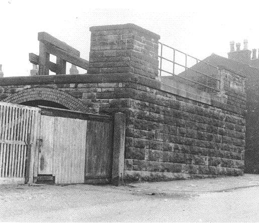
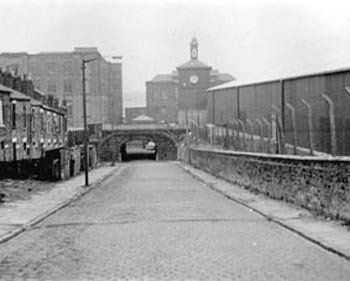
1. Barrier Street often known as Shed Lane. No houses fronted onto this street. We see the back of Joseph Street.
1977 © Fred Hosker / Jackie Nisbet
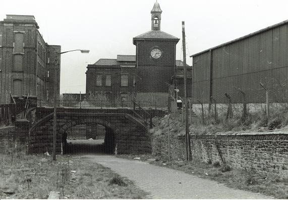
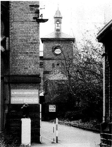
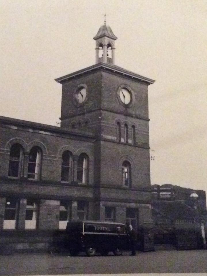
2.Barrier Street (Shed Lane) The bridge carrying Stephenson’s 1828 railway. 1977. Perhaps we do not know whether this was built over an existing street by Stephenson (likely) or whether it was provided later for the mills. The Dobble Clock was a Daubhill landmark for many generations and its rather tinny sounding bell is fondly remembered. Civic vandalism to have allowed this to be demolished.
© Fred Hosker / Jackie Nisbet c1977
3. A picture that has been doing the rounds for many years. The Railway Bridge and Daubhill clock, picture taken by Mr F Boardman 1975. Ownership now – Bolton News.
4. Probably earlier than 1975, before the modern shed was built. What had previously been on what looks like a demolition site on the right? Posted on Facebook by Gene Watts
5. Daubhill Clock The Sunnyside Mills complex was originally Tootals Broadhurst and Lee, TBL, Tobrolco, but in the 20th Century there were many mergers and take overs and the sign mentions “Sir Richard Arkwright Co” and English Sewing Ltd”. The clock appears to have been removed from the tower.
6. Daubhill Clock from Janet Hart; her father was head of maintenance and he was a keen photographer in the days of black and white and rolls of film
North side of St Helens Road.
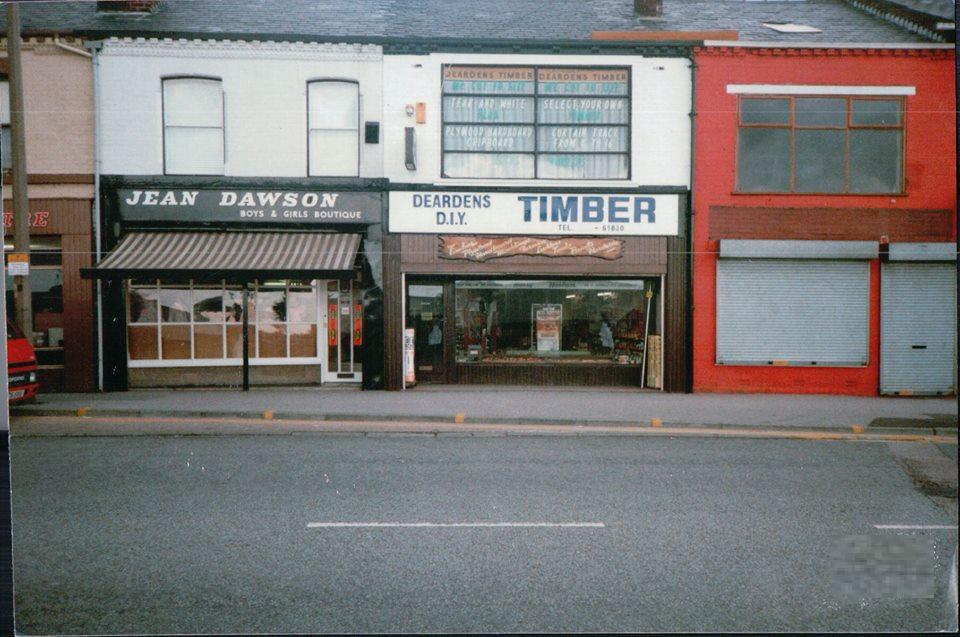
Two very well remembered shops, Jean Dawson and Dearden’s. Picture posted on Facebook by Victoria Smith
Maybe equally well remembered by some viewers.
© Fred Hosker / Jackie Nisbet
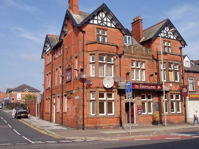
©WDC 30 Sept 2013 The Oddfellows Arms Hotel is one of only two pubs remaining on the “Dobble Mile”.
Blackledge Street is to its left.
However this also closed its doors in 2021.
Blackledge Street; unusual three-storey houses; Oddfellows Arms on the right; the block at the left was low down which was emphasised by the re-laying of the road surface and the raising of the pavement. The original pavement level is retained in front of the doors the two levels being separated by a rail.
The two level pavement is clearly seen here. This is the block between Blackledge Street and Prescott Street. This whole block has now been replaced by the Rumworth Hall, the new location of the Daubhill Labour Club opened 1972/3.
Immediately to the left was a row of little cottages, set well back from the road, with long gardens and stone flag garden walls. These were demolished around 1960 to be replaced by a petrol station.
Picture by Gene Watts.
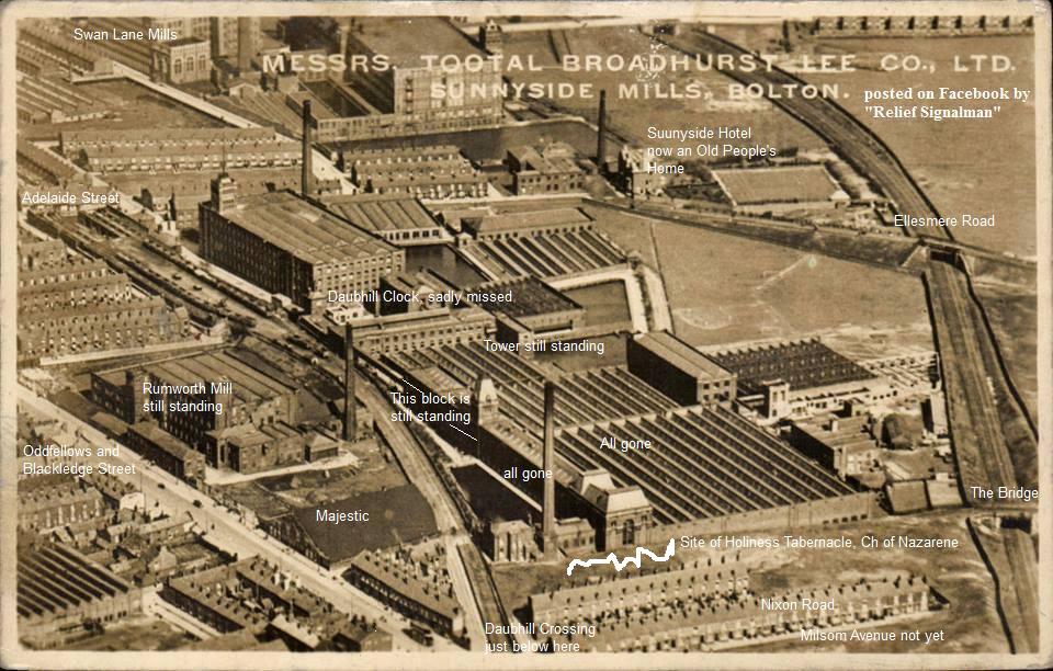
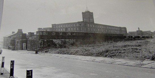
Pre 1931. An aerial picture of the area stretching from Adelaide Street across the whole Sunnyside Mills complex to Nixon Road (possibly called Beaumont Road at the time of this picture). Towards the bottom of Adelaide Street we see the turn off into Bridgeman Street alongside the mills of the Swan Lane Spinning Company, Rutland Mills, The Sunnyside Hotel with its bowling Green, then turning the corner Ellesmere Road with its long incline up to the railway bridge. On this picture we see clearly both the original 1828 line of the railway and the 1885 diversion. So from the top of Adelaide Street we follow the original line across the front of the mills – there is no question that the existence of the railway was the determining factor in the decision to put Sunnyside Mills in this location – passing the clock tower and the main tower where the line curves towards St Helens Road and the level crossing.
2021 Rumworth Mill still stands functioning as "non-wovens". The whole of the Sunnyside complex has now gone including the tower and adjoining bloch marked as "still standing" on the above picture.
St Helens Road cuts across the bottom left corner. Notice the Majestic Cinema.
Between Rumworth Mill and the level crossing is the MAJESTIC cinema. I have been trying for years to get a picture of it without success – apart from this one. At some point around the turn of the twentieth century, Rumworth Skating Rink was opened at a position in front of the present Majesty Van Hire site. Skating was however soon overtaken by another leisure activity.
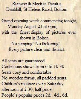
Not an actual newspaper cutting, sadly, but this is the wording of a notice which was placed in the Bolton Evening News of 21st August, 1911.
The cinema was later renamed The Majestic and provided entertainment until the late 1950s. Before WWII it was possible to go in to the cinema for half price and stand behind the screen. Some people who did this regularly, took mirrors through which to view the pictures. On the back rows were a number of double “courting seats”. For many years the children’s Saturday matinee cost 3d. There was always lots of stamping at exciting times and it was not unusual for the manager to stop the film and come out to the front of the cinema demanding that the kids keep the noise down or the film would be stopped and not started again. The children’s programme always ended with a serial, a “cliff-hanger”. In the early days it was possible to get into the cinema without money by paying with empty jam-jars.
Evening showings were “continuous”. If you planned to go to the second showing of a film (often called “the second house” but that was not quite sensible for continuous performances) it usually happened that you went into the cinema 10 or 15 before the first showing of the “big film” had finished. (How annoying for the first house people waiting for the denouement!) You then sat through the B film, the newsreel, the adverts, perhaps a cartoon and then watched the main film. Towards the end you would hear, from various parts of the auditorium, “This is where we came in,” and people would get up at that point and leave. (Again very annoying for the other people who would have preferred to watch the film to the end undisturbed.) There was often quite a stampede for the doors at the end of the film as the credits began to roll. Of course few people really wanted to read the credits but the main reason was to get out before having to stand for the National Anthem!
Falling cinema attendances and perhaps the need for expensive maintenance meant the Majestic eventually closed its doors for the last time. In any case the brave new modern post-war world had other things to do. Around 1960 the Majestic was demolished and so too was a row of little cottages, set well back from the road, with long gardens and stone flag garden walls, on the other side of the road. In their place two symmetrically placed petrol stations were built. The planners clearly thought that the growth of motor car use would be so great that two petrol stations would easily have enough business, and two facing one another meant that you could always enter a garage without having to cross the road. Of course there was never enough passing traffic for two garages and the locals rapidly decided which was their favourite garage and never went to the other one.
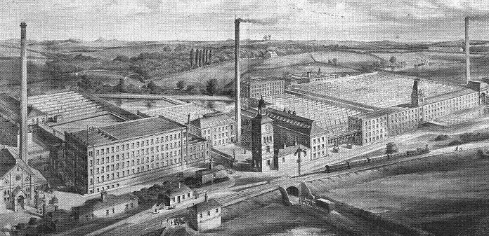
This engraving of Sunnyside Mills was probably created BEFORE the mills were built as an illustration of how they would be expected to look. In fact the eastern end does not tally too well with later photographs and what Leslie Gent calls “Daubhill Station” (the two little buildings with chimneys either side of the railway) may never actually have existed.
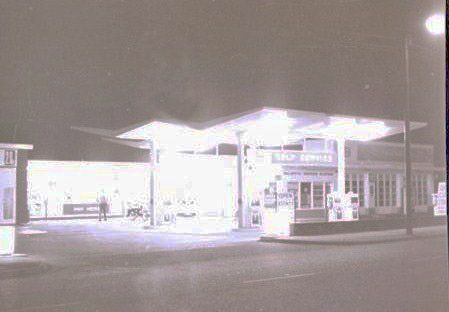
The Esso garage on the site of the Majestic became much the more popular and the garage on the site of the cottages closed after a few years to become a taxi office, a car wash and a body-work workshop. The Majestic garage remained open for much longer but closed eventually though the final owner continued his business as Majestic Van Hire behind the garage site.
A picture from Gene Watts of the garage by night
. The Majestic site remained empty for many years but has become (from about 2008) a car wash and a depot for lorries transporting road-stone.
The site in 2013 © WDC
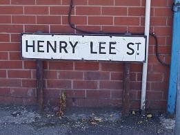
The street down the side is Henry Lee Street commemorating the one of the founders of Tootal, Broadhurst and Lee who had a small cotton mill here before that company was formed. It leads to one of the original entrances to the Sunnyside site.
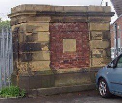
At the end of Henry Lee Street (only about 50 yards from St Helens Road) is a gate post for one of the entrances to the Mill area. This is the only bit of Sunnyside Mills which survives except for some stone carvings now incorporated into a wall at the side of the Market Place in Bridge Street.
This gate post is listed but the clock and the tower were not!
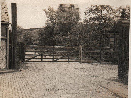
Immediately outside that gatepost were these gates across where the railway entered the Sunnyside Mills area. Part of the gatepost can be seen at the right hand end of the railway gates.
The building on the left side of the picture is the back corner of the Majestic Cinema.
March 2010 (C)WDC
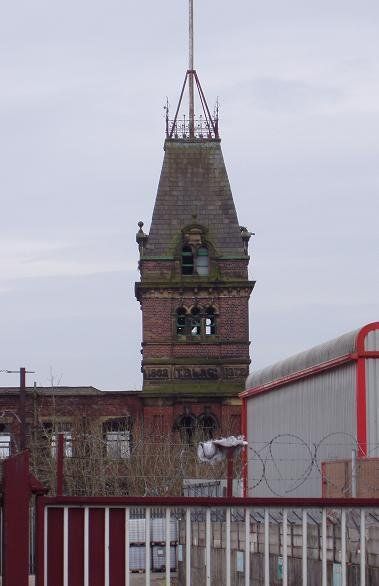
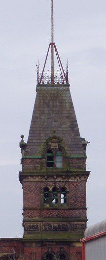
The Sunnyside Mills observation tower. Still structurally sound and in reasonable condition.
A couple of years later all the tiles were stripped from the roof.
It was demolished along with the remaining block to the left of it c2019.
Why oh why was it not listed?
The stonework says-
1862 T.B.L.& Co 1872
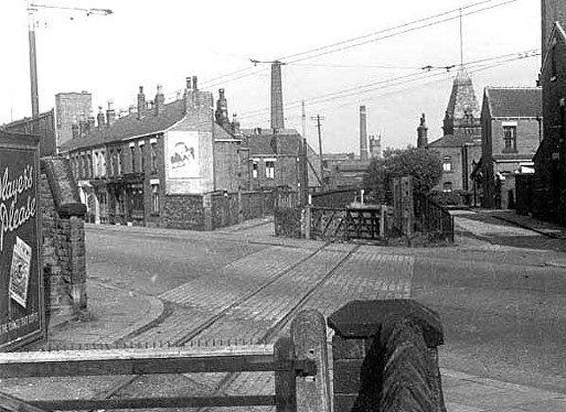
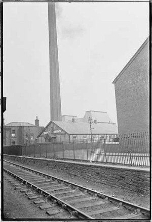
This picture seems to belong to Harold G Bowtell, taken 31 August 1952. A scene engraved in the memories of some of the older residents of “Dobble Crossing”. The chimney in the centre of the picture and the tower and what looks like a house in front of it are all part of Sunnyside Mills. The distant tower and chimney along the line of the railway are Swan Lane Mills. The corner of the Holiness Tabernacle can just be seen. Note the trolley bus wires.
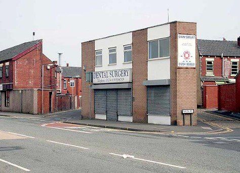
What it looks like more recently. Dentist June 2010; Dance Steps August 2013. The later picture better matches the view of the 1952 picture but the Holiness Tabernacle is now not just peeping out round the corner but has grown, has extended to the left and has changed its name. (C) WDC
The Sunnyside Tower bit the dust c2019.


click <>X
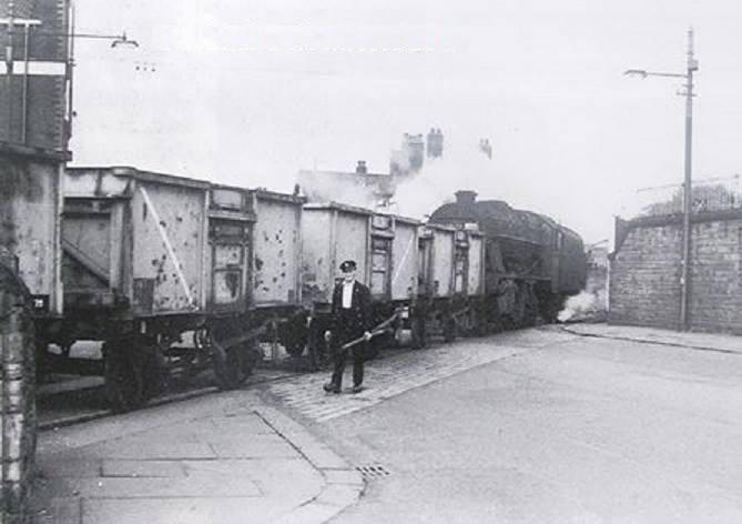
1, 2, 3, 4. Daubhill lecel crossing. Every morning coal was delivered to Sunnyside Mills. The houses behind the loco cab are on the Daub Hill 12-15 feet above the level of St Helens Road. In front of the loco funnel is Miss Boyce’s pet food shop then the block with the post office (Mr Lathom) and the Oddfellows pub is at extreme right.
5, 6, 7, 8. These pictures are from 1937 from the Bolton Worktown Project photographed by Humphrey Spender.
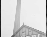
9. The Holiness Tabernacle some time after its opening in 1931.
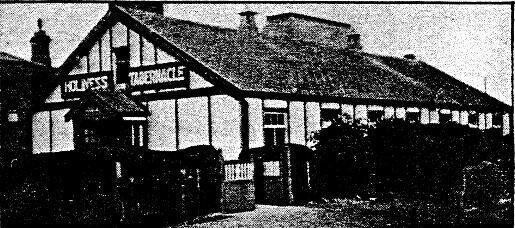
10. Holiness Tabernacle, Mayor’s car at opening of new sanctuary which is the part from the A-frame and to the right. The old building to the left remained for many more years as the Sunday School. c1963
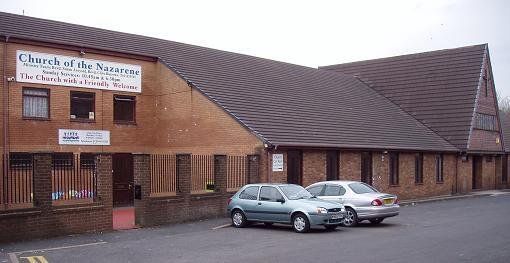
11. The Church of the Nazarene on Southend Street now.
Bella Street on the other side of St Helens Road with the Daub Hill on the right, known as the home of the Daubhill Corps of the Salvation Army. The Daubhill Citadel was the bottom five windows of this block. They joined forces with Haynes Street Mission in around 1990 and moved to the mission chapel. What is now called the SA Bolton South Corps thrived, rebuilt the chapel in about 2000 and added another building as the sanctuary in 2012.
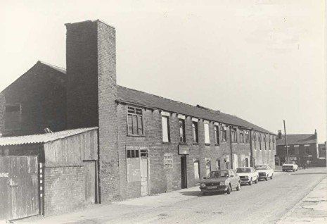
The buildings closer for a time were occupied by A E Sharman,s joinery business. Martyn Horrobin tells me that it was owned by his father. The picture dates between 1980-82 because that is when his father owned the white car, middle of the three.
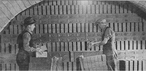
Bella Street is perhaps best known for T and J Higson’s brick works. There seems to be no picture of these but here we see workers setting bricks in a kiln in 1946. The kilns were quite accessible and you could feel the warmth on the outside walls. It is said that local tramps found this a comfortable place to sleep.
I have been told that the buildings in the picture above were occupied by Higson's until they closed, the kilns however are behind the viewer.
Many of the houses in Daubhill were built using Daubhill brick. It is a strong and durable hard-faced Accrington type brick.
<<<< 30885 Milsom Avenue with Hooton Street across the top and the Billiard Hall / Snooker Hall / Pool Hall / Pill Hall just visible at left

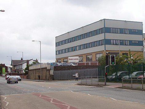
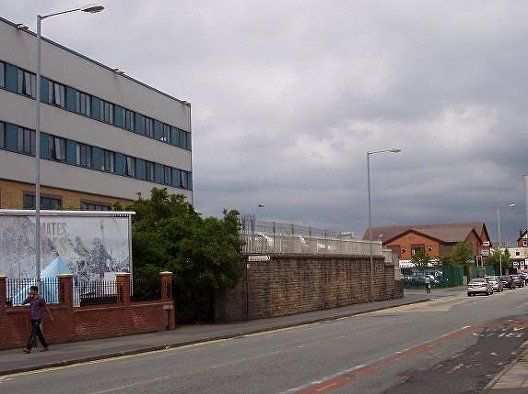

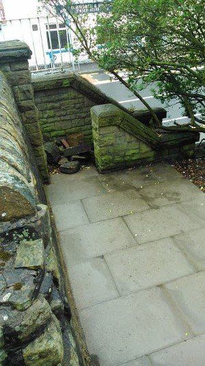
The Daub Hill with its retaining wall in 2012. The wall would have been built to retain the hill when its end was removed to reduce the climb of the Bolton and Saint Helens Turnpike.
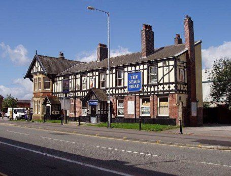
The street up to the right is Bella Street. At the left side of the picture is the (ex) Stag’s Head Hotel and ASDA. The hill which had houses on it up to 1969 has been occupied since then by the Park Cakes bakery.
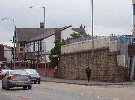
The height of hill which was removed can be judged on this picture.At the left hand end of the Daub Hill were steps. At the right end was access to the houses at the top by a steep cobbled street.
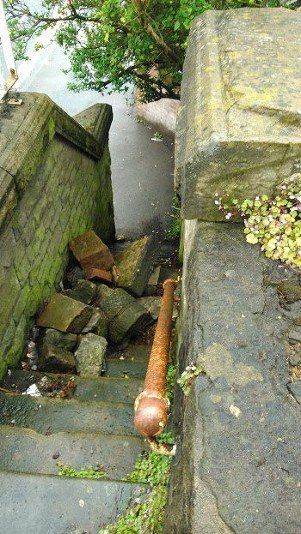
Looking back the other way, the new brick wall at left has been built by the new owners of the Stag’s Head, now Manor House and no longer a pub, across the line of the 1828 railway.
Posted on Facebook by Edward Thompson
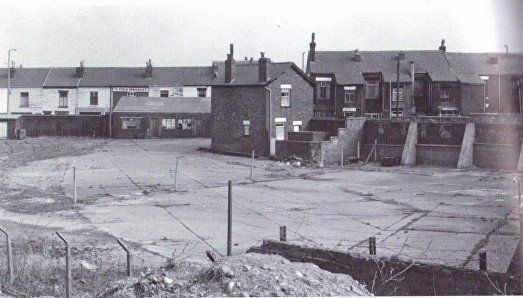
1969 - The old houses on the Daub Hill being demolished.
Notice the stairs.
The railway line runs into the picture alongside the hoardings.
These pictures by Peter Haslam.
The steps are still there but are sometimes blocked by debris. They are blocked at the top by the perimeter fence of Park Cakes.
Just before you get to the top you can turn left which is where the photographer is standing on the first picture. This seems to have led to a Bowling Green.
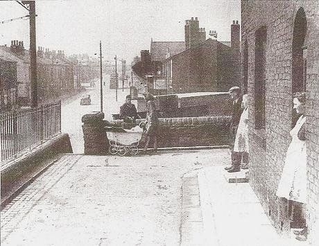
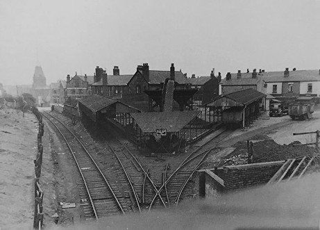
1948 At the front of the houses on Daubhill, looking west towards the steps, the Stag’s Head and Daubhill Station.
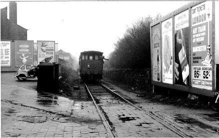
© 23 March 1965 H J Scowcroft.
The coal train on its way to Sunnyside Mills. The train is coming towards us; the guard is signalling to the driver that they are reaching the road.
There was also a branch line to left into the Coal Board coal yard behind the Sag's Head.
The Stag's Head Hotel is to the left.
September 2009 © WDC
just after the pub has finally closed.
The coal yard behind the Stag’s Head was supplied by the train which supplied Sunnyside Mills. This in turn supplied many local coal merchants and some local individuals.
Picture from the book "Hulton Sidings"?
Picture from Gene Watts of the coal yard after it ceased business. On St Helens Road can be seen “The Cycle Specialists” which had been Ken Charlson’s but was probably Geoff Smith by this time. Shortly after clearance this site became NETTO but is now ASDA.
The yard manager's house is still standing.
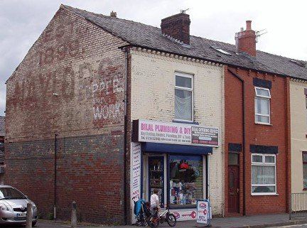
© WDC Typical terrace and corner shop on St Helens Road built around 1900. This had been Eddie Foster's wood and DIY shop for many years. Of some interest is the "ghost sign". It was very common in the early 20th Century to use wall space like this to paint adverts - not always for the business whose wall it was using. A second sign (copper ---work) had been painted over the original but had weathered less well though the lower corner had been protected by a later still, screwed on advertisement hoarding.
You will also see where the street name "Hyde Street" has disappeared from, not that it matters since no premises fronted onto this street.
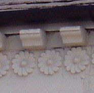
Many terraces have a line or two of decorated brick below the gutter. Here and on some others in the area we have DAISIES. It is almost certain that these houses were built using Higson's "Daubhill Brick" and the daisy was perhaps a speciality for some years.
Sadly they are not always retained when the wall is refaced.
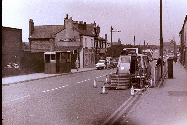
Daubhill, Looking back down St Helens Road. The coal yard is over the wall on the left, what had once been the NCB office where householders could order coal for delivery is now Lloyd Finances. That site was cleared to build Netto which is now ASDA. Stag’s Head, St George the Martyr, the line of the railway, the Daub Hill the houses having been cleared but Park Cakes not yet built, Oddfellows – has been one of the only two remaining pubs of the 19 that used to be on Derby Street and St Helens Road but closed 2021.
Daubhill 1952
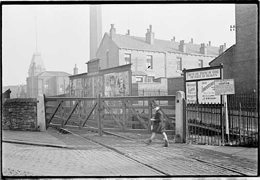
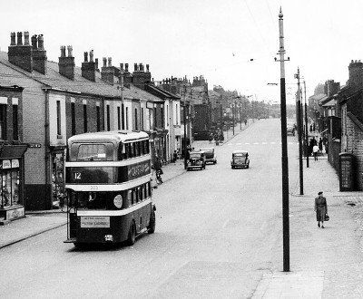
St Helens Road approaching Morris Green. Hyde Street (corner where Eddie’s wood shop was), number 12 bus which will turn left at the next corner for Walkden and Manchester, Daubhill Zion Methodist Church on which site we later had W&G minimarket becoming SPAR and now McColl's (from c2018).
The Morris Green Lane and Deane Church Lane corner pass over the Bolton - Leigh railway line (1885 diversion) from the near left to the far right corner at which point was the Daubhill Station.
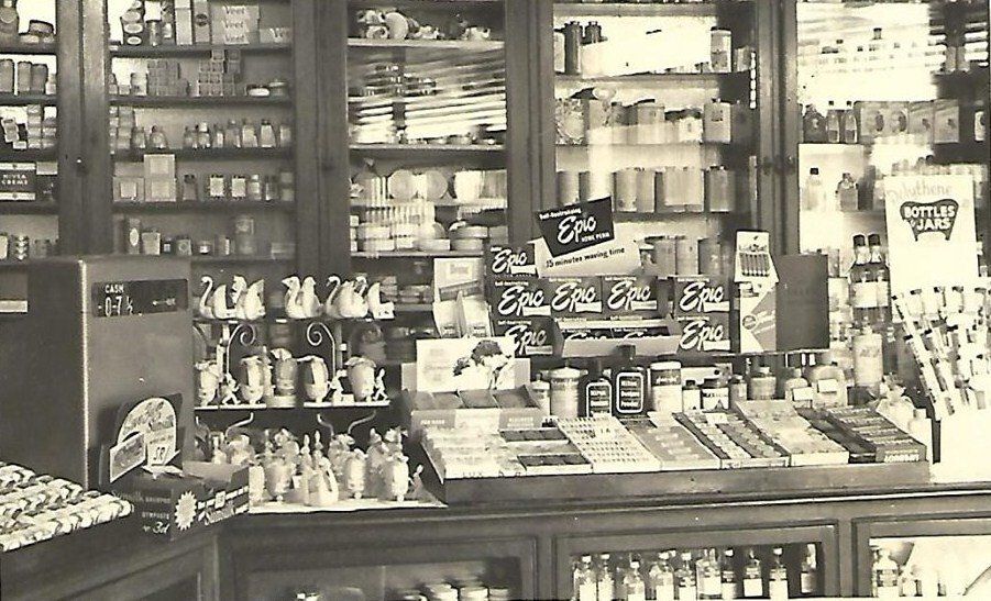
Just before that corner is a narrow back street with a chemist's shop on the corner.
Interior of Timothy White' and Taylor's chemists.
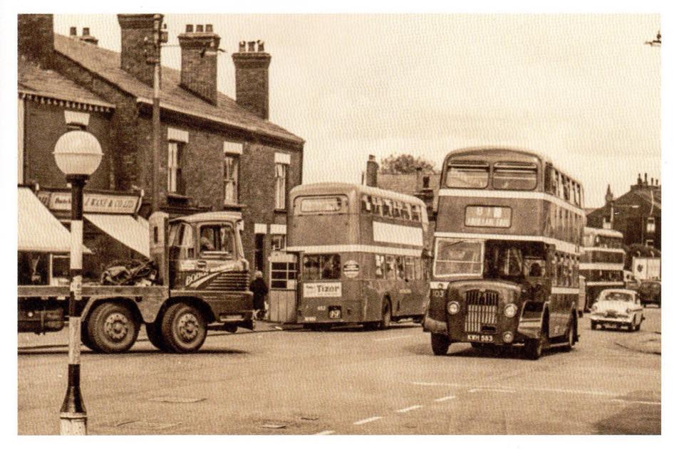
Daubhill; St Helens Road looking down from Deane Church Lane corner, Wane’s butchers. Then houses (not shop fronts), 81 bus coming up, buses with open rear doors, no traffic lights. Picture posted on Facebook by Edward Thompson.
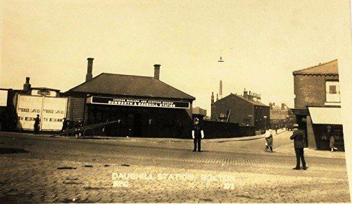
LMS Railway, Rumworth and Daubhill Station 1929. The hoarding advertises the Majestic Cinema screening Three Loves, released 1929 Directed by Curtis Bernhardt. With Marlene Dietrich, Fritz Kortner, Frida Richard, Oskar Sima. Straight ahead is Deane Church Lane.
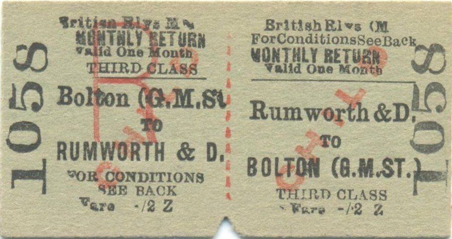
Ticket in the possession of Steven John Parker. Image included with permission.
On the next page we continue up St Helens Road as far as Four Lane Ends.