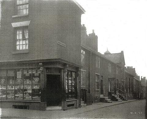
24 Moor Lane
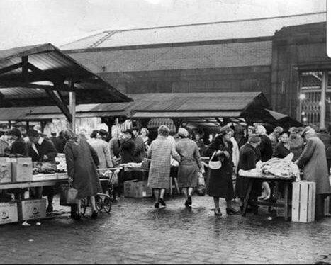
On the corner of Deansgate and Moor Lane, The White Lion which gave its name to the first bit of Spa Road, opposite - White Lion Brow.
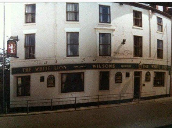
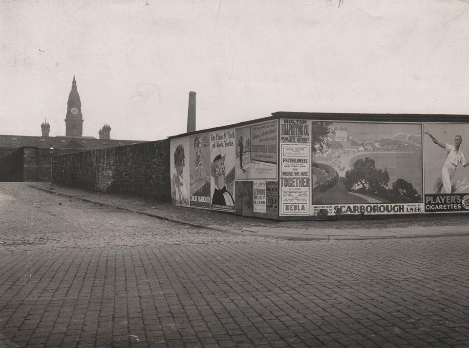
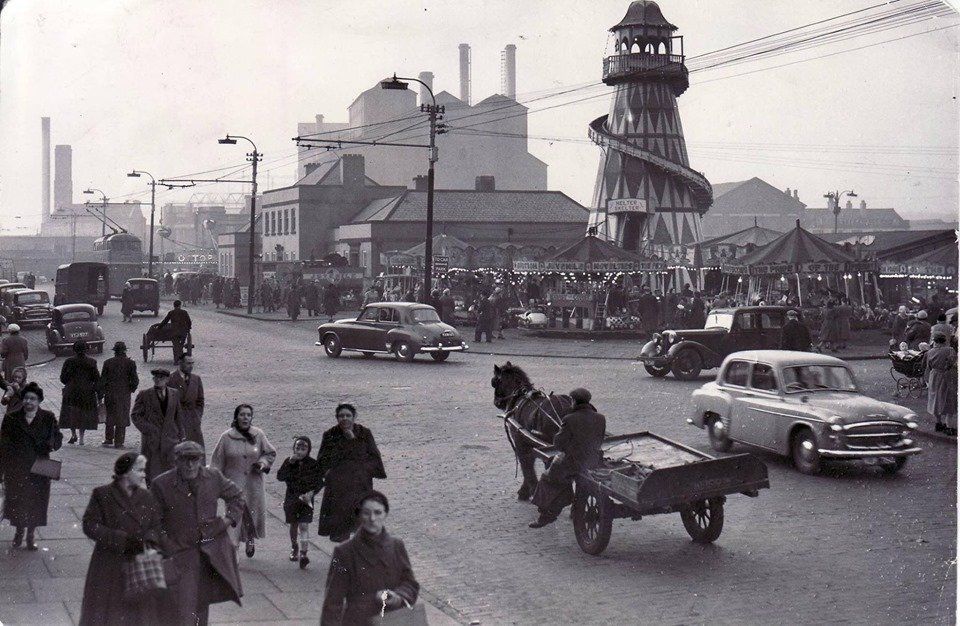
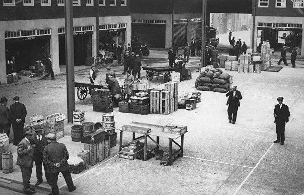
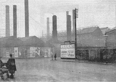
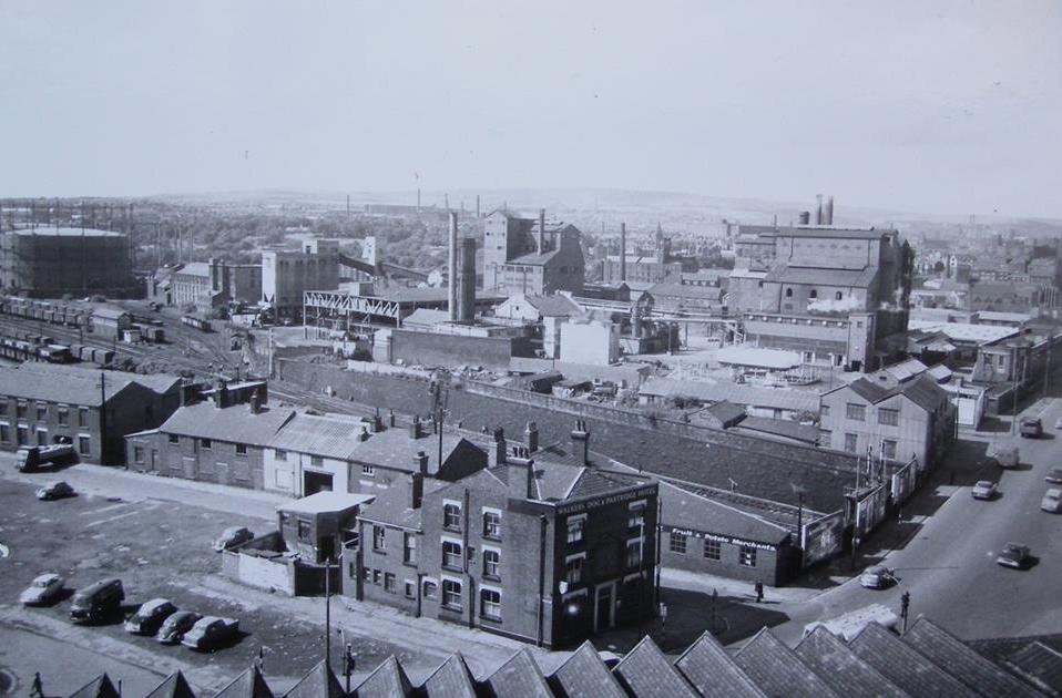
We see the firestation, then moving to the right along Deansgate the GPO and the Hippodrome. In the centre we see the warehouses which were originally built for the Bolton Chequerbent railway which supplied coal to the Iron works and Bessemer furnace on what became the Bus Station. There are no buildings associated with the bus station except the Market Offices. We see, bottom right the Ashburner Street Market with its old wooden outside stalls. Bottom left is the gas works.
February 2020 (C)WDC
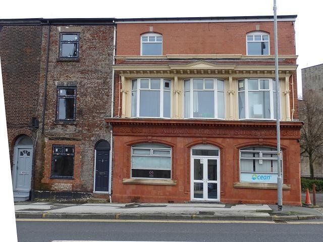
The Albion Friendly Society at 9 Moor Lane.
Presumably a local society connected with the Albion Foundry or Albion pub or both.
The building had a good clean and polish in 2018.
Posted on Facebook by Andrew Hodson
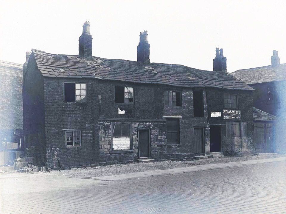
17-23 Moor Lane, (on the left as you go away from the White Lion) cottages date from c1650 The upper wall of one was 'wattle&daub' It was used by Harry Mason ?1930s. Numbers 19-21 had been occupied by the Chadbond family with 19 children.
ATLAS WHITE is white concrete.
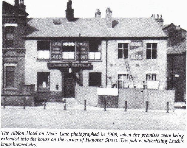
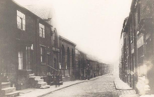
Moor Lane looking towards the Gypsy's Tent with the Albion and Hanover Street on the left.
Posted on Facebook by Denis McCann
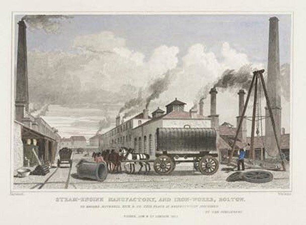
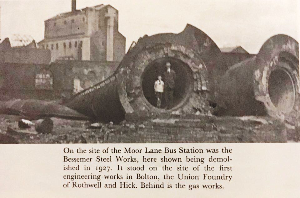
On the right of the above photograph but on the left as we travel away from White Lion Brow is the area most recently known as the site of Moor Lane Bus Station but 200 years ago was the hub of Bolton's metal industries.
The picture is of Rothwell,s loco works, Moor Lane.
Peter Rothwell who had owned a timber yard on this site went into business with Isaac Dobson, this firm eventually becoming the world-famous Dobson and Barlow. Rothwell was a member of the informal businessmen's club the Black Horse Club which assisted Samuel Crompton in his old age. Rothwell owned the Union Foundry on this site while Dobson's mushrooming business had moved by 1860 to Kay Street. In 1830 Rothwell with Benjamin Hick built the "Union" locomotive, one of the first four to run on the Bolton-Leigh railway line. Rothwell is remembered by Rothwell Street off Derby Street.
.In 1849 Rothwell and Co supplied the dredging machinery for the first steam-powered bucket dredger on the Sharpness canal.
(C) Bolton Libraries and Museums - A Certificate
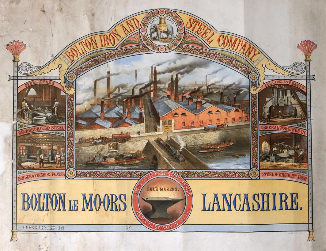
This Company was owned by John Hick (son of Benjamin) and William Hargreaves using the new Bessemer Furnace constructed by Henry Sharp (1863). They took over part of Rothwell's works in 1864. In 1865 they achieved the casting of the largest anvil block yet made in England weighing 210 tons (part of an industrial steam hammer, not for use by the local blacksmith).
Grace's Guide.
gracesguide.co.uk/Bolton_Iron_and_Steel_Co has a lot more interesting information
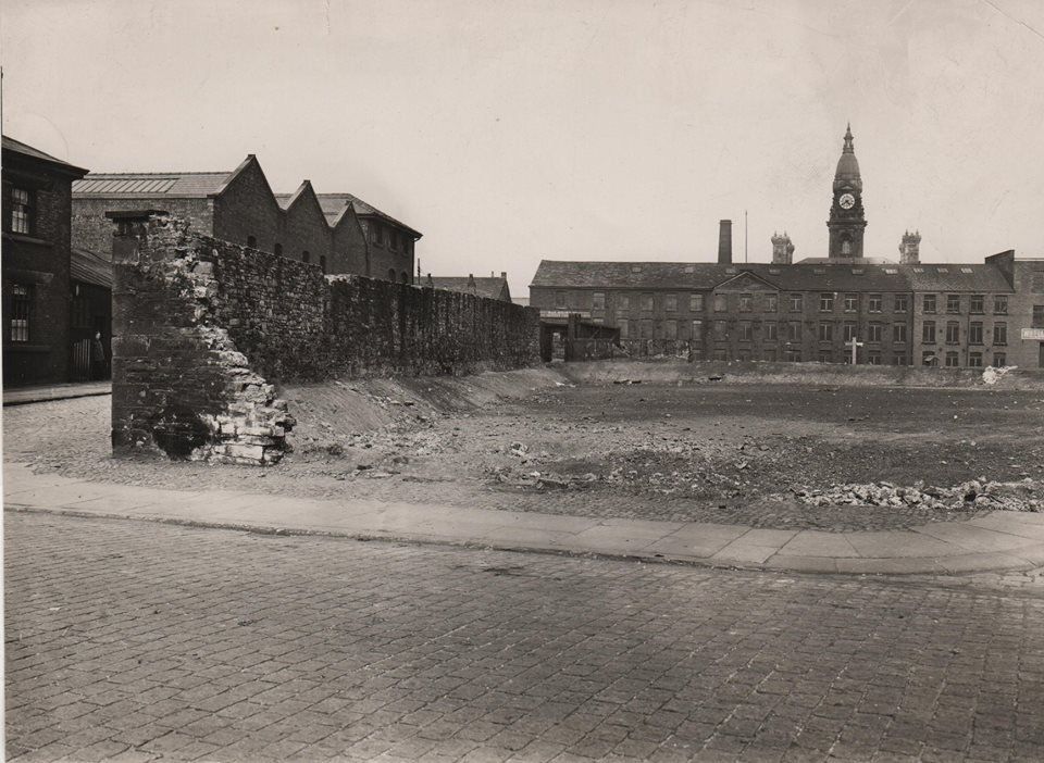
1927 looking from Blackhorse Street across towards Moor Lane and the Gas Works. The demise of the Bessemer Furnace.
Moor Lane goes across the picture with Railway Street going away from us. That wall was the northern boundary of the site which contained the Bessemer Furnace, the Union Iron Works and other companies. The wall remained as the bottom of the car park and then the far end of the bus station.
The gap in the wall may be where the railway came through having come from Great Moor Street, along Ormrod Street and through the middle of the works site.
Picture posted on Facebook by Gene Watts.
Different date from above, no hoardings.
Picture probably taken very soon after the Bessemer Furnace site was cleared. The buildings obscuring the Town Hall are unfamiliar. Are they on Blackhorse Street or on Spring Gardens and Howell Croft about to disappear in 1932 to make way for the Crescent?
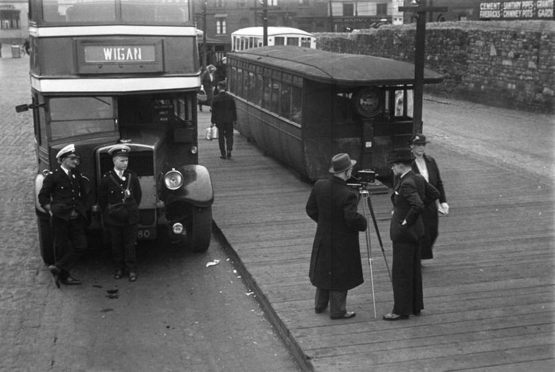

1937 The man with the camera is Humphrey Spender. He must have an assistant up a ladder with his spare camera!
We are at the far end of the now cobbled bus station with the wall on our right.
The single bus stand behind the Market offices are at the other end of the site (from 1932) but we are many years off any further development of the bus station.
The warehouse over the wall on Railway Street is probably occupied by Masons. selling cement, sanitary pipes, granite, firebricks, chimney pots.....
Darren Green posted this on Facebook to highlight the position of that wall.
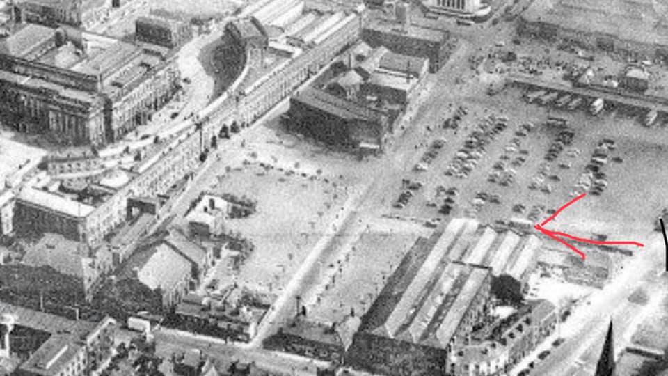
We see the single line of buses then the car park of the 50s, 60s, then the wall, then the railway warehouses.
Up the middle of the picture is Blackhorse Street, then Cheadle Square , Queen Street and the Civic Centre Crescent. The Odeon just sneaks on at the top.
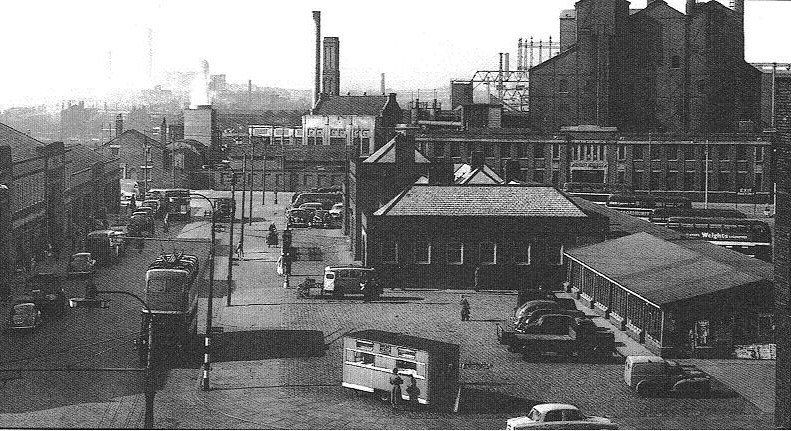
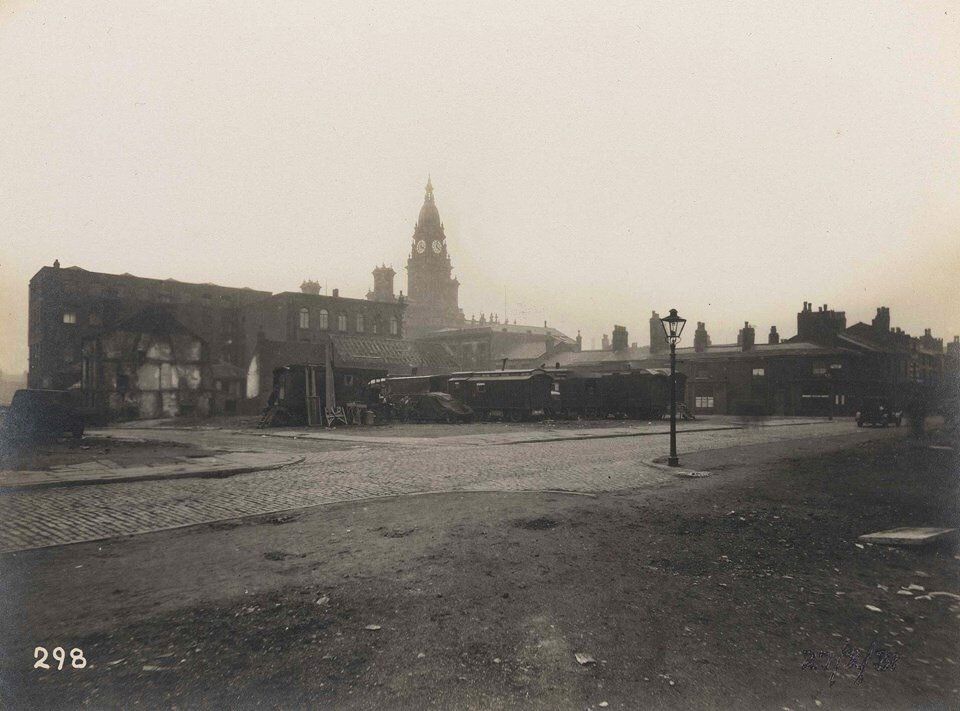
The car park with the wall from a different direction. Gas Works bottom left. Deansgate goods station in centre (no railway lines by this date) Also old fire-station, Deansgate GPO, Hippodrome.

Click and navigate
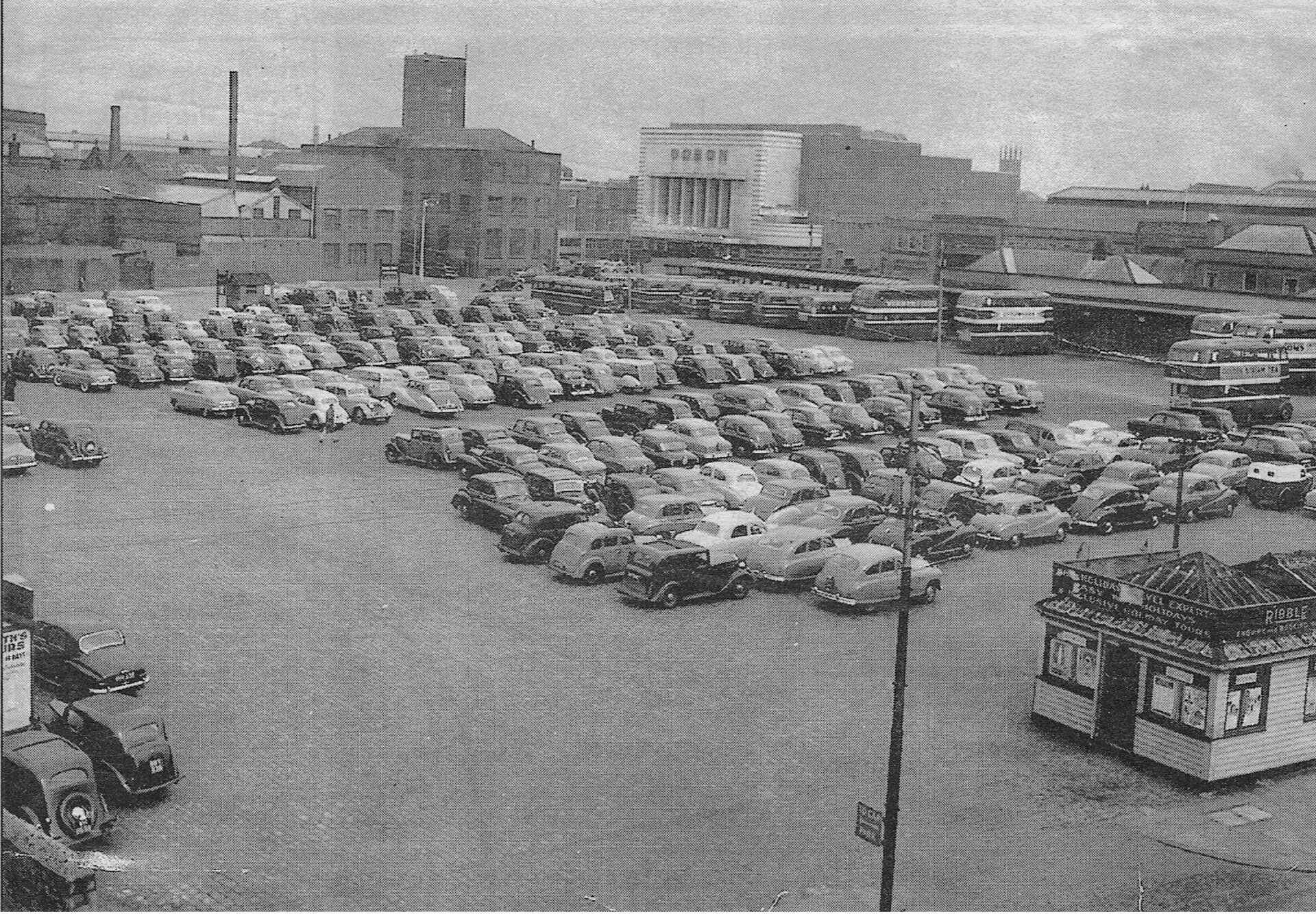
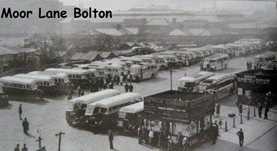
1 A view across what became the bus-station but what was for many years the main town centre car park. The bus station is one line of buses. The Ribble offices were a small hut alongside Moor Lane. The Odeon is still a cinema. Notice the parked cars,Standard Vanguards, Austin ?Cambridge.
2 David Whenlock's picture. A car spotter's paradise of the 1960s - you could tell the cars apart then.
3 Looking in the opposite direction towards St Paul’s church.
4 Fairground pushed to one side to make room for coach excursions, Bolton Holiday fortnight.


1 1947
The Moor Lane Car Park (where the Bus Station was until 2017), became the departure point for day trips at first as this one in the September holiday week, though later they seemed to run mostly in the second week of the June holidays.
2 Moor Lane, still a car park. Ambulance station on Cheadle Square.
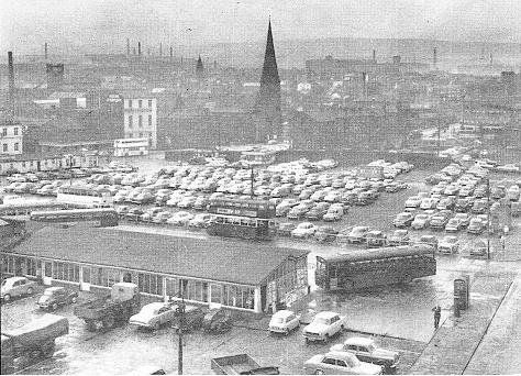
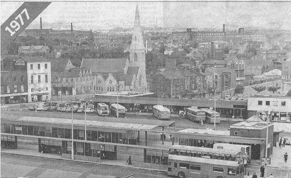
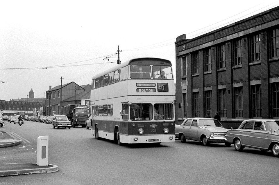
3 1977
It appears that St Paul’s has been cleaned. One of the various versions of the bus station.
4 1929 The Sir Richard Napier 30 Moor Lane mentioned above. Closed 1939.
1963
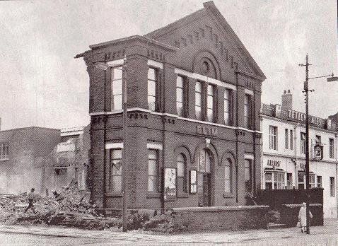
Elim Chapel Moor Lane corner of Gas Street being demolished.
Ashburner Street, gas works, market, market offices, trolley bus almost at the terminus, just past the children’s library and turn right into Howell Croft South, mobile food stall.
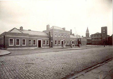
Market Ofices, Ashburner Street. In front of the central door is a weigh bridge. In days gone by delivery trucks were licensed according to their own individual weights and trucks were weighed here before the owner went to pay his money at the Town Hall. A story was doing the rounds in the 50s of an individual swanking to his mates, “I let all the tyres down before I got it weighed! There’s forty pounds in each tyre, tha knows!” (For the untechnical – the pressure in each tyre was 40 pounds per square inch but that is not the same as the actual weight of air in the tyres which is immeasurably small.) The use of the weighbridge was discontinued many years ago. The Offices, which were built in 1932 matching the market opposite, housed Age Concern in later years, but were demolished around 2017 as the bus station was moved to Great Moor Street. Demolition – another piece of civic vandalism – hardly seemed necessary, they were essentially one with the market, but someone wanted to re-route the vehicle entry to the market car park.
Ashburner Street, pre March 1956 because of trolleybus
New Years Eve 1955
This picture apparently was not published because of the fair or the New Year festivities but to illustrate a complaint about the very busy traffic on this junction, from Blackhorse Street onto Ashburner Street.
If they could only see our roads now!
1965
Maundy Thursday, gas works still there, very busy. The photographer seems to be standing at the top of the steps going up to the main entrance of the Odeon cinema. The black structure on the right is the black tiled wall separating the steps from the pavement. It looks as if the top of the wall was intended to have plants in it. I vaguely think I may have seen plants there sometime. OK, hands up, which child used to leave her mother to walk along the pavement while she ran up these steps and down the ones at the other side?
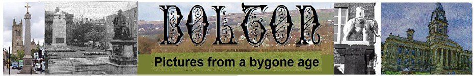
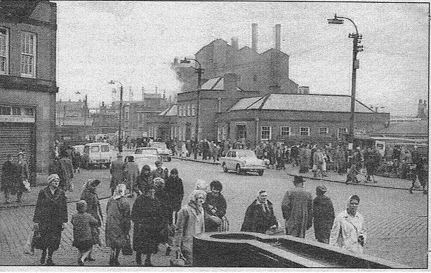
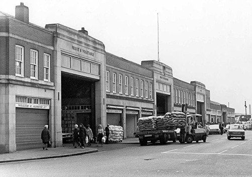
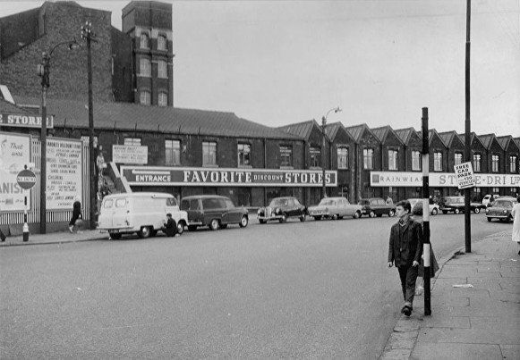
1969 The two left-most entrances give access to the Wholesale Market. The third entrance is the Fish Market and the fourth, lower entrance is retail fruit and vegetables and general produce.
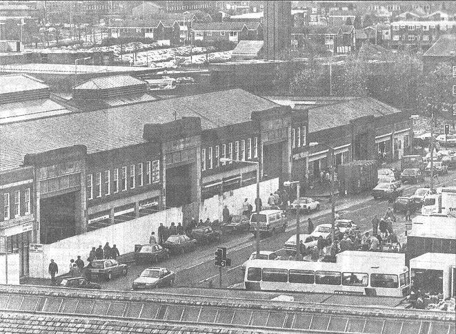
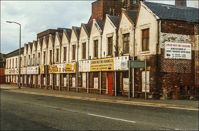
November 1992.The Wholesale Market is closed of for renovation prior to extension of the retail market. Behind the market is the tower of the new fire-station.
1932 posted on Facebook by Patricia Jones
The interior of the wholesale section of the newly built Ashburner Street market. Cannot recognise the buildings outside through the door. It seems to be buildings on the line of Ashburner Street before it was extended through to Moor Lane and before the Market Offices were built.
1953
Make-shift stalls across the road from the market proper, was this just plants? Look through to the Lever Chambers which do not yet have an additional storey and the Magee’s bonded warehouse where we turn right to get to Howell Croft South and the Leigh trolley buses.
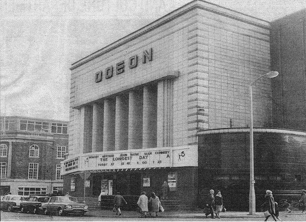
The Odeon.
Its First Night was 21 August 1937 with the first Battalion of the Royal Scots band. Although primarily a cinema it had live acts from time to time including Gerry and the Pacemakers, The Searchers, Dusty Springfield and Freddy and the Dreamers.
We see Lever Chambers and between that and the cinema is a remaining tiny bit of Back Spring Gardens.
"The Longest Day" about the 1944 D-Day landings was released in 1962. At this date the Odeon still looks well maintained.
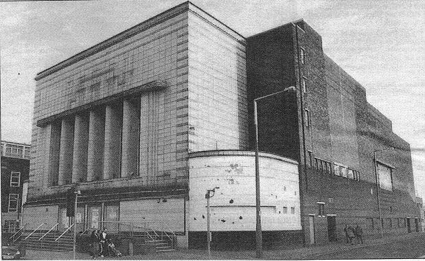
Feb 2007
The Odeon had been a Bingo Hall from January 1983. Now we see it in a rather sad state, scheduled for demolition shortly after this picture.
There were grand plans for the site but they seemed to bite the dust shortly after demolition as austerity hit.
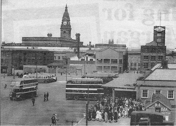
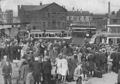
Bus station. Summer 1948?
1951?
The large crowd of passengers seem to be waiting for a coach to come and pick them up. They are probably not at a service bus stop.
The Ambulance Station at Cheadle Square can be seen.
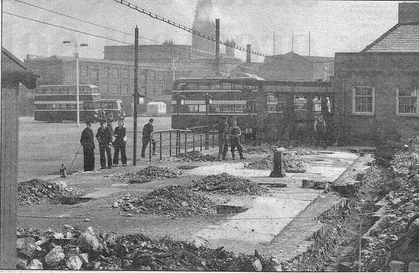
1951
Building the cafe at the Moor Lane end of the bus station.
This building is probably to replace the X.L. Tea Bar at left.
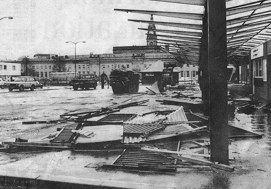
April 1985
Work begins on a £1.5million project to update Moor Lane Bus Station to be done in phases to minimise inconvenience over a period of 18 months. This area used as a bus station since about 1930, the canopies being demolished had stood since 1969.
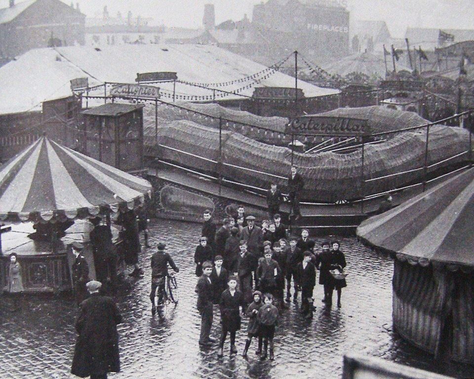
The fair was a regular visitor to this site at Bolton Holidays and at New Year. After the bus station was rebuilt to occupy the whole area the fair moved for some years to the site of Great Moor Street Station, now Morrisions, then various temporary sites.
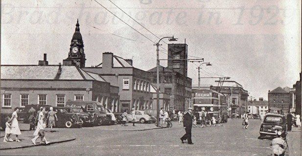
1923 Spring Gardens from its corner with Ashburner Street.
This street went from Ashburner Street to Deansgate and looking at the same place now you would see the unused side door of the Library, which used to be the Children’s Entrance. The street name can (just) be read on the left picture then any doubts removed by comparing the Mission Hall and the steps to the nearest houses with the 1891 map.
In the foreground Ashburner Street runs across the picture. Opposite us into the picture is Spring Gardens and immediately across the road from us would have been the Robin Hood Hotel on the corner of Spring Gardens then a little to the right the Founders Arms Inn on the corner of Howell Croft which runs left and into the picture behind the workmen’s vans. The Victoria Restaurant in the corner of Victoria Square is under and slightly to the right of the TH clock.
c1932 when TH was extended and the Crescent built.
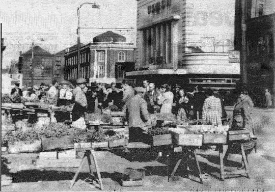
Back to Moor Lane and the outdoor market.
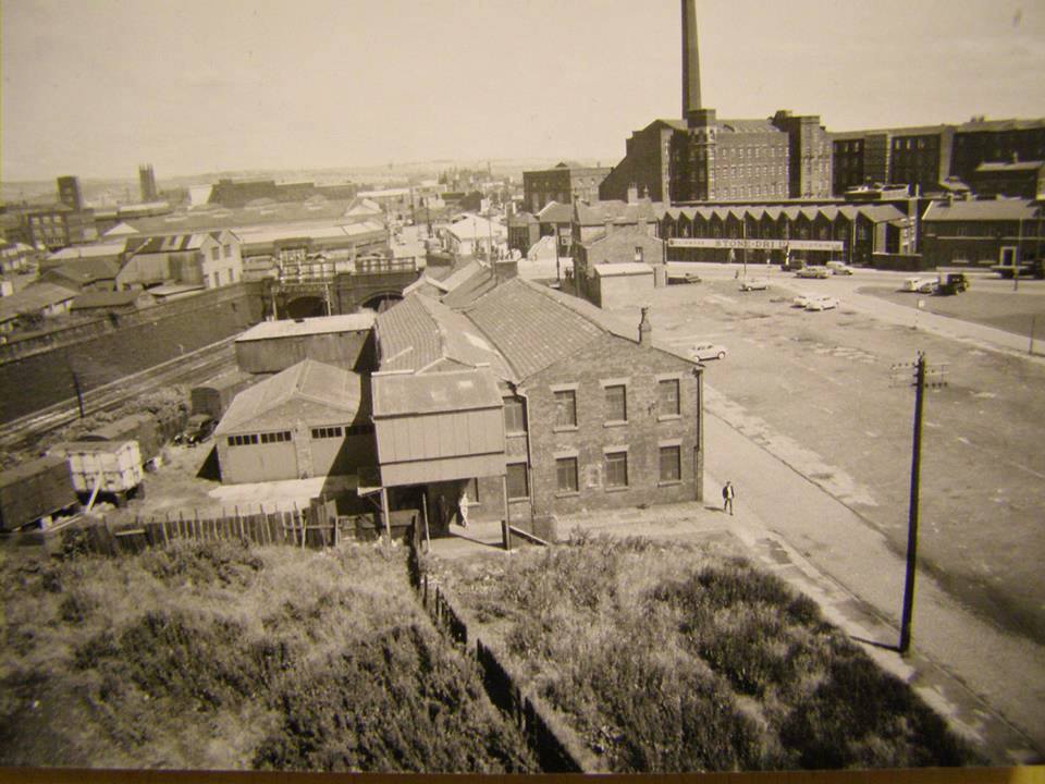
Moor Lane, opposite the Market, looking towards Deane Road and Derby Street with the Gas Works offices on the right. The bollard is at the turn in and out of the bus station. The very front of a car can be seen emerging from Ashburner Street. See the zig-zag roof of Flash Mills (Stone-dri) then Fletcher Street Mill and the tower of SS Peter and Paul R C Church.
1925 immediately beyond the market is a left turn into New Street. The picture looks back with New Street on the right.
This whole area from New Street (along the back of the market) down almost to Deansgate and from Moor Lane to Black Horse Street was once the site of the Bessemer foundry. In this picture demolition has started and continued to 1927. Moor Lane Bus Station first came into use on part of the site in 1930 and the Ashburner Street Retail and Wholesale Markets together with the Market Offices and Weights and Measures were officially opened in September 1932. This picture is of Moor Lane with New Street off to the right.
Immediately beyond New Street, Moor Lane with Stone-Dri.
Picture by Tom Gerrard
Note the characteristic zigzag roofs on this building.
late 1960s
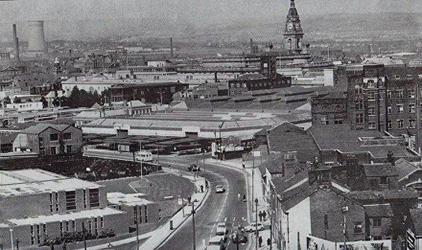
View from air of Moor Lane with Dog and Partridge, gas works, Winter Hill. Many people will remember the zig-zag roof of part of Flash Mill which contained Division One, Stone-Dri and Benson’s for Beds at various times.
Note the double gable against Moor Lane this side of which we have the Bolton Preston railway. On the 1891 map the railway is covered over at this point with streets and a school built over it.
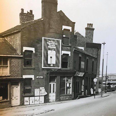
On the picture we have an odd shaped building which is fruits and potato merchant, then Partridge Street and the Dog and Partridge looking very isolated because of all the recent demolition around it. In the bottom left corner is Lupton Street.
Picture posted by Gene Watts
Looking towards Moor Lane after lots of demolition – Dog and Partridge is still there at the left hand end of the zigzag roofs fronting onto Moor Lane.
Flash Mill with its chimney is very conspicuous.
It is interesting to note that the railway lines go under two separate and different bridges. The streets and school mentioned above were over the lines going under the left hand bridge. Later the railway was widened removing Back Partridge Street (shown on the 1891 map but with no space for it to be on the above picture) and the right hand bridge was built.
Looking back along Moor Lane we see the new fire-station. On the market we have the stalls of the “outside market” or “open air market”. These seem to be steel structures which replaced the old wooden stalls.On the right nothing has changed as yet.
Noting the double gable referred to on the picture two above, we again see the railway but note that the new fire-station has replaced the Dog and partridge.
(C) Bolton Library and Museums
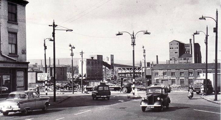
We have moved 200 yards along Moor Lane towards Derby Street and Deane Road.
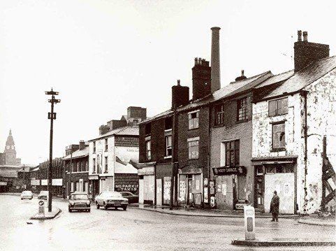
Property on Moor Lane awaiting demolition in 1973. The street on the right is Flash Street.
The Old Three Tuns is the lower building beyond Flash Street, the Harp garage is the premises next to the right hand end of the nearer block.
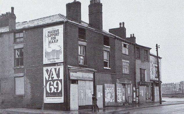
This is Moor Lane, Flash Street on the left, Harp Garage in the block, looking to the demolition site being prepared for the complete reconstruction of the Moor Lane, Trinity Street, Derby Street and Deane Road junction.beyond the corner of Derby Street and Deane Road where the University is now.
On the opposite side of Moor Lane, Lupton Street. Beyond the old-style “no waiting” sign is Partridge Street. Beyond the bus it is possible to see the corner of the Ashburner Street market adjacent to New Street.
The bottom end of Derby Street where it meets Moor Lane (to the right), Deane Road (to the left) and Crook Street (near right). The Derby Street Girls School is immediately behind us. A lot of demolition has just taken place on the corner of Deane Road and Moor Lane opening up the view to the far end of the Gas Works. The main buildings of the Gas Works are prominent above the buildings not yet demolished.
The Britannia Hotel is on the left edge of the picture.
It is the intention to go up both Deane Road / Wigan Road and Derby Street / St Helens Road but before that, on the next page we take a look at Great Moor Street.