16 Church Bank and Church Wharf
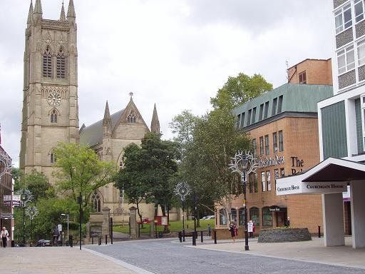
(C)WDC Churchgate - the street going to the Church. Church Bank is the steep hill to the left going down to the River Croal. The view in 2009. Although this is September we appear to have the Christmas decorations on the lamps. The Bolton News Office is a bit bland but not unpleasant and by no means out of place.
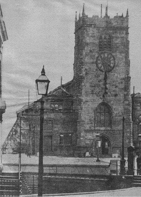
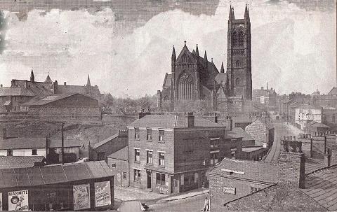
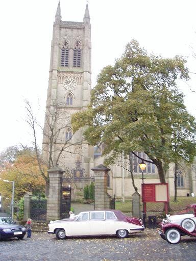
The present Parish Church was financed by Peter Ormrod (1795-1875) at a cost of £45,000 a Bolton mill owner (cotton spinner) and a Partner in the Bolton Bank, his father having been one of its founders. (He is remembered by Ormrod Street off Moor Lane along the side of the market.) The Parish Church tower is 54 metres (180 feet) high, said to be the highest bell-tower in the (old) county of Lancashire. The parish church was consecrated on June 29th 1871. It replaced an earlier building but evidence has been found of a church establishment back to Saxon times.
We will remind ourselves of where we have come from and have a look around this area before going down the hill.
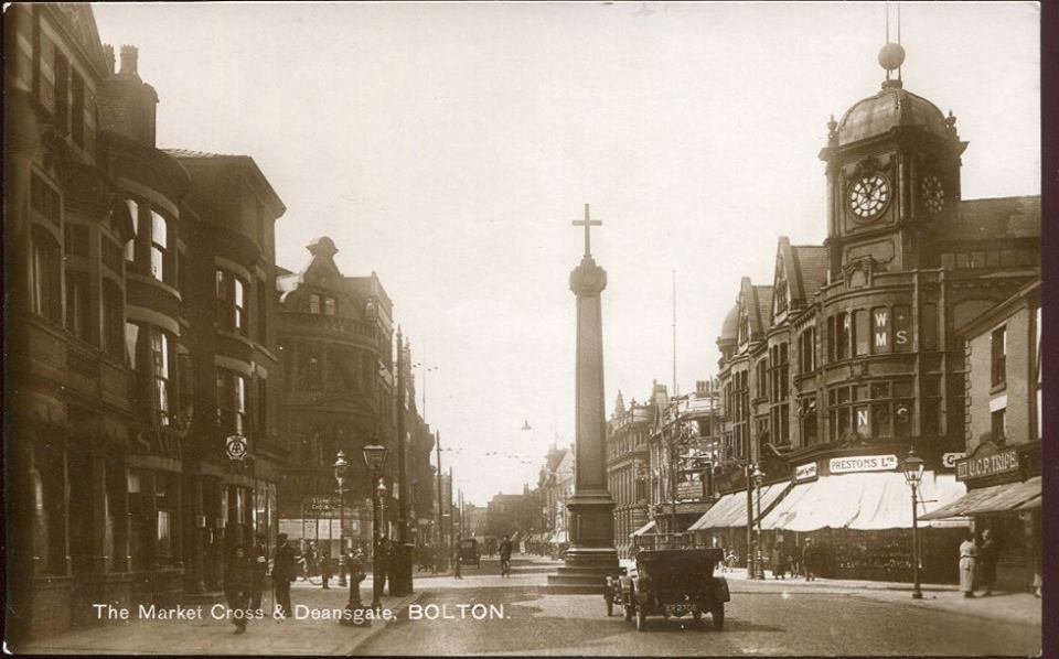
A quick glance back to see the Grand and the Legs of Man. On the right hand side we see the National Benzole garage (don't forget this was the main A58 to Bury and on to Leeds) with the Boar’s Head, Sabini’s and the Capitol beyond it. Further away the market cross and Preston’s.
(C)WDC September 2009
All change by 2009 except for the Pasty Shop.
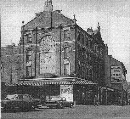
This picture is undated but is clearly somewhat later than the above. The Grand is now a Bingo Club.
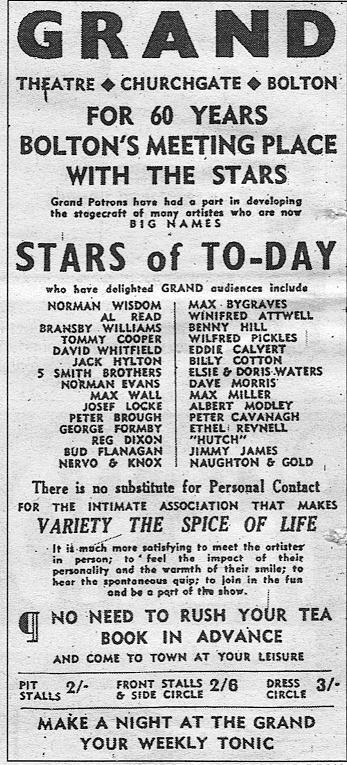
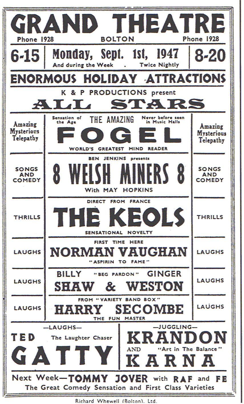
Right above>>>> Bolton Evening News advert for the Grand. The names including Norman Wisdom and others you will recognise are of people who had appeared at the Grand in the past and had now become famous. Seats 2/-, 2/6, 3/- (10p, 12.5p and 15p. Don't forget wages were around 1/6 an hour.)
Right>>>>> A performance bill with at least one famous name. This was a variety show, twice nightly, not necessarily every act appeared at every show, for the September Holiday week of 1947. Juggling, telepathy, comedy, singing and a French novelty act - what more could you ask for?
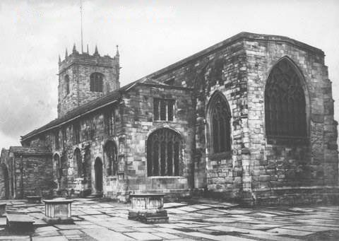
The previous Bolton-le-Moors Parish Church, demolished 1866 having been built around 1450 though a Saxon cross was found during demolition and the first record of a Vicar of Bolton dates to 1254. It was reported that so many people packed into the decaying building for the last service that it was feared the gallery would collapse. The structure on the left appears to be buttresses added fairly recently (relative to the date of the picture) to put off the inevitable collapse.
Bolton Archives, pre 1962
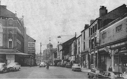
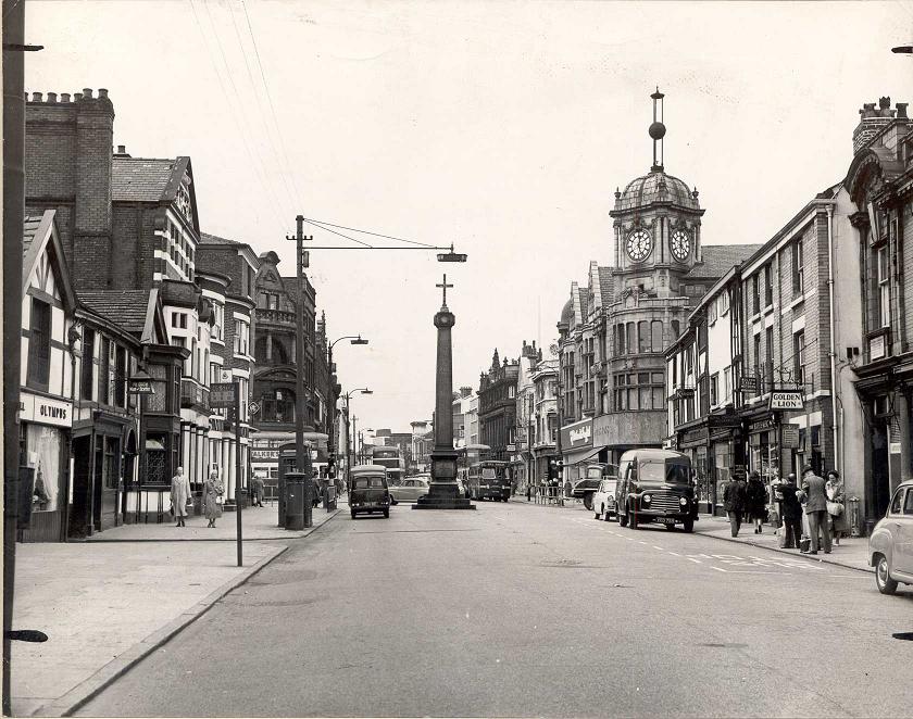
Another look back towards Preston’s sadly undated, Booth’s Music is still to the left of the Golden Lion with Bolton School of Motoring above it, Olympus Grill is on the left, Churchgate is still a bus-route and the road to Bury, the three vehicle number plates visible do not have a year letter so the picture may be from 1960 or just earlier (before 1962 when Booth’s moved).
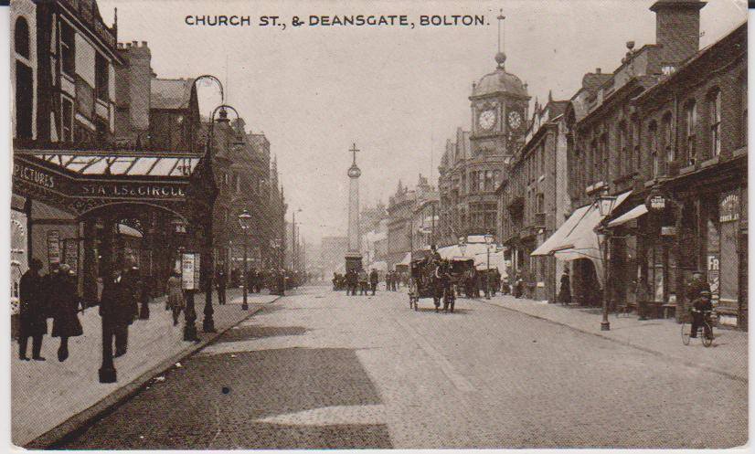
.One of David Whenlock's postcards dated 1930. The publisher got the name of the street wrong. We note that the terra-cotta building exists at this time.
David Whenlock again, 1910.
Window blinds are a feature as so often but the car steals the show.
UCP Tripe on the corner of Bank Street, it appears that Martin's Bank on the corner of Crown Street in under construction.
And again.
A splendid hand coloured black and white picture of 1905. It is not quite clear but we seem to have the previous Preston's building on the corner of Bank Street (Preston's moved there 1905). There is no market cross, of course, erected 1909. The cabbies' shelter is still there. We see the Pasty Shop and on the near right we have the Boar's Head Hotel. We note that it is cement rendered, the familiar black and white details were a later addition. The name of the pub appears in raised letters on the rendering along with "Market Hall". The hanging lantern says "Magee" along its top edge.
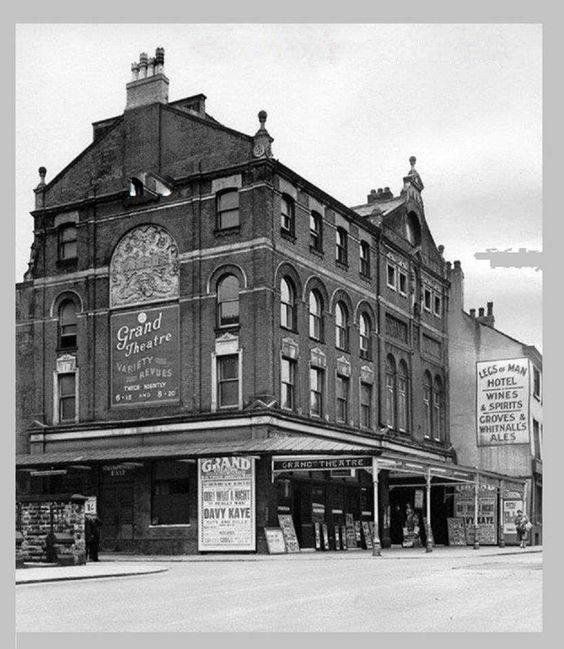
Of course we have both the Grand Theatre and the Theatre Royal. Dominant on the left are the Legs of Man and the Derby Arms.
At last we see it in its glorious splendour.
The Grand Theatre (closed as such in May 1959 but the building being used in other guises for a while afterwards) was demolished along with the Legs of Man and the Derby Arms in 1963 to be replaced by Churchgate House.
The Grand was famous for its Variety Shows and Christmas Pantomimes.
It started life as a wooden circus owned bt Fritz a former Royal Jester. This was demolished it 1892 and the familiar Grand Theatre was built initially to house the circus but able to be converted in a matter of a few hours into a theatre. The first performance was in 1895 by the Bolton Amateur Operatic Society.
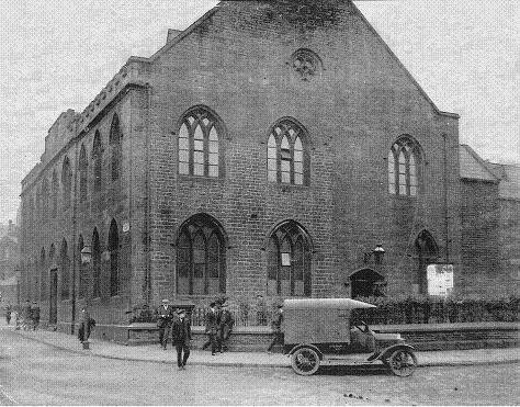
The Parish Church School on the corner of Silverwell Street and Churchgate where the Bolton News offices moved to from Mealhouse Lane. Bolton News later moved to Wellsprings in 2013 (2012?).
The Parish Church school was built in 1819. It had served as a school for about ten years but its main use was for the Parish Church Sunday School which at its peak had 1400 scholars on the register with 110 teachers. On Saturday evenings it was used to teach the three Rs to poor boys and sewing and knitting to the girls.
It is a large hulk of a building but lots of excellent detail make it look not unattractive.
The Parish Church school, built in 1819, is being demolished. The Bolton News now moved to this site but moved again to Well Springs on Victoria Square in 2012.
For Sale?????? (site only maybe)
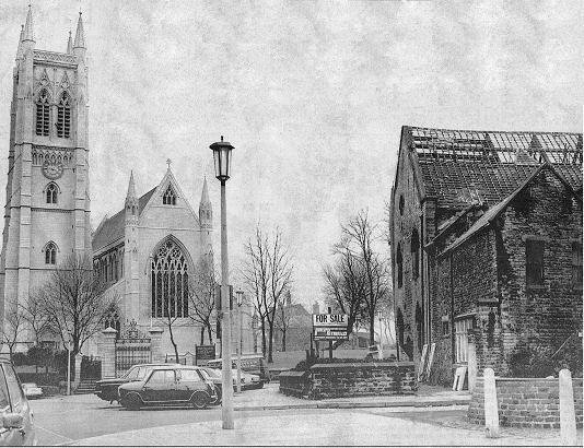
Its position in relation to the Parish Church is clear with Silverwell Street between the two buildings and Paley Street to this side of the school.
We headed the page with the above picture but repeat it here for comparison.
(C)WDC October 2007

(C)WDC October 2007
The old Bolton-le-Moors Parish Church
Bolton Archives picture
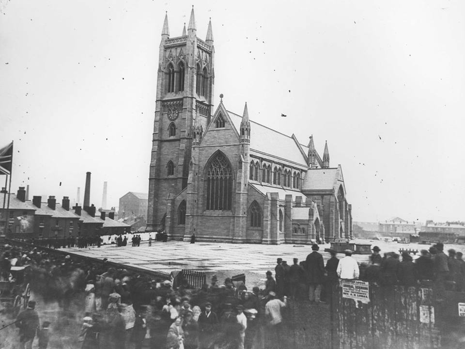
The new Parrish Church, presumably just completed and this is the opening ceremony. The placard advertises "Annual Sermons" with the Rev ? ? Lomax (or Lomas).
A look up Church Bank with the church on the left. We see the Grand Theatre then the Legs of Man pub closed in 1962, a pub of that name having occupied that spot since 1836. On the right the street name Church Bank can be seen, from that point we have numbers 1, 3, 5 and 7 Church Bank.
A more distant shot showing the top half of Church Bank.
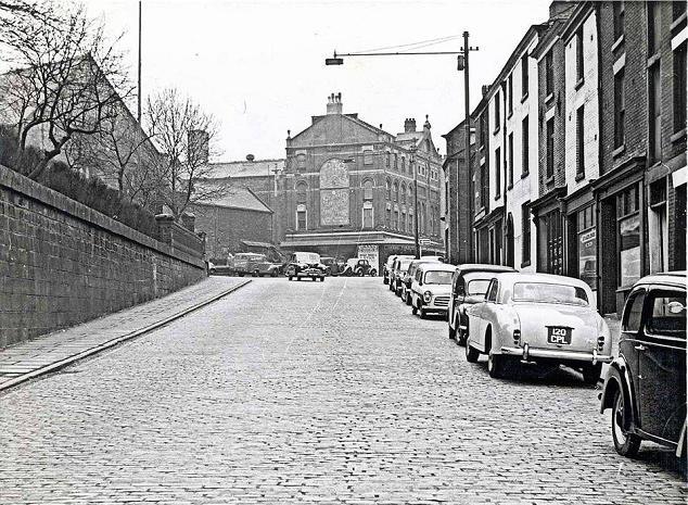
Looking down Church Bank to Church Wharf.
Houses do not continue any further because of the River Croal which passes under the road just beyond the lightly constructed building which says PIANOS. It previously dealt in bicycles.
At the bottom of the hill Church Wharf is the bend to the right while Mill Street turns off to the left. Immediately to the right of that corner were the wharves servicing the Bolton arm of the Manchester, Bolton and Bury canal.
This steep cobbled street was the main A58 to Bury and beyond.
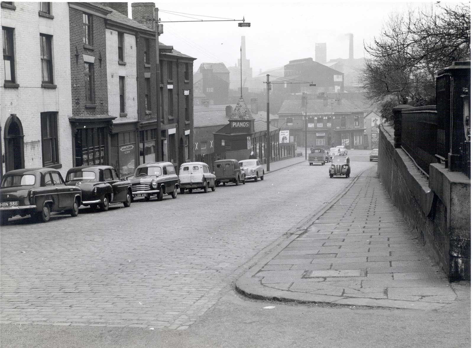
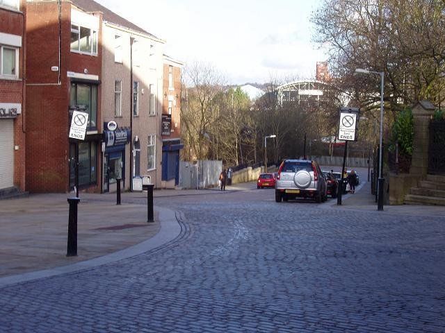
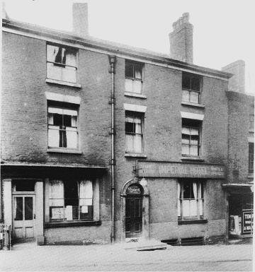
View down Church Bank similar to the previous one. Church Bank starts at the "Restricted Zone Ends" white sign. At extreme left - what an insensitive 1960s type building to put in this "historical area" opposite the corner of the Parish Church. It must be admitted though that the buildings on Church Bank itself from an earlier era are not really any better. The four buildings on the left of Church Bank date back at least to the 19th Century, possibly earlier. Number 1 in red brick has been largely rebuilt but numbers 3, 5 and 7 are essentially unchanged except for the ground floor shop and garage fronts.
9.11.13.15 on the previous picture have disappeared. The rounded door top with the keystone is visible on this and the previous two pictures.
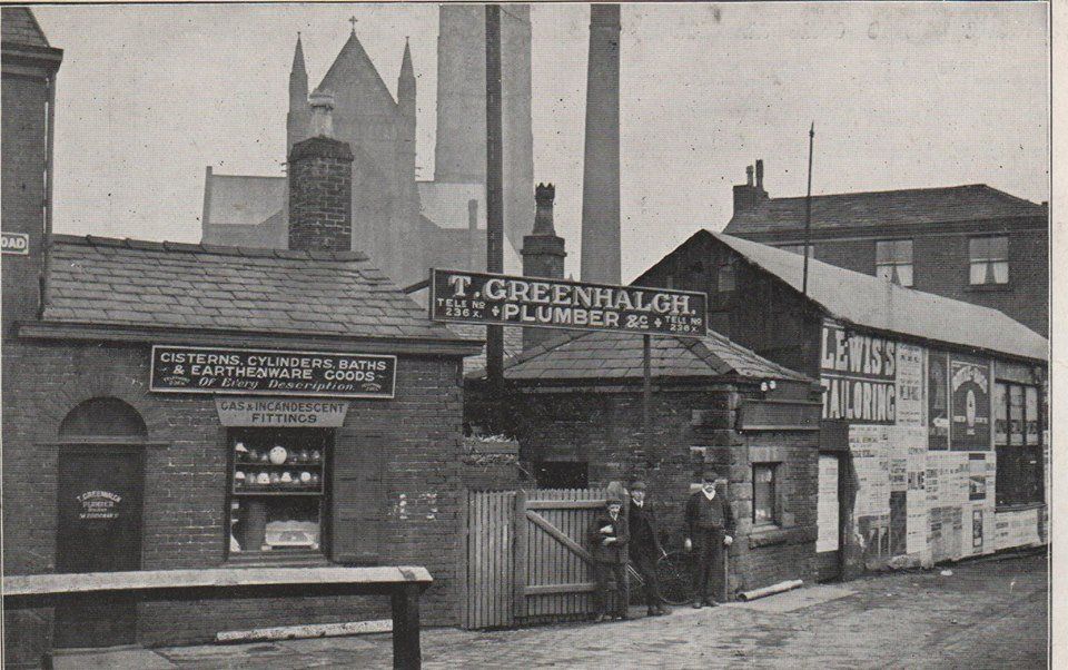
1, 3 and 5 Church Bank. The shop on the corner later became Mrs Martlands antique shop until the late fifties.
The Imperial Hotel 3 and 5 Churchbank, closed 1934. These buildings are still standing.
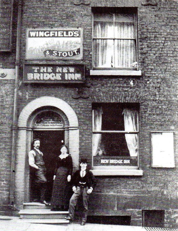
The New Bridge Inn, 15 Churchbank, closed 1907.
This had been Printers Arms c1869-1895 but was renames New Bridge Inn possibly because a the new Bridge built over the Croal just at the bottom of the hill.
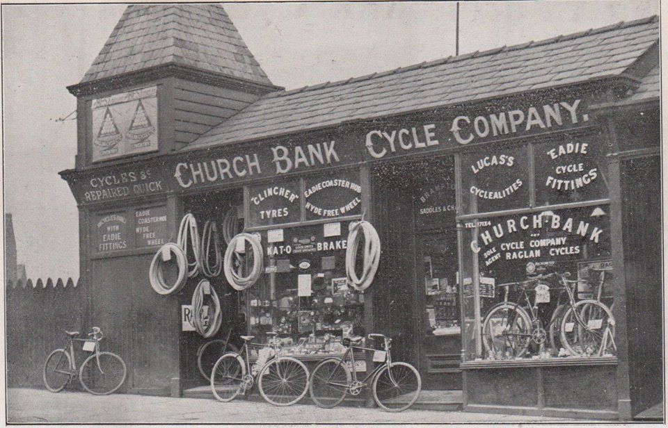
The building we saw from the top of the hill, labelled pianos - had been Raglan Cycles 25-27 Churchbank, opened 1903, closed 1909.
"Cycles &c repaired quick"
Posted on Facebook by Gene Watts.
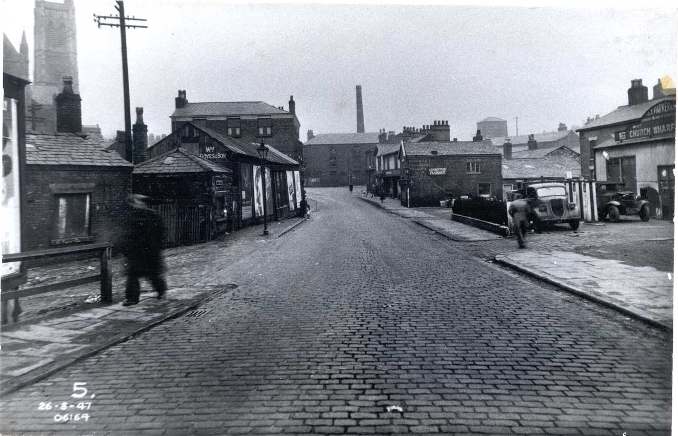
1959
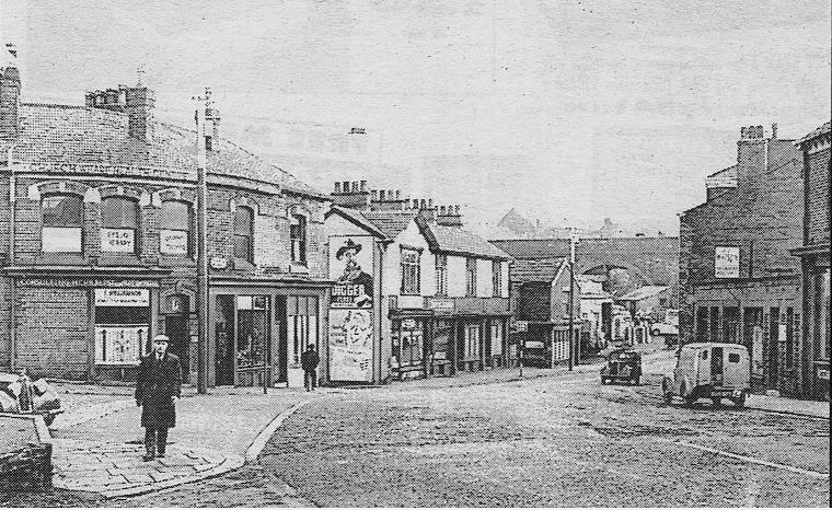
At the bottom of Church Bank the road curves round to Church Wharf. This was the original road to Bury, and was still used to go to Bury in 1959 though by this time many people would have been more familiar with the route taken by the 23 bus via Bridgeman Place and Bradford Street.
Church Wharf seems to have been quite a thriving community, a little townlet hidden away below the Parish Church. The shop on the corner is “consulting herbalist”. St Peter’s Way now crosses this scene a little short of the railway viaduct.
The River Croal passed (and still passes) under the road about where the viewer is standing. Does it emerge behind the brick wall? Mill Street is on the left. A garage is visible which enables one to locate some other pictures of this area.
St Peter's Way was built straight across this scene and the only thing on the picture that remains today is the railway viaduct.
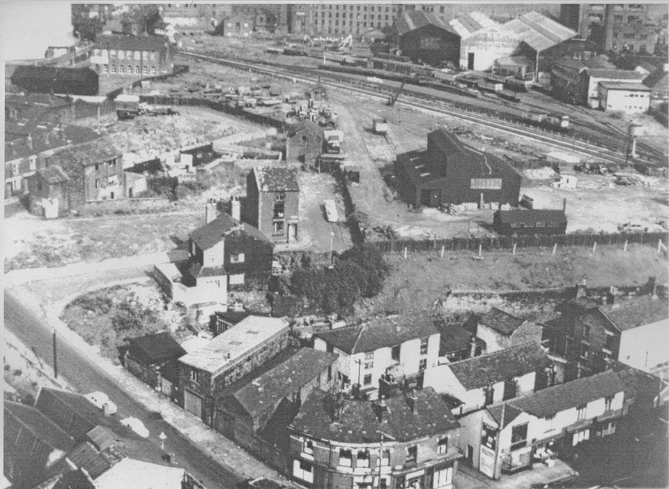
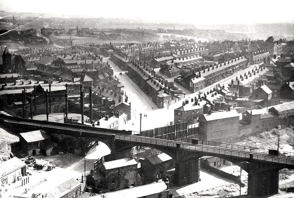
.Aerial picture posted on Facebook by Tony McGuinness.
In the foreground the round corner of the previous picture. Behind, a scene typical of many areas of industrial Bolton.
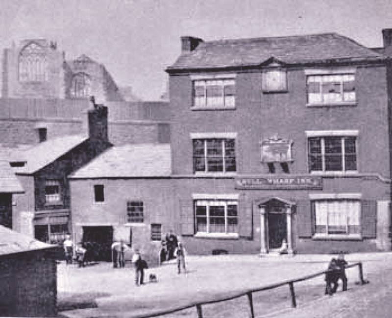
What a splendid and evocative picture, the whole of the Church Wharf area dominated by the Parish Church. The Bull and Wharf – probably the only pub ever, anywhere with this name. You can see up Church Bank to the Grand Theatre. The wharves at the end of the Bolton, Bury and Manchester canal are to the left across the front of the pub.
Cora Scoble Fielding says, “The rooms above we're called the committee rooms and Lesley Baverstock and I played in them as kids. Her Mum used to bring us pop and crisps up. I loved the smells of the pub...smoke and stale beer!!! As a child living in The Haulgh I walked up Churchbank thousands of times. Used to go to Ye Olde Pastie Shoppe and eat a Pastie and a meat pie!! on the way home. Tasted oh so good. we never took the bus. It was near enough to walk.”
The Bull and Wharf was demolished in1966 in preparation for St Peter’s Way. Gordon Readyhough says that the area below the Parish Church appears on maps as Church Wharf BEFORE the canal and its wharves were built and suggests that the word was originally warth (wharth) a shore, strand or flat meadow close to a stream.
An earlier picture of the Bull and Wharf. The Parish Church behind it seems to be the old church in process of being demolished So this dates the picture to 1866.
The whole front of the pub was remodelled between this picture and the previous one, not at all an improvement in appearance but perhaps it gave more upstairs rooms for letting.
Now we are on the wharves looking in the other direction across the front of the Bull and Wharf.
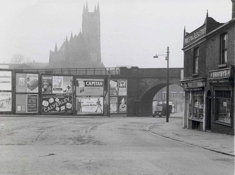
The road across the picture is Church Wharf, the main road to Bury. The garage we remarked on is just out of sight to the right. The church at the top right is St John's, Latimer Street near Lum St gas works.
At the right, above the foregound building is the Bull and Wharf. The railway viaduct is almost immediately behind us. On the left OAD is Wharf Road and is indeed the (only) road to the wharves. It goes under the railway viaduct just a few yards off the picture. The canal itself does stretch a few yards back to this side of the viaduct.
Bolton Archives picture, 1947
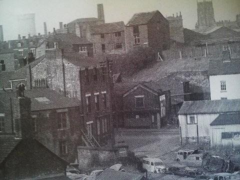
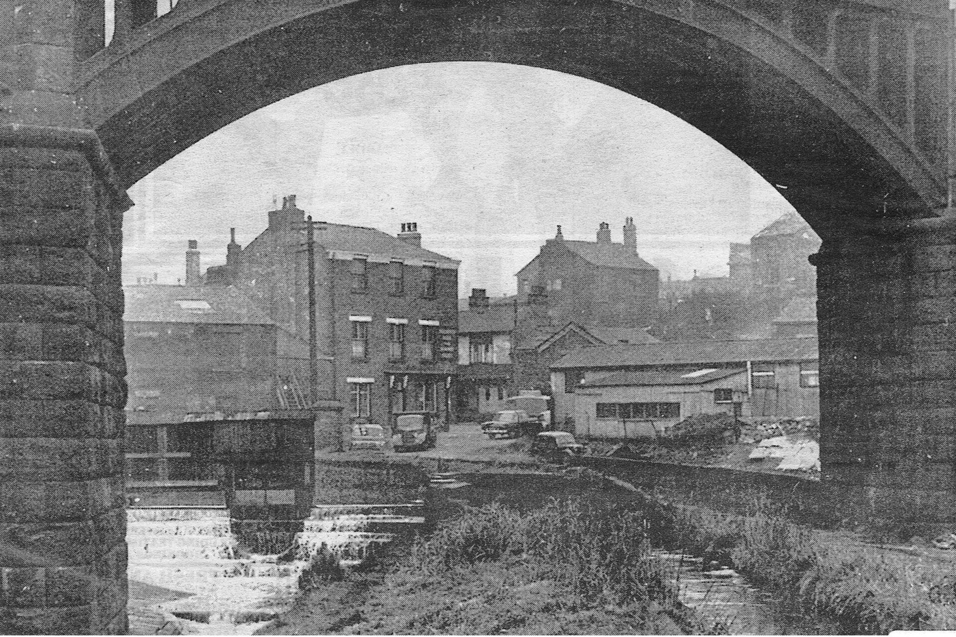
The photographer is stood under the railway arches looking back to the bend in the road at the bottom of Church Bank with the Bull and Wharf on the left. The road off to the left in the foreground is the short unnamed Wharf Road going down to the wharves.
Parish Church top left. Local businesses – Parker’s Garage (our landmark), Crompton’s plumbers (visible on the main picture of the Bull and Wharf and Parish Church), Wm Boyes and Son, and others.
Cora Scoble Fielding says: "behind the hoardings there used to be carts belonging to Eckersleys. Their horses used to be hitched to them and they did all kinds of deliveries. We played on them as kids.
Bolton Archives picture 1958
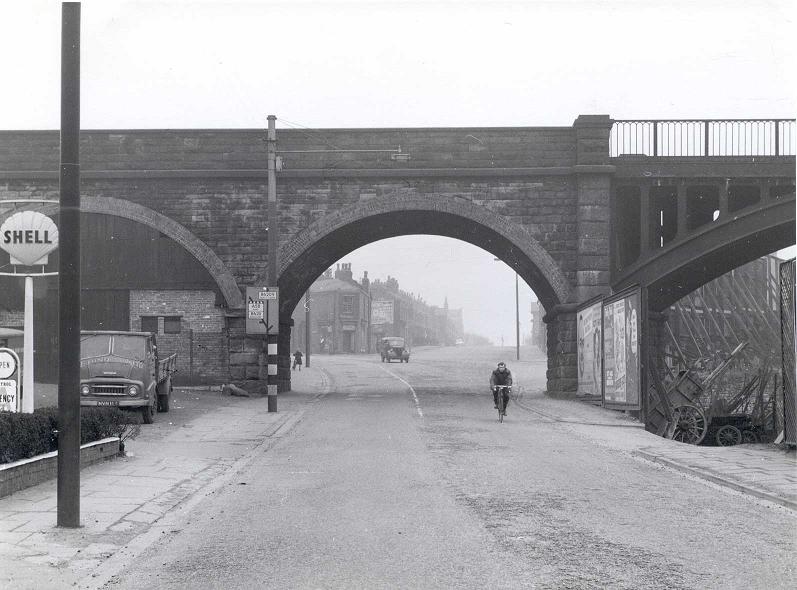
Looking in the other direction at the far end of Church Wharf. The photographer would now be stood near the middle of St Peter’s Way. Our landmark garage is on the left. Under the railway viaduct we have Bury New Road to the left, Castle Street straight on with Dorset Street off to the right.
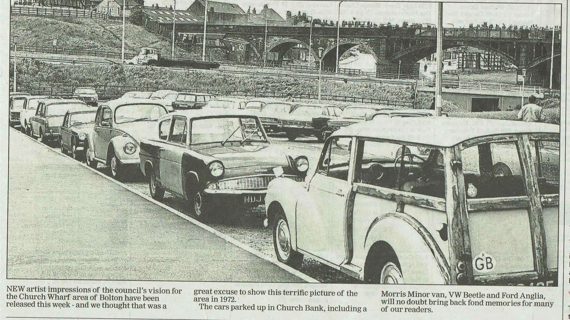
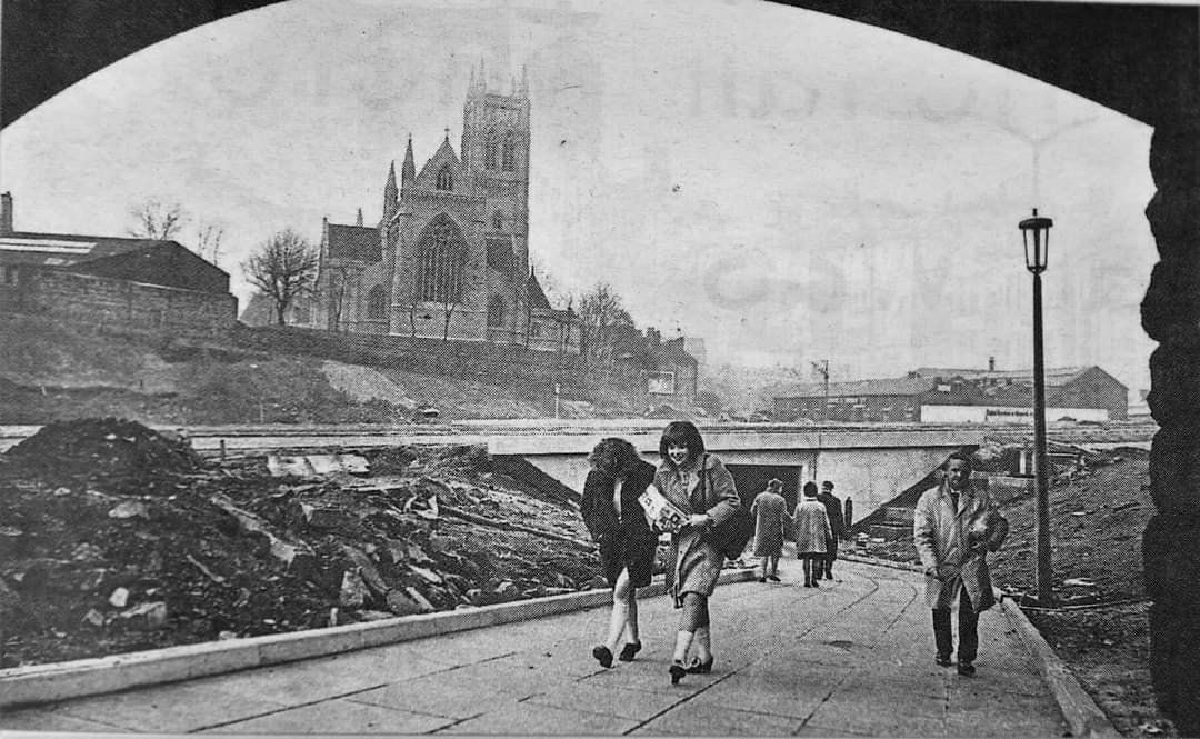
The bottom of Church Bank in 1972 looking across the site of Church Wharf The lorry is on the just constructed St Peter's Way crossing the picture in front of the viaduct. The subway can be seen towards the right.
Probably around 1972 like the picture above. From under the railway viaduct looking back towards the underpass under the not yet in use St Peter's Way with the Parish Church dominating the scene.
Bolton Archives picture 1958
Looking back to where we have come from with Bury New Road behind us and Castle Street up to the left.
. Aerial picture posted on Facebook by Lee Johnson. View probably from Parish Church tower, Church Wharf, railway viaduct, Bury New Road, Castle Street. The garage is on the very bottom left.
1961
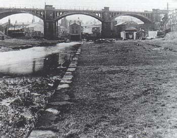
Church Wharf itself looking from beyond the railway viaduct. The Bull and Wharf is obvious. Once very busy, particularly unloading coal, but the canal had been closed some while by the time of this photograph, it never having reopened after a breach near Nob End.
We are actually looking at the River Croal here, dammed to raise its level to provide a flow of water in the channel to the right to keep the canal topped up.
The canal itself is under the next arch to the right.
. 1959 Looking back towards Church Wharf canal basin from east of the railway viaduct. The canal is under the nearer arch and the river under the one to the left.
David Whenlock's picture.
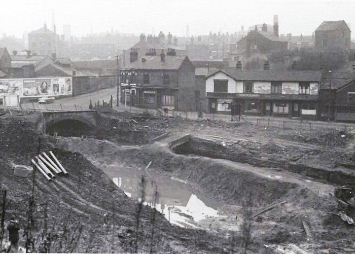
Site of Church Wharf immediately before construction of St Peter's Way.
Church Bank off to the left, Mill St into the picture, Church Wharf across the picture.
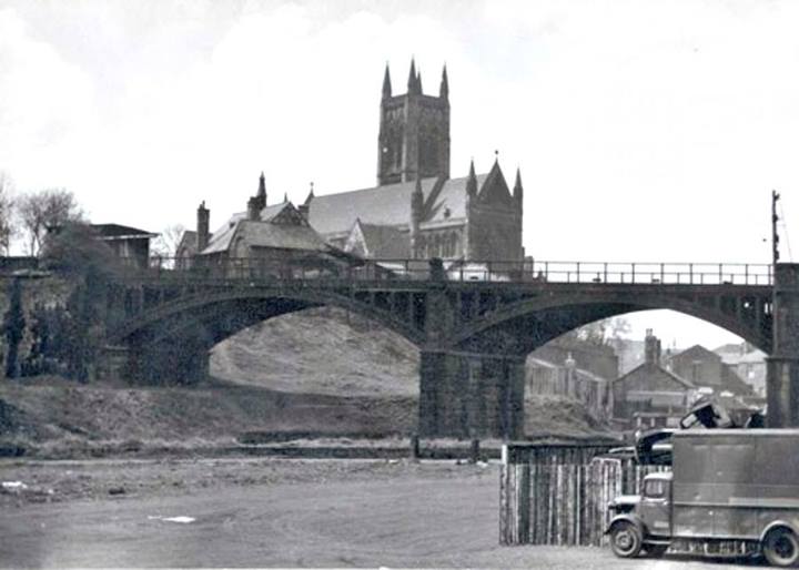
The bridge shows the River Croal emerging from under the Church Bank / Church Wharf junction The Lum Street gasholder is on the sky line.
The river immediately upstream of that bridge is visible and accessible in 2020. The river on the picture and further downstream is now culverted and underneath St Peter's Way.
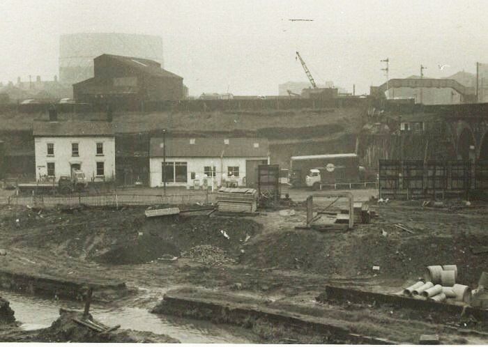
David Whenlock's picture.
Site of Church Wharf immediately before construction of St Peter's Way. Church Wharf runs across the picture with our landmark garage in the centre and the railway viaduct to the right. We would have passed under the viaduct to reach Castle St and Bury Rd.
There are more pictures of this area on the Croal pages of the web-site.
For now we return to Preston's corner and take a walk down Bank Street and up Crown Street.