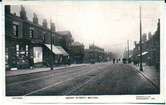
28 Derby Street
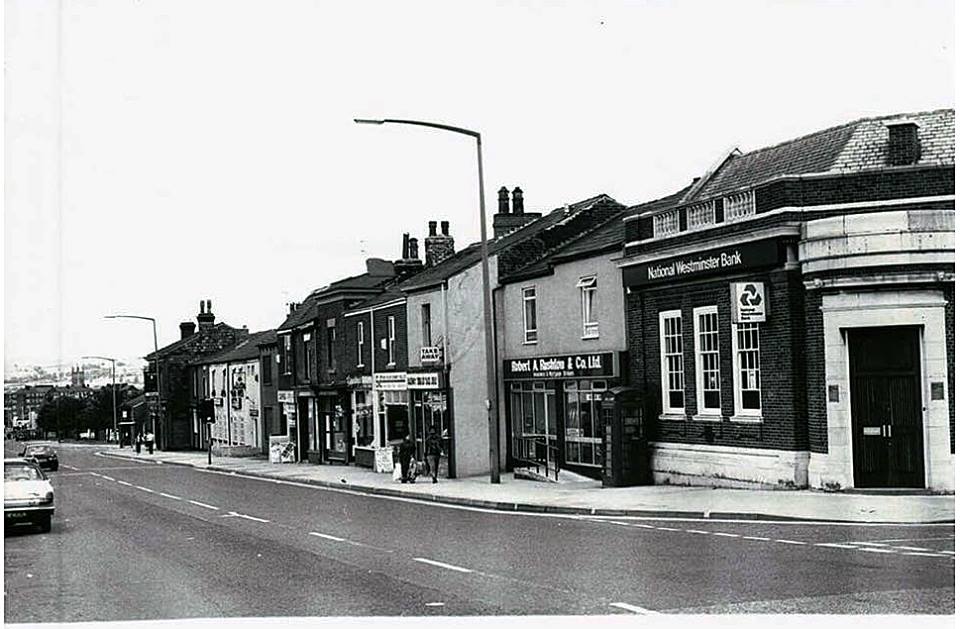
Across the road from Bamber Street, Cricket Street, the National Westminster Bank and the block of premises towards town with the Trinity Church in the distance and the moors beyond. The building on the corner had previously been the District Bank and was originally the Manchester and County Bank. In 2019 it opened as a restaurant, the grape and olive??? There is a tiled (mosaic) floor in this bank featuring a swastika. This was a symbol of good luck and prosperity 3000 years before the Nazis. In its original form it is seen facing both ways though as a sign of good fortune it was more often the opposite way round to the hated pre World War II symbol.
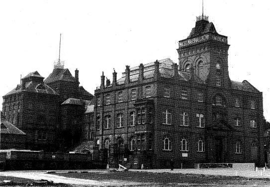
Magee’s Crown brewery was a landmark. It was founded in 1853 by David Magee who had moved from the Good Samaritan alehouse to the Crown Hotel in the 1860s before building the brewery which preceded the large complex of which we have pictures. The brewery we have been familiar with was owned in 1911 by Joseph and Anna Magee (nee Marshall) who lived with their family and five servants at Maryland, Chorley New Road. Their daughter Audrey (later Battine) was born 15 May 1904. Her portrait was painted, completed 17 October 1935, by Philip de Lazlo, the leading portrait painter of that time. She succeeded her mother as chairman of the company in 1951 and died 12 December 1965 leaving more than £1million. The brewery
buildings were demolished some time before 1980 (closed October 1970) and though the site is used now by a number of businesses including Cambrian pop which was part of the Magee Marshall organisation (Greenhall Whitley from 1959), the site just looks like an almost empty, untidy, open space.
David Magee (or McGee) was born in Bolton about 1829. In 1858, he was proprietor of the "Good Samaritan" beerhouse and brewery at 73, Derby Street in Bradford Ward. About 1866, he moved to the Crown Hotel at 217, Derby Street, and established the first Crown Brewery on adjacent land near the junction of Derby Street and Cricket Street. The brewery was extended in 1875, and again in 1893. David Magee died in 1875, and was succeeded by his eldest son, Thomas, and his other sons, John and Joseph. In 1885, the family took over Daniel Marshall's brewery in Brown Street, Bolton, and the limited company Magee, Marshall was established in 1888.
http://discovery.nationalarchives.gov.uk/details/rd/f20e666d-adea-4e52-b61e-4ff577387211
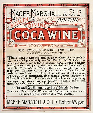
Above - Health giving coca wine – not what they were usually known for.
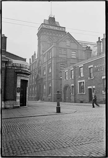
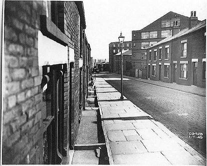
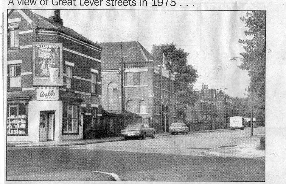
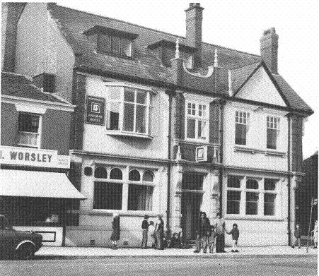
Left - Main feature is the front of the brewery but note the bank (District Bank), and the police pillar.
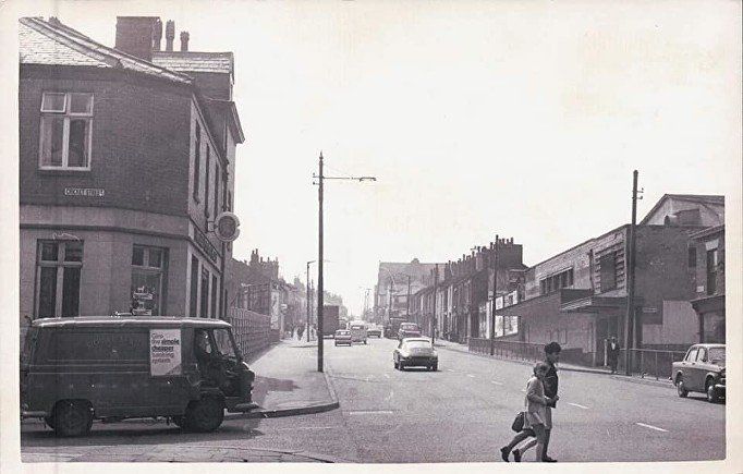
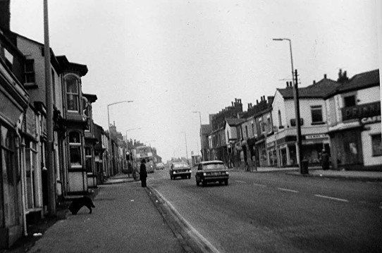
Cricket Street and the Crown Hotel on the left; the rest of that block has been demolished. On the right we see Thomas Street then the Tivoli (more later). It is just possible to make out Drinnan’s as the road bends to the right. Again we see the Congregational Church and no mosque.
We do not have a picture of the next street down on the right, Bamber Street, but it was well known for the Dong Toy Laundry (previously Sam Yick)
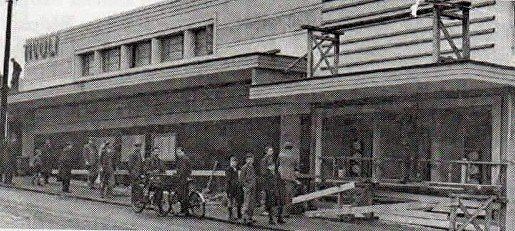
The Tivoli Cinema was built on the site of the Derby Picture House which was demolished in 1937. The Tivoli Cinema was opened 28th February 1938. Seating was on a stadium plan, with a raised stepped section at the rear rather than a conventional overhanging balcony. The proprietor was Rialto (Bolton) Ltd. and the proscenium was 65ft wide. There was a nicely streamlined, ‘modern’ frontage.
Interestingly, the proscenium had seemingly reduced by the 1953 edition, which gives it as just 44ft wide.
The Tivoli Cinema was closed in 1960. In August 2002, the building was apparently being used as offices, as Tivoli House. More recently, Shahina Textiles Ltd have moved in.
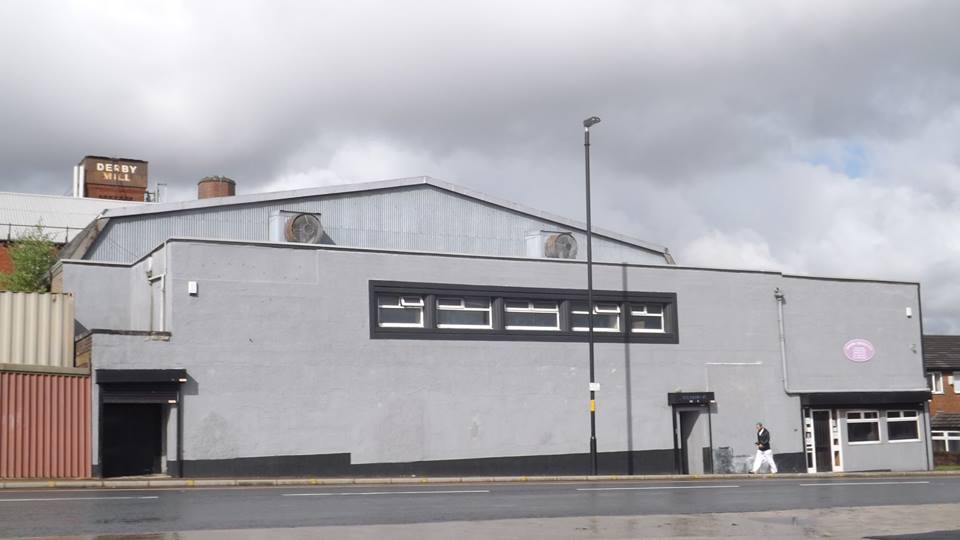
2019(?) picture of the Tivoli by Gene Watts. Now a bland almost unpleasant building. Surprising what a difference the horizontal lines on the wall and the canopy made.
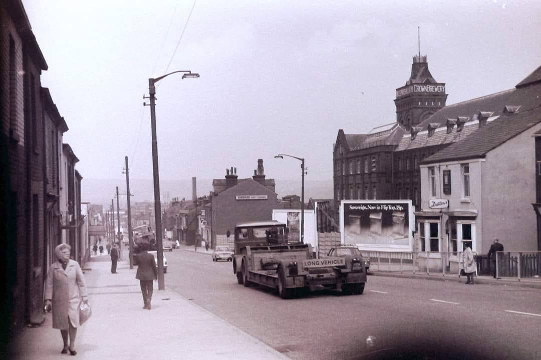
Looking back down Derby Street from just below Cannon Street.
On the left the canopy of the Tivoli is just visible.
On the right we have the Crown Brewery and the Farmers Arms.
And looking up the hill we reach the junction of Derby Street with High Street (on the left) and Cannon Street (on the right) with Peace Street just beyond that. The bay windows on the left belong to the Rams Head. On the right we have Drinnan’s Temperance Bar and Ice-cream Parlour. On the other corner of Peace Street some people might remember James Lee, electrical goods.
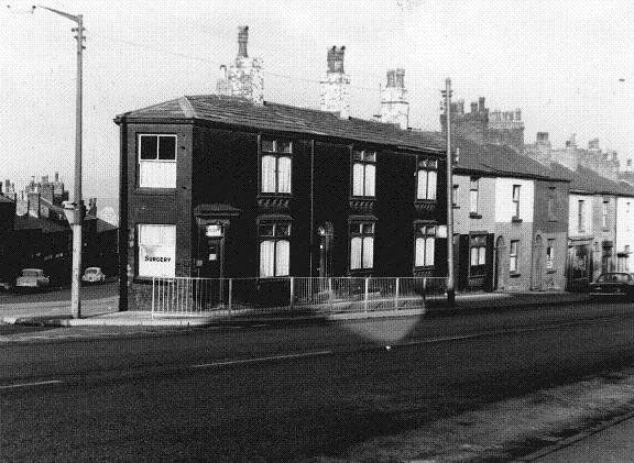
Corner of 270 Derby Street and Cannon Street. Doctor's Surgery.
1977 © Fred Hosker/ Jackie Nisbet.
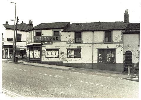
Oct 1977, Drinnans, apparently now closed down but certainly in need of a bit of paint.Many people will have fond memories Drinnan’s Ice-cream parlour with its juke-box.
© Fred Hosker/ Jackie Nisbet.
Manfredi's had a similar but much smaller shop only about 50 yards down Derby Street from here but their main shop was on St Helens Road.
Cannon Street 1949
BEN: OUR photograph today was sent in to us by a regular reader of the Looking Back page.
Thomas Gregory of Runnymede Court was brought up in the Deane area and sent us this charming photograph of Cannon Street, looking towards Derby Street, in 1949.
Mr Gregory remembers Drinnan's well and says it was like a little cafe where you could go and get soft drinks and ice cream and they had a juke box to play your favourite music.
They also had ice cream vans which went round the area, just like Manfredi's do today.
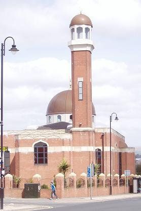
The cobbled roads and pavement have now been replaced with asphalt and the houses and Drinnan's ice cream and dairy shop have been replaced with a mosque. The mosque, Zakariyya Jaame Masjid was established in 1966 in Peace Street Methodist Church and was the first Masjid in Bolton.
This corner of Cannon Street is sometimes said to be where the Cavaliers charged from in the English Civil War. The Bolton Massacre, sometimes recorded as the Storming of Bolton, was an episode in the War, in 1644.


Click and navigate
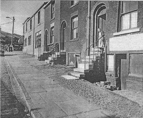
Just further down, these buildings remained I October 1977.
© Fred Hosker/ Jackie Nisbet.
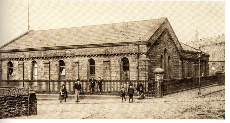
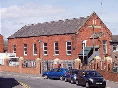
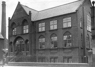
Emmanuel School on Cannon Street posted on Facebook by Edward Thompson.
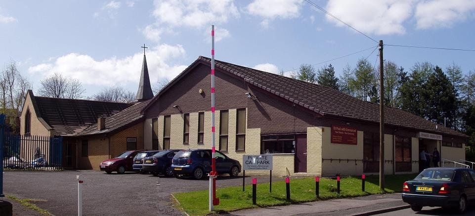
April 2010 (C)WDC Emmanuel Centre opposite what had been Emmanuel Church.
It had been used for worship by a "mission" even while Emmanuel Church was still serving its intended purpose, but has now become the church / worship centre for the congregations of Emmanuel Church and St Paul's Deansgate.
A little lower still some early twentieth century houses on Cannon Street. Marked as July 1949
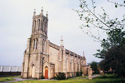
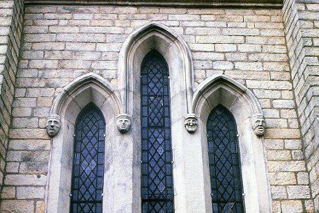
Lower down still and more correctly associated with Deane Road than Derby Street was Emmanuel Church pictured in May 1988 shortly before the building was converted into flats. The building to the left was the Cannon Street supermarket and medical centre (with a chemist and a betting shop).
Window detail below.
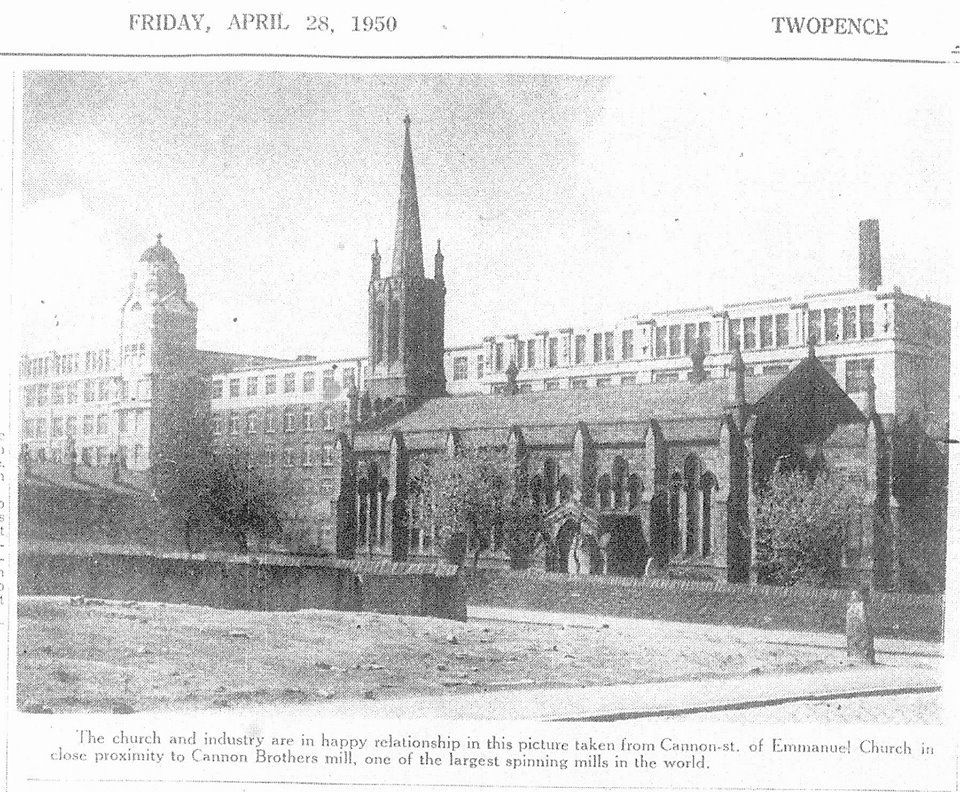
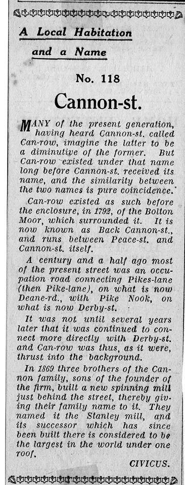
To put the church in its previous context – 1950 Emmanuel Church and Cannon Bros Mill, Cannon Street which at its time of building in 1869 was one of the largest cotton spinning mills under one roof in the world. A series of brief articles in the Bolton Evening News from April 1934 which describe over a hundred Bolton streets and tell how they got their names is quite clear that Cannon Street was named by the Cannon Brothers. It has always been controversial as to whether it had anything to do with the cannons of the Royalist troops during the civil war and of course we would have quite a coincidence if the Cannon Bros had found a suitable site for their mill only to discover that it had the same name as them. An earlier street along part of the line of Cannon Street and Back Cannon Street was called Can Row but this apparently has no connection whatsoever with either possible derivation of Cannon.
We return to Derby Street and the area between Cannon Street and Peace Street, now the home of a mosque
Above:.This was Peace Street Methodist Church pictured here shortly after becoming a mosque.
Peace Street Mosque was established in Peace Street some years before this grand edifice (right) was constructed. The mosque, officially called Zakariyya Jaame Masjid, was established in 1966 and was the first Masjid in Bolton. The English world mosque is apparently a corruption of the word masjid (mas – zheed) which is the normal Arabic word meaning literally "place of ritual prostration". It is generally used of the building but like the word “church” really refers to the congregation and any place or gathering where orthodox Islamic prayers or rituals take place is a masjid. The North African pronunciation masGid perhaps gives a clue to its English form.
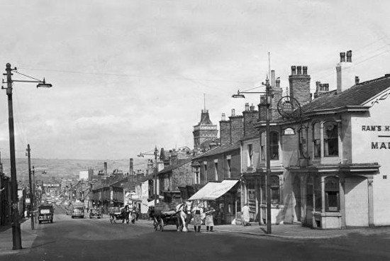
Derby Street just as we remember it with The Ram’s Head on the corner of High Street and the Magee Marshall Brewery tower peeping above the houses. The carts are brewery drays and the horses are called Happy and Jolly.
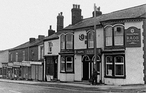
After the Ram’s Head ceased trading as a public house it was taken over for a time by the Royal Antediluvian Order of Buffaloes.
Down High Street we find the High Street library. The library is still there (2021) but in a newer building.
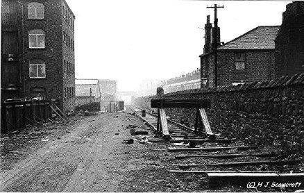
Almost opposite the library is Flora Street, over the wall to the right on the picture above and over the wall to the left on the picture below. At this point the original Bolton-Leigh railway (before 1885) crossed High Street by a level crossing. The line terminated at this point after 1885 but was still used to service local mills including bringing water from Burton on Trent to Magee's Crown brewery, until the 1960s. The terrace of houses on the right in the distance is Lumsden Street. The faintly visible bridge must be the Rothwell Street footbridge with Shaw Street Bridge behind it.
This picture 21 February 1966 © H J Scowcroft.
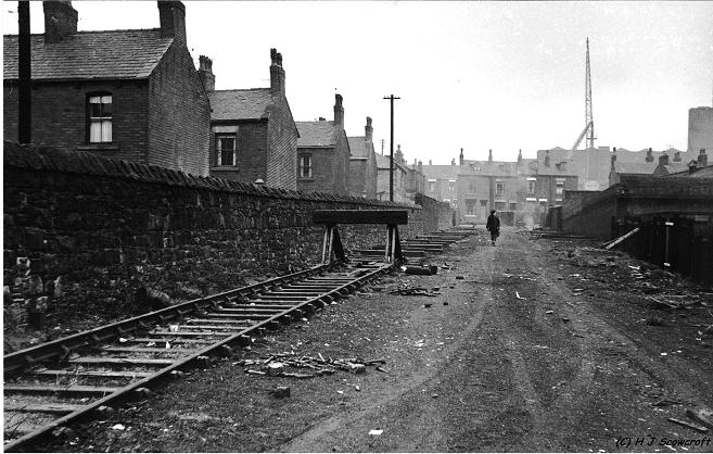
Looking in the other direction, the houses opposite the track are on High Street with the library just to the left. The more distant houses are Pike Road. A house has now been built on the line of the track adjacent to High Street.
This picture 21 February 1966 © H J Scowcroft .
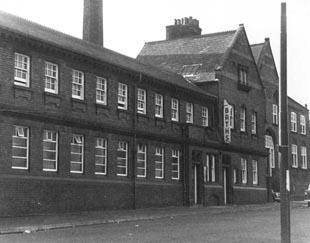
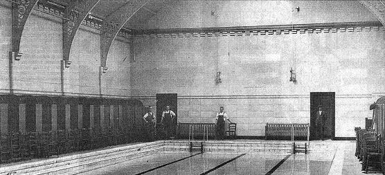
We also find the High Street Baths – though these are long gone. The interior is pictured in 1937
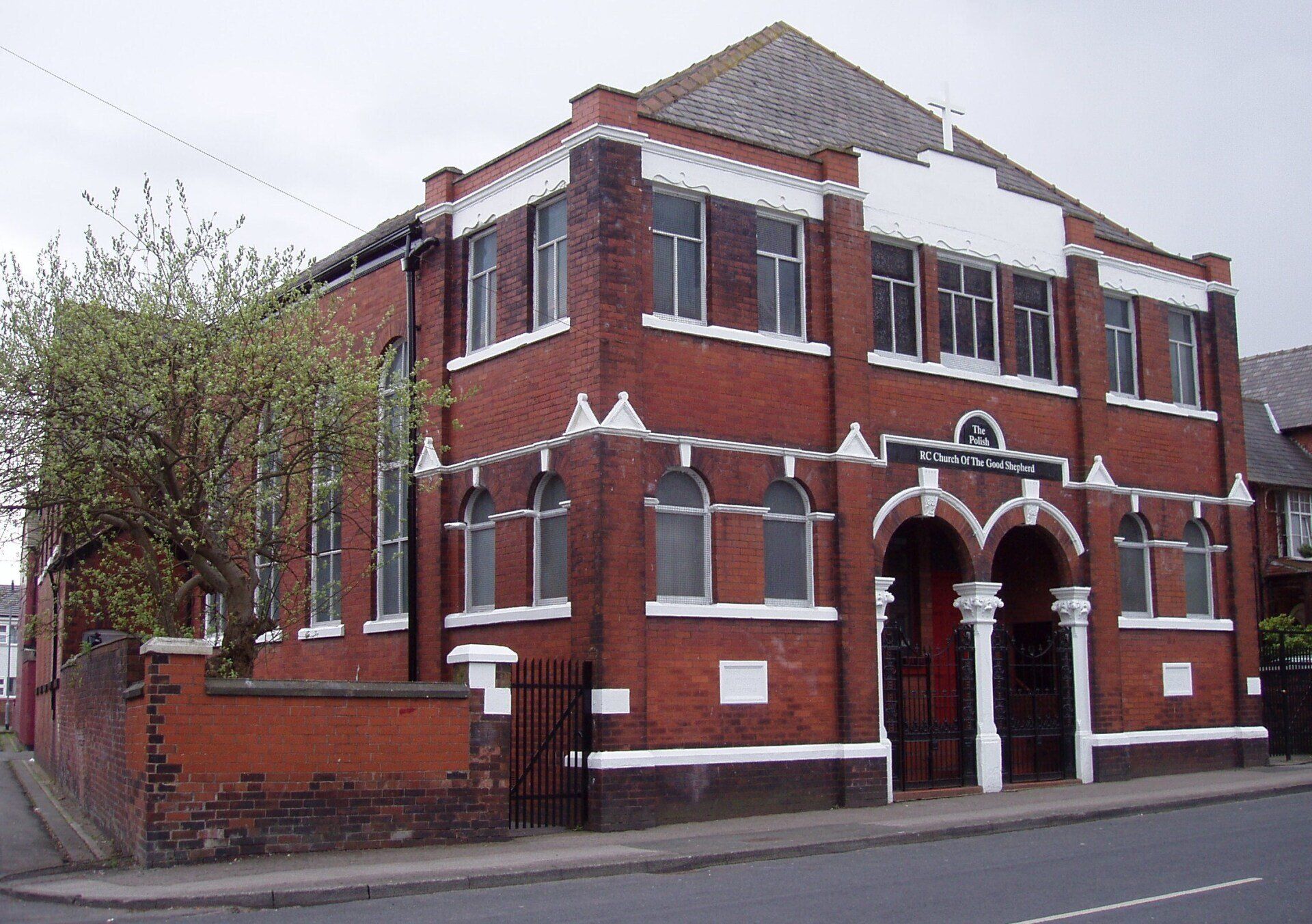
At the far end of High Street where it joins Lever Street we have High Street Independent Methodist Church, now the Polish Catholic Church of the Good Shepherd..
We look down Derby Street across the High Street Cannon Street junction.
One of David Whenlock’s postcards.
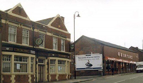
The next pub up Dobble (there were 19 pubs from Howell Croft to Daubhill Station, depending on quite when you counted them) is the Pike View on the corner of Swan Lane. Pike View shares its name with Pike Road a little way behind it which led to The Pike the mansion of Robert Heywood (which still stands). It is unlikely that this pub name refers to Rivington Pike.
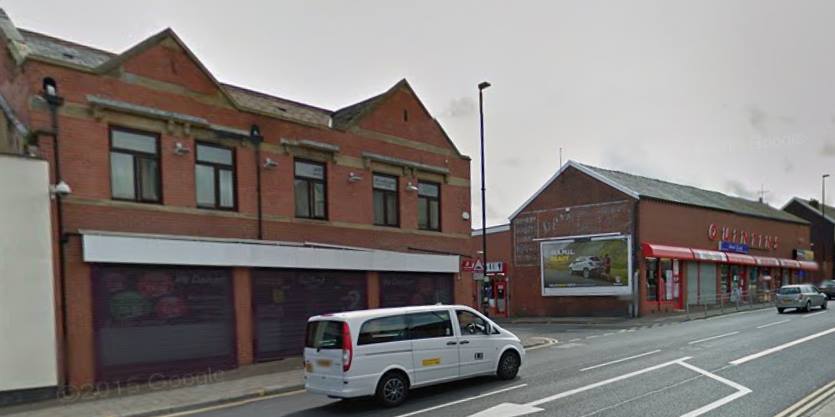
The whole block above Swan Lane was rebuilt to house Quintin’s. That has now been split up into a number of separate shops.
Picture is ©Stan VanHoogstraten
Stan VanHoogstraten. repeated this picture when the Pike View ceased being a pub and the frontage was rebuilt. Many features of the building are retained, and yet....... © Stan Vanhoogstraten.
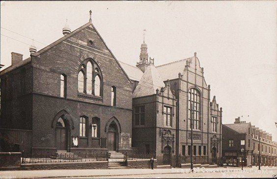
Immediately across from Quintin’s was Derby Street Congregational Church and School. The building to the left still stands and is Gordon’s carpets and furniture shop. The right side has been demolished and small shops built. The church closed in 1970 because of falling numbers and dry-rot. It is a shame the school was preserved and the church demolished although the school is a pleasing enough building and the church perhaps a bit over-ornate for modern tastes, Picture posted on Facebook by Andrew Hodson.
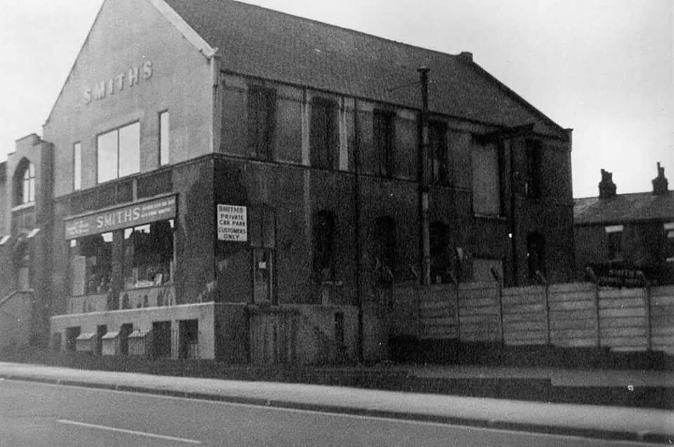
The school’s original features have all been lost. Presumably the warehouse doors and hoist on the side wall were provided for the purpose of having two sales floors of quite heavy items. A quaint new entrance has appeared.
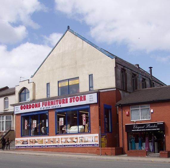
May 2010. It looks so much better in colour! The side has been tidied up and the newly built extension at the front has not made it look any worse. © WDC
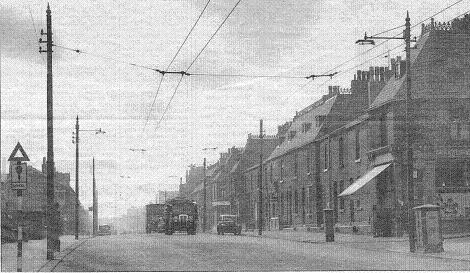
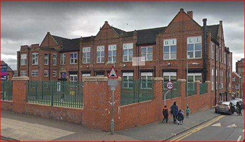
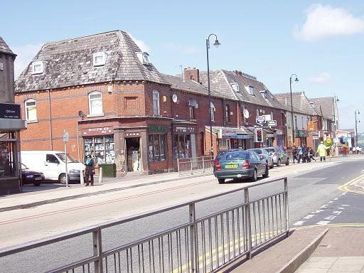
We reach the top of the hill and Sunning Hill School. View Street is on the right, Goldsmith Street is on the left just before the school.
In 1956, at the time of the picture the trams had gone, and the overhead wires show that trolley buses had taken over. View Street is the first turn on the right. Further away there is the white area over the window and door of the Jubilee Fruit Stores on the corner of Broadhurst Street. On the left we have Goldsmith Street then Sunning Hill School. Notice the iron work along the roof ridges of the houses on the right. Notice also the old School Sign.
Sunning Hill School Google Streetview.
The Short History was published in 1992 for the School's Centenary.
Its site was one of a number of "stately homes" built up Derby Street by the nouveau riche mill owners - see the page (Daubhill) 1849 map - the place to live .
Roger Hampson 1925-1996 born in Tyldesley, Lancashire, studied at Manchester College of Art from 1946-1951, taught at Bolton College of Art and Design, becoming principal, 1961-7
Sunning Hill School from Broadhurst Street with the Jubilee Fruit Stores on the corner.


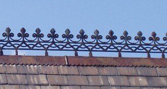
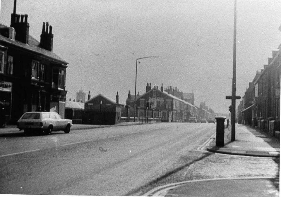
1. Opposite the school are two blocks of houses of rather unusual style Every roof ridge used to have iron work
2. The block to the right – one remaining piece of roof decoration can be seen. The left turn at the pillar box past the crossing patrol is View Street and the gable at the right is Gordon’s carpet shop which had been the Derby Street Congregational School building.
3, 4 closing in to the roof decorations.
It is a serious crime against good taste that these ornamentations have been removed over the years. Daubhill has lost the Daubhill clock, the Tootal's Mill tower and most of these adornments. They should all have been listed.
Click on any picture to enlarge. Then use < > X
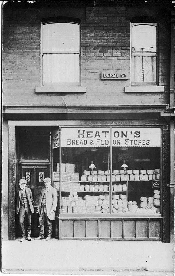
On our left as we go "up Dobble" is John Heaton’s bakery, 413 Derby Street. This is the LAST SHOP on Derby Street. The premises next door to the right are 1 Saint Helens Road.
Across the road on our right is Willows Lane and then the Railway Hotel which is number 2 Saint Helens Road - so that ends our trip up Derby Street.