26 Great Moor Street
A quick look back to where we've been before we carry on up Great Moor Street.
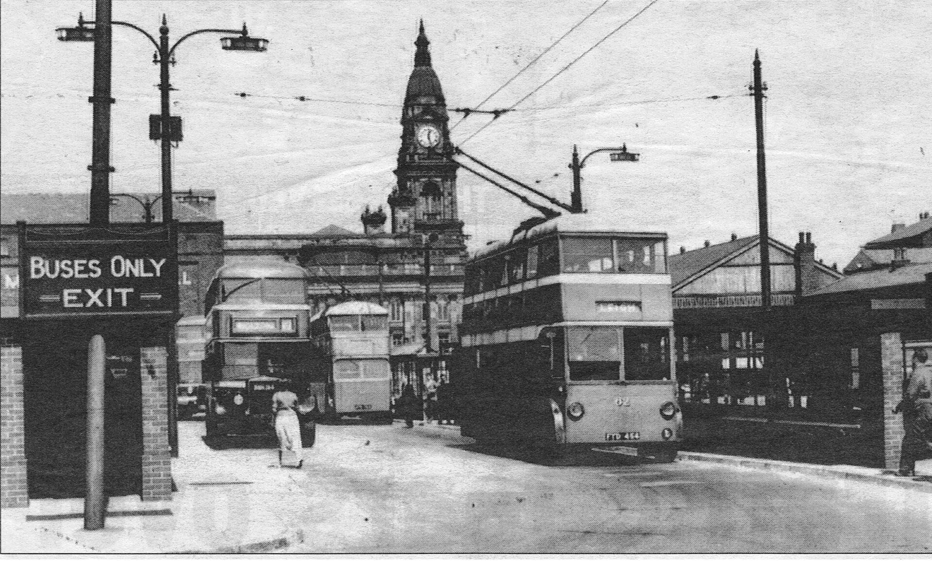
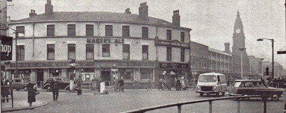
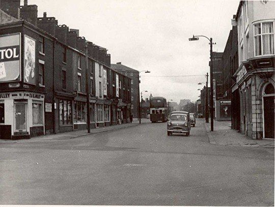
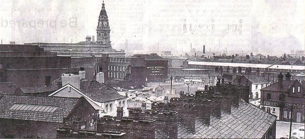
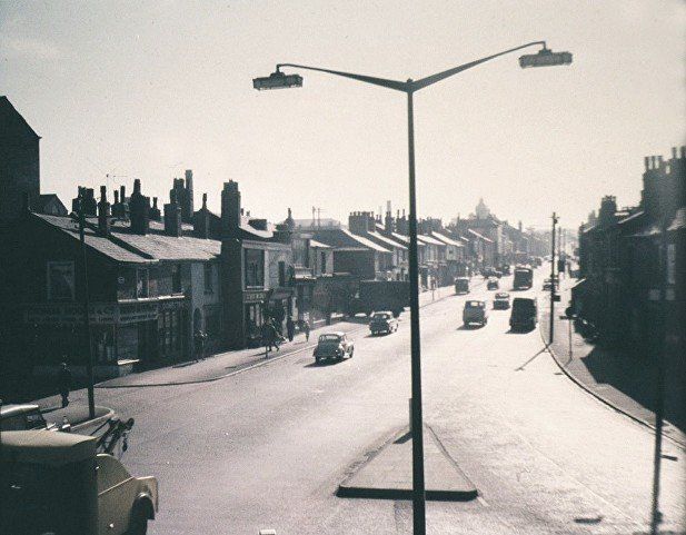
Probably 1950s, looking down Great Moor Street to the LIDO. St Patrick’s has no steeple.
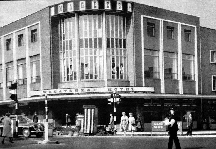
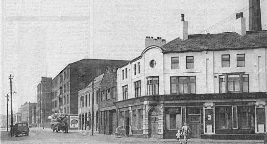
Newport Street / Great Moor Street corner after Waller and Riley’s was rebuilt to match the round corners of Wheatsheaf and Shannon’s.
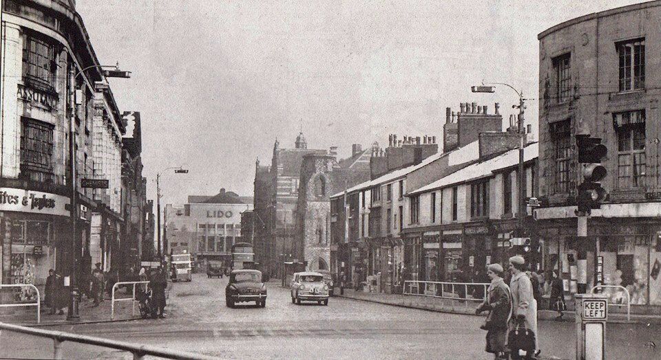
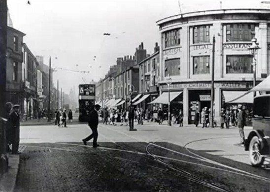
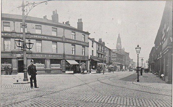
Apparently this corner was the first in Bolton to be equipped with traffic lights but here we still have the policeman on his little box,
The policeman without his box to stand on. We have a view down Newport Street from Great Moor Street.
On the corner the Wheatsheaf pub with Vose's UCP tripe shop attached.
Spot the clock on the wall of Greenough's jewellers.
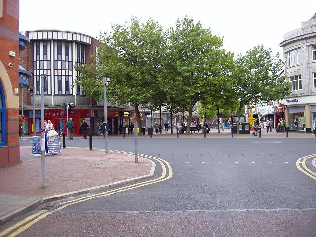
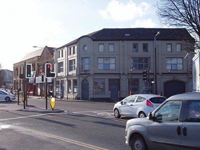
24 Sept 2009 (C)WDC
Difficult to repeat the 1920s view because of the trees. Here we see the new Wheatsheaf.
The first Wheatsheaf on that site was built in 1835. The new building was opened in November 1962 and was renamed Serendipity’s in 1986. It became Home Bargains in 1997/8.
Newport Street, the new shops have now been built on a line further back than the originals so that the Wheatsheaf is too far forward. The shops have not yet been built at the far end of the block up to the corner of Victoria Square.The purpose of the redevelopment of Newport St seems to have been to widen it to cope with traffic. But not many years later it was closed to traffic!
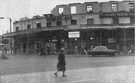
1962
The Wheatsheaf finally bites the dust. It was re built, still rounded but in line with the Newport Street and Great Moor Street shops. It closed down, to reopen as Serendipity but is now a budget shop.
Newport Street, the Wheatsheaf now rebuilt further back relative both to Newport Street and Great Moor St. Not too long afterwards it became Serendipity’s. It is now Home Bargains.
The widening of Newport Street and pushing the shops back meant that Coronation St which was essentially the back street of Newport Street was also pushed back level with Old Hall Street Sooth between the back of the shops and the Octagon multi-storey car park. Old Hall Street South has now disappeared being a continuation of Coronation Street.
posted on Facebook by Jack Crompton.
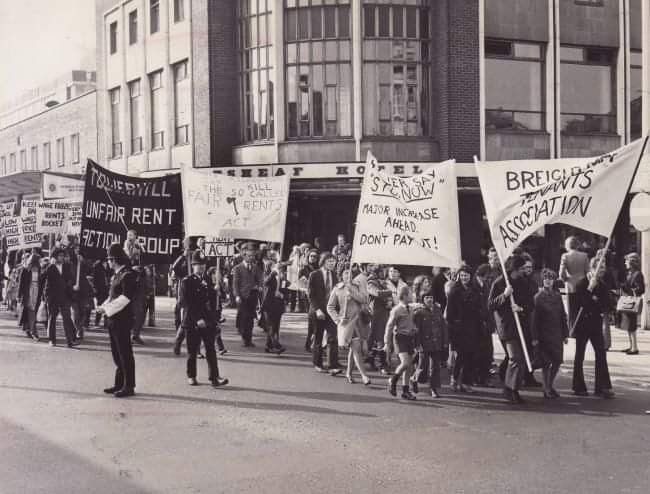
Council Tenants Rent Increase protest
Guess - this is in response to the (Fair) Rent Act of 1977 giving tenants rights against being charged unfair rents and in many cases rights of tenure after the original contract term finished. A tenant could apply to a court for a "fair rent" to be declared. It was not impossible for the declared fair rent to be more than the tenant was paying. It was feared that many subsidised rents (eg for Council houses) would rise considerably.
1963
The shops immediately up from the Wheatsheaf which has not yet been rebuilt, the corner of the old can be seen on the right edge of the picture.
Howell Croft South bus station is still there with the Flag Hotel immediately beyond it.
The Octagon car park now occupies this site. The Flag was still there in 1967 after the Wheatsheaf had been rebuilt.
It was said that the Flag got its name because more than 150 years ago eight dray horses with chains and rollers were used to transport a huge flagstone fifteen foot square and weighing six tons from a local quarry to this public house. The stone was used to cover part of
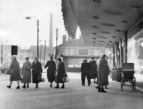
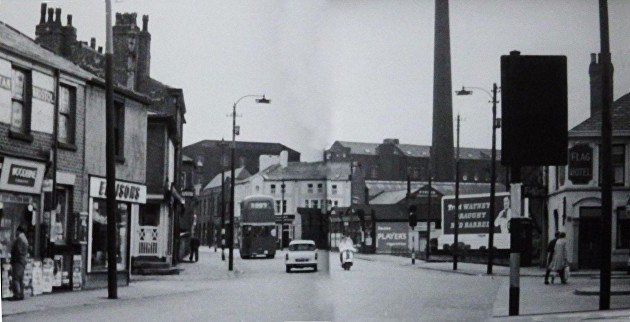
Great Moor Street new shops , Flag Hotel, Howell Croft Bus terminus is still in use. Flash Street Mill chimney.
1959
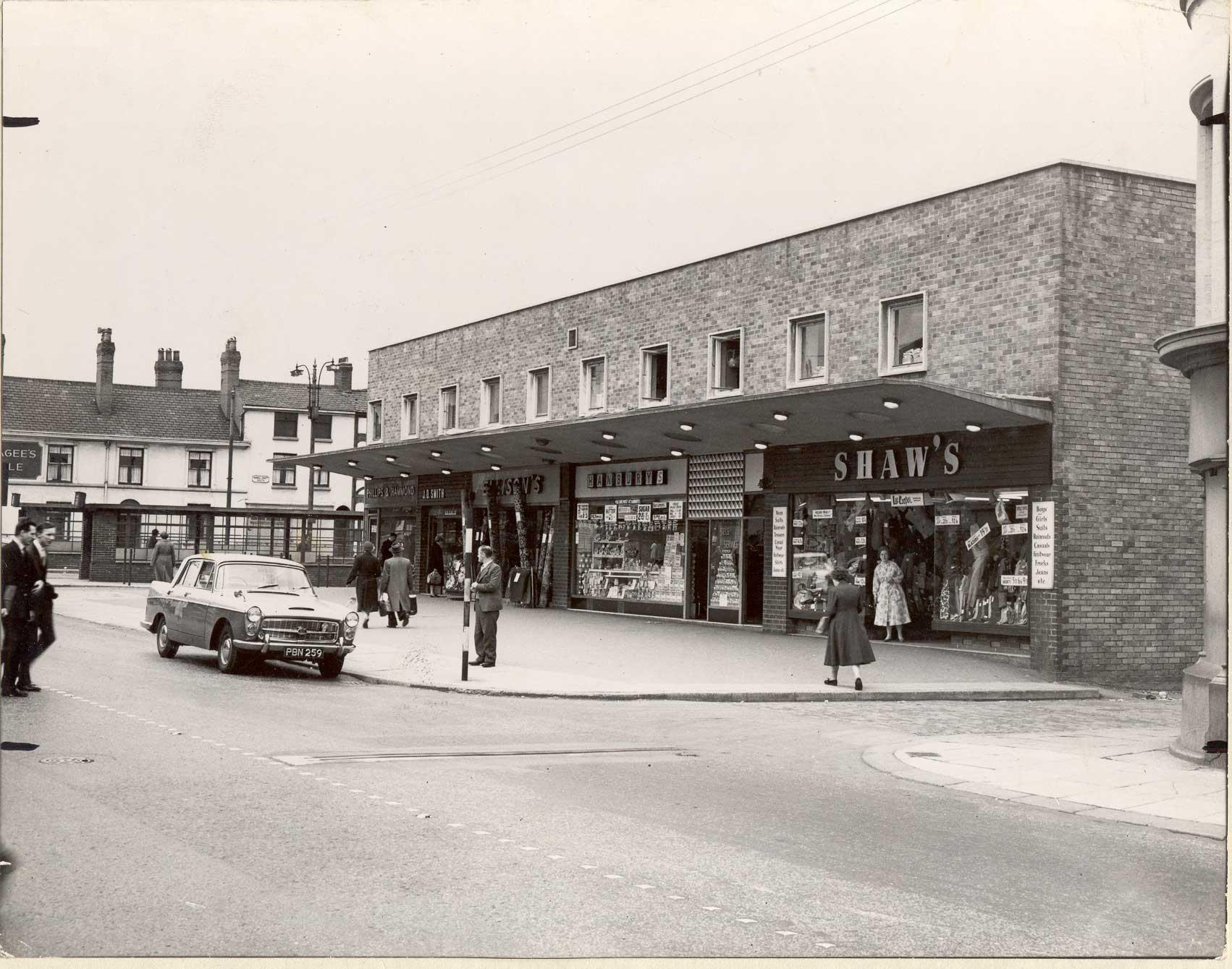
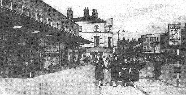
Great Moor Street, we have the new shops with Ellison’s carpets and Shaw’s outfitters.
The Wheatsheaf is still the original building now out of line with the shops.
Old road sign. Just behind us is now the entrance to the Octagon car park and the rerouted Coronation Street.
Great Moor Street at the end of Coronation Street between the Wheatsheaf and the Howell Croft South bus station.
Over the wall had been a tram terminus and the old wholesale market.
This side of the Wheatsheaf was Coronation Street, now slightly rerouted.
It was pretty much like this to the mid fifties.

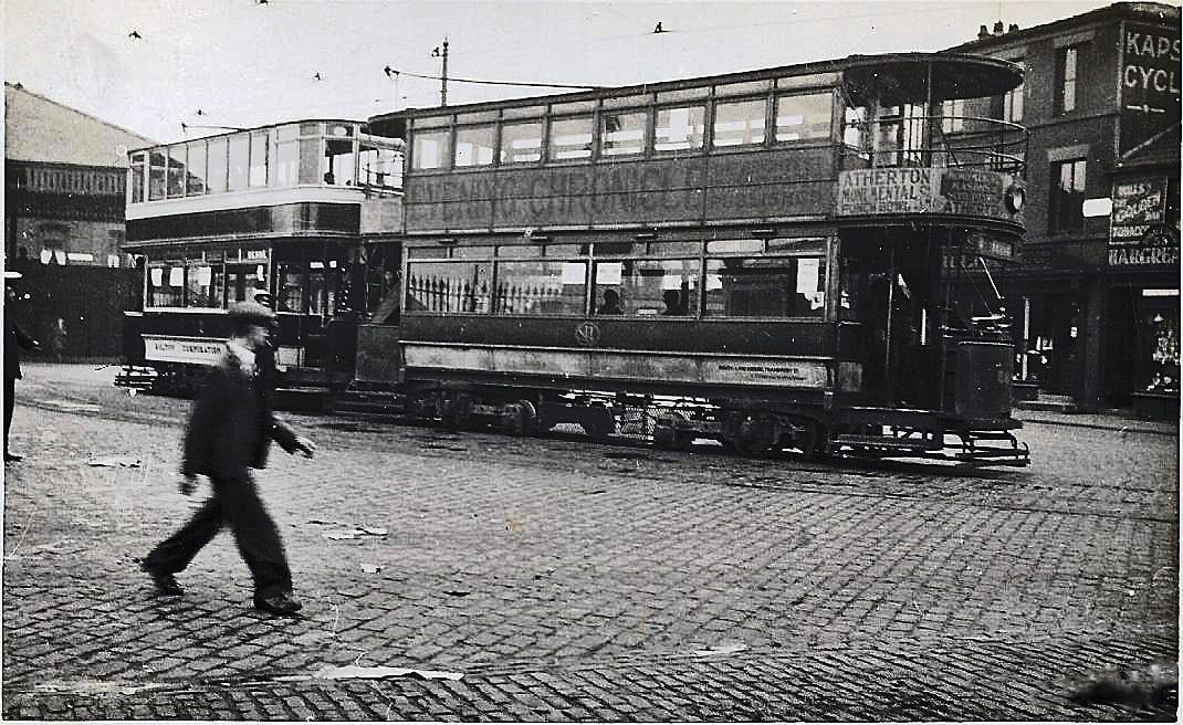
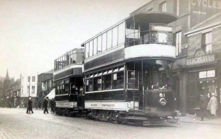
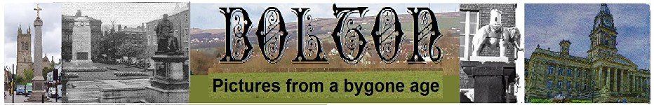
Tram terminus at Howell Croft South, Great Moor Street looking down to the LIDO so post 1937 and pre 1947 when the trams were discontinued.
At the left the roof (it never had walls) of the Wholesale Market though the market had by this time moved to Ashburner Street (1932).
David Whenlock picture
Posted on Facebook by Peter Lodge
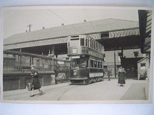
Tram terminus at Howell Croft South, Great Moor Street
Posted on Facebook by Peter Lodge. Late 1930s or early 1940s.
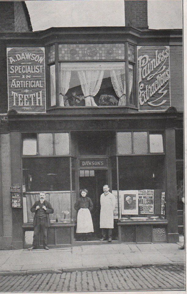
35 Great Moor Street.
This is one of the shops now occupied by the extended Olympus Chip Restaurant, just behind the trams in the picture above.
Posted on Facebook by Gene Watts
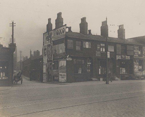
early 1900s
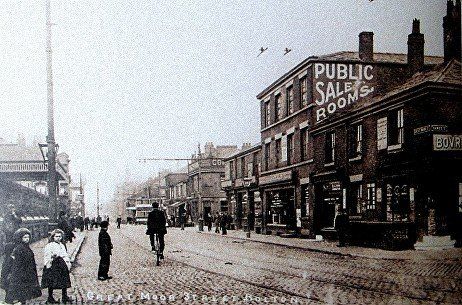
Great Moor Street with Howell Croft tram station on the left.
Dawes Street is on the right edge - now the main walk way to Morrison's.
Public Sale Rooms on right and further away, the Griffin pub on the corner of Soho Street.
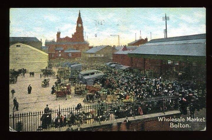
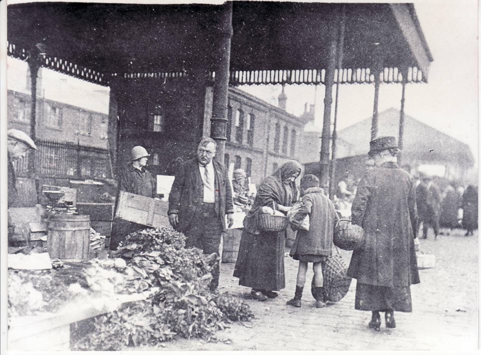
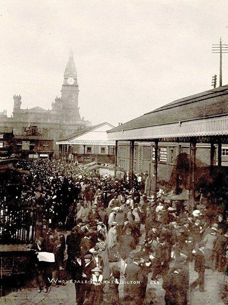
Howell Croft South alongside Great Moor Street.
This was known as, and marked on maps as Wholesale Market but it always seems to have been retail as well.
The market moved to Ashburner Street in 1932. Note the roof for protection of the stall holders - it never had walls - this was still in place in the 1960s.
definitely retail
1920s hats
miserable stall holder
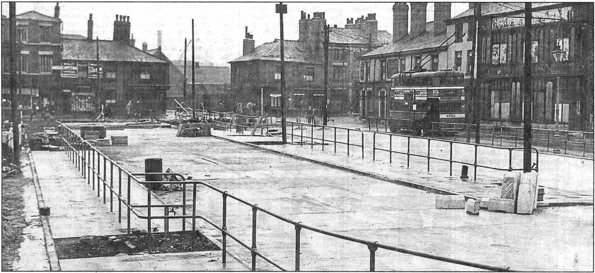
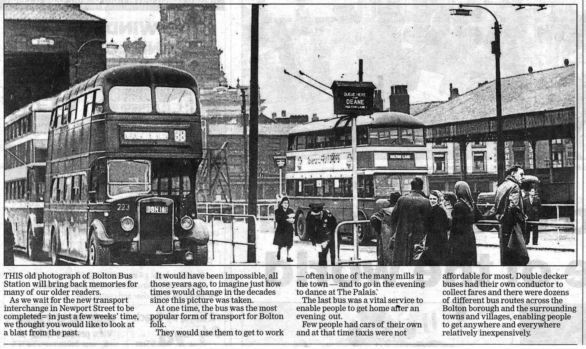
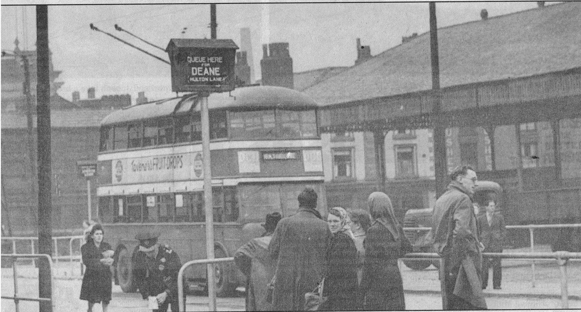
This seems to be the construction in 1947 of the Howell Croft South bus station for trolley buses to Leigh and petrol buses to Deane and Westhoughton.
Note the trolley bus running along the street (Howell Croft South) in front of the Flag Hotel. That was a temporary measure. Of course we remember them running into the bus station at the right hand side of the picture.
The Flag apparently got its name because in the mid 1800s, eight dray horses with chains and rollers were used to transport a huge flag(stone) fifteen feet square and weighing six tons from a local quarry to this house on the corner to be used to cover part of the floor.
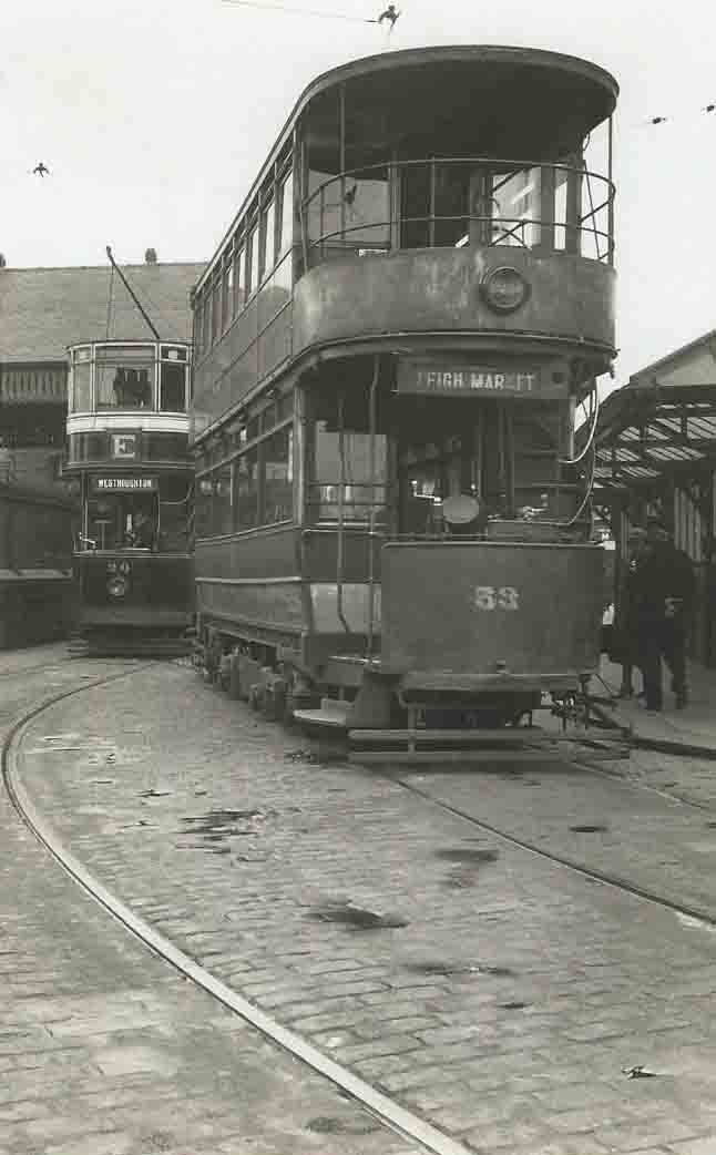
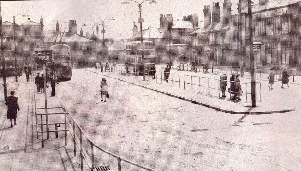
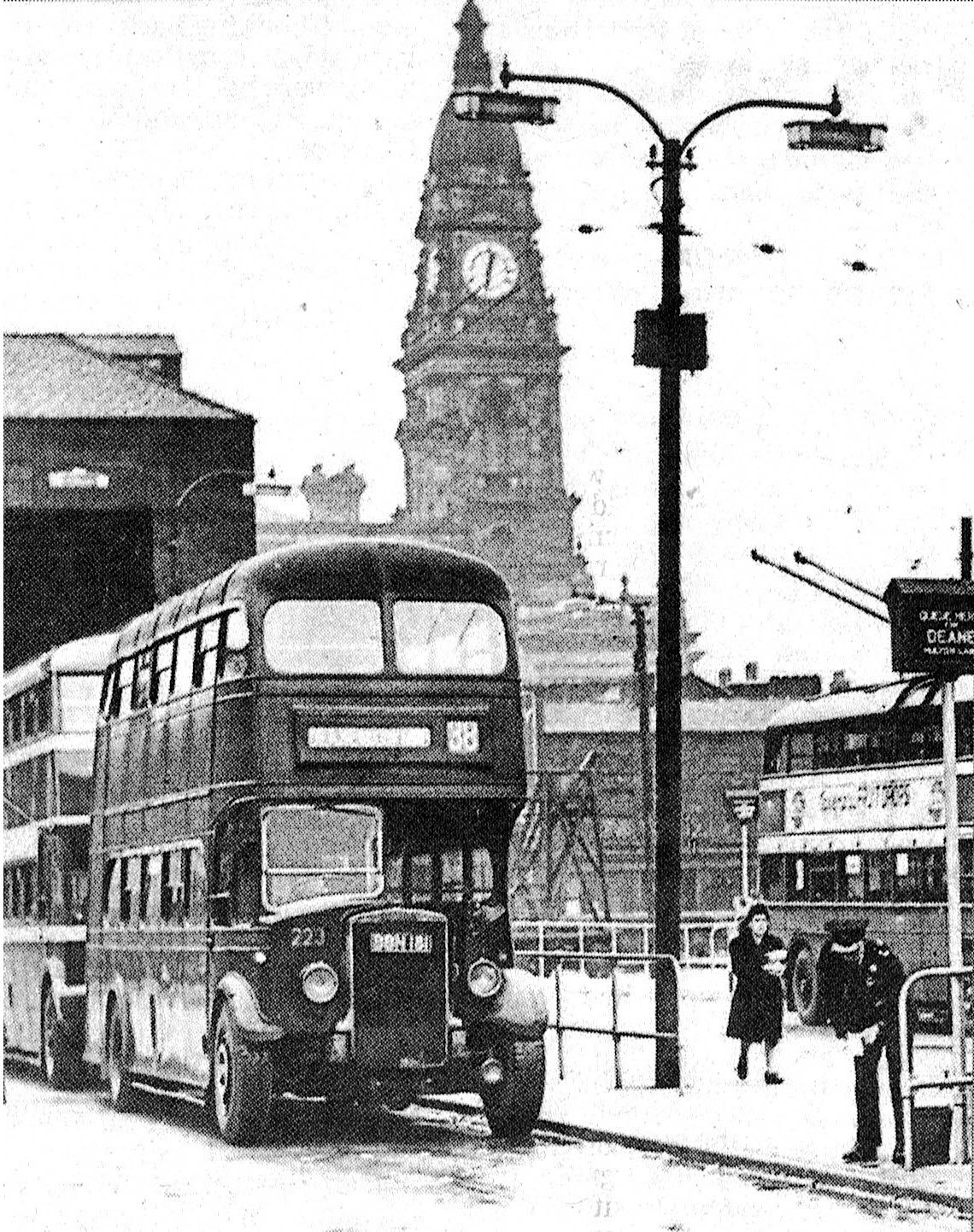
Howell Croft Bus Station. Great Moor Street runs left to right just beyond the two nearer buses.
The trolley buses have now been diverted to run into the bus station. Still no shelters.
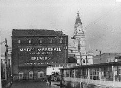
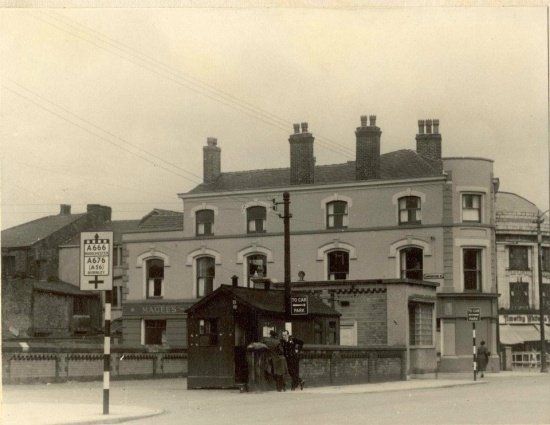
Howell Croft South bus station - looking away from Great Moor Street. The Magee Marshall bonded warehouse dominates the scene. There are bus shelters now erected c1953
<<<< Howell Croft South bus station shortly after opening 1947. Note that there are no bus shelters yet.
Howell Croft South. The last trolley bus ran in 1958 and the bus station closed in the 1960s. Trolley buses had been taking over a number of tram routes in the Bolton, Atherton and Tyldesley area since South Lancashire Tramways was renamed South Lancashire transport in 1929.
Although trams had run to every part of Bolton it is worth noting that the Bolton to Leigh route had the ONLY trolley buses in Bolton.
Note the market roof.
No shelters at this date. They were installed c1953.
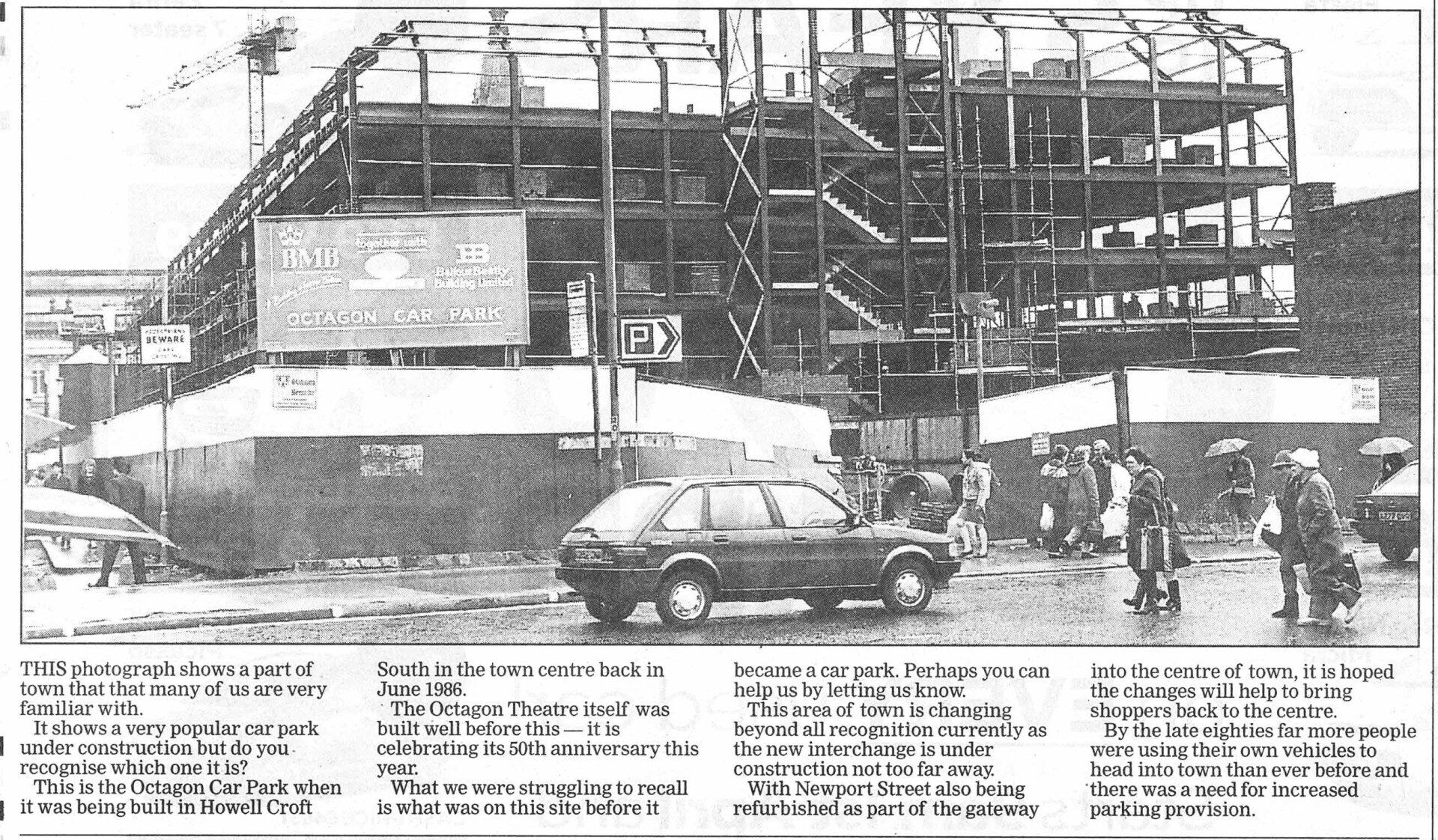
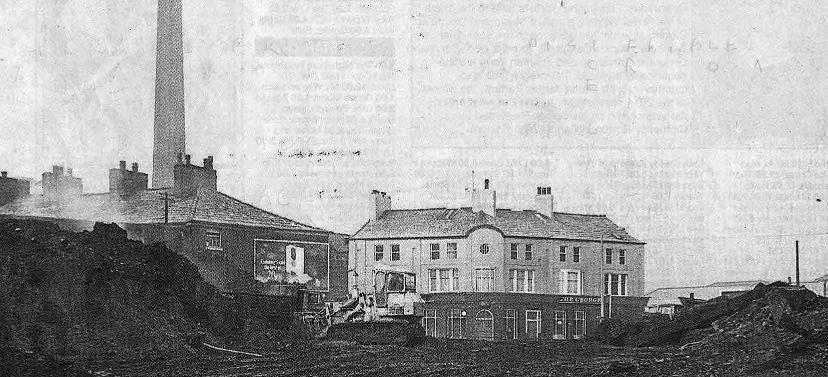
June 1986
To get your bearings see the end wall of the "new" Great Moor Street shops at the right edge and the Town Hall in the distance.
This is the Octagon multi-storey being built on the site of the old wholesale market and tram terminus and part of the Howell Croft South bus station.

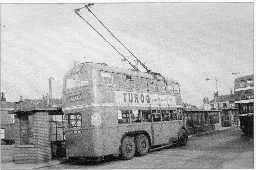
1 A good picture of a trolley bus at Howell Croft South. This has been taken after the shops on the northwest side of Newport Street have been demolished but before they were rebuilt because you can see the fronts of the shops on the opposite side of Newport Street.
Note also the cafe at the corner of the bus station.
2 1956
A trolley bus at Howell Croft.
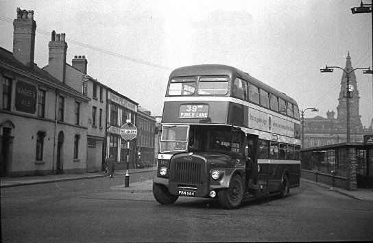
3 Number 39 leaving Howell Croft for Punch Lane.
Picture posted on Facebook in Bolton Lancashire Bygone Days
4 The trolley bus leaves Howell Croft Bus Station and turns right (our left) to go up Great Moor Street and Derby Street to Daubhill, Atherton and Leigh.
Loved by many, quiet, smooth, non-polluting (locally at least, the pollution was elsewhere as the electricity was generated from coal!) but just a few people found its motion caused them to feel sick.
Couldn't run where there were no wires and although this was a natural progression from the trams and overall a successful project running was not flexible enough.
The buses leave Howell Croft Bus Station and turns right to go up Great Moor Street and Derby Street and are presented with this view.
The corner of the Flag Hotel is visible at the right edge. Flash Mills with the enormous chimney dominate the scene. The white building behind the bus is the George Hotel on the corner of Blackhorse Street. To the left of that, buildings are obscured by posts but then we have the Dole Office, Ormrod Street, and the part of the Mill facing the Hargreaves House flats. On the left side of the road beyond the shops you might just recognise the building at the side of Great Moor Street station.
Under the road, under the Players sign, runs the Trinity Street to Preston railway line.
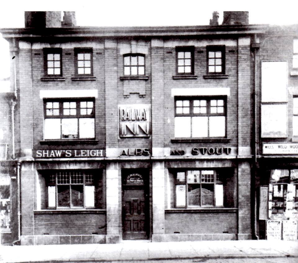
Shortly after leaving the Howell Croft bus station you passed the Railway Inn at 63 Great Moor Street, close to where the railway line from Trinity Street passed under the road on its way up to Bullfield and Lostock.
This is where skatepark is now.
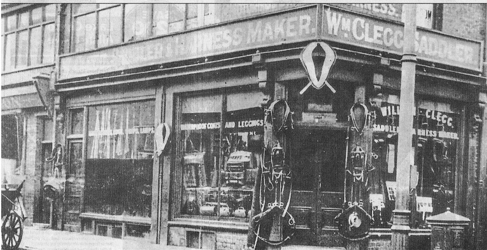
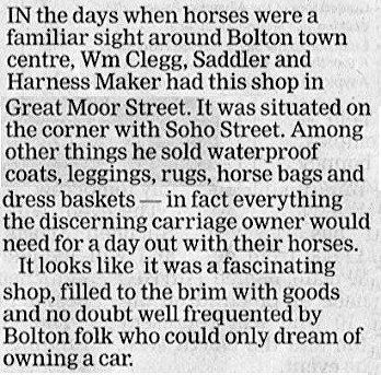
Great Moor Street
Saddler on the corner of Soho Street where Allen’s shoe shop was for many years until it moved to Newport Street in 2021.
Image below is Bolton News text for this picture.
David Whenlock' picture
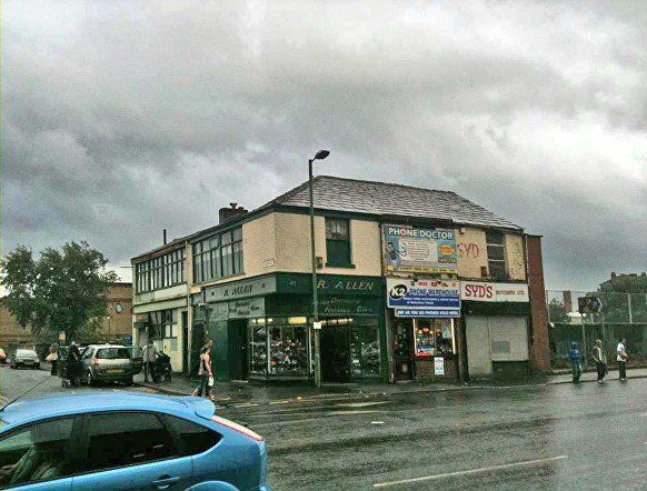
Great Moor Street, corner with Soho Street. Allen’s shoe shop on the corner remained there until 2021 when it moved to Newport Street. Syd's was already closed at the date of this picture.
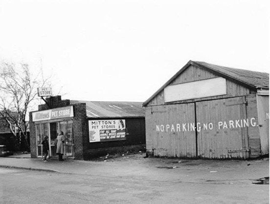
Mitton’s pet shop, Soho St., behind Allen’s shoe shop, opposite Griffin Inn.
© Copyright Carol Winder and licensed for reuse under this Creative Commons Licence
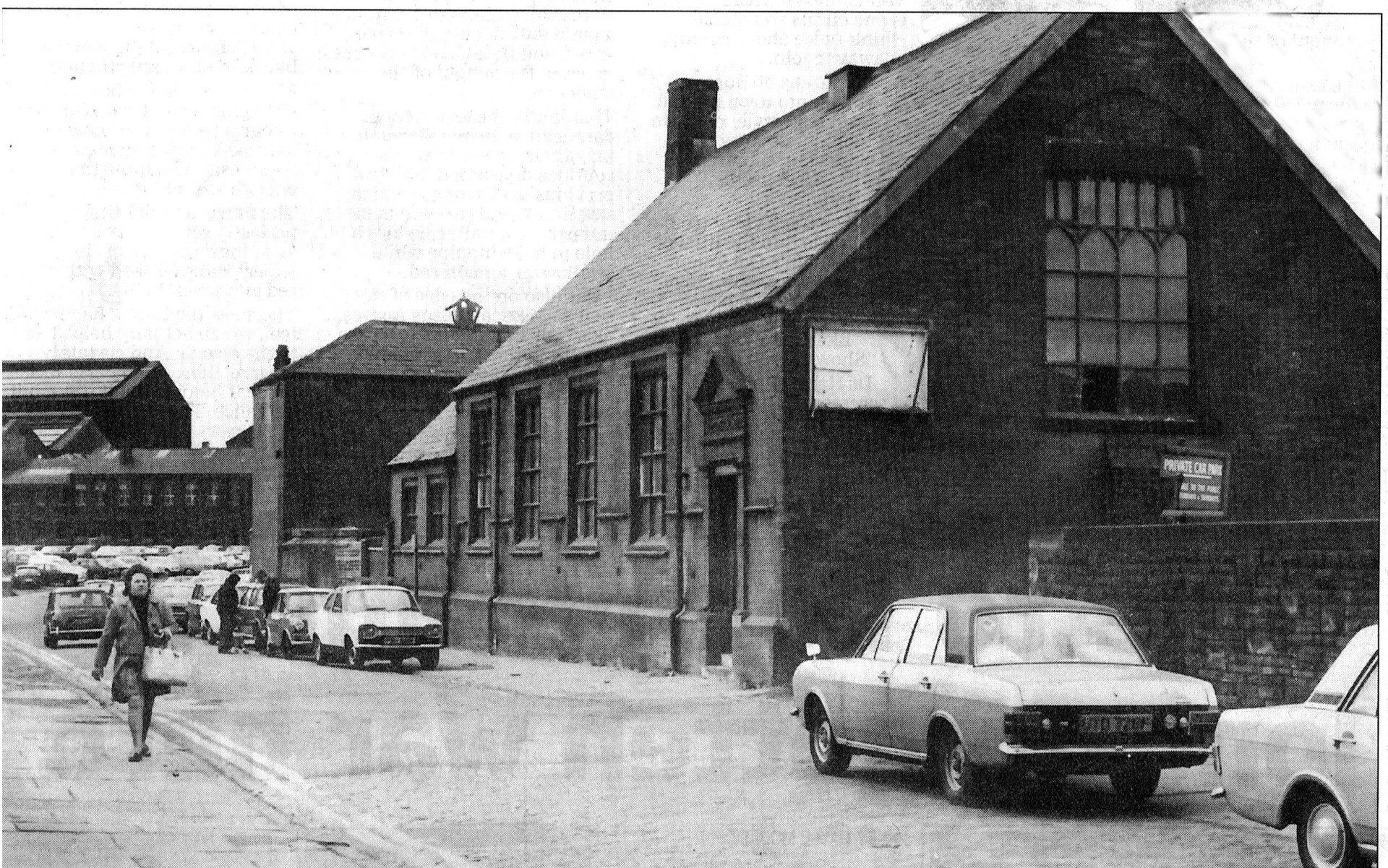
Almost straight across the road from Howell Croft South bus station was Dawes Street. This now leads to the Morrison’s supermarket.
“One of Bolton's oldest youth clubs, the Catholic Boys' Club was under threat of closure unless a new headquarters could be found by September 1974. The Boys' Club moved out of its Dawes Street headquarters in June and was forced to store its equipment in schools and private houses until new premises were found. Our picture shows the empty Catholic Boys' Club in Dawes Street, Bolton.” (BEN)
Hick Hargreaves can be seen in the distance
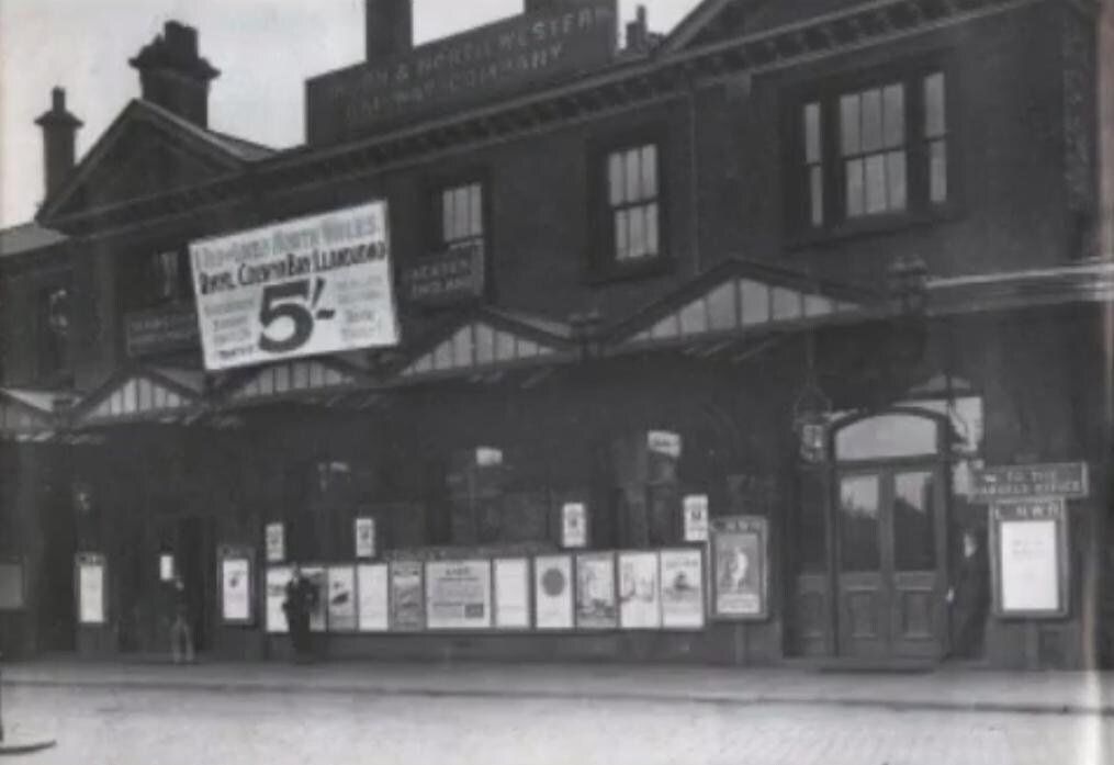
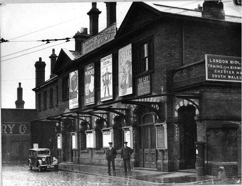


1 1936? Great Moor Street station.
North Wales for five bob! Anybody coming with me?
Actually I imagine most people would not be able to afford to take a family on that trip.
Railway opened on 1 August 1828 (1 July?), one of the first railways to be opened in the world, initially for goods but soon after for passengers, it was the second oldest passenger line in the world, two years before the Manchester – Liverpool line, initially to Leigh, extended to Kenyon Junction in 1831 shortly after which passengers could reach Liverpool and North Wales. First station opened 1831. The station was rebuilt in 1875 when the line through Great Lever, past the hospital, across Plodder Lane and on to Walkden and Eccles was opened. The station closed for regular services in 1954 though was used at holiday times for North Wales until 1958. It was finally demolished in 1966. (Daubhill Station closed, 3.3.52, the line was not used after 29.3.65)
2 This line was first envisaged by William Hulton who wanted to get his coal from mines at Chequerbent into Bolton for the cotton mills and the not inconsiderable domestic market. He had discussions with George Stephenson who was already in Lancashire planning the Manchester to Liverpool railway.
Hulton got about 40 local businessmen together to raise capital and to get acts through Parliament. The original idea was expanded to go from Chequerbent to Atherton and then to Leigh, but it was always in their minds that there would be great benefit (and profit) in extending beyond Leigh to connect with the Liverpool Manchester line giving a direct route from Bolton to Liverpool (and incidentally also Bolton to Manchester). The Bolton to Leigh line was opened to regular services for goods in 1828, two years before the Manchester Liverpool line.
It was arguably the FIRST RAILWAY IN THE WORLD to run having been built with the intention of offering regular passenger services. Stockton Darlington took passengers at an earlier date but in an ad hoc and unco-ordinated way on a line that shared steam, horse drawn and man-handled trains.
3 Three wheeler. Guess this picture dates from early 1950s
The station already looks a bit uncared for, not in its original "italianate" glory.
The platforms were at the level of the first floor windows, probably to allow the railway to go over Crook Street on a bridge without an impossible gradient to get there.
To the right of the door at the right was a gate which led to to a ramp which allowed vehicles up to the platform level. After the station was demolished the platform area was used as a car park for a year or two. I am not sure whether cars went up the ramp just mentioned or whether a wider more accessible ramp was created for that purpose. I certainly went up it a few times but can no longer remember exactly
4 Great Moor Street Station and the block of shops/houses west of Blackhorse Street. The block of shops is now a car park and the new junction at the corner of Morrison’s petrol station.


1 Great Moor Street Station Four very long platforms
2 Great Moor Street station. Looking along Blackhorse Street from Great Moor Street. The ramp giving vehicular access to the platform level. What a huge place it was.
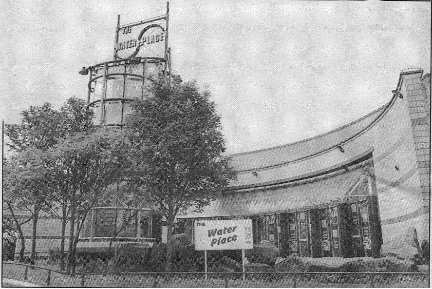
The Water Place was built on the front of the station site at a cost of £5.8million and opened by the Queen on
1st December 1988. It never attracted its anticipated 350,000 visits a year and was plagued by problems, closing for two weeks for repairs after just eight months, in 1992 an evacuation due to fume leakages with 23 swimmers taken to hospital, water leaks to the slides in 1997 needing repairs costing £55,000 and a continual saga of accidents and thefts from the changing rooms. Early in its life it was found that ¾ of the swimmers were from outside the borough and that it was losing thousands of pounds a year. It finally closed in 2002 when it was revealed that it needed renovations likely to cost £4million and it had already accumulated a deficit of £750,000.
Sad really. Most people who went really liked it though some "real" swimmers were unhappy with the size and the availability of the training pool.
I remember being on the Morrison car park (immediately behind the WaterPlace) when a car load of people all the way from Cheshire asked me "Where's the swimming pool?" I had to disappoint them by showing them the recently flattened empty space.
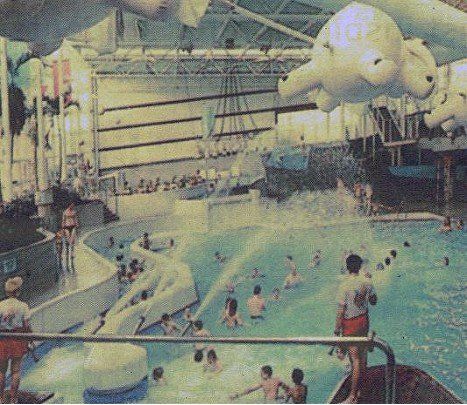
<<<< Water Place interior from Bolton Evening News.
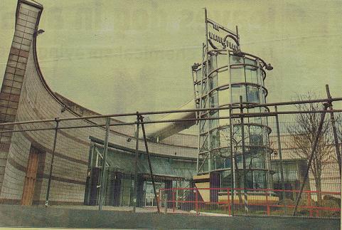
Closed and awaiting demolition..
Did you ever see the kids queuing up that tower to go on the slide? Boy did most of them look cold!
Picture taken c1920 shows buildings along the north side of Great Moor Street immediately opposite the station and the corner with Back Spring Gardens.
Back Spring Gardens went from here, across Ashburner Street and all the way to Deansgate. A short bit of it still exists between the Lever Chambers and the Odeon site.
Great Moor Street, the corner of Blackhorse Street with the station just behind us, the George Hotel, still there but closed for a few years and with planning permission sought for flats and shops. It has been renovated as student accommodation but I do not think it has residents yet. Just beyond, now Oggi and Washington, then “the dole” then Flash Mill the other side of Ormrod Street .
February 2014 (C) WDC
The George Hotel part way through renovation, the building which is now Oggi and Washington hairdressers and the Dole Building, all hardly changed from the previous picture.
A view across to the George from the demolition site that had been Great Moor Street Station. The Ashburner Street market is visible on the right and the block of houses on Great Moor Street up from Blackhorse Street which survived for a few more years is on the left.
Great Moor Street looking west, the tower of Magees Crown Brewery and the roof of the Daubhill Congregational church are on the skyline. Blackhorse Street crosses GMS in the foreground with the George on the right and what was later Scholey’s wood shop on the left. The William Younger’s advert is on the corner of Ormrod Street, across from the Labour Exchange. Hargreaves House flats are to the left of the bus.
Flash Street Mill, nearer to us is the Labour Exchange and between them is Ormrod Street.
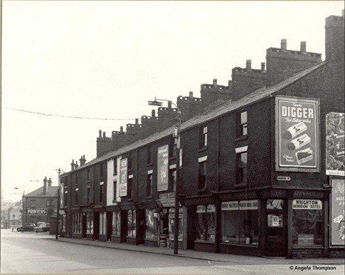
posted on Facebook by Angela Thompson
Great Moor Street, the block of shops west of Blackhorse Street but looking back towards Great Moor Street Station.
The street name plate says Ormrod Street so this street was on both sides of GMS.
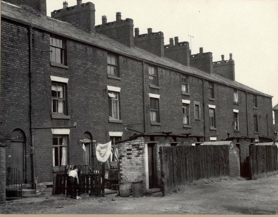
The rear of the shops on Great Moor Street. Note the outside toilets. It seems these were probably communal - not enough for one per house.
Nothing too special about the chimneys, but slightly unusual and have served as a marker for locating some pictures.
A view along the back of the houses and shops on Great Moor Street. The photographer probably got his height by shooting from Hargreaves House.
Magee Marshall’s “bonded warehouse”. is a landmark as usual. The backs of the “new” shops on Newport Street stretch across the right side of the picture.
You might notice the Odeon cinema viewed from the rear, far left; the George Hotel (the fairly obvious white building a little way in from the left) which still stands though it is now student accommodation; just to its left the sort of warehouse which now houses Oggi and Washington hairdressers;
Elizabeth House between the Odeon and Magees is still there. We also see the Howell Croft South bus station (you can see a bus) and the little cafe in the corner; the Flag Hotel – white building towards the right on the corner of Howell Croft; the building (printers) which was alongside Great Moor Street Station forecourt (the station is out of shot to the right).
Picture posted on Facebook by David McgaugheyCrock
You can see the flat area of the ex-station with one car parked. You can see the original ramp which I am guessing was used at this time to get to this temporary car park
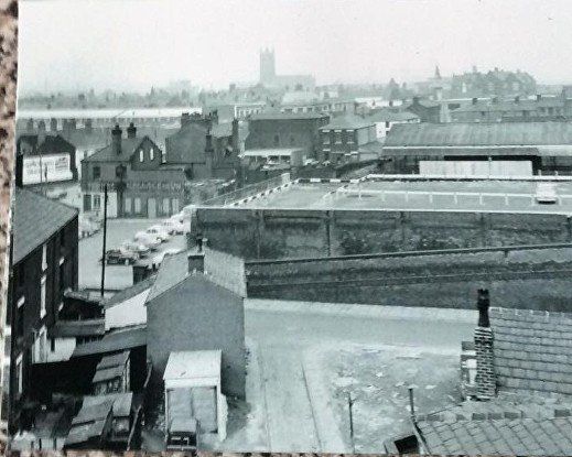
We are looking across the end of block in previous picture. Large warehouse and buildings fronting onto GMS still stand. Parish Church, St Patrick's and County Grammar are visible on skyline.
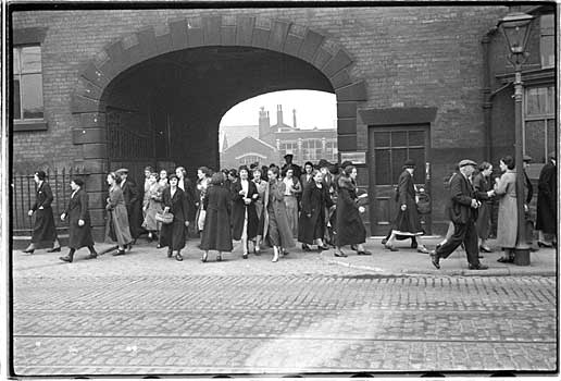
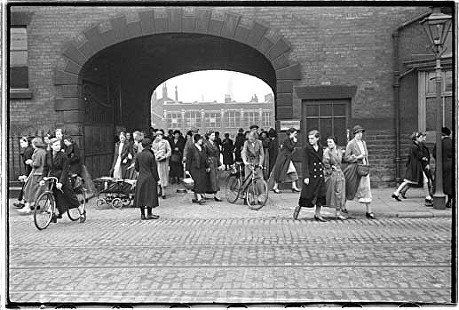
Spender 1937 - worktown project
(C) Bolton Library and Museums
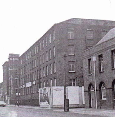
Flash Mill, home time, later occupied by trade outlets, materials, glass, etc. All demolished for Sainsbury’s, now G Casino.
Hargreaves House is immediately behind us.
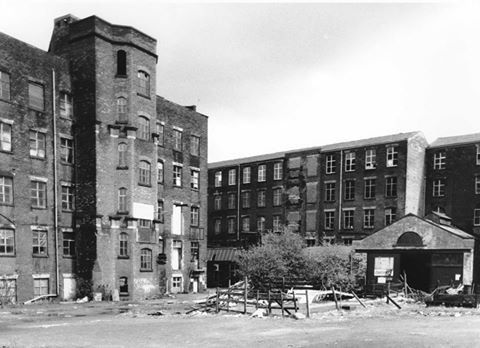
Interior court yard of Flash Mills. Demolished 1988
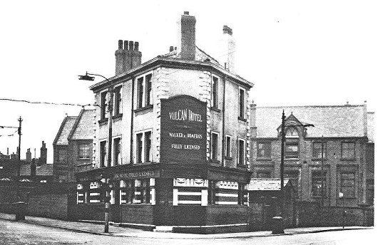
The Vulcan with the Derby Street Girls’ School behind it. Great Moor Street is up to the left, Crook Street is to the right and behind us. Just further up Great Moor Street (to the left) is the Grey Man where the trolley buses going into town turned left from Great Moor Street along the bottom bit of Derby Street past the Britannia Garage.
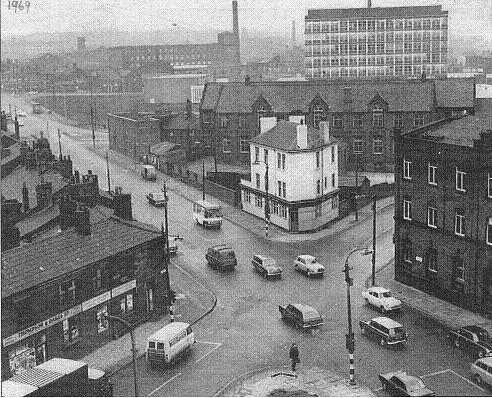
1969
The Vulcan again in its context on the corner of Great Moor Street and Crook Street. This picture is probably from a window high up in Hargreaves House flats.Thomson and Oakes is on Crook Street, they were soon to move up Great Moor Street to a newish shop that had belonged to Entwistle and Walker.
If you had been going home on the number 12, you would have come up from the left and turned left up Great Moor Street.
The Bolton Institute of Higher Education tower block is behind the Derby Street Girls’ School. This is a short time after its separation from the Technical College but long before it became a University.
At the left end of the Girls’ School is the Grey Man pub which marks the end of Great Moor Street.
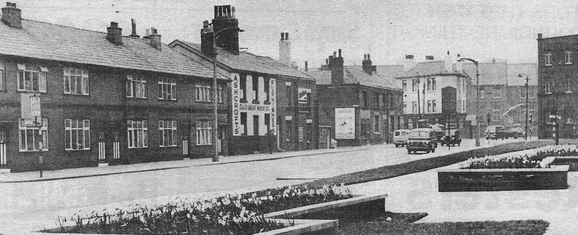
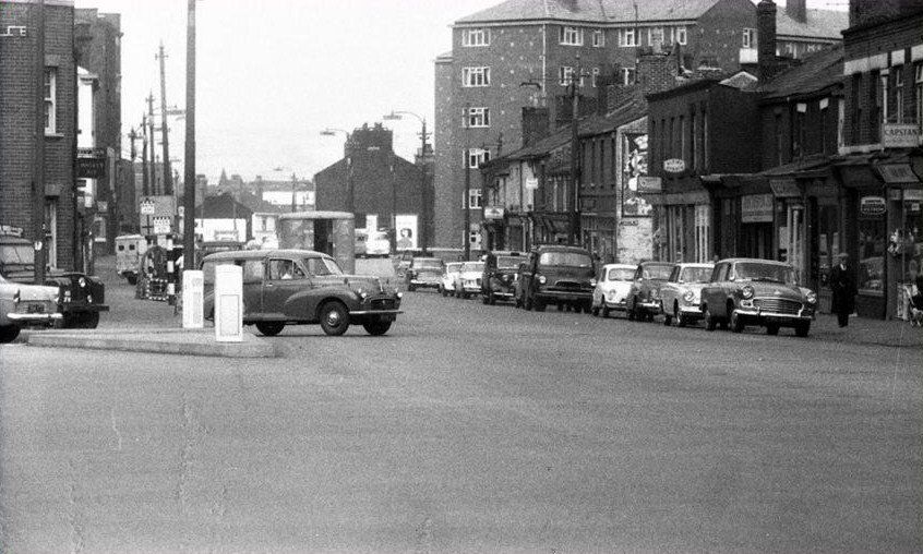
Crook Street approaching that junction, the Vulcan, Flash St Mills and Derby Street school. The flower beds are at the side of Hargreaves House. Nothing of this scene remains now.
The white building in the near block says "Ashcroft's Furnishers, 23&25 (?) Great Moor Street" which of course is half a mile from here.
David Whenlock picture
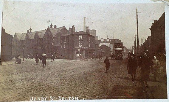
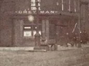
From Derby Street we look at the Grey Man Hotel and its ornate lamppost and horse trough. To its right, which is straight on from the upper part of Derby Street is Great Moor Street which had once been called Weston Street at this point. To the left of the tram we see the Vulcan on the corner of Crook Street.
On the bit of Derby Street which veers to the left we see the Derby Street Girl's School.
The Grey Man with the gables of Derby Street Girls' School appearing beyond it. A lot of demolition has taken place on Derby Street to the left.
I do not know the date of the picture or its originator.
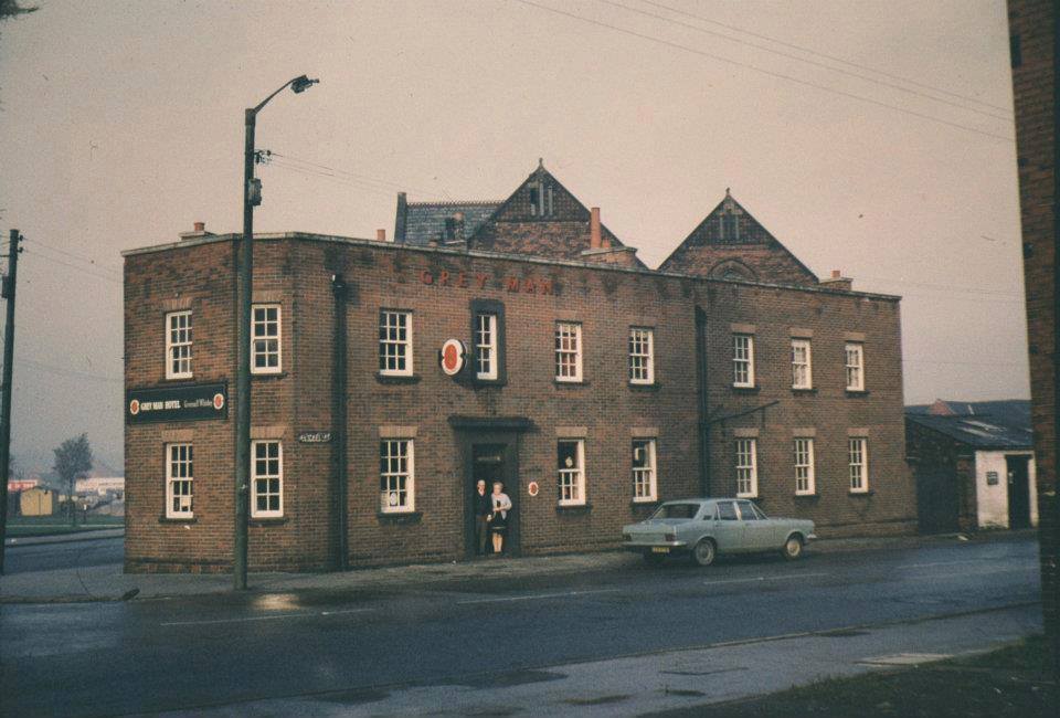
Ian A Nealon commented on Facebook "This is my Nan and Grandad outside the Grey Man Hotel which they had until 1973 when it was demolished."
Picture posted on Facebook by Andrew Hodson.
We stand on Derby Street with the bottom 200 yards of Derby Street veering off to the left (this is the way the trolley buses went), looking at the top end of Great Moor Street. At the junction Crook Street crosses GMS and close to the junction is Hargreaves House (flats). Apart from Hargreaves House just about everything visible on this picture has now gone.
September 1979
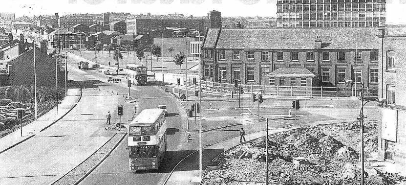
Picture probably taken from Hargreaves House. The junction has been remodelled and much of what was there has been swept away.
Derby Street School is still there but no longer a school. For a time it was used as a Student Union building for the Bolton Institute of Higher Education. Bolton One, a health centre and Jason Kenny Sports Centre with swimming pool and gymnasium stand there now.
Behind the school is the high rise block for BIHE which has now been demolished.
The mill to the left of the school, Eagle Mill of the Eagle Spinning Company, still stands and is part of the University (as BIHE now is). It housed (still does?) the textile department.
Above this on the skyline you can see Brandwood Street School, about a mile away.
Beyond the grassy area is the Derby Arms on the corner of Derby Street and John Street - which became College (now University) Way.
Derby Street from the Grey Man on the corner of Derby Street and Great Moor Street. The tower to the right of the lamp post is Magee's Crown Brewery.
On the next page we begin our journey "up Dobble", that is, up Derby Street then St Helens Road to Daubhill and beyond.