
cr5 ... to Church Wharf
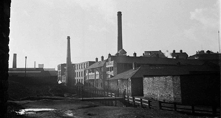
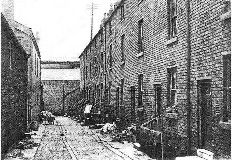
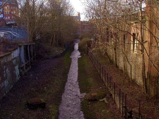
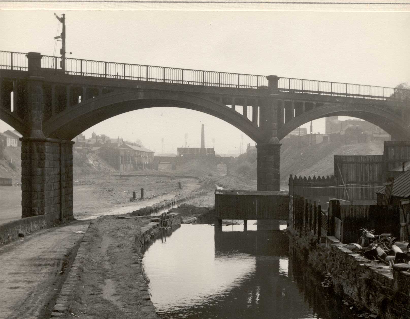
In the years following the construction of St Helena Mill, this part of the Croal valley filled up with industry. The picture above looks upstream. It was taken during the 1930s, probably 1937, 38 as part of Humphrey Spender's Worktown Project. Note the alley way on the right which went up to Bark Street. A picture on the previous page concentrates on the middle chimney which belongs to St Helena Mill. Another source for that picture labels it "The Tannery" which actually refers to the buildings between the mill and the alley way.
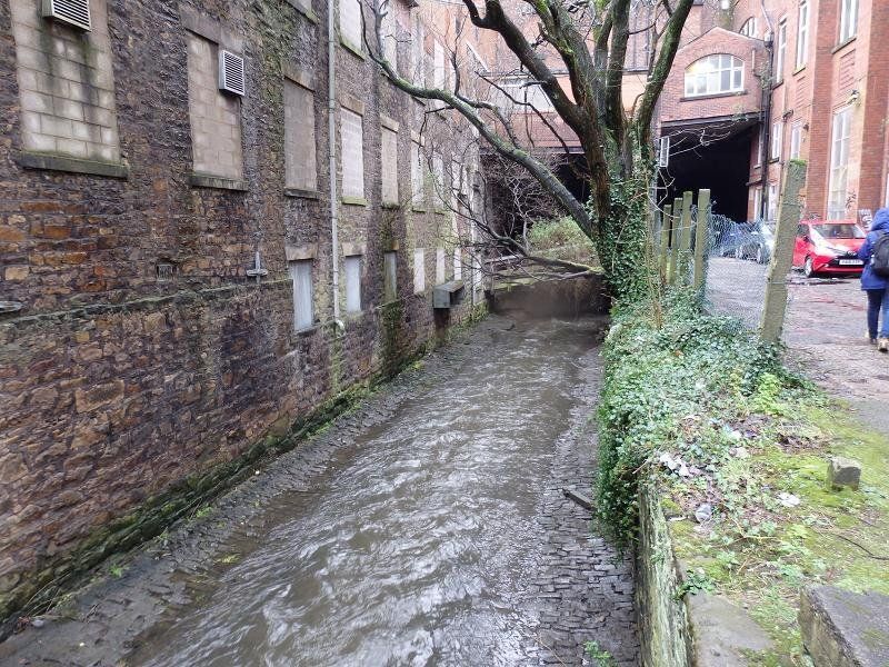
The area to the left of the river has been cleared. It had not been densely packed with industry like the right bank. It had one mill but quite a lot of housing including a row immediately adjacent to the river, called Waterside. Sounds wonderful but might have been better named Iron Works View.
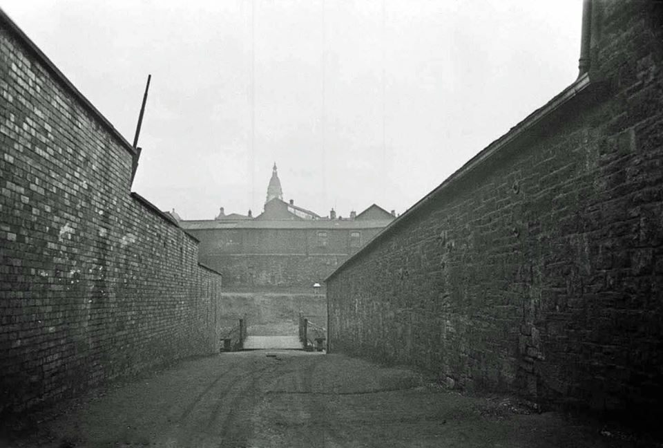
<<<<This picture looks down the street from Bark Street to the bridge and across the Croal Valley to the Town Hall. This is a Spender photograph. It was taken shortly after a large number number of industrial buildings had been demolished. The tannery is on the right and the Beehive Iron Foundry on the left.
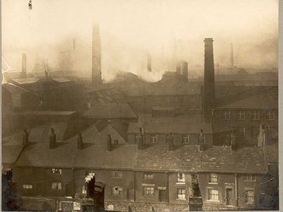
Fifty years earlier looking across from St George’s Road across Bark Street you would have been presented with a much more crowded industrial scene. This picture is undated and is simply labelled "the tannery". We appear to be looking from above St George's Road and the row of houses is probably Bark Street. Not too long after this picture the tannery moved out of town to Rose Hill. But the label hardly does justice to the scene which also contains the Albion foundry, the Bolton Brass works, and the Beehive Iron foundry.
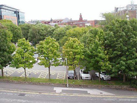
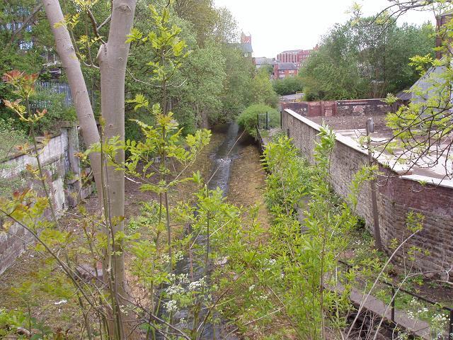
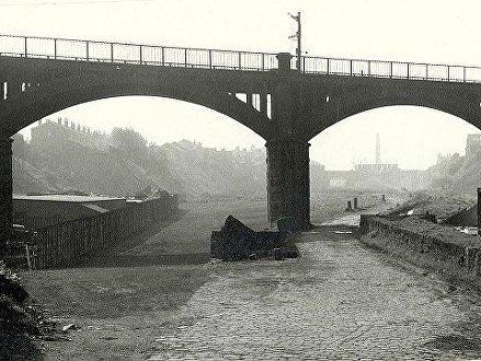
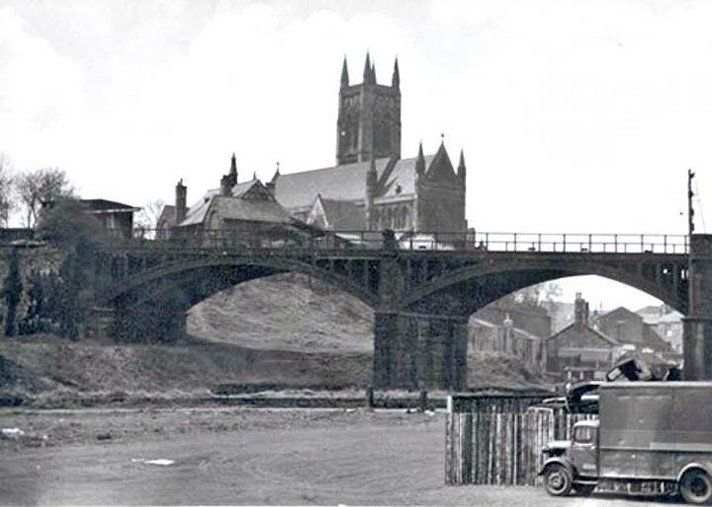
All that industry had already disappeared by 1937 when Spender took his pictures. This is what you see now looking across that area from right to left, viewing from the High Level Bridge. New building between Bark Street and St George's Road on the left, Deansgate and the GPO buildings on the right, Victoria Hall and the Market Place on the sky-line. The River Croal is off the picture to the right flowing away from us.
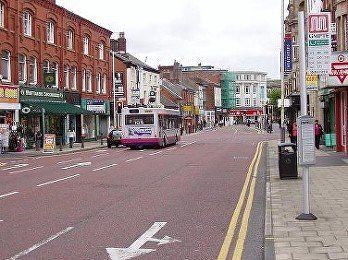
At this point we need to divert onto Deansgate.
(1) We look from just opposite the GPO towards Knowsley Street, but it is Ridgway Gate we are interested in, (C)WDC
(2) corner of Deansgate and Ridgway Gate pictured 1950s and (3) 2009. (C)WDC
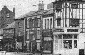
(4) 1935, Georgian houses on the right side of the street near the top of Ridgway Gate.
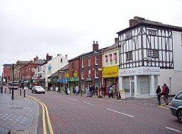
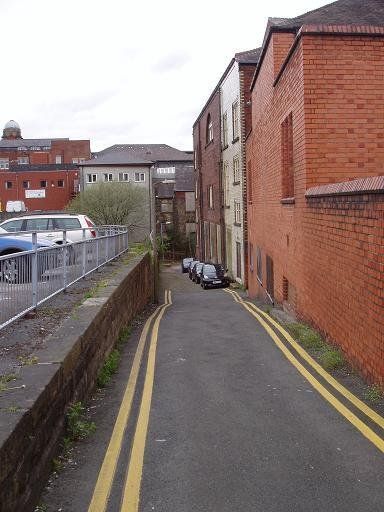
(5) More recently, as we go down Ridgway Gate, behind Poundstretcher we find the Victoria Hall on the right and a car park on the left. This narrow little lane goes down to the River Croal. The buildings seen at the end of this lane are actually on the other side of the river. (C)WDC May 2013
Click on any picture and navigate.
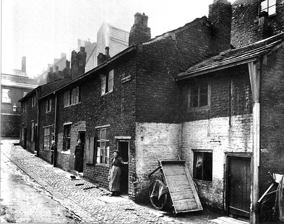
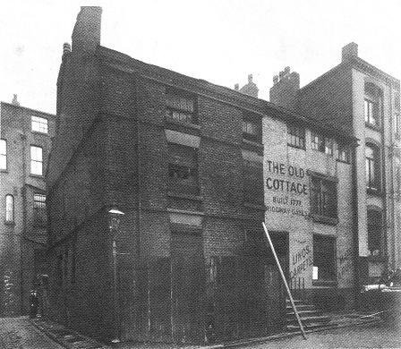
At the bottom of this lane was a row of houses called Ridgway Fold.
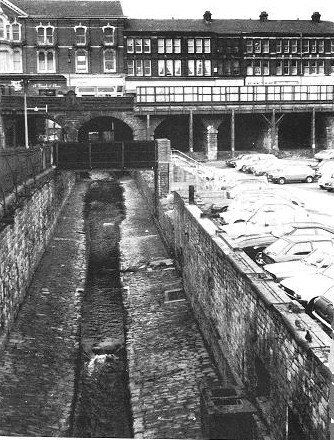
The black and white picture from 1895 is taken from close to the river, almost at the bottom of the lane on the coloured picture, looking back up towards Ridgway Gate and Deansgate.
Behind this row of houses is the Albion Forge. The Albion pub on Moor Lane is actually only a few hundred yards from this and that is probably where it got its name from.
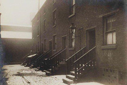
Many photographs of this era share the characteristic that the locals are posing at the front door. You wonder whether the photographer has asked them to be on his picture or whether word got around that there was a photographer chappie in the vicinity and out they all came to try and get on the picture, like people in the street standing behind the TV reporter!
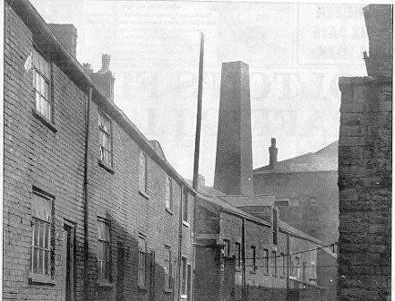
Just to the west, off Central Street was Albion Court pictured here 1920s or 30s.
Picture posted on Facebook by Edward Thompson.
Up Ridgway Gate (towards Deansgate) and to the right is another street with the intriguing name of Velvet Walks.
At the bottom of Ridgway Gate we reach the River Croal
1 Looking upstream (C)WDC May 2013
2 looking downstream (east) from the bottom of the car park towards Knowsley Street,
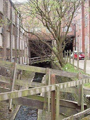
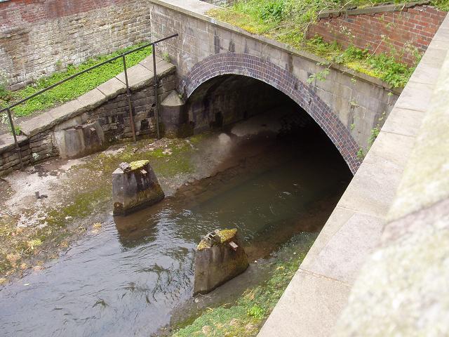
3 The River Croal as it disappears under Knowsley Street. The Victoria Hall is on the right. Since the mid eighties the river has been hidden from view for the quarter mile to Bridge Street as it is now covered by the Market Place. However before that time it emerged at the other side of Knowsley Street. (C)WDC May 2013
The Croal is about to pass under Knowsley Street. The rightmost of the two bridges is Brook Street which also went under the Street but no longer exits because it is blocked by the new Market Place building. The Victoria Hall is on the right. (C)WDC March 2020
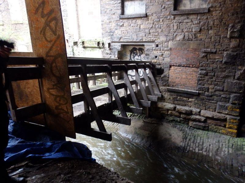
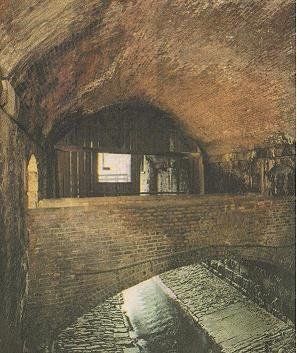
Immediately inside the bridge over the river. The bridge crossed from the bottom of Ridgway Gate to the back door of the mill. The bridge has been kept in good condition but access is prevented.
(C)WDC March 2020
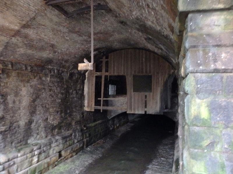
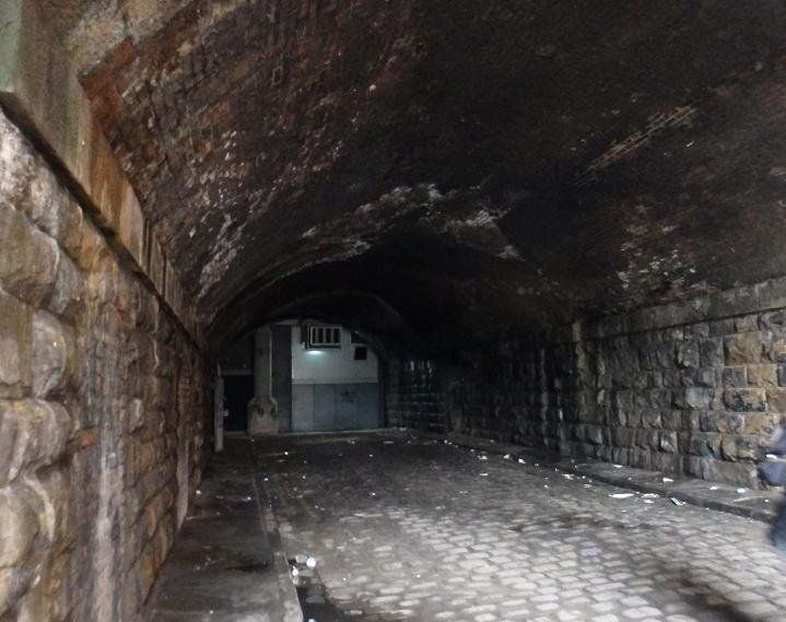
The river as it progresses under the road. This bit of bridge dates back to the construction of Knowsley Street 1855. You might notice a square of light in the lef wall below which is an arched brick foot-bridge. A little way beyond this the main bridge becomes a concrete culvert constructed with the Market Place in 1985. (C)WDC March 2020
Cutting from Bolton Evening News.
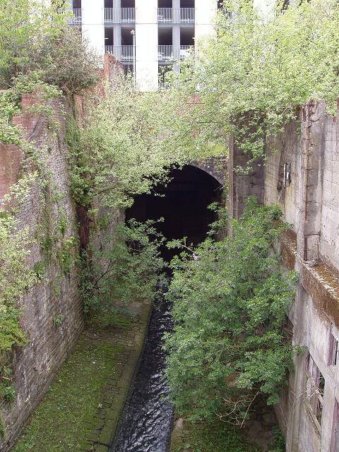
We are beyond that footbridge which also shows a light at the Market Hall side, and are looking upstream to where the river entered the tunnel.
Brook Street just below the Victoria Hall. It used to go under Knowsley Street and along the Croal to Bridge Street but is now blocked by the basement of the Market Place. (C)WDC March 2020
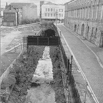
<<<< This is looking down from Knowsley Street towards the Co-op building on Bridge Street. Brook Street runs along the right side of the River Croal. On the right is the wall of the Market Hall. On the left mills have been demolished.
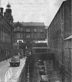
Above: This looks back in the other direction to see the Croal coming out from under Knowsley Street. The Bark Street mills were still standing, seen to the right. The steps by which pedestrians could access this route to Bridge Street can be seen. The roadway alongside the Market Hall, on the left in the second picture goes under Knowsley Street and the buildings on its far side to access the bottom of Ridgway Gate.
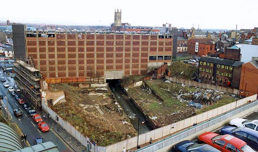
Having emerged from under the Market Place, the Croal continues its journey through the town centre, from Bridge Street to Bow Street. Woolworth’s is immediately up on the right. The street across the bottom left hand corner is Bow Street and the building dominating the picture is the Bow Street car park. This is taken 1997 (posted by Peter James Roscoe on the Bygone Bolton facebook group) from the roof-top car park of the Market Place and shows the corner which had been the Bolton Co-op main offices, bank, meeting hall, butchery department and grocery store. Since then it has been built over and Argos stands on that corner.
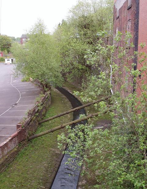
The Bark Street Mills have gone and it becomes clear that all of this part of Knowsley Street, which seems like ground level, is actually raised on a viaduct twenty or so feet above the river valley.
Same view in 2012 by Terry Hutchinson and posted to Bygone Bolton. To this side of the multi-storey car park is a service road. Beyond the car park is Crown Street running up from Bow Street to Deansgate and then Manor Street which becomes Bank Street running from the bottom of Folds Road to the Preston’s corner.
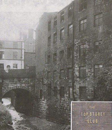
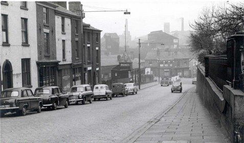
Crown Street was the site of the infamous Top Storey Club fire in May 1961 We are looking downstream as the river passes under Crown Street. This picture emphasises the height of the upper floors. Some people sadly lost their lives by jumping to escape the fire.
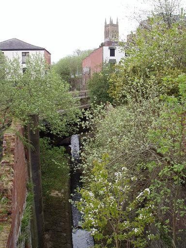
From Crown Street we look towards Bank Street and the Parish Church. (C)WDC May 2013
Brown Street and Water Street run alongside the river downstream from Bank Street. About 100 yards further on the river turns right round the end of the spur on which the Parish Church is built and reaches Church Wharf.
(C)WDC May 2013
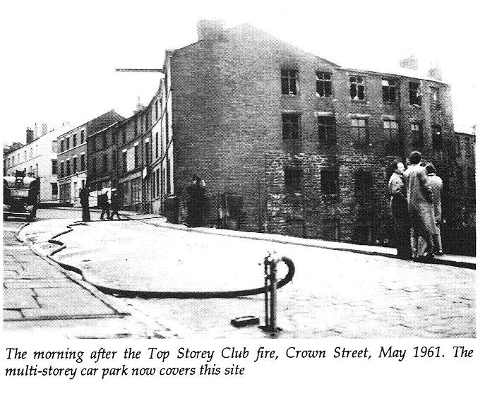
cutting from Bolton Evening News - looking up Crown Street.
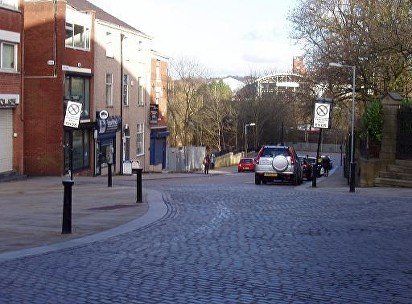
Then we look back upstream from Bank Street to Crown Street and the Bow Street multi-storey car park which now covers the site of Top Storey. (C)WDC May 2013
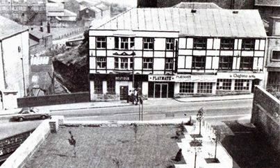
Bank Street and its well known night-spot, called Playmate at this time but taking a number of other names over the years.
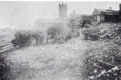
Below us is the site of the original Unitarian Church, used as a Sunday School and social facility after the Present church on our right was built.
The River Croal flows away from us and can be seen beginning its turn to the right round the Parish Church.
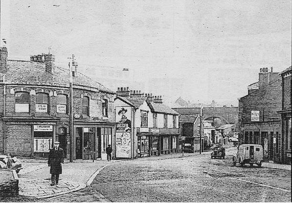
The River Croal runs along the bottom at the left of the picture. Churchgate runs along behind the buildings at the top of the bank on the right. This area is behind the Boar's Head Hotel and is the site of a cock-fighting pit.
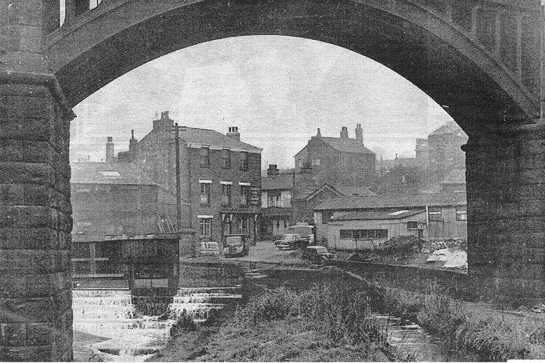
This is Church Bank pictured 1958, and was the main road to Bury. The Parish Church is on the right. Church Wharf is at the bottom of the hill. The Croal passes under the road just before the bend.
And here is the view in February 2014. The white rendered house and the building with the blue shutters remain as before but the rest of the block has gone. The whole middle distance has changed but the tower of the Kestor Street mill can still be seen. (C)WDC February 2014
11 February 2014 (C)WDC
Here is the river as it approaches the bridge at the bottom of Church Bank. Bolton News of 24 Feb 2014 reports, “A ‘dangerous’ former factory is set to be demolished. Bolton Council said that they intend to knock the old Church Wharf Foundry in Church Bank near St Peter’s Church down to its existing slab level. The work will start in May and is expected to take around three months.
Until around 1970 the river passed under the road (behind us) to Church Wharf where it fed the Bolton canal and wended its weary way towards the Haulgh and Burnden. Now it is culverted from this point flowing alongside or under St Peter’s Way and is not seen again until the other side of Haulgh Bridge (Bridgeman Place, Bradford Street).
18 May 2015 (C)WDC
Similar view with the Church Wharf Foundry now demolished.
18 May 2015 (C)WDC
The River Croal goes under the bridge at the bottom of Church Bank. It used to reappear at the other side in the Church Wharf canal basin. It now disappears under St Peter's Way and reappears at the Haulgh.
18 May 2015 (C)WDC
What are these structures? Supports for an old footbridge? Sluice gate supports to control the flow of water into the canal?
The little community of Church Wharf. "Church Wharf Health Centre, Consulting Herbalist" on the corner. The wharf itself is on the right as the road bends. The River Croal passes under the road just behind us.
The road goes under the railway viaduct before reaching Bury Road. The canal and river also go under further to the right.
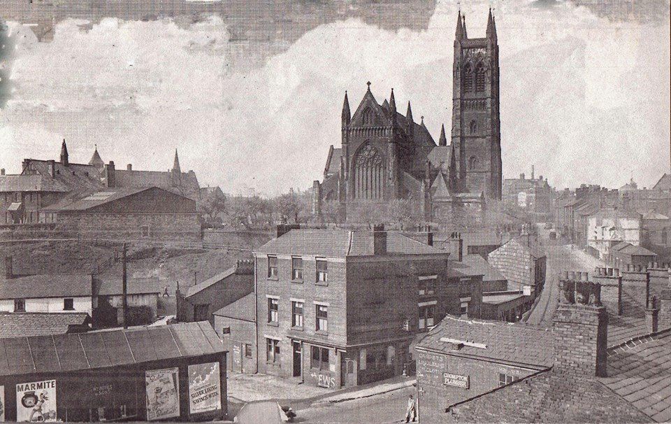
A splendid picture of Church Wharf, Church Bank and the Parish Church. The Grand Theatre is also just visible.
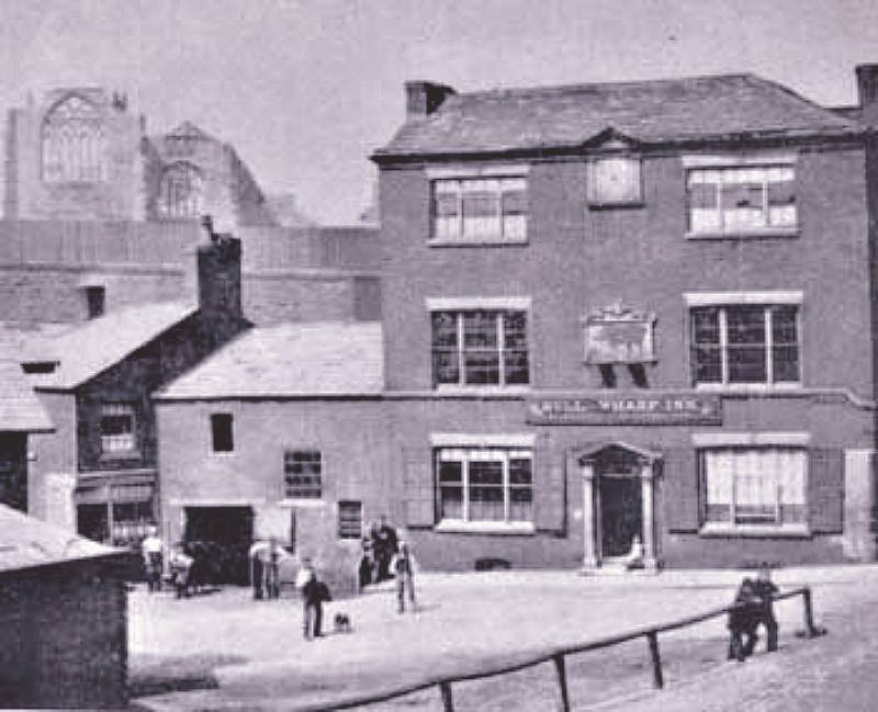
The pub in the centre of the picture is the Bull and Wharf.
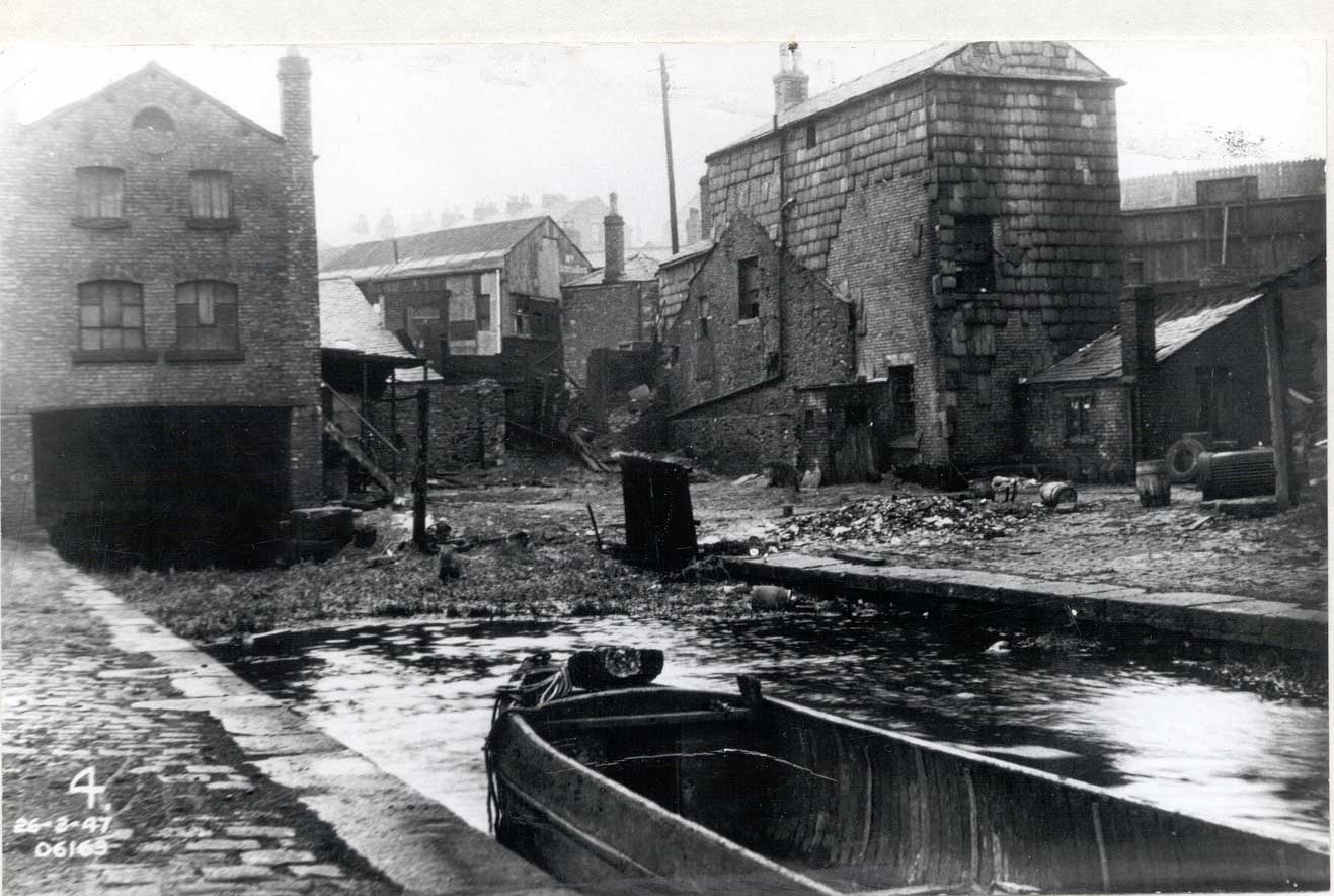
The canal wharves themselves are down to the left across the front of the pub. This picture was taken in 1947, the canal still existed at this time but it was no longer in use.
The Bull and Wharf was demolished in1966 in preparation for St Peter’s Way. Gordon Readyhough says that the area below the Parish Church appears on maps as Church Wharf BEFORE the canal and its wharves were built and suggests that the word was originally warth (wharth) a shore, strand or flat meadow close to a stream.
An earlier picture of the Bull and Wharf. The Parish Church behind it seems to be the old church in process of being demolished So this dates the picture to 1866.
The whole front of the pub was remodelled between this picture and the previous one, not at all an improvement in appearance but perhaps it gave more upstairs rooms for letting.
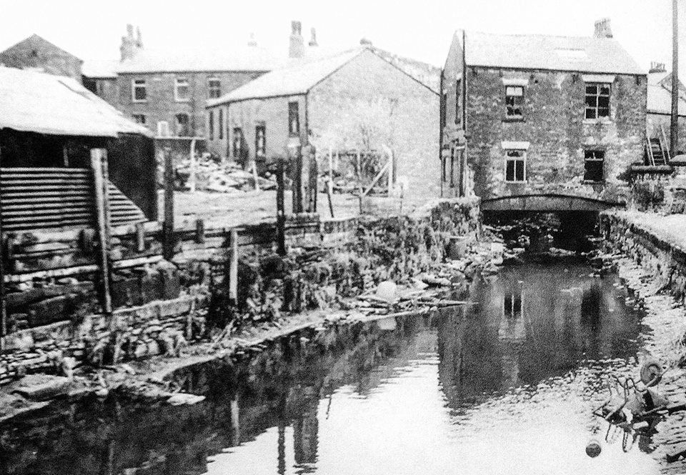
The Croal is immediately to the left of the foreground buildings. Off the picture to the left are some buildings and the end of the canal is in front of those.
Picture from David Whenlock
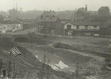
Site of Church Wharf at the start of construction of St Peter's Way.
Church Bank off to the left, Mill St into the picture, Church Wharf across the picture with the garage off to the right. The curved building at the road junction is the building seen at the bottom of the hill (consulting herbalist) looking down Church Bank.
So we are looking across where the Bull and Wharf had stood. The bridge from which the river is issuing is the one we saw it entering a little while ago.
Picture from David Whenlock
A bit to the right of the previous picture. The railway viaduct is just off picture to the right.
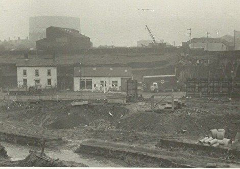
This is the Bolton end of the Manchester, Bolton and Bury canal. The area is already looking derelict even though the boat looks serviceable. The Croal runs through this area on our left and its water is used to feed the canal. . An old map shows quite a complex system of the canal, the original line of the Croal, and a newer straightened cut for the Croal.
This is the River Croal shown clearly on an 1891 map as going under a building at the side of the Bull and Wharf..
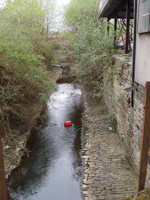
Throwing stuff you don't want in the nearest waterway is nothing new. Spot the wheelbarrow.
Immediately downstream from the previous picture is a weir raising the level of the river. A map shows a sluice allowing water into the channel on the right from the river level above the weir. Another sluice is shown further downstream. Although evidence for this is not obvious on the map this channel must be used to top up the canal.
This is the River Croal just above the weir of the previous picture. The river then is constrained to be narrower and snakes along the banking to the right before going under the bridge to the left in the distance at the Haulgh.
The canal has been filled in by the time of this picture but was to the left of the path. The canal takes a bend to the left, you can see a black track on the picture, then bends to the right again to go under the left arch of the distant bridge.
The chimney is at Springfields Pater Mill. The rectangle in front of it is not a building but an advertisement hoarding.
The view from slightly to the left. The hoardings have resolved into separate boards.
Picture posted on Facebook by David Whenlock.
This is from a position almost identical to that of the previous but one picture. It shows the start of work to culvert the river prior to the building of St Peter's Way.
We have now followed the river under the railway viaduct and look back towards Church Wharf (the road with the garage). What an utter shambles the river valley and the canal bed have been allowed to become.
Another look back through the arches this time to thr Parish Church. The viewer is probably on the filled in canal. The river is in the depression across the picture.
The next page continues from Church Wharf to the Haulgh, Burnden and Hacken Lane.