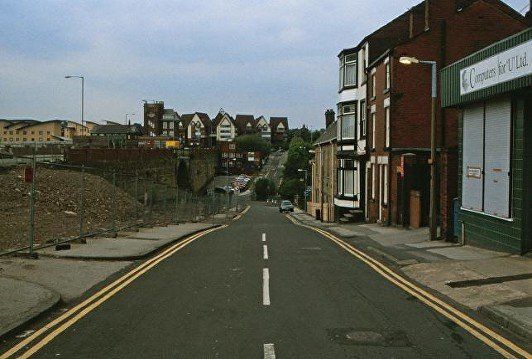
23 Fire Station Corner
with Marsden Road and Spa Road
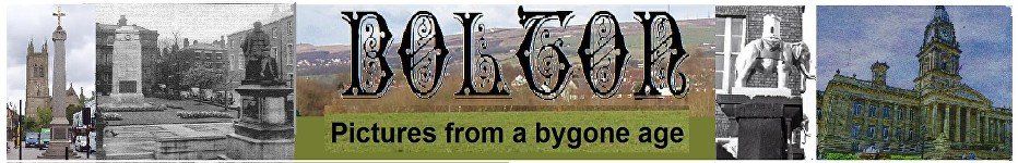
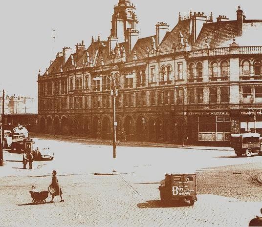
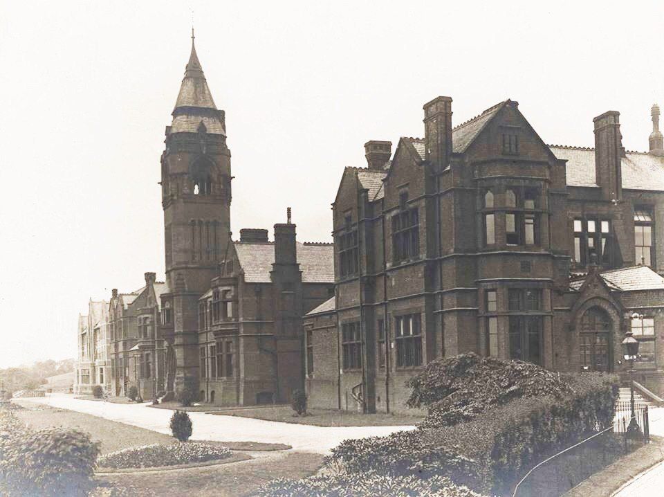
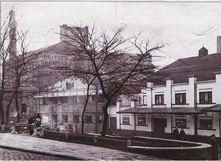
FireStation c1900 The Fire station opened 20 October 1899.
The Bolton Evening news seem to have made the fire-station its favourite photographic topic going by the frequency with which it appeared in the paper. The pictures were never the same however, there seemed to be a never-ending redesign of the junction, no island, one island, a few islands, “Silly Isles”, traffic lights. Although we think of the fire-station we knew and loved, so much better than the monstrosity which has replaced it, in fact the building itself changed over the years, its original fancywork being gradually removed and the shops around the corner disappearing. We now have shops again on the ground floor of Marsden House.
NOTE the fancy tower, the balustrades and finials round the roof, two enhanced frontages with raised roofs and dormer windows. Over the years these gradually disappeared. One theory is that the vibrations from the Iron Works just 200 yards away damaged them.
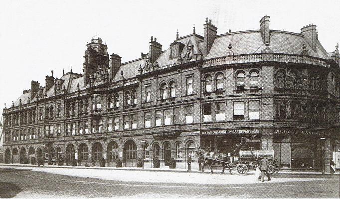
The road junction seems to be clear of islands, bollards etc.
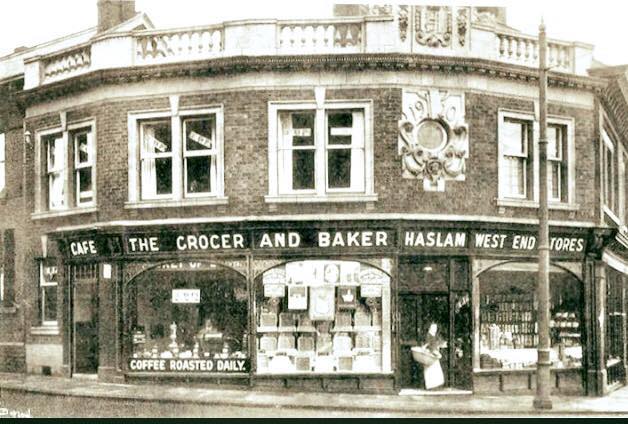
Bolton Corporation Gas Department; Crane and Sons, high on frontage Crane’s Pianos.


Click on any image to enlarge then navigate using < > re-click will sometimes zoom. exit with X
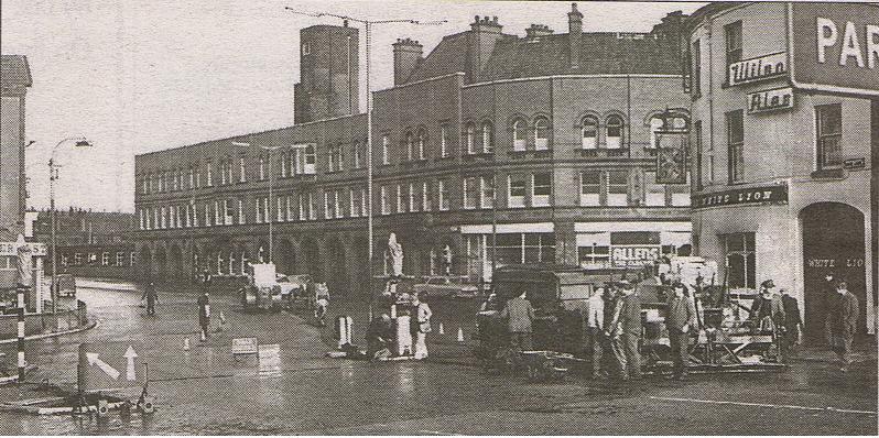
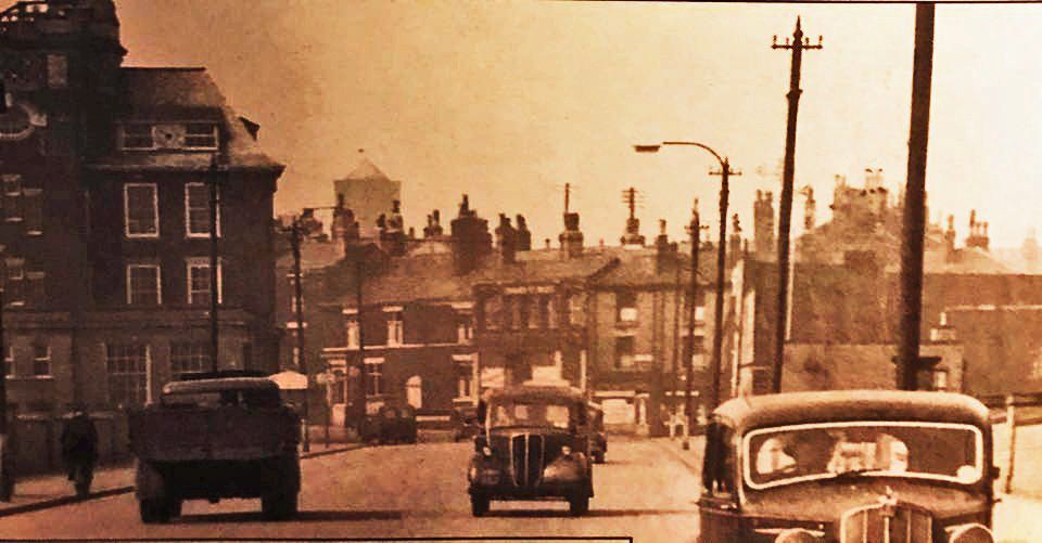
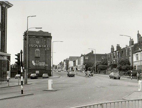
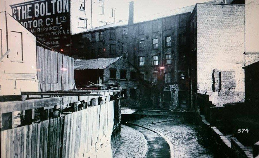
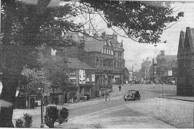
1 Splendid picture with tram. Posted on Facebook by Owen Lythgoe. On the raise roof over the front of the tram is some ironwork which was too fine to be seen on the top picture.To the left is a wall over which is a considerable drop to St Edmund's Street, Pool Street and the River Croal. Far left there just seem to be hoardings on the corner of St George's Road, just like now.
2 Picture posted by Peter Lodge
Very similar to previous; ironwork on the three parts of the building with dormers is visible, but what is the structure in the middle of the road?
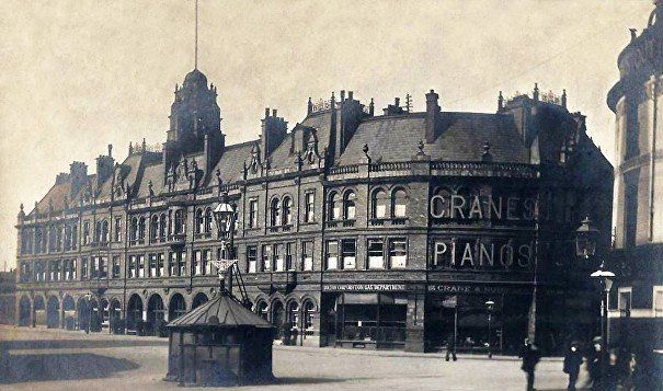
3 c1989 Fire station and horse drawn fire-engine maybe at the opening?
4 1902 Fire Station decorated for the coronation of Edward VII.


1 Date not known
Building almost same but dormers removed from raised roofs. Bolton Corporation Gas Dept replaced by Evans sign writers. Might be dyers and cleaners to the right. Lamp-post in middle of junction. Be wise, Buy, Bolton co-op, Bread,
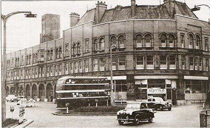
2 1955-60?
Balustrades remain but finials and fancy gables gone, we now have a flat roof at left hand end, plain tower. Silly Isles. Still Evan's Sign Writers
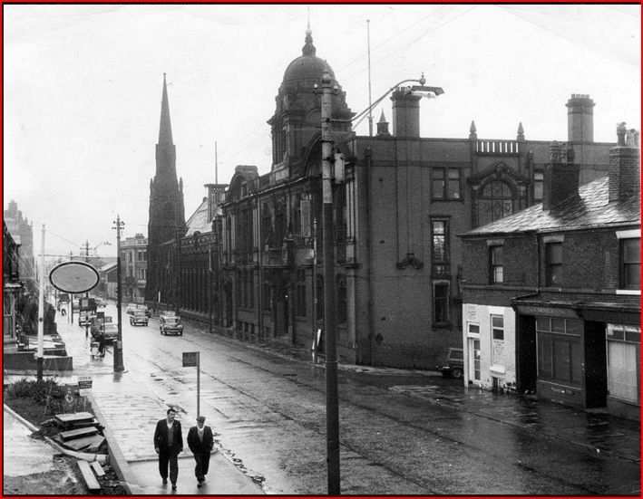
3 Bolton Evening News
OUR photograph is a view of the roundabout junction complete with flowers galore — at Marsden Road and Deansgate in July, 1955. The main building housed the fire brigade and we can also see Metro Dyers and Cleaners. At the junction of Deansgate and Moor Lane, to the right, the original White Lion building still stands, but is now Matchwinners, a supplier of sports wear, trophies and equipment. (2018 - a solicitors). We can also see, just coming out of Deansgate, the number 19 bus to Doffcocker, with Holroyds Cycles, just behind it. Drivers those days seemed to find their way with minimal signage - just a small sign in the middle of Marsden Road pointed the way to Manchester, Bury and Burnley, and in Deansgate were directions to Leigh and Wigan.
The paragraph also bemoans the derelict (at the time of writing) Gypsy's Tent just off picture and "unfortunately, the beautiful building has gone — along with the roundabout replaced by traffic lights — and a modern development now stands there housing the Cinnamon restaurant, Pizza Hut, a pharmacy and shops." I wonder if the writer was awar of how much of the "beautiful building" had already disappeared by the time of the picture. Note however that the balustrades around the roof line are still there.
4 Balustrades replaced by quite high plain brickwork, Evans gone, Metro cleaners still there, Silly Isles, Bolton Corporation bus.
c1963
Metro has been replaced by Allen’s the cleaners. On the right is the Hippodrome Theatre and the Hen and Chickens. On the right edge of the picture is one of Magee’s warehouses a building dating back to the days when there was a station there not too much after 1828.
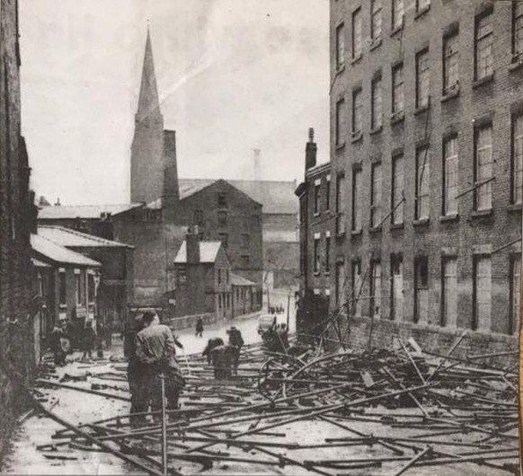
1963 Demolition of Mason’s warehouses, probably the last remnants of the Bessemer Foundry. A railway line from Great Moor Street ran to here.

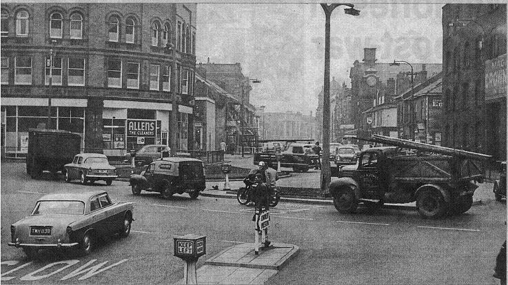
1 1964 Building the same with Allens the cleaners. Installing traffic lights.
2 1964 Traffic lights almost ready and some resurfacing being done. On the corner is the White Lion Hotel from which White Lion Brow opposite gets its name. For some years up to about 2016 the building housed a sports wear wholesaler. At the moment (2018) it is occupied by a firm of solicitors.
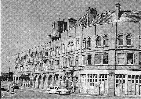
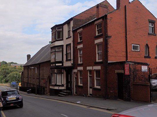
3 c1980 No shops, windows on right make it look abandoned, has the new fire-station already been built by this point?
4 August 1998 (C)WDC Final days. The arched doorways and the first floor windows remain the same as when it was built 99 years previously, the pitched roofs also remain on the Deansgate side but it is certainly not the building it used to be.
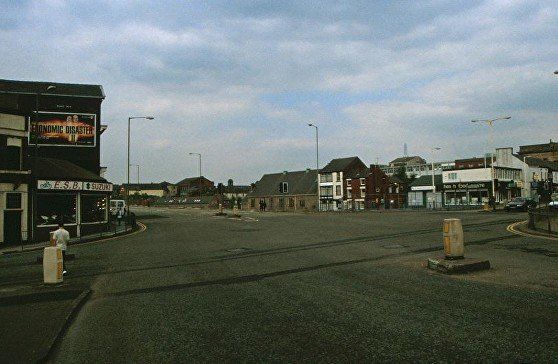
May 2001 (C)WDC
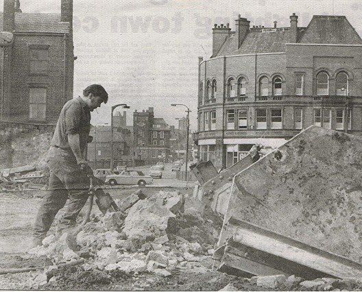
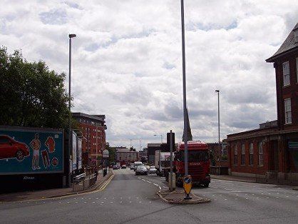
White Lion Brow, Marsden Road High-Level, old fire station demolished giving a clear view through to St Edmund Street.
May 2001 (C)WDC view down St Edmund Street, old fire station demolished. On the skyline the rather quaint St Georde's Court apartments and to the left the rather less quaint St Catherine's building. St Helena Road crosses at the bottom of the hill. Beyond the cars on the left of Pool Street is a corporation building which looks like a low one storey building from the High Level Bridge but from this side is revealed to be three storeys.
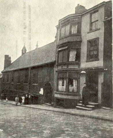
St Edmund's Church, St Edmund's Street. Date c1900? Is the house the Presbytery (RC Vicarage)? Perhaps the figure on the steps is the priest.
Picture at left is September 2016 (C)WDC
At the bottom of St Edmund’s Street is Bolton’s oldest surviving mill, St Helena Mill built in 1777.


1 April 2004 ©David Whenlock
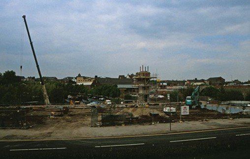
Starting construction of Marsden House, the much hated replacement for the old fire-station. Critics should note that much of the original ornamentation of the fire-station had been removed long before it was demolished. However the Council and the builders promised to retain many of the features of the frontage which remained. In the event reasons were found which made it impossible to retain these features. People do wonder if the promise was ever intended to be taken seriously.
The original walls would not have supported the weight of the much higher structure we have now but in any case, if new foundations had been provided inside the original and the old walls pinned to the new it is hard to see how the old and new could have blended aesthetically.
At this date the Gypsy's Tent is functioning.
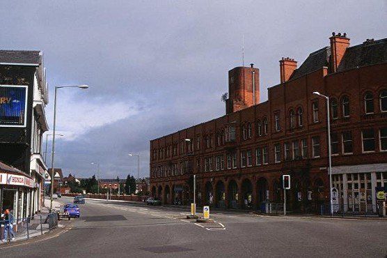
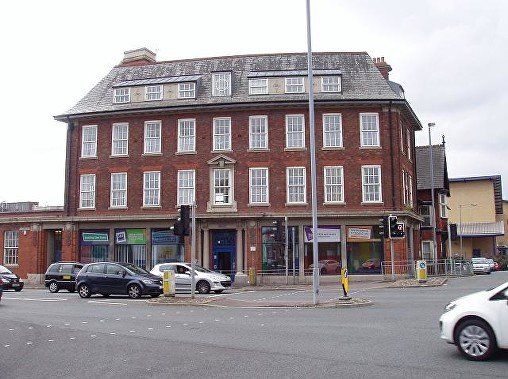
2 24 September 2009 (C)WDC
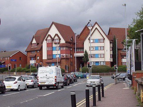
Marsden House on the site of the fire station. Tall and bulky but not too oppressive on this corner, lost the fine detail of the original ground floor with its arched doorways, but the building as a whole has detail, it is not simply bland and featureless, and is not as different from the fire-station immediately before demolition as people like to claim. No claims to beauty though.
3 It does dominate the Golden Jubilee building, though.
24 September 2009 (C)WDC same junction with White Horse Brow off to the left. Note the rather pleasing St George's Court in the far distance, the Diamond Jubilee Building (Salt Pie Mill) has survived so far, the Gypsy's Tent is on the extreme left, now closed as a pub and the White Horse (closed some years before) is on the extreme right.
4 20 September 2016 (WDC) a view along Marsden Road (the High-Level Bridge
Posted on Facebook by Susan Garraway.
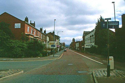
Marsden Road approaching the corner of St George's Road. The Bolton Workshops for the Blind built in 1914 are on the left.
Many people will remember the shops round that corner.
St George's Road goes in both direction from this corner, left to the Crofters and Chorley Old and New Roads, right to Bridge Street and Kay Street.
August 2013 (C)WDC
closer view of St George's Court, an imaginative and rather attractive, whimsical maybe, block of apartments.
Taken from slightly too far forward. The Workshops for the Blind ARE still on the left though now used for another purpose.
March 1955 - changes to the road layout at the corner of St George's Road and Marsden Road. The shops we see on this corner were to be replaced by Topp way and St George's Court
1981 the new Topp Way ploughs its way through the shops on the corner. St George's Road is left and right from this junction.
A quick look along St George's Road.
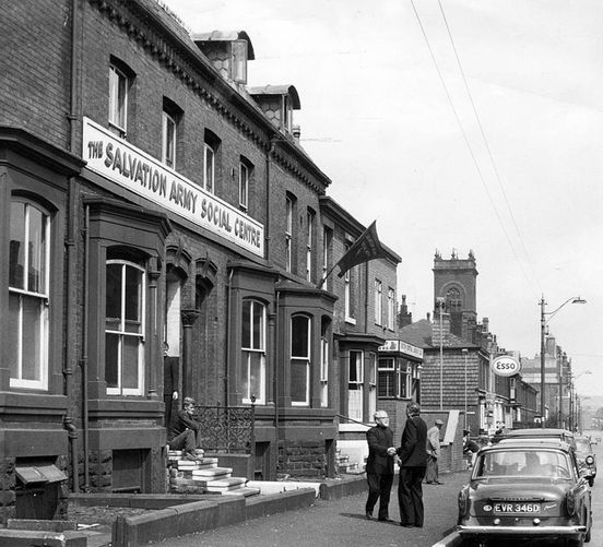
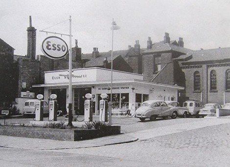
This picture was posted on Facebook by Julie Vanian and is dated 1964.
The Esso sign seems to have been whited out on the original photograph rather than painted in real life. The Spinners' Hall is an imposing structure. Beyond it is the St Andrew and St George U. R. Church which still has its steeple. On the more distant corner of Knowsley Street is the St George Hotel.
The Salvation Army is still there (2021) but in totally rebuilt premises. The square tower is of St George's Church.
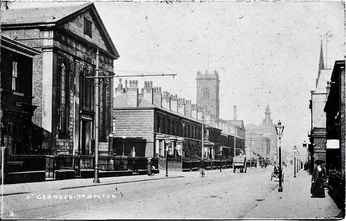
David Whenlock postcard. c1920?
A good row of Georgian houses with a preservation order on them. At left is a Methodist Chapel which was replaced by the Esso garage. We see St George's again and the "pagoda" on what had been the Co-op Drapery Department, the building remembered by many as the Prescription Pricing Authority.
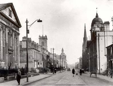
Probably early 1950s, trams have been discontinued, the tram cable poles now being used as lampposts.
A view straight along the fine Georgian street which is St George's Road. The chapel on the left has not yet neem replace by the garage. St George's Road Congregational Church (now St Andrew and St George URC) still has its steeple (removed in 1969). The Co-op Drapery (maybe Prescription Pricing Authority by this time) retains its pagoda .
Probably 1960s. The garage has replaced the chapel. The Sunday School behind still stands.
August 1998 (C)WDC - St George's Road. No steeple, no pagoda. The notice on the gable end says that this is the Medina Mosque.
A look at the Spinners' Hall before we carry on. This building was constructed in 1880 for the Junior Reform Club. It was purchased in 1886 by the Bolton Operative Cotton Spinners Association then the wealthiest society of its kind in the country. It later became the home of a number of Trades Unions.
September 2017 (C)WDC
29 August 2013 (C)WDC
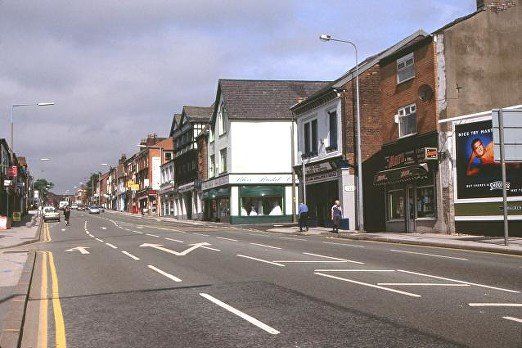
The end of Marsden Road. The single storey building on the left actually has three floors with its ground floor on Bark Street. The building on the corner had been built as the Workshops for the Blind. We see that St George's Court has been built and Topp Way has been open for some years.
St George's Road up from the Marsden Road corner - Workshops for the Blind on the left. Tyson and Gill tile company. Another pleasant enough building which is in complete contrast to what replaced it. It featured on the original Bolton Elephant Walk though I never found the elephant. Picture posted on Facebook by Vince Wayne.
29 August 2013(C)WDC
Workshops for the Blind opened in 1914 intended to accommodate 120 people after it outgrew its premises in Tippings Street. Now in use for other purposes. A pleasant enough looking building though with no particular features.
29 August 2013 (C)WDC
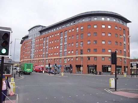
St Catherine's House is what replaced it.
August 1998 (C)WDC
St George's Road, Vernon Street on the right.
A rather nice "corner shop" for the just out of town corner of St George's Road and Vernon Street. The carving indicates a date of 1920. The building is still there (2021) but the business is not.
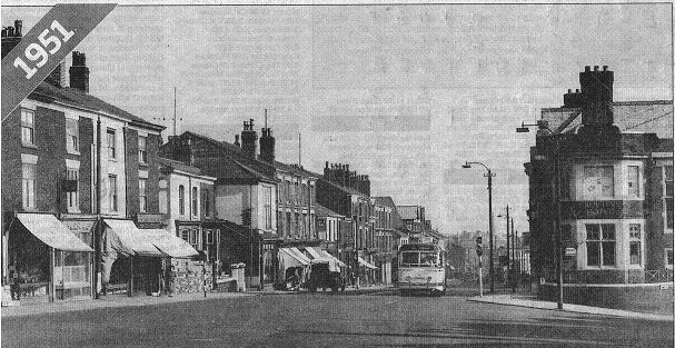
St George's Road and the Crofters 1951.
The Crofters is another local pub that was eventually owned by Magee Marshall before they were taken over by Greenalls in 1958. I had started life as the Whitsters Arms and in more recent attemptes to revive its fortunes we have seen it called Gallagher's Oyster Bar, Oystercatcher Brasserie, Tapas Eatery and Moghul's Palace. In 2009 it was taken over by local licensees Jane MacDonald and Frank Smith and became Smudges, It closed in 2010 after the sad death of Mr Smith.
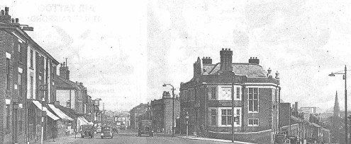
A similar view but perhaps a dozen years or so earlier showing the postion of the Crofters between St George's Road and the steep drop down Chorley Street. In the distance we see the steeple of St Pau's Church, Deansgate, and surprisingly until you work it out, the Odeon Cinema.
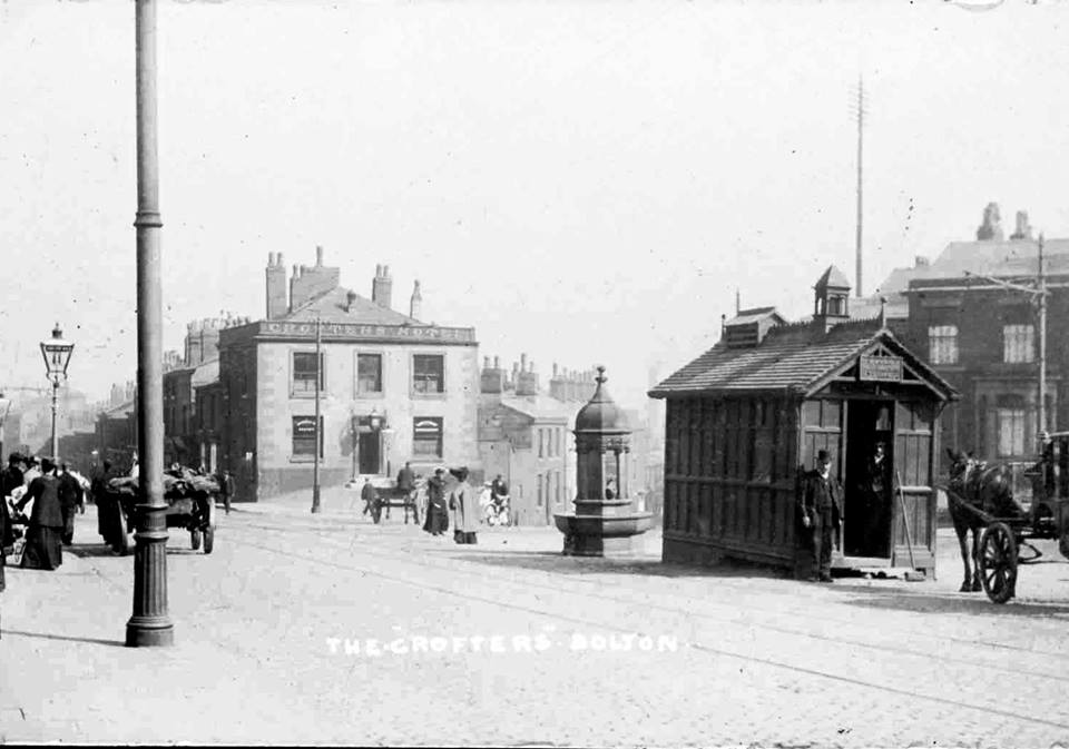
c1910 The Crofters, we have tram lines and the date is after electrification. The posts were supports for the cables - more clearly seen on the one at the far right. There is no sign at all of any motor vehicles. Despite being on a tram route we still have horse cabs and the main feature of the picture is the cabbies' hut. The public fountain is now near the entrance to Moss Bank Park. The Bolton Royal Infirmary is approached from a street just off picture to the right but we will visit that establishment shortly via Chorley Street.

We now return to the Gypsy's Tent corner in preparation for our journey along Spa Road.
9 August 2013 (C)WDC A view back over the High Level Bridge. Marsden House has by now replaced the old fire-station
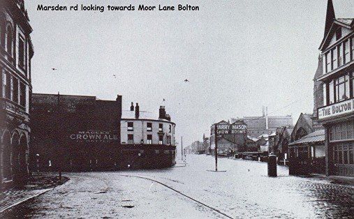
picture posted by Lilian Whittle Moore on Bolton Lancashire Bygone Days.
Moor Lane from Marsden Road. We see Magee’s warehouse, White Lion and on the right of Moor Lane the gas works, Harry Mason’s fireplace maker and extreme right the Gypsy' Tent.
Buildings behind the White Horse, probably including the Magees warehouse began life as railway goods warehouses, served by a single track from Gt Moor Street goods yard. They closed c.1928 when the Bessemer Forge, Bolton Iron works, Bolton Brass works etc were demolished. One of the buildings beyond what we can see was used by Harry Mason & Sons as a workshop and warehouse for some years prior to demolition in c.1962.
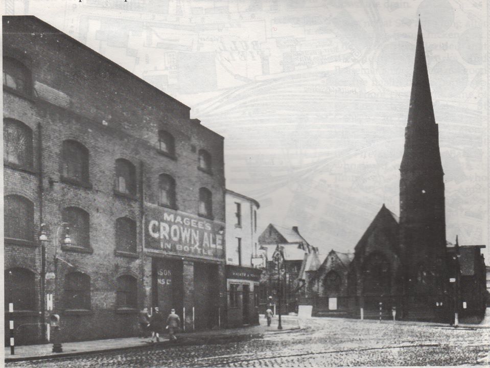
Looking out of the end of Deansgate past the Magees warehouse and the White Lion to St Paul's Church with Spa Road to its right.
24 September 2009 (C)WSC we see the Gypsy’s Tent at one time including “Romany’s” now closed down and for sale. This was converted into flats in 2017/8 after being empty for a number of years. Beyond Chorley Street is the Lads and Girls Club on the old Nevada site.
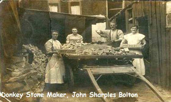
We take a short detour down Chorley Street where we see the local donkey stone maker. The name comes from the facf that one of the earliest and best known stones had a picture of a donkey impressed into it.
This picture has also been circulated labelled "Shaw Street" (off Derby Street).
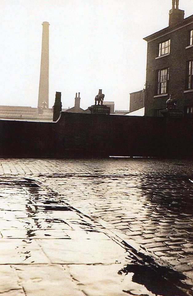
At the lowest point of Chorley Street we can look over the wall to see the River Croal winding its way behind Salt Pie Mill. Bolton Motor Company faces onto Marsden Road and is now the Diamond Jubilee Building.
Bolton Evening News 1949
We are looking down Chorley Street to Spa Road and St Paul's Church. "The picture was taken after two men working on scaffolding four storeys high outside T R Bridson and Son Ltd. were injured when the coping stone above them fell on to the scaffolding, bringing it to the ground. They were taken to the infirmary which was "virtually just round the corner" ."
On the left, the low wall is the bridge parapet over the River Croal.
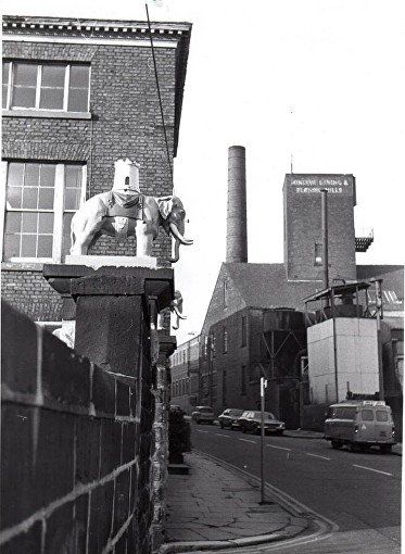
Elephants on the gateposts of Bridson’s Croft at the bottom of Chorley Street. You may well have passed them if you walked from the Infirmary into town.
These were made of cast iron and weigh more than half a ton each. They were removed in 1977 when that area was demolished and donated to the town by the then owners, William Kay Timber Importers and were put into storage somewhere.
The Marks and Spencer Charity Canopy was built in 1984 and the elephants took pride of place on the brick columns either side.
The canopy was demolished in 2014 and the elephants disappeared again for a little while.
They are now to be seen on top of the pizza kiosk between Lever Chambers and the Octagon Car Park.


1 keep walking up Chorley Street and you would have reached the Bolton Royal Infirmary, seen here across the River Croal or one of a number of lodges.
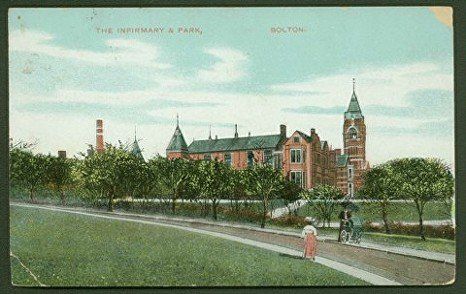
2 The Bolton Royal Infirmary in its hey day.
3 How many people walked down here to A&E from Chorley New Road?
4 The Infirmary viewed from Queen's Park, early 20th Century. What happened to the passenger from the wheel chair?
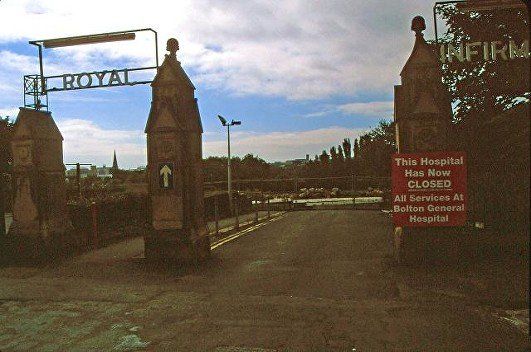
In August 1998 the Infirmary was no more. (C)WDC
And back to White Lion Brow from where we continue along Spa Road.
Similar view, 2017 (C)WDC. There is a new building on Chorley Street but the row of shops between that and the Gypsy's Tent date from 19th century. There is still an alley through to Salt Pie Yard recalling the name of Salt Pie Mill which still exists as the Diamond jubilee building.
1949
Looking back to Deansgate having just gone into Spa Road, St Paul’s Church is on the right. The row of shops to the left of the Gypsy's Tent is still standing on White Lion Brow which is the top corner of Chorley Street. (June 2021).
Picture from David Whenlock’s collection substantially improved by WDC. Picture is later than 1899 when the Marsden Road fire-station was built. The nearer row of houses on Spa Road itself were demolished in the first half of the twentieth century being replaced by the cinema which became Navada skating rink. Then we see buildings on Chorley Street as it goes down to the left. Some have been replaced but the right most shops are still standing. Over the roofs we can see part of Salt Pie Mill with Harry Mason painted on the side and the top of the fire-station.
September 2016 (C)WDC
The alley way at the left corner of the pub leads to Salt Pie Yard. Salt Pie Mill is seen over the roofs of the old houses/shops, though it is not clear whether this is the original Mill or a rebuilding when it
became the Diamond Jubilee Building in 1897 when at least the whole frontage was renewed.
Towering over the whole scene is Marsden House - apartments which replaced the fire-station in 2004, the fire-station having been demolished in 2001.
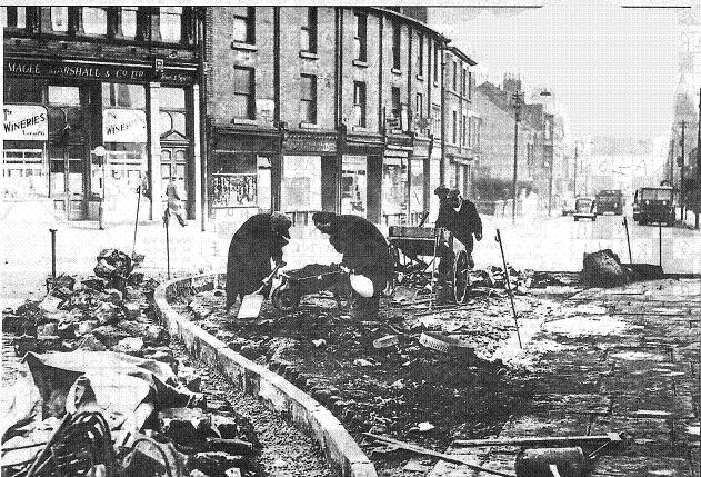
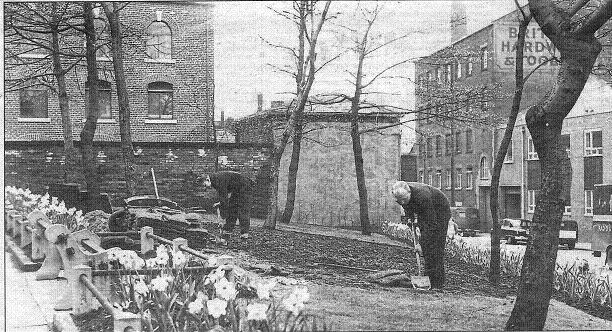
Bolton News. Working on garden area between Spa Road and Garside Street.
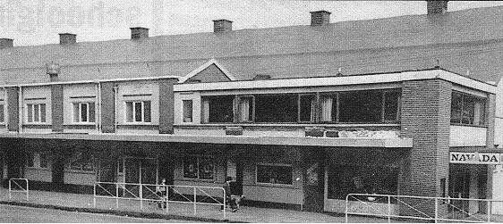
Navada skating rink. Built as a skating rink, then Olympia Cinema, then New Olympia, then the Regal and finally back to skating/dancing as the Navada. It burned down in an arson attack in 1985, was derelict for many years, is now Bolton Lad’s and Girls’ club who were in Bark Street previously as Bolton Lads’ Club.
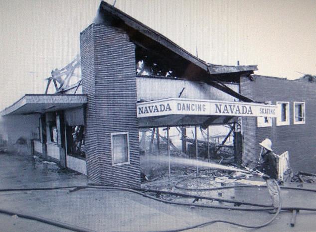
1985 Picture (C) Owen Lythgoe
Navada after the fire.
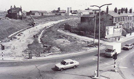
Spa Road, clearing the old Nevada site May 2001 (C)WDC
We can see the wall of the High Level Bridge and Claremont Church on St George's Road. We can follow the line of Chorley Street and beyond it the top of St George's Court and St Catherine's building
1956
The old Bolton Corn Mill, Spa Mill, a building later owned by Fisher Raworth & Co, and the building starting life in 1909 as the Olympia skating rink, becoming the Regal Cinema, then Navada skating rink, burned down by an arson attack in 1985. Now Bolton Lads and Girls Club Bolton Lads Club having changed its name and moved into a new purpose built building here in 2002.

Sept 2016 (C)WDC
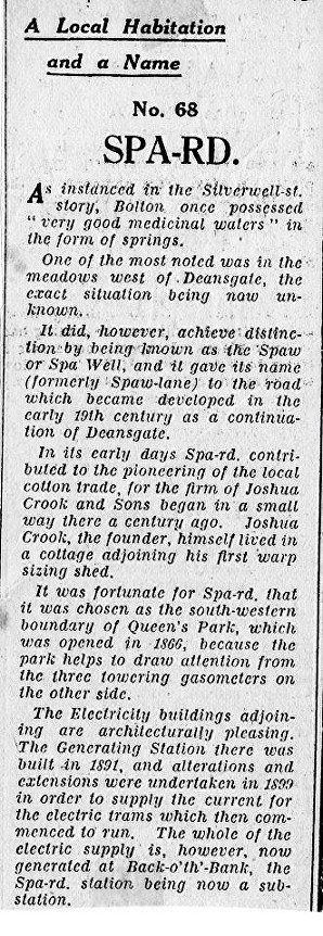
Spa Road, the old electricity offices. In the brick building behind, Bolton’s electricity was generated before the move to Back o’ th’ Bank.
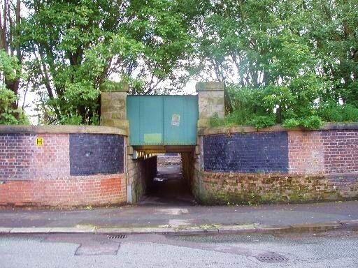
Almost at the far end of Spa Road, the footway under the railway leading to the part of Deane known as the Pocket.
There are more pictures of the Spa Road area, not Spa Road itself, on the Croal pages.
On the next page we return to the Gypsy's Tent so that we can begin to make our way up Moor Lane.