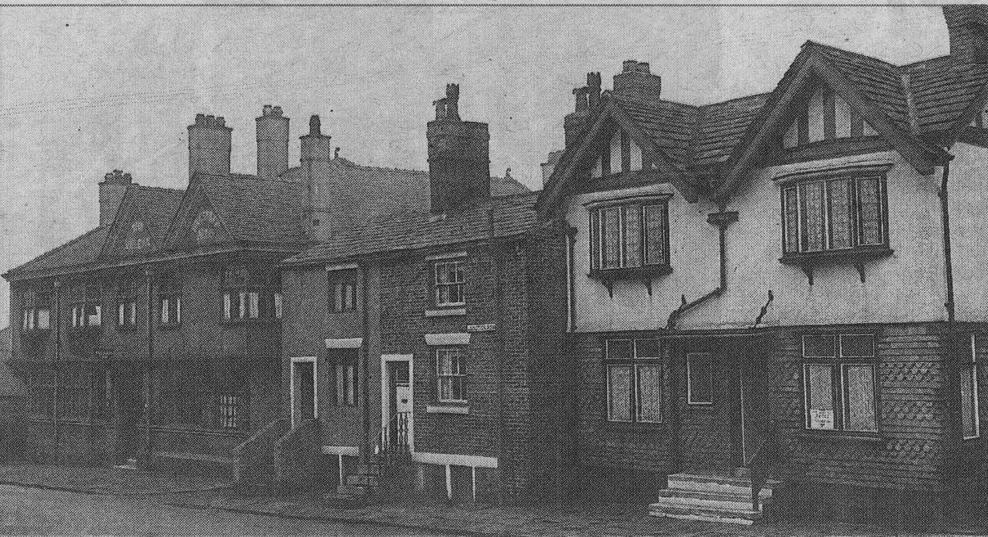
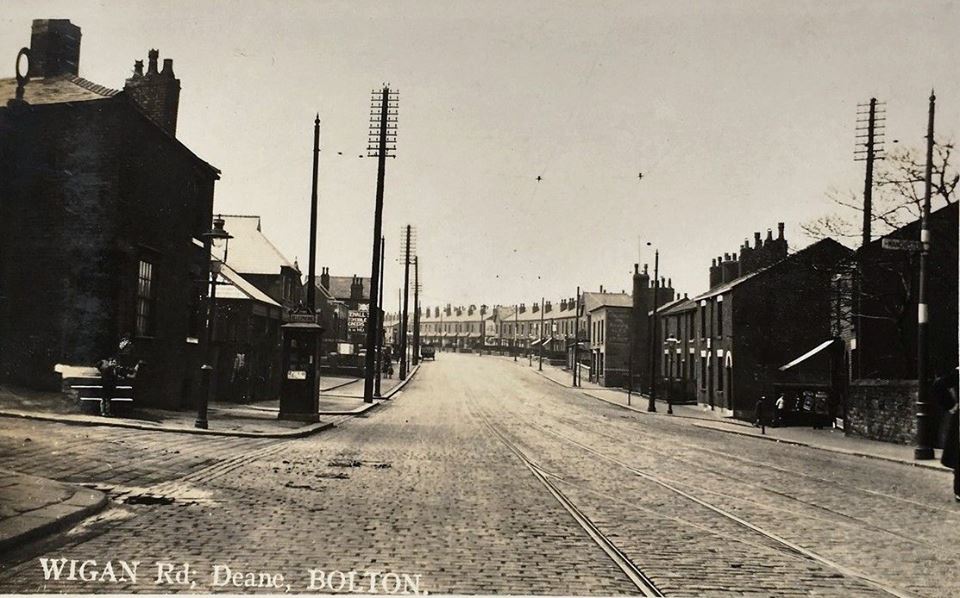
32 Wigan Road
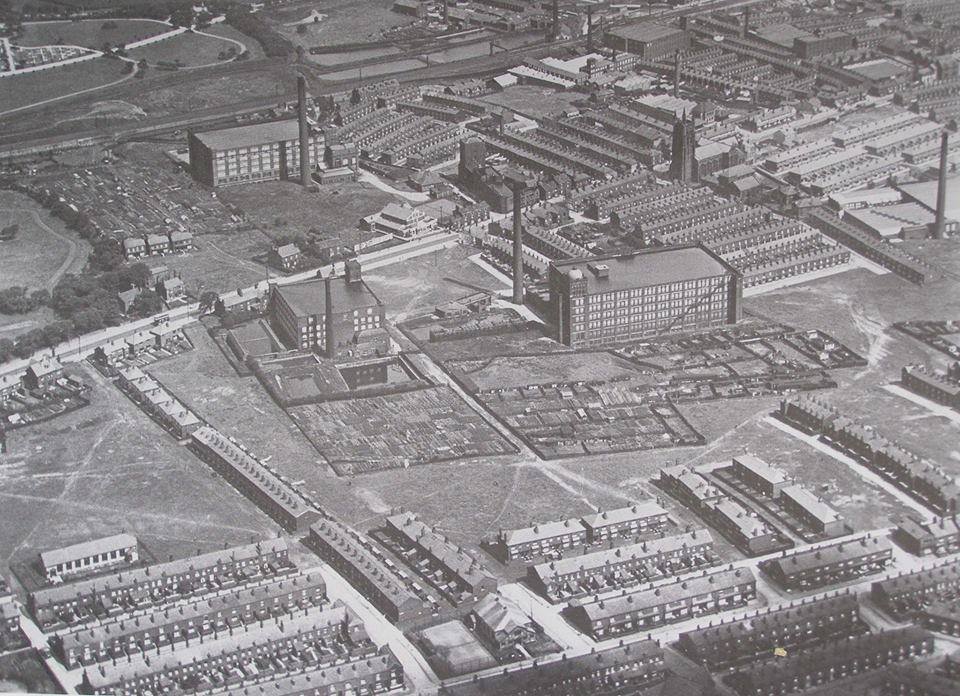
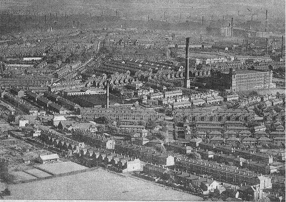
Wigan Road (to the left) and Deane Road from mid left to top right. Top left corner is the corner of Heaton Cemetery and below it the edge of Haslam Park. In from there is Croal Mill before a couple of additions. The mill below it is Deane Mill and to the right of that I only know as "a cotton mill". On the road between the mills is the Deane Weleyan Methodist Church founded in 1867 further to the right on Moss Street later named Fern Street. The building we see dates from 1927 but no longer exists.
The very dark smoke blackened houses at the bottom right contrast with newer buildings higher. It is perhaps a surprise to see quite so much empty space. Most of the houses pictured still stand and many more have been added. Croal Mill remains but the other two do not.
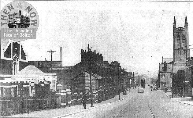

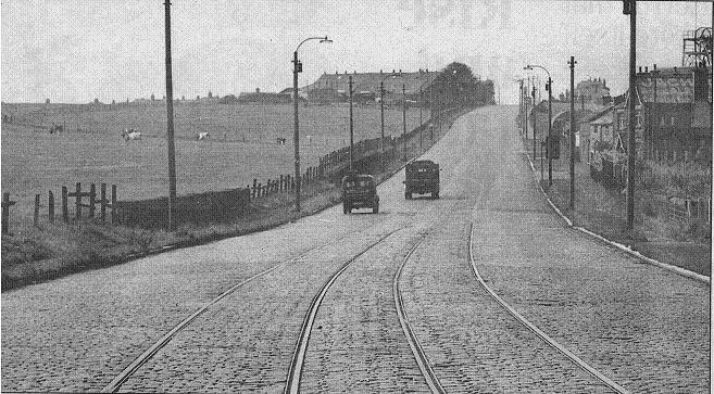
We are looking down Deane Road into town from the point where it becomes Wigan Road, in 1939 when the Methodist Church was there and in January 2021.
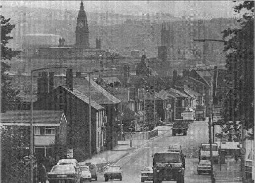
A view in 1987with the Town Hall and the Parish Church clearly visible. The gasholder is off Folds Road. The Spa Road Gasworks are just off the picture to the left. The hills around Breightmet and Affetside make up the back-drop for this picture.
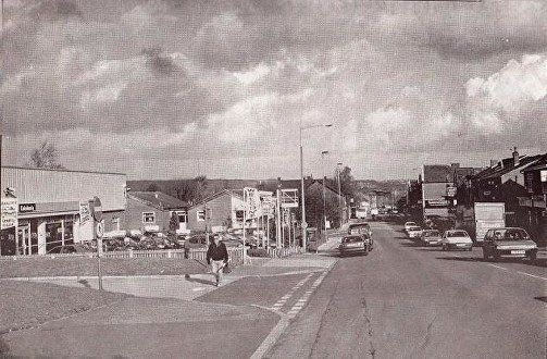
One more view towards town while the building to the left which became Bolton Blind is Caledonia used cars.
1952 - We have now reached Haslam Park (behind us and to the left.)
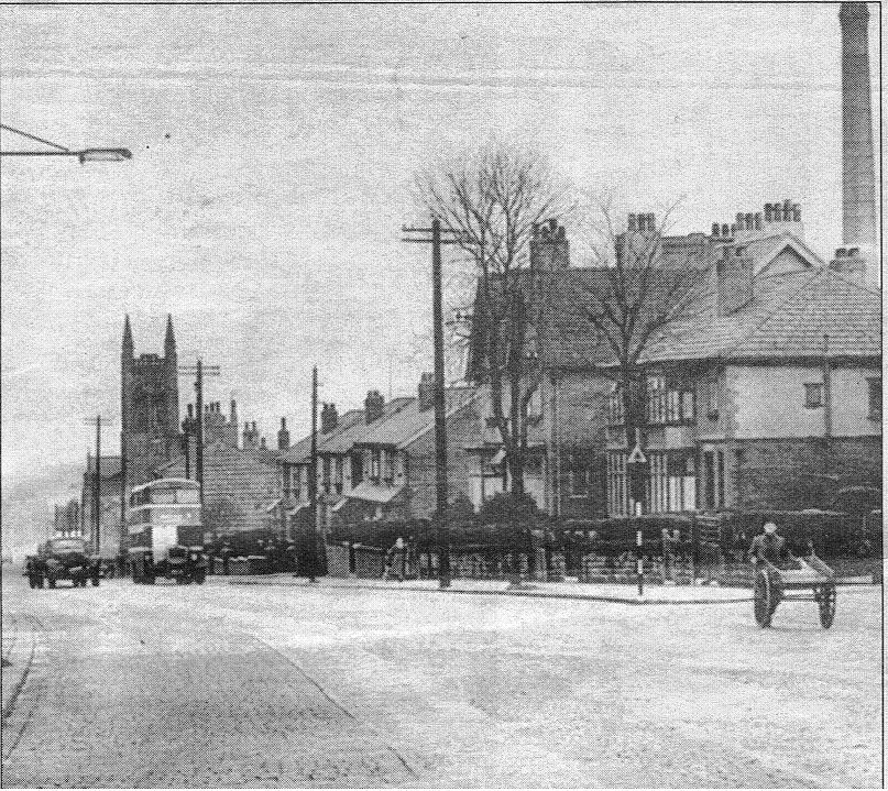
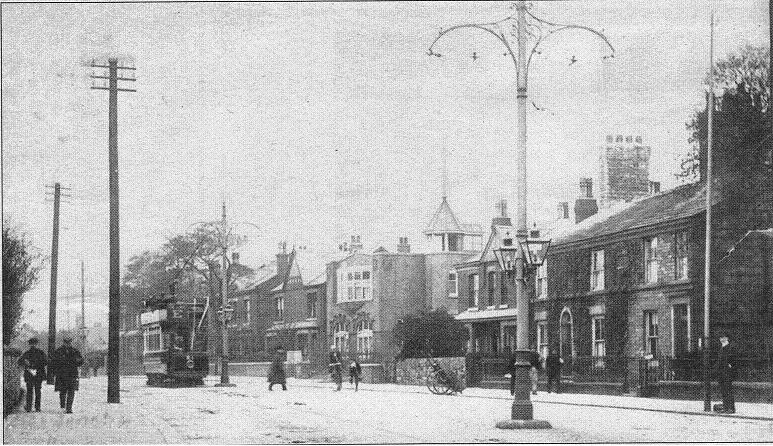
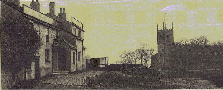
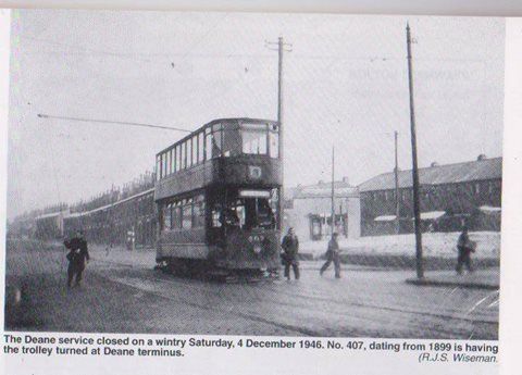
Our last look at Saviour's Church and the big chimney. The road is cobbled and we seem still to have tram lines or at least can see where they were. We note the man with the barrow and the old rectangular road signed topped by a triangle.
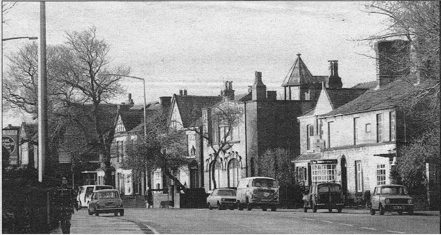
Same houses in 1986. The chimney and the church have both now gone as have a couple of trees.
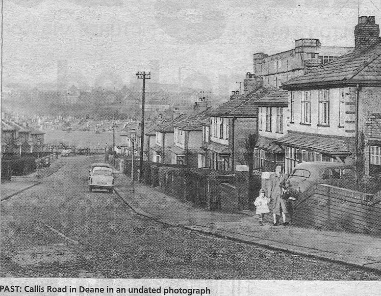
To the north of Deane Road, that is on the left relative to the above picture but on the right as you travel up the hill is Callis Road. The mill is Croal Mill.
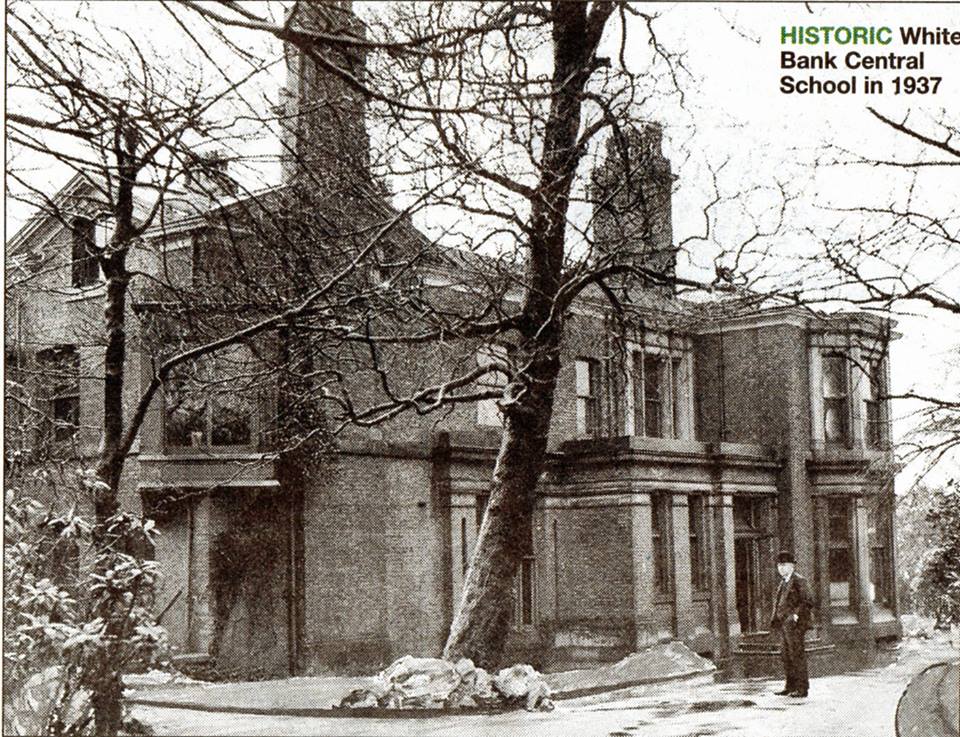
Haslam Park had been the White Bank Estate which was a farm owned by the Blackburne family. It was bought in 1838 by Joshua Crooke, a cotton mill owner, who replaced the farmhouse with a mansion. His eldest son Joseph became a Bolton MP. When Joshua's widow died in 1871 (1870?) the estate was bought by her Grandson, William Haslam. It was presented to the town as a school and park by Mr Lewis Haslam MP in 1922 (or 1920 with the park and school opening in 1922).
The house with additional buildings was used as Whitebank School (boys' secondary). The hall has now been demolished and the school is now Haslam Park Primary School.
Lewis Haslam (1856-1922) was a Liberal MP in Monmouth, Wales 1906-1918
Sir John Haslam (1878-1940, half-brother of Lewis Haslam) was Conservative MP for Bolton 1931-1940 (died)
Joseph Crooke 1809-1884, eldest son of Joshua Crooke, was a Liberal MP for Bolton1852-1861 and a member of Bolton Council 1868-71.
A branch of the Haslam family went to Preston and Preston also has a Haslam Park given to the city in a similar manner.
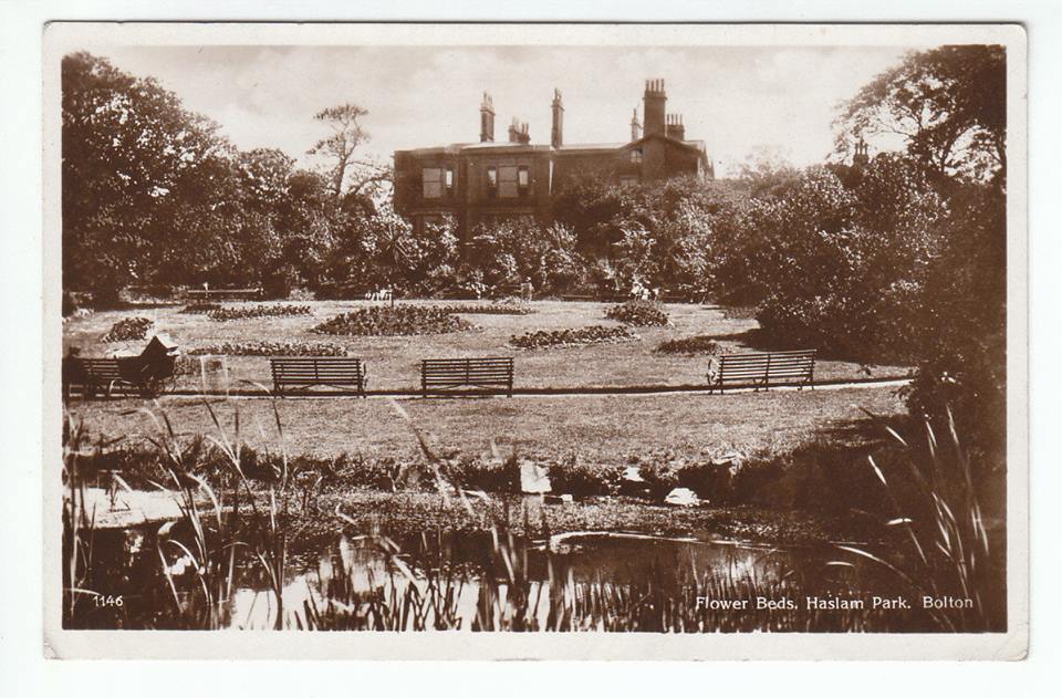
One of David Whenlock's postcards
The pond, flower beds and Whitebank Hall in Haslam Park.
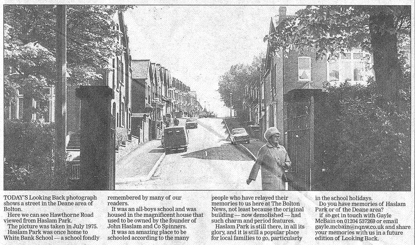
July 1975 - This was the main gate into Whitebank while it was still a private residence. Hawthorne Road is directly across Wigan Road.
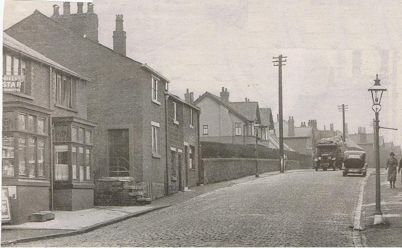
1980s The block immediately up from Haslam Park. What has for many years been Cafe Vienna was Anne's Pantry. We have Grange Road then the terra-cotta Orient House. It shares its name with Orient Mill on Brandwood Street, five minutes walk towards St Helens Road.
Orient Mill was a cotton mill run by Robert Farnworth as Robert Farnworth Ltd. Robert and wife Ann lived in Orient House and are presumed to have had it built. They retired to St Annes.
The structure on top of Orient House was the subject of a long-drawn out discussion in the Bolton Evening News as to its purpose. Bove cote, gazebo, observatory? The truth is far less interesting. The roof is flat and accessible. This was a shelter over the trap door over the stairs leading to the roof.
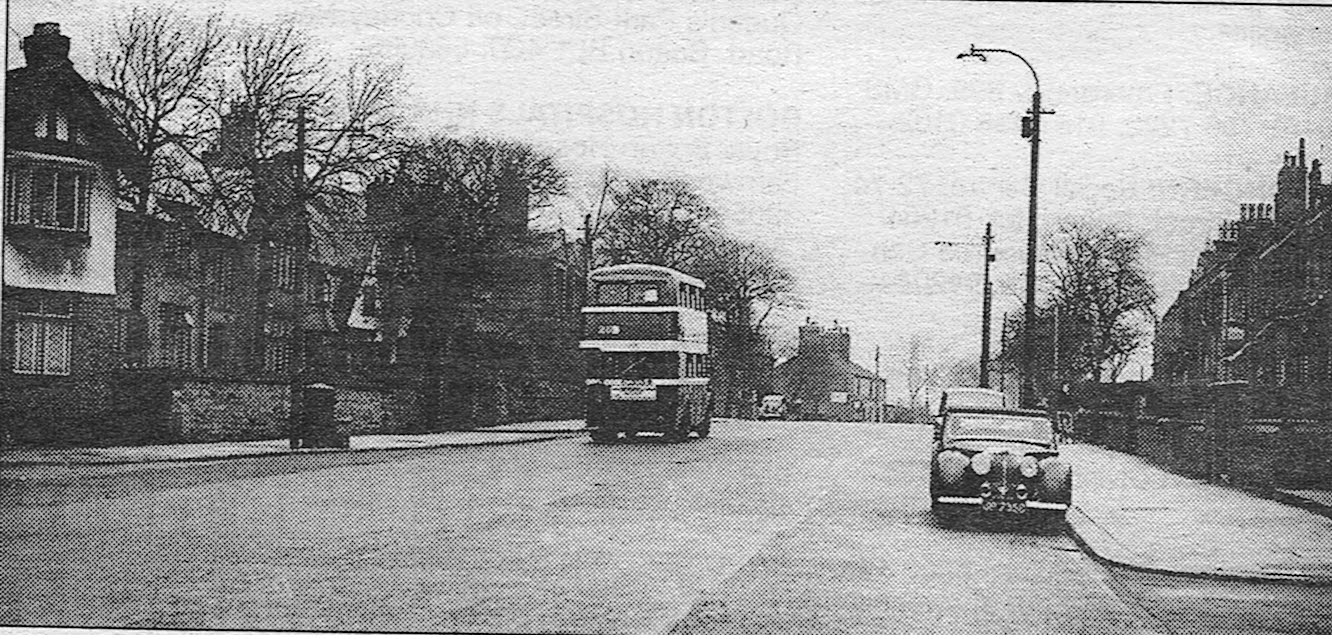
c 1906 almost identical view. We note the open top tram - ideal for this snowy day! E for Deane also later continued to Westhoughton, D had already been used for Dunscar - the very fancy poles supporting the lamps and tram wires - and the flag pole on top of the "gazebo".
1976 no flag pole, no tram wires.
1950s we move on about 300 yards and look back towards Haslam Park. Junction Road goes down to the left and Deane Church Lane is on our right. Not much different today but a lot quieter then.
Triumph Renown facing us. (?)
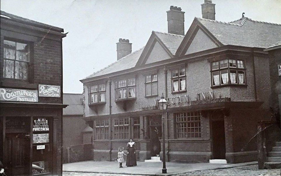
Top of Junction Road. The Vulcan Inn at the left. 1953?
Top of Junction Road. The Vulcan Inn with what appears to be the carefully posed landlady and daughter.
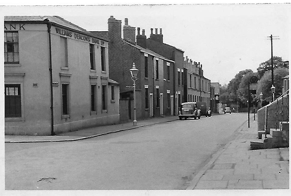
On the left we have the end of the wedge shaped building that for many years was the Williams Deacons / Royal Bank of Scotland branch. At this time it is a sweet shop or grocery store (it sells Bovril as well as Rowntree's Pastilles, Rowntree's Cocoa and Fry's pure cocoa.)
This is a picture from David Whenlock.
Looking down Junction Road towards the gate of Deane Church.
The building in the wedge is now Williams Deacon's Bank.
David Whenlock's picture.
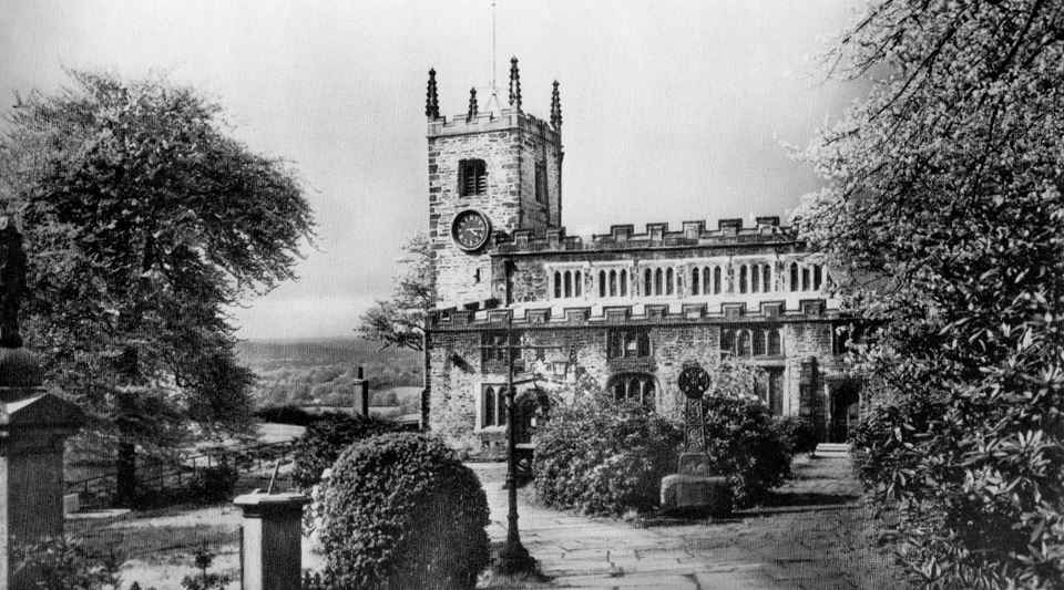
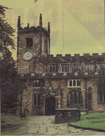
Deane Church - the Parish Church of Saint Mary, Deane.
Picture posted on Facebook by Edward Thompson.
Below Deane Church is Deane Clough the the King's Head
As we climb out of the dip around Deane Clough we have a view that was once very familiar because at this time it was the normal route to Beaumont Road.
Beyond the lorry we come to "Millionaires' Row and New York.
Date probably 1920s.
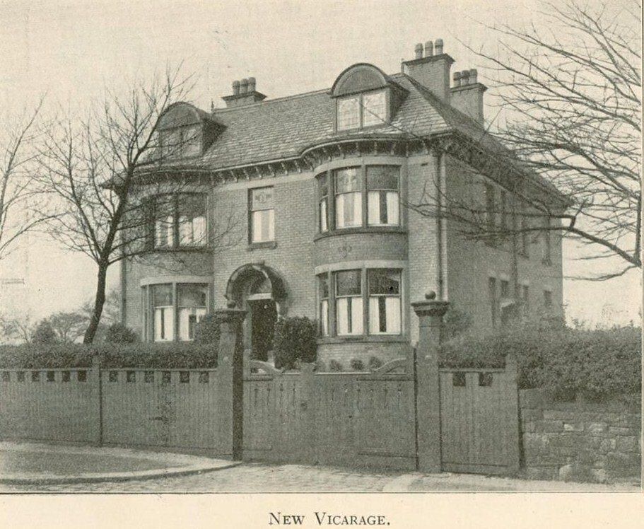
On Junction Road, "Millionaires' Row" we have Bakewell's which was built as the Deane Church Vicarage.
It has been a residential home for many years.
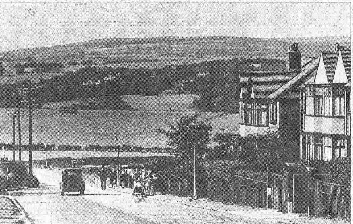
We carry on along past New York and Junction Road takes a sharp right turn down this hill with a great view across the fields and on to Winter Hill.
The line across the field is where a steep drop down to the Middlebrook and the railway starts. The Deane Golf Club later extended across here. Everywhere else is covered by the Ladybridge Estate.
It's That Man Again
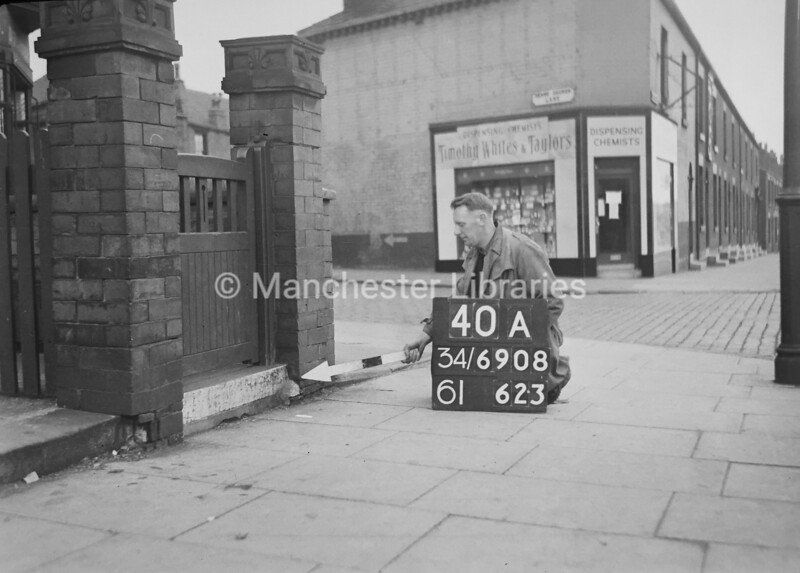
Clear picture though of the junction of Wigan Road with Deane Church Lane which round the corner divides into Willows Lane and DCL which goes through to St Helens Road at Daubhill Station.
On the corner is Timothy White's and Taylor's chemists. That corner is still a chemist but now it it Boots.
So we will detour for a moment up Willows Lane an ancient thoroughfare which over much of its length divides Deane from Daubhill and at its far end divided the town of Bolton from the township of Rumworth (and Daubhill).
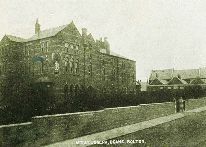
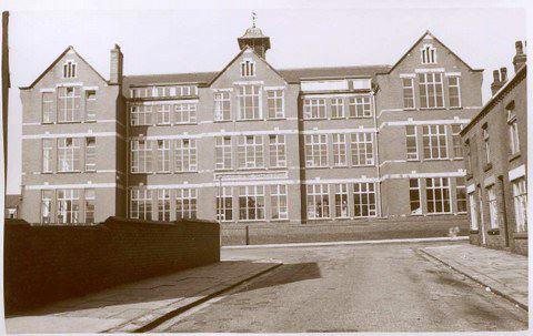
Mount Saint Joseph's School, Willows Lane.
A convent was established on Willows Lane by The Sisters of the Cross and Passion (this order being founded in Manchester in 1852).
In 1902 a school was set up in a cottage in Avery Terrace, Willows Lane, with five pupils. It was re-established more formally as a Catholic Girls Secondary School in 1905 with 67 pupils about half the number the building was designed for.
For many years the Headmistress and most of the teachers were nuns.
In 1912 a new wing was added to accommodate boarding pupils but this was converted to classrooms in 1948. More building in 1931 provided kitchen, dining room, gymnasium art room and domestic science. . After WW II it became a direct grant school and became comprehensive in 1979. The school moved to Minerva Road close to the Royal Bolton Hospital in 1988 run jointly by Bolton Council and the Salford Catholic Diocese.
A small group of nuns remained on Willows Lane for some time but the buildings were sold to become an Islamic Education Centre in 2005.
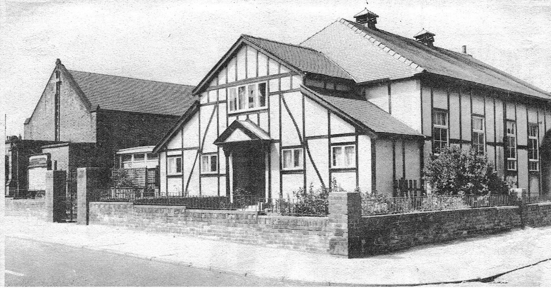
Melbourne Road Methodist Church. The black and white building was the original church dating from the 1930s. The building to the left is the new church built ?1970s. The old building continued to be used for some time for social activities but became disused. Attempts were made to sell the building but it was eventually demolished and now flats occupy the site.
Although the congregation remained fairly strong, the church building suffered large amounts of vandalism and the sad decision was taken in 2019 to discontinue that work and amalgamate with St Helens Road Methodists about half a mile away.
Nov 1960
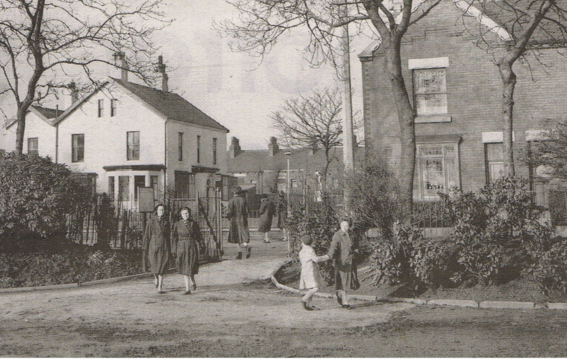
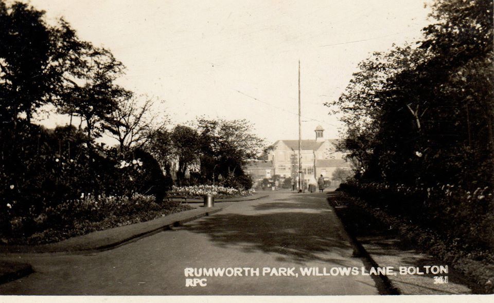
Willows Lane gate of Willows Park (Rumworth recreation ground). The white building had been the manse for St George the Martyr’s. It became the Willows pub but was closed by 2010.
Click and navigate
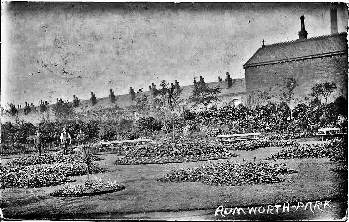
Willows Lane, Willows Park, more correctly, Rumworth Park. It used to have an open air swimming pool, still there when I was young but never with water. The end wall of a shelter which was in effect the changing rooms is still there on Hawthorn Road.
1 the entrance from Hawthorne Road looking towards Brandwood Street School.
2 David Whenlock Postcard. The houses are probably on Willows Lane but might be Hawthorne Road.
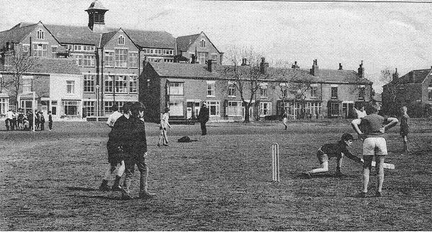
3 May 1969 Willows Park playing field, seems to be grassed, it was cinders when I walked to it each week from St Bede’s.
Brandwood Street School is clearly seen.
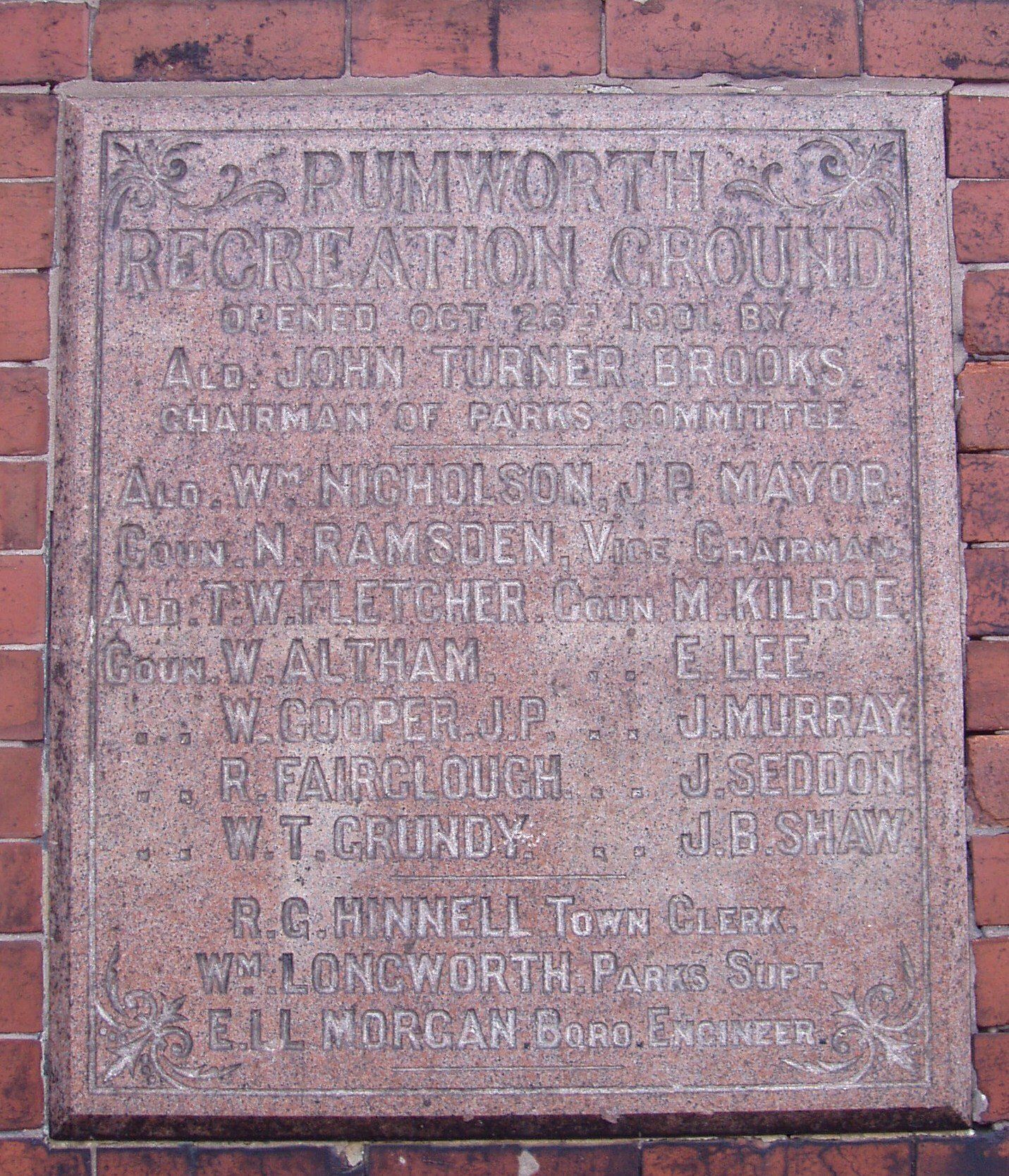
4 The plaque on the back of the swimming pool shelter. "Rumworth Recreation Ground / opened October 26th, 1901 by / Ald John Turner Brooks / Chairman of Parks Committee......."
Brandwood Street School.
Brandwood Street is across the picture.
Nat Lofthouse attended this school before going to Castle Hill Secondary School.
Picture on the Daubhill pages.
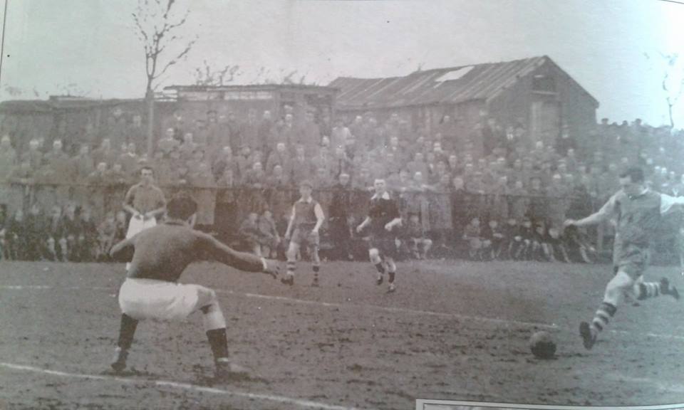
Immediately south of Willows Park was Daubhill Athletic football ground.
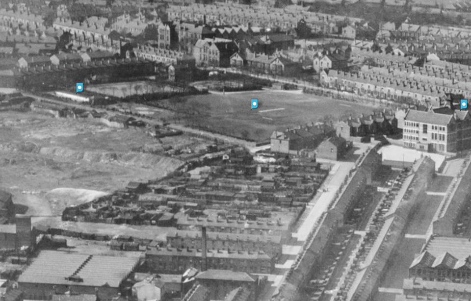
Willows Park (Rumworth Recreation Ground) is in the centre of the picture. Willows Lane runs across the picture about 3/4 up. Brandwood Street runs up from the bottom near the right hand side.
from left to right the blue blobs are
the swimming pool
the cinder surface playing field
Brandwood Street School
At the left side we have the shale 'ole. This was a quarry that had been used to obtain clay by Higson's brick works on Bella Street. The Daubhill Athletic football pitch was constructed on the edge of the shale 'ole facing the park.
Back to Wigan Road with Hulton Lane on the left.
The pale slightly odd shaped roof to the left of the telegraph pole and tram cable pole is the Co-op.
The Deane tram at the end of Hulton Lane, the closest buildings on the previous picture having been demolished. The trolley is being reversed for the journey in the other direction.
D was Dunscar. E was Deane. So??
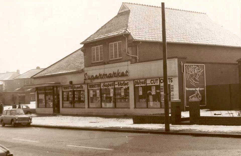
The Co-op. Picture posted on Facebook by Stan Vanhoogstraten.
The Co-op in a rather overpowering blue when this became the corporate colour and the new format of co-op was adopted.
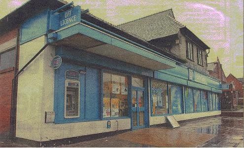
Was it later green?
It is now rather less strident.
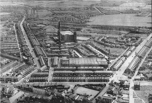
1951
The co-op is at bottom right. To its left a bus is using a turning circle on what is now a car park
Deane Church Lane snakes up the left side.
Dove Mill is more or less central and still has its chimney. Closer to us is Wharf Mill.
Beyond the mill is a quarry. This was also used as a source of clay by Higson's brickworks. It was connected to the "shale 'ole" by a miniature railway which passed under Deane Church Lane. The quarry was later used by the corporation for land-fill then grassed over. For a very short time it had a rugby pitch on it. In 2021 an estate of around 300 houses is being built here.
Beyond the quarry is a black line which is actually a fence constructed of tarred railway sleepers. Between this and the quarry was a path locally known as the "switchback" the somewhat undulating nature of the black line hints at the reason for the name. Over the fence but not visible as it was in a cutting is the railway from Great Moor Street Station.
Beyond that, what looks rather like a lake is the Hulton Lane Playing Fields. Smethurst Lane is clearly visible going up to the fields of the heights.
1954
A little higher up Wigan Road, rather different angle brings in Brandwood Street School and Swan Mill. In the foreground, Rumworth Hotel
Oct 1955
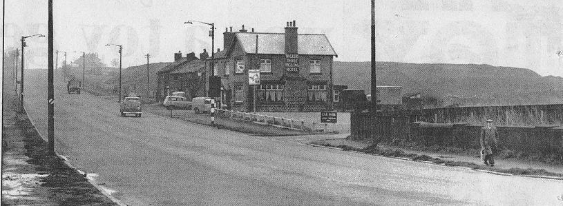
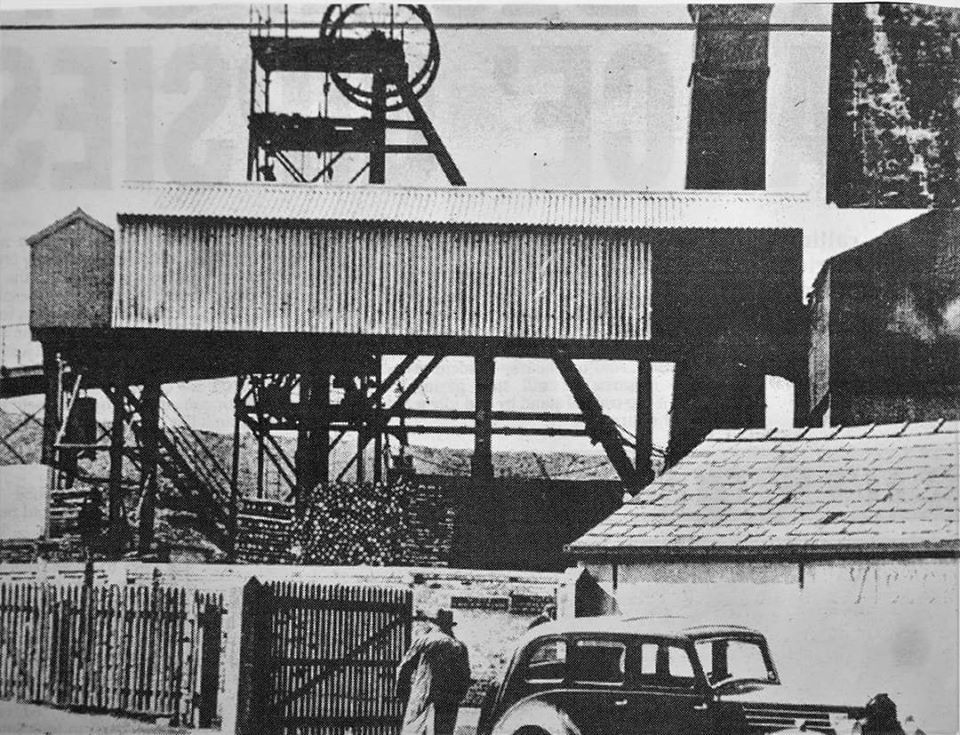
Just beyond Beaumont Road, at Knutshaw Bridge, looking towards Westhoughton. The Three Pigeons pub is there but just behind it is Victoria Colliery (Deane Pit, the smallest mine in the Manchester with a weekly output of 1000 tons produced by 135 men. The BEN of 16 November 1959 reports that it is scheduled for closure as part of the scheme to reduce output) now the site of the Barton Grange Garden Centre (now Bolton Garden Centre). The cobbles are very uneven and the tramline, still there eight years after the last tram ran seem to come to an abrupt end. We still get cows in that field, though more often sheep and on odd occasions, elephants. At the top of the hill on the left, the farm buildings are rather more substantial than what remains now as the Farmhouse Restaurant. Further left the chimneys of houses on the Hunger Hill estate are just visible above the skyline. Just further up the road, another colliery, Chain Pit at Hunger Hill had the distinction of being the last in the country to employ women and children (underground?).
1966
The Three Pigeons is little changed except that the cottages beyond the main building are now a car-park, but behind it is a slag heap which is all that remains of the Victoria Colliery (Deane Pit).
1951
We have a closer view of the houses attached to the Three Pigeons a year or two earlier
Victoria Colliery
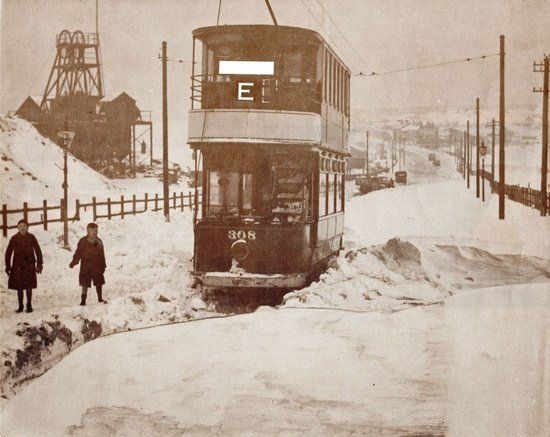
Tram 308 on route E in the snow near Victoria Colliery. Probably 1940.
1951
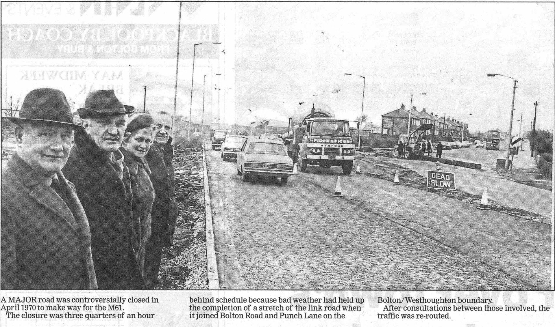
Over the top of the rise to Lock Lane, this is looking back towards Bolton with Lock Lane (a little still cobbled country lane leading round the back of Rumworth Reservoir to Chew Moor) on the left and Hunger Hill estate on the right. Tramlines remain though not in use, but it appears only to be single track. Nowadays when heading away from Bolton, we go down this hill to the M61 then continue dropping slightly to the A6 at Chequerbent. We forget that Wigan Road was cut in two by the M61 resulting in great protests from the people of Snydle (Snydale) on both sides of the motorway because they were being cut off, the Wigan Roaders cut off from Westhoughton and the Snydlers cut off from Bolton. In the event they are probably quiet glad in the quietness of their respective isolations. But we forget that not far behind the stand point of the photographer the original Wigan Road began to climb again, quite steeply....
1970 Traffic is diverted from the original A58 (rising to the right) onto the new road going to the M61 island and the new Chequerbent island.
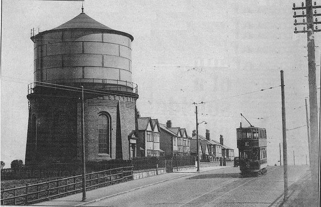
1939
Continuing up Wigan Road, at this point Bolton Road, Westhoughton we pass the local landmark of the Snydle water tower, now converted into a house although the original plan to keep it intact, retaining the the metal tank as well as the brick base was not allowed. The tram track is clearly one way. The tram is “E” and it goes into Westhoughton past the White Horse.
It is still a landmark of being nearly home when you see it from the M61.
1937
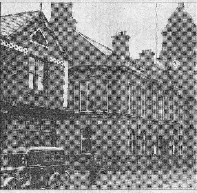
So here we are in Keaw Yed City, Market Street and the Town Hall.
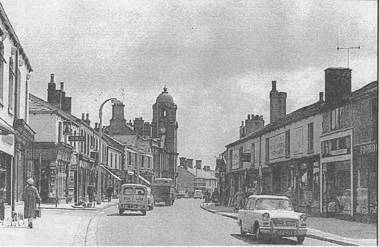
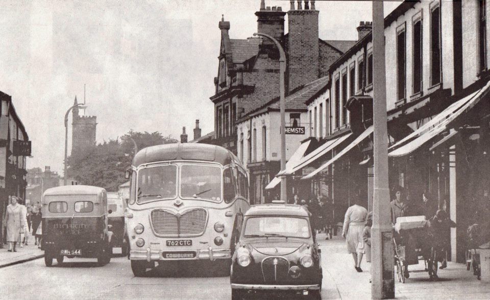
Back off a little along Market Street
1959
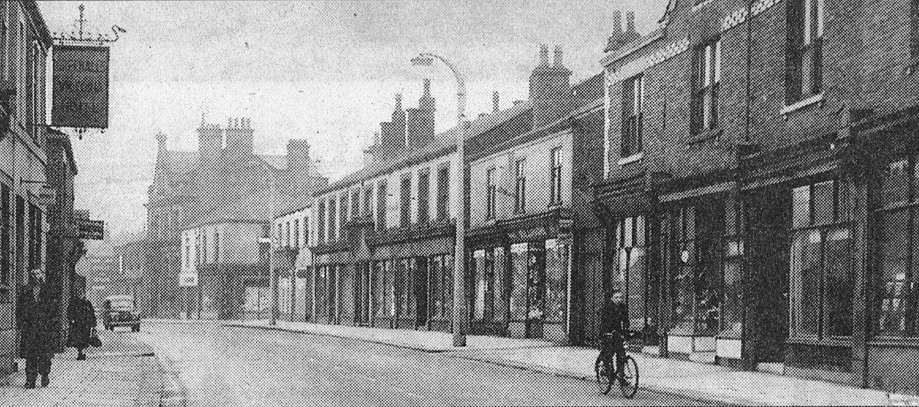
Looking towards Wigan, the original caption says, “No shortage of shops in Market Street.”
1969
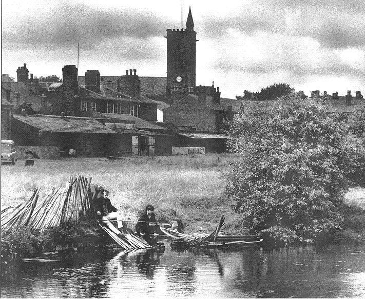
“Fishing in an old lodge near Westhoughton cricket ground”
Is the Bolton News caption for this picture - before the cricket moved out of town so that Sainsbury's could be built.
And with a last look at Westhoughton church's unusual spire on a tower, this is the end of our journey.
On the next page we begin a stroll along the River Croal from its source as the Middlebrook at Red Moss to its confluence with the Irwell near Kearsley.