30 St Helens Road
Click an image to see it full size. Navigate with < > Exit with X < > will appear if you move towards the left or right side of the enlarged picture.
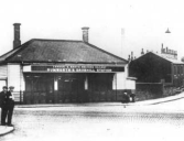
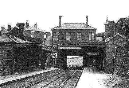
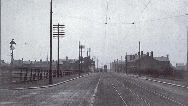
1. Rumworth and Daubhill station
2. Deane Church Lane alongside the station 1949
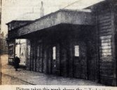
3. Daubhill Station - picture posted on Facebook by Peter Haslam showing the “To Let” sign displayed outside the booking hall at Daubhill Station. Clearly the station is now closed to passengers but trains are still running and there are no immediate plans to demolish the station.
4. Deane Church Lane up the east side of the station. posted by Gene Watts
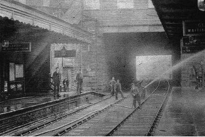

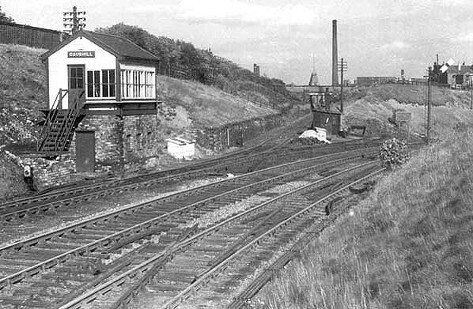
1. Rumworth and Daubhill Station in 1952 looking along the lines, open and functioning posted on Facebook by Steven Buckley
2. probably 1950 Daubhill Station looking along the lines, open and functioning, man with hose-pipe
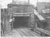
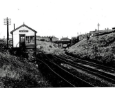
3 and 4. Daubhill Station in process of demolition while the line is still in use, 1955. The Station had closed in 1952.
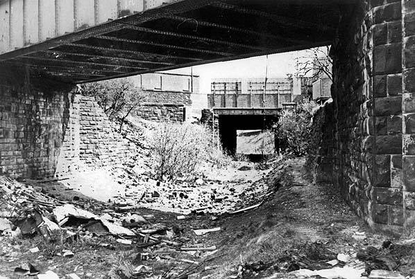
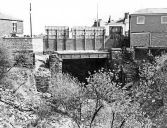
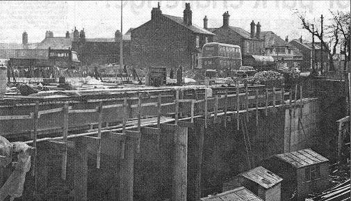
1. 24Oct1978 picture from Tom Openshaw; the nearer bridge is at the bottom of Longfield Rd; the further bridge is where Daubhill Station had been, on the left corner of Deane Church Lane.
2. View from behind station with Deane Church Lane on the left, looking towards Morris Green. The station has been removed and in-filling the cutting will begin later. Picture posted on Facebook by Stephen Southern.
3. 1952: 150 yards behind Rumworth and_Daubhill. At this point the original, 1828, line goes straight on to the Daubhill level crossing, Sunnyside Milis and Daubhill coal yard while the 1885 diversion swings right to go under St Helens Road at Daubhill Station
4. Daubhill signal box and junction between the 1828 and 1885 lines. To the right the bridge you can see is Longfield Road, the station sits atop of the St Helens Road bridge about 30 yards further on.
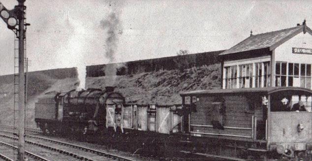
1. Loco and coal wagon at Daubhill signal box, the one seen on previous page going across the level crossing
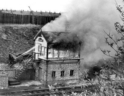
2. Daubhill signal box fire 1965 Darren Clayton.
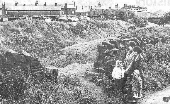
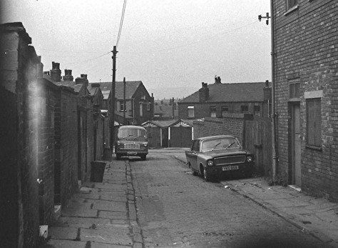
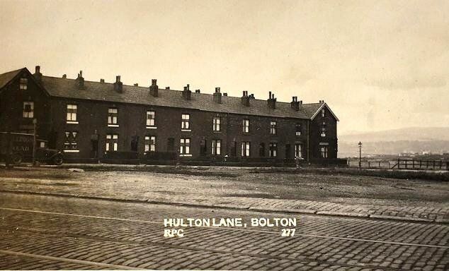
Daubhill railway line July 1972; Olwyn Carroll & Joanne (3). Brenda Lee & Amanda (4) standing on Bert Street. They had complained that the broken down wall made easy access for children to a hazardous area for children. We are looking across the 1885 and the 1820 lines. The row of houses with lots of chimneys is Jubilee Street overlooking the old line and the coal yard. Part of Daubhill Bridge where this line went under Deane Church Lane can be seen.
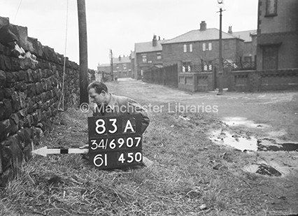
Bert Street – several hundred pictures of this man and his colleagues as they marked locations for Ordnance Survey were released on the internet recently.
The railway is over the wall at the left and we are looking towards St Helens Road.
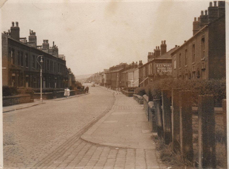
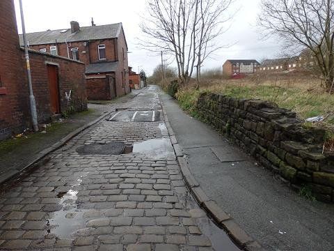
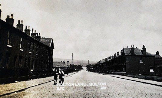
Bert Street in February 2020 (C)WDC. This street runs alongside the railway as far as the Hulton Lane Playing Fields.
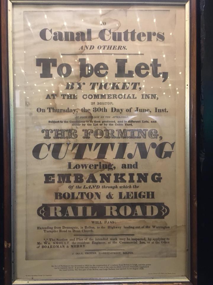
Advertisement poster for people to cut and embank the line of the Bolton-Leigh rail road posted on Face book by Linda Hope who saw it in the Giddy Goose, Teneriffe.
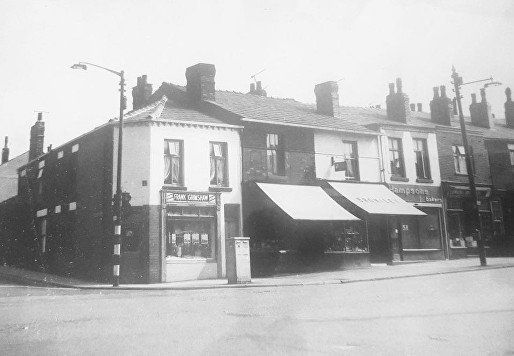
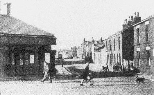
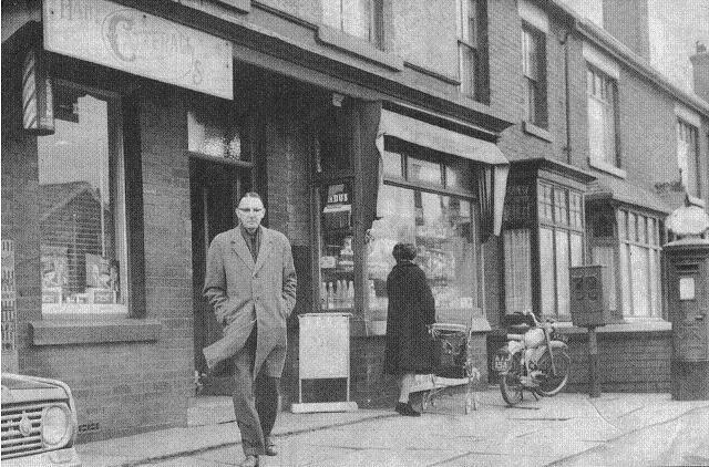
The corner of St Helens Road and Morris Green Lane with Frank Grimshaw’s butchers on the corner. Hampson’s looks empty.
Bottom of Morris Green Lane looking across to Deane Church Lane, decorator’s shop and “Harlequin”, numbers 2 and 4 Morris Green.
Posted on Facebook by Gene Watts
Morris Green Lane, left hand side, next block up from Woodbine Road.
Shop window says, "The Book Exchange".
(C) Kenneth Taylor, with permission.
Morris Green back street further up than Woodbine Road and Pelham Street with Scott’s pop on the right. The gable is the Co-op “stores” on the corner of Woodbine Road. The row of houses behind the garages is the back of the old side of Woodbine Road.
Lots of "Grimstone" garages were erected in the 1950s/60s. The ones which can be seen replaced earlier tarred, wooden ones on which cricket wickets were regularly chalked to the great displeasure of the owner. There was a very good chance of knocking the ball over the wall into Scott's yard. The batter then had to climb over and find the ball and be awarded "six and out".
Posted on Facebook by David Whenlock


click and navigate Pictures from a photo album in the possession of Gene Watts.
1 Down Woodbine Road, past the three pairs of semis was the “bottom field” and the hen pens. Across the railway can be seen the Sunnyside Mills with its chimney and the bottom of Nixon Road.
2 Woodbine Road bottom field and hen pens with the bridge over the railway that never came into use presumably because the original plan to extend Woodbine Road never materialised.
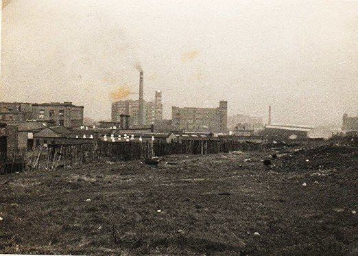
3 Woodbine Road terminated at the end of the single terrace of houses (“Skennin’ Row”) then continued as a narrow path past the hen pens down to Ellesmere Road where a short street was again called Woodbine Road. Clearly someone, sometime intended this to be a through road. It never materialised though in the late 1900s more houses were built at the Ellesmere Road end. The path was blocked off in the 1960s. Beyond the pens and over the railway we can see a number of buildings of Sunnyside Mills. We can also see Swan Lane Mill, the Sunnyside Hotel, Townson’s wood sheds and Orient Mill. Up on the right had been Lomax’s football field later occupied by Evans’s waste paper
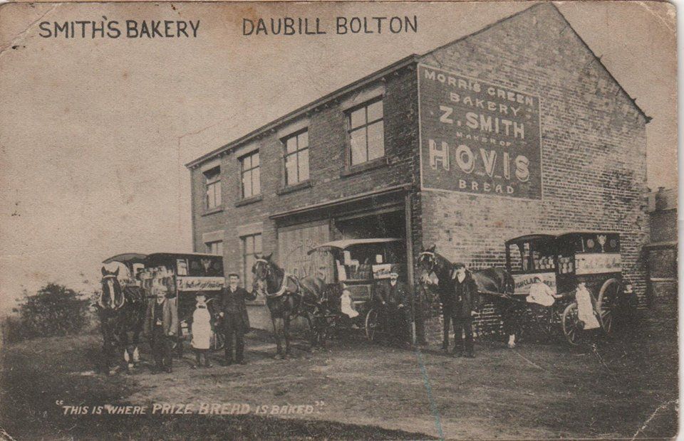
Hovis, Z Smith's bakery, somewhere in the area. (Gene Watts)
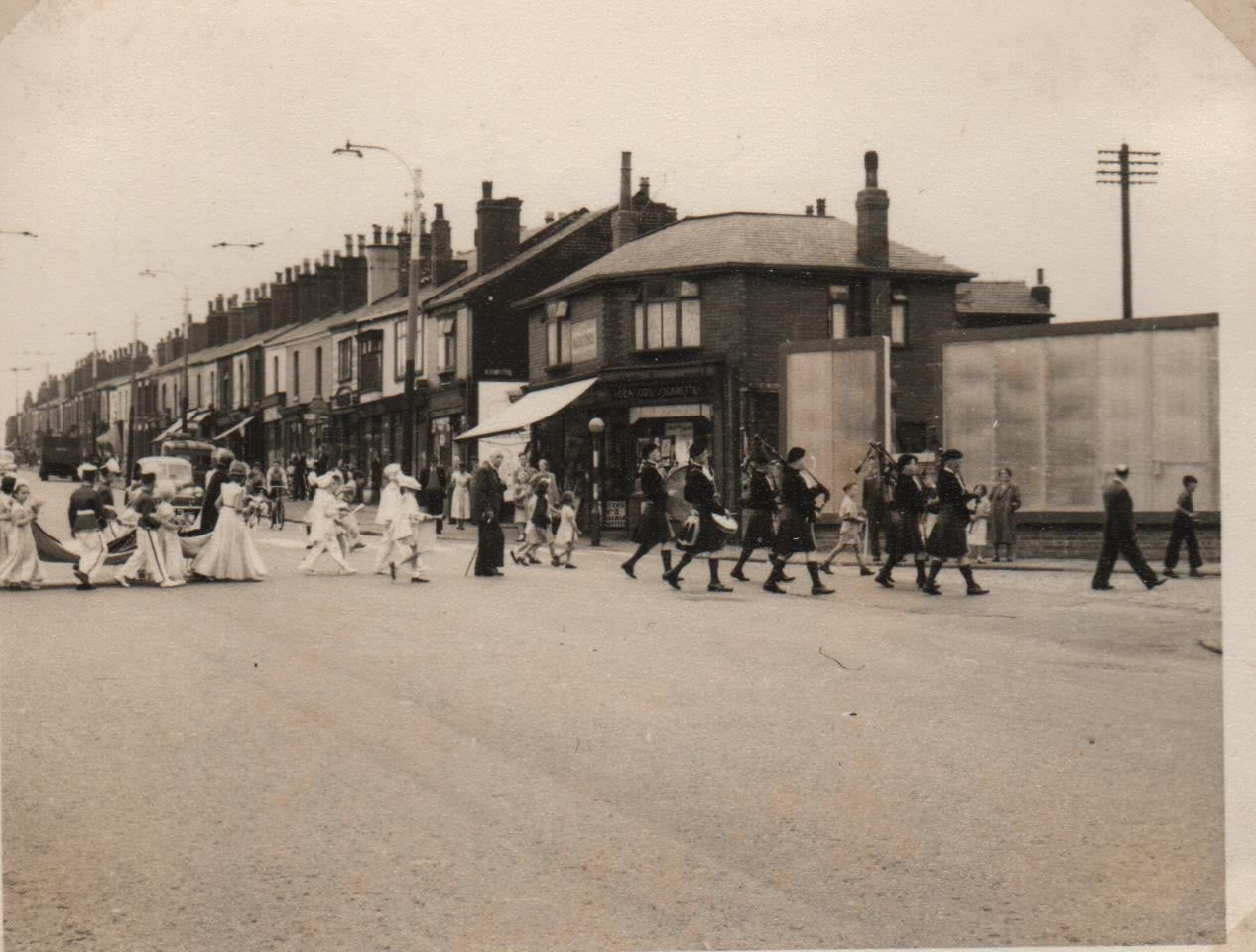
Back onto St Helens Road. Sermons Day, sometimes called Walking Day. From mid May to late June not a Sunday went by without the sounds of a band and awareness that it was Sermons Day for one of the local churches. Sometimes two in a day, indeed some churches had a "Walk of Witness" in the morning and another in the afternoon.
Which Church? Only clue is that they have a Rose Queen or Sermons Queen; some churches certainly did not. Date? After the station had been demolished.
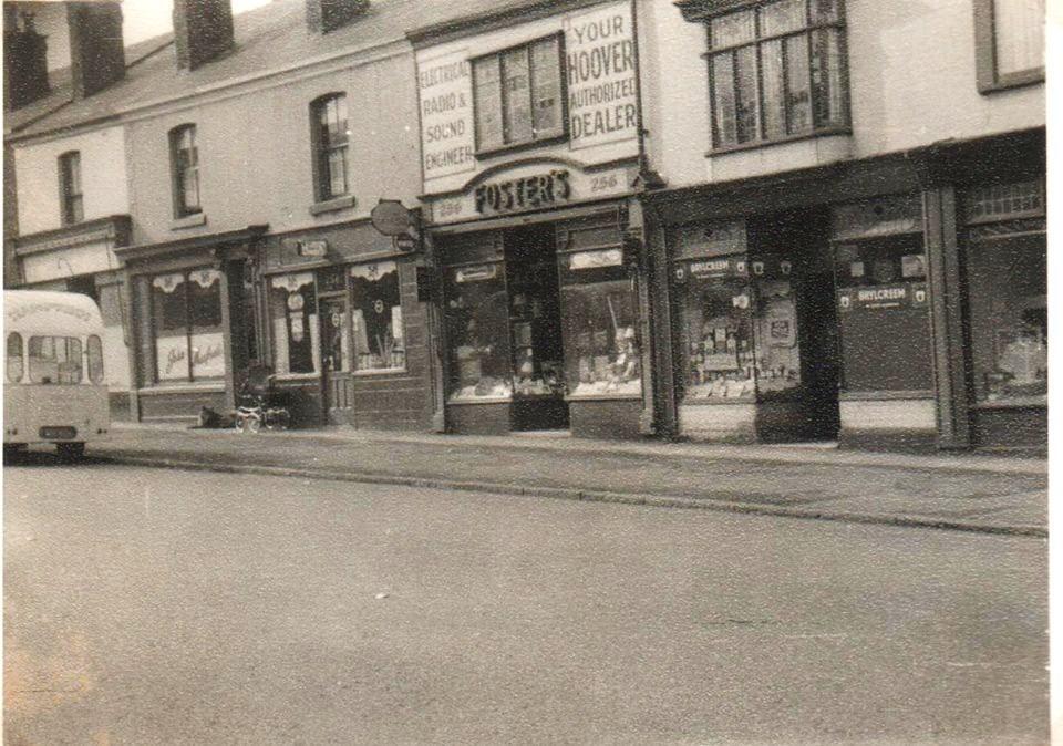
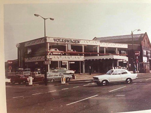
We proceed a short way up St Helens Road. On the right side of the road is Manfredi’s Ice-cream Parlour. We also have Foster’s electrical goods and Kemp’s barbers.
Picture posted on Facebook by Gene Watts.
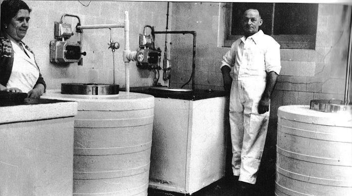


1.Manfredi’s - Giuseppe (John), founder of company, and wife Cesira. Giuseppe was interned in 1939 but released after 18 months. (click to see Cesira).
2 Manfredi’s icecream van 1950s
3 Manfredi’s icecream van 1960s Bolton Memories 2001; 2009 reprint version ©True North Books Ltd
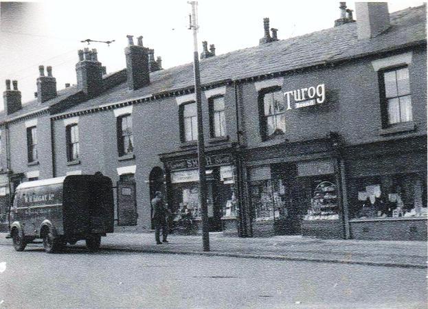
A little further up on the right hand side; Smith’s became Sykes chemist; The chemist (no longer Sykes) extended to the left. The Turog shop has been June's Bakery for many years and has added an upstairs window. Carol's Wave In occupies the shop to the left of Turog and the shop to the left of that (off picture).
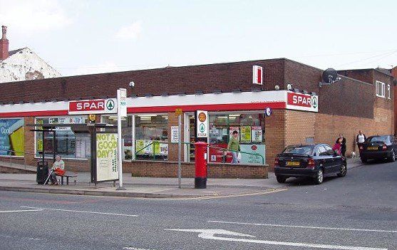
and on the left, the site of Daubhill Zion Methodist Church which opened 1884 and closed 1976. The mini-market built here began as Winwick and Giles (W&G) and after being SPAR for some time, around 2017 became McColl’s. The Post Office came into this building quite some time after it opened when the PO opposite ASDA closed and Geoff Smith Cycles extended into that shop. ©WDC April 2010
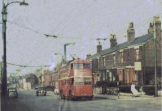
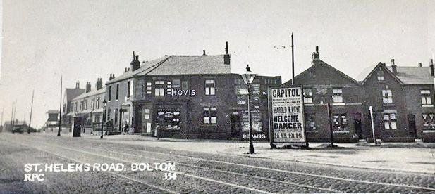
1958 Trolley bus just up from Daubhill Station, outside Dr Kirkwood’s surgery. The last trolley bus ran 31 August 1958. Lower down at Timothy White’s and Taylor’s chemists, the painted sign on the end wall says, “National Health Service Dispensing”. For years this said “Bile Beans”. 1913 newspaper advert:"Bile Beans - Cure biliousness, dyspepsia, torpid liver, sick headache, malaria, indigestion, sour stomach, bad breath, vertigo, dysentery, jaundice, enlarged spleen, drowsiness after meals, etc, without griping, sickening or weakening the system."
The gable of Daubhill Zion can be seen below the chimney.
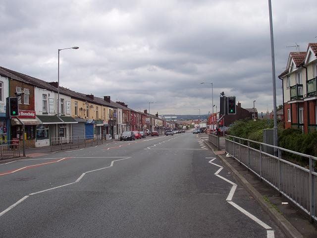
28Jun2012 ©WDC Looking down St Helens Road to Daubhill from Middle Hulton from a little above that point
Chemist, June's Carol's on the left. The square block is Park Cakes.
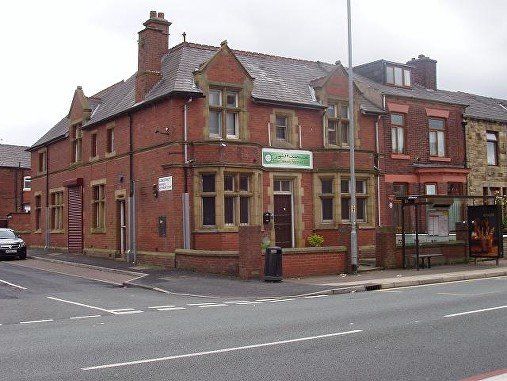
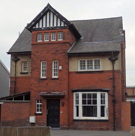
Saint Helens Road: what had been the Middle Hulton Police Station pictured 28Jun2012 ©WDC.
It is now a (Moslem) educational centre.
Aldred Street is to its left.
28Jun2012 ©WDC
Alongside the police station is Aldred Street where Haynes Street Mission had been but is now the Bolton South Salvation Army. The part at far right was very new at the time of the picture.
Haynes Street Mission had started in Haynes Street but sometime before 1950 moved to this site and their old building was then used by a sewing company. The Mission building on Aldred Street was at the far left of the picture and was rebuilt by the S.A. soon after they moved in.
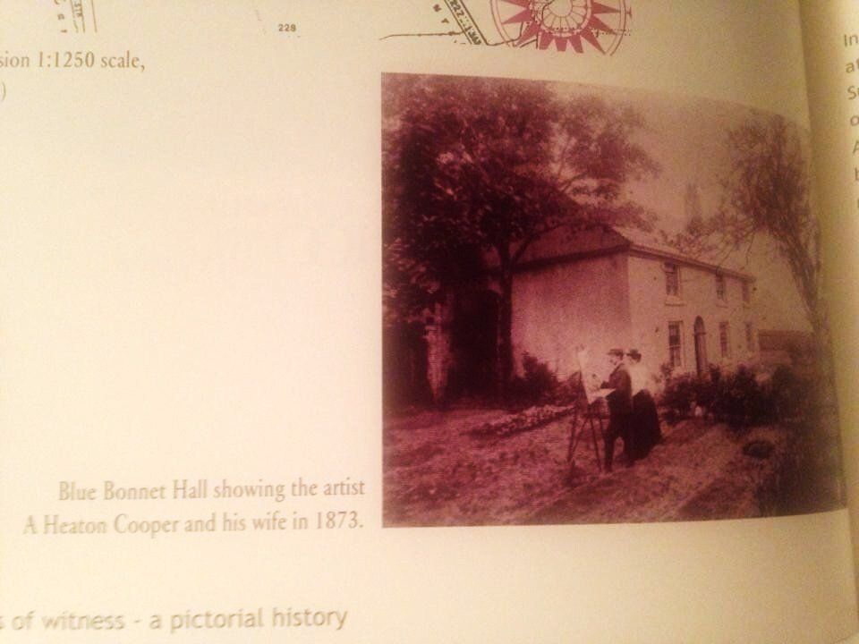
Blue Bonnet Hall was on the north side of St Helens Road immediately west of its junction with Smethurst Lane where St Helens Road takes a slight turn to the right It was a quite substantial building just called Rose Cottage but this was extended and became Blue Bonnet Hall. This was the home of artist A Heaton Cooper and his Norwegian wife. The picture (1873) is from a booklet published to commemorate the history of St Helens Road Methodist Church (at its centenary?) and was posted on Facebook by Catherine Macleod. Blue Bonnet Hall was later occupied by James Rowland Simpson “a drysalter and oil merchant” whose industrial premises were in Idle Lane off Deansgate (now Central Street).
Hulton Lane tram car shed. postcard from collection of David Whenlock. This picture is prior to 1947 but all the buildings including the tram shed still exist. If you look carefully you can see a tram, coming up on the right, but also on the left of the road a shaky looking vehicle which seems to be engaged in high level maintenance.
It looks as if the building immediately to the right of the tram shed is being renovated for its use into the 1970s as a post office. The post box is still there (2021) but was moved off the private area onto the public pavement when the PO closed.


1.This is the tram car shed not too long after tram service was discontinued in 1947. The tram height doors have gone and the interior has been divided into ground and upper storeys. Immediately inside the door is a steep ramp used to get cars to the upper floor.
2. The tram shed is little changed but a new car showroom has been built to the left. It later became a Renault Garage. Posted on Facebook by Janis Caffrey.
3 and 4. The tram shed still stands but the frontage has been rebuilt and partially covered by cladding. The showroom to the left has been remodelled and partly rebuilt and the site is now the Ummah Welfare Trust. (Ummah is all the people worldwide who are Moslem). This re-building was completed around 2014-15. The building at the right with the pointed front wall, which had been the Post Office remains essentially unchanged. ©WDC 24 July 2020.
The rear of the building is little changed. ©WDC 24 July 2020.
Across the road from the garage (Ummah Welfare) is an unusual house. The downspout indicates a date of 1901. The building was probably the manse for the adjoining Saint Helens Road Methodist Church. ©WDC 24 July 2020.
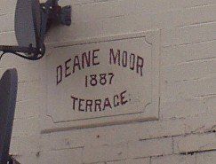
Above: A view of St Helens Road and the top of Hulton Lane immediately to the left of the tram shed (Hulton Motors), one of David Whenlock’s postcards. The hoarding advertises the 1929 film “Welcome Dancer” starring Harold Lloyd, one of first films to be shown at the Capitol on Churchgate. The wide gable has a plaque indicating Deane Moor Terrace 1887. Deane Moor was a large area from Moor Lane in town up Deane Road covring much of the area between Willows Land and the Middlebrook, widening out over the are west of Daubhill to include the Hulton Lane area and to the top of Cow Lane (where was Deane Moor Colliery) and beyond. The terraces on Hulton Lane and St Helens Road are still standing. To the left beyond the houses is a space with Booth’s Steel works behind it. The square block to the left of the houses is a sign for Booth’s.
At right: the plaque much more recently.
The rest of the block at the top of Hulton Lane. To the right, the fence edges a field which still had cows on it until around 1970 (though a couple of bungalows were built in the near corner in the 1930s) and in the far distance Winter Hill and Rivington Pike. A David Whenlock postcard.
A view down Hulton Lane with the aforesaid bungalow on Barbara Road.
Longfield Road is on the right.
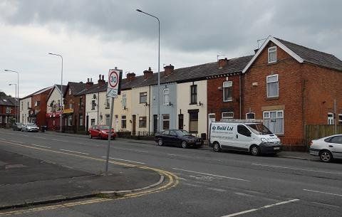
That block in July 2020 ©WDC
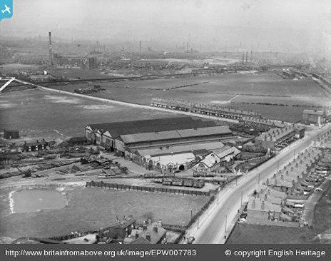
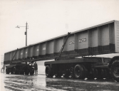
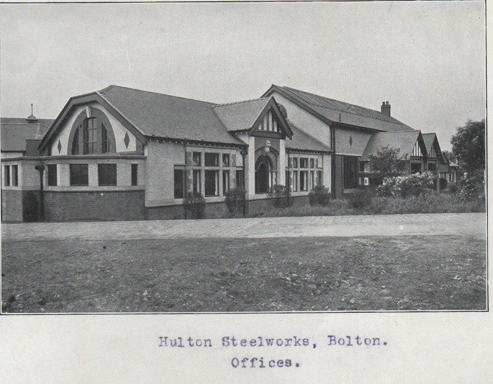
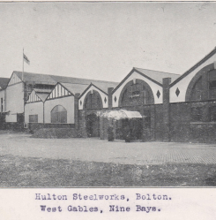
Hulton Steel works (Booth’s) 1922 (above left) www.britainfromabove.org.uk/image/EPW007782 ©English Heritage. St Helens Road is across the bottom right of the picture. The view of the offices as you came along St Helens Road (from the bottom of the picture) to that corner would be very familiar to many. Hulton Lane slopes across the picture just more than half way up. What is surprising to us now is just how little building there had been in that area. Slightly higher, the black line sloping up from left to right marks out the Bolton-Leigh railway. The far side of the embankment can be made out then the black line is a long fence made out of tarred railway sleepers dividing the railway from a footpath and a quarry..What became Hulton Lane Playing Fields is still farmers fields. The mill towards top left is Dove Mill.
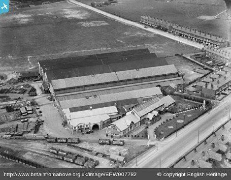
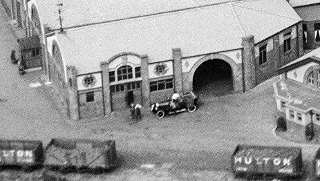
Above right: Note how many railway tracks there were to supply the steel works with its raw materials. These joined the Bolton Leigh line at Hulton Sidings. Just up from the railway wagons is an arched door way at the side of which is quite a posh car..
What trolley bus passengers saw as the passed the steel works.

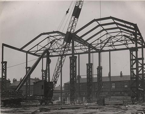

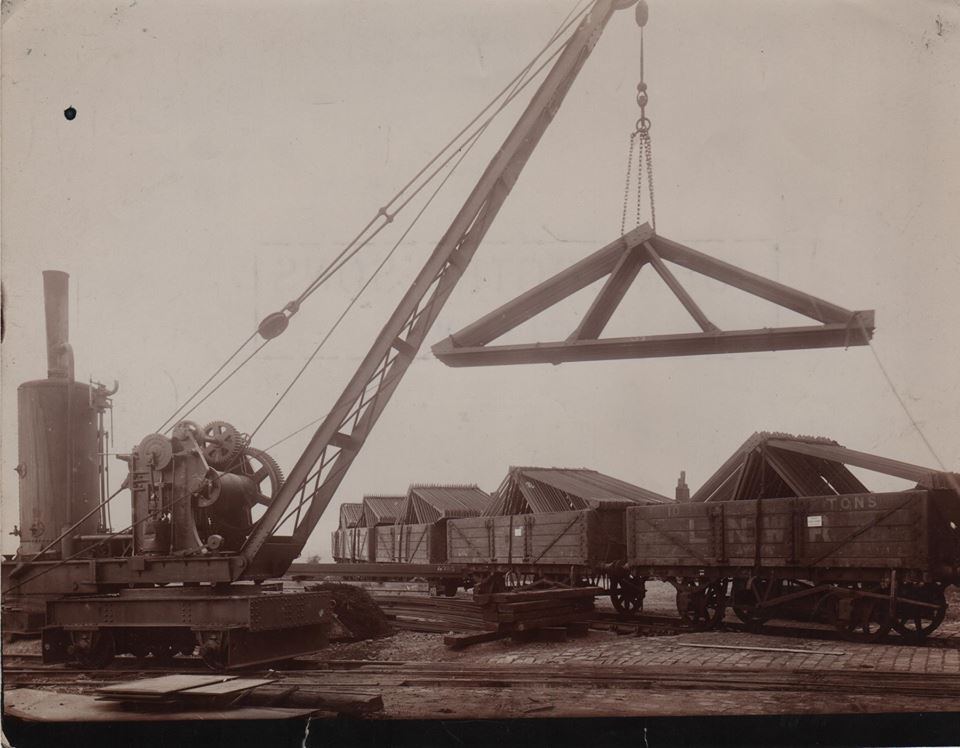
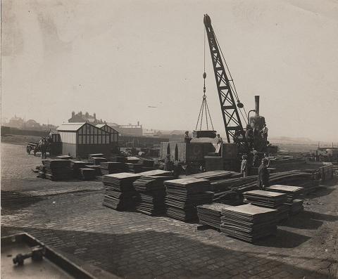

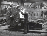
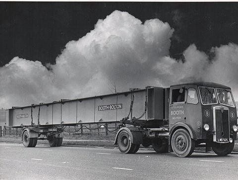
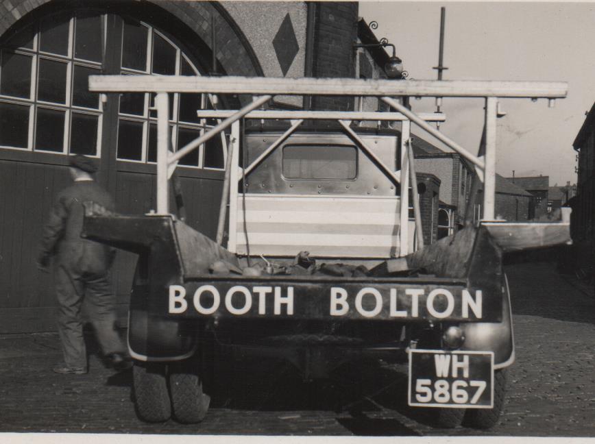
Gene Watts obtained an album containing many pictures of activities at Booth’s steel works which he posted on Facebook.
Above are just a few of them. Click and navigate using < > X
The last two pictures are from another source.
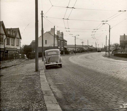
1950 St Helens Road goes over its highest point on Deane Moor, this point is also known as Hulton Mount. On the left we see the Borough Laundry. Note cobbles, trolley bus wires, Booth’s Steel works.
The cobbles off to the left, blocked by CWH 489 now go past Burns Animal Food processing plant and lead to a path across Garnett Fold which can take you to Punch Lane (Wigan Road) or Hermon Bank Farm or to Four Lane Ends. All the land is reclaimed after open cast coal mining followed by land fill c1980.
imageFile_480 Bolton Archives ©BIMS
On the other side (north west ) of Saint Helens Road opposite the Laundry.
Plane Tree Farm and Cottage, “All my own work”.
© WDC 1990
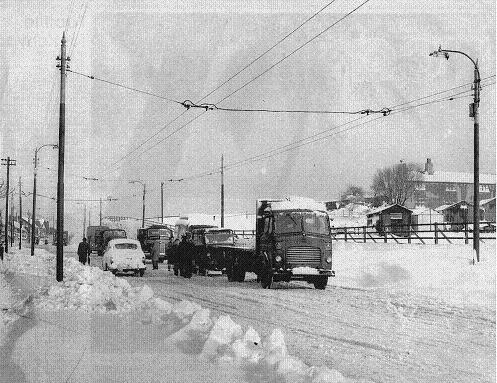
Jan 1958
A lot of snow on St Helens Road at Hulton Mount, White Gate Farm, though not nearly as deep as in 1947.
St Helens Rd: looking back from Plodder Lane up towards Hulton Mount. David Whenlock postcard.
An interesting feature on the front of the Red Lion
St Helens Road – from Plodder Lane corner looking to Four Lane Ends, Red Lion, Hulton Arms, St Andrews Church.
1968
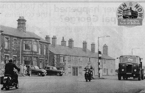
You may just remember these shops and the houses in the last block before the Red Lion at Four Lane Ends, they had to make way for the M61. There had been some hints that other shops might be built nearby but they never came to pass.
1970 There had been a large semi-circular diversion of the road at this point while the bridge over the not yet constructed M61 was built and traffic from Four Lane Ends to Bolton was behind us. The bridge is almost finished on this picture and was opened to traffic in March 1970 after which the diversion was removed to make way for the motorway.
The pair of houses which survived the M61 are still there
July 2020 © WDC
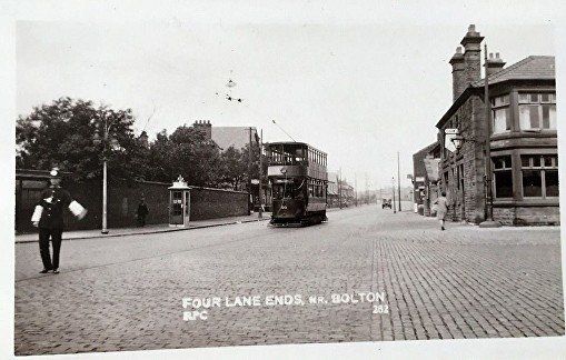
Looking back towards Bolton from the junction of St Helens Road with the A6. The Red Lion is on the right. One of David Whenlock’s postcards.
Red Lion, Four Lane Ends. We are looking along the A6 towards Walkden. The whole row of cottages now forms part of the Red Lion. At this time the one furthest right looks to be boarded up, the others may still be occupied.
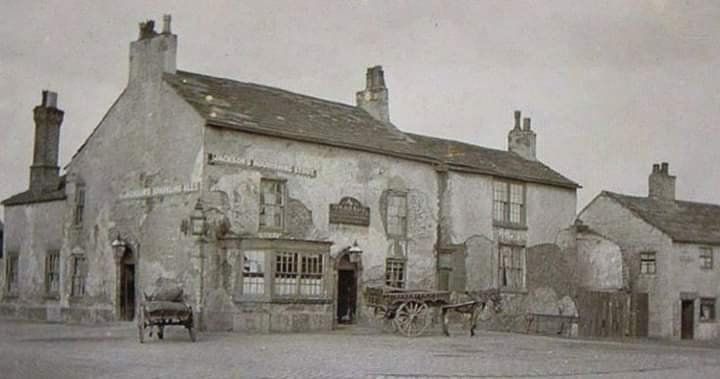
The Red Lion before its current build..
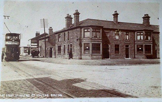
1908 David Whenlock postcard
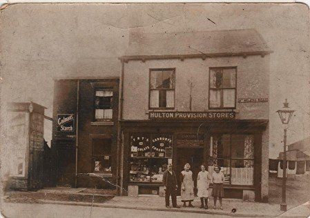
This is immediately up (towards Bolton) from the Red Lion.The structure to the left which looks like an advertising hoarding can be seen to the right of the tram on the picture above. Over the door it says CARTERS ???????Provision dealer - and more
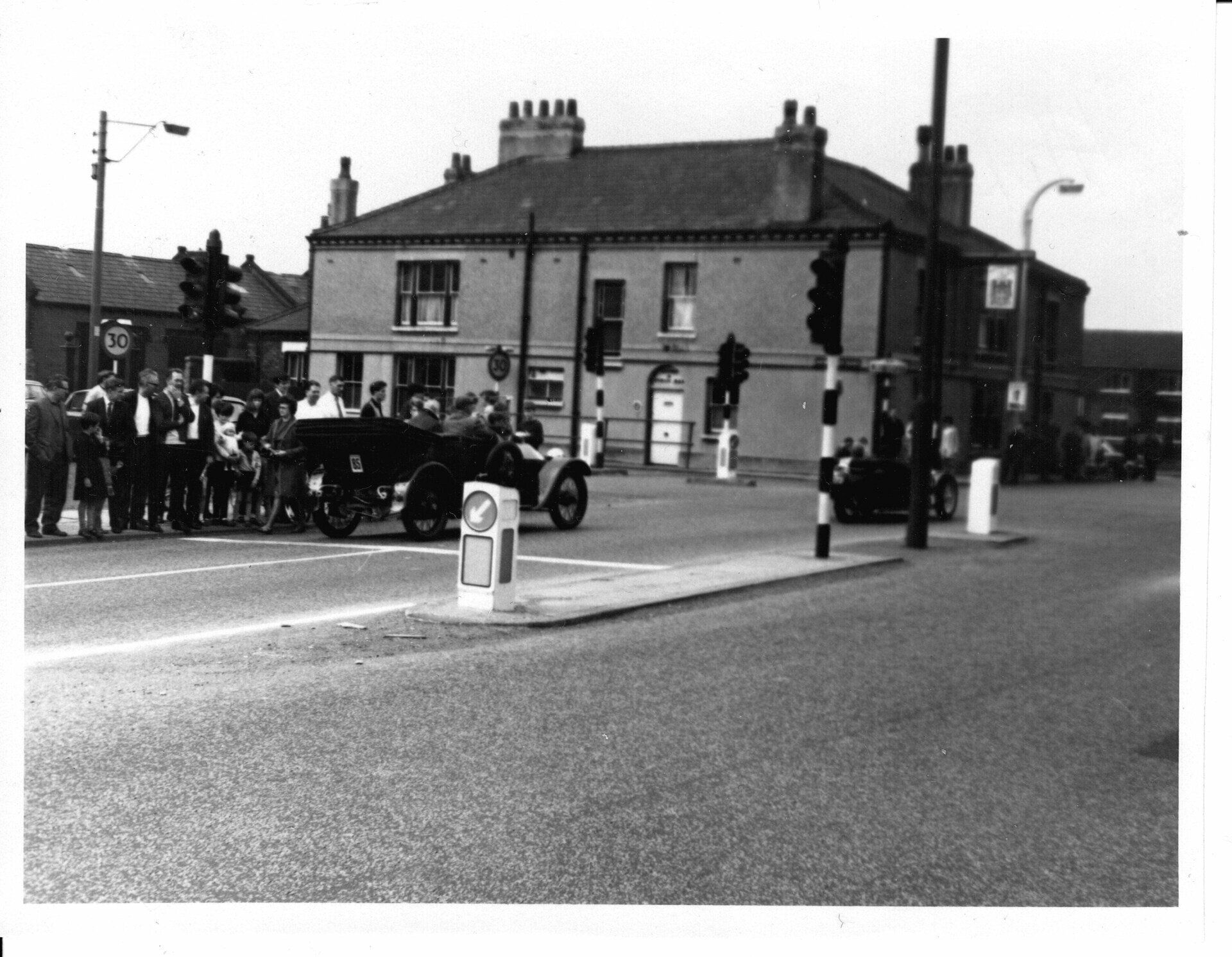
On the opposite corner of the junction from the Red Lion is the Hulton Arms. Newbrook Road to Atherton is on the left. This is probably c1977 so that car is not normal traffic. I do not know what this event is.Part was through the junction appears to be a tricycle (two wheels at front, one at rear).
(C) Fred Hosker / Jackie Nisbet
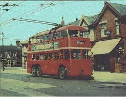
A Trolley Bus immediately beyond the A6 junction at Four Lane Ends and the end of our journey up St Helens Road.
On the next page we return to Bolton and make our way up Deane Road and Wigan Road.