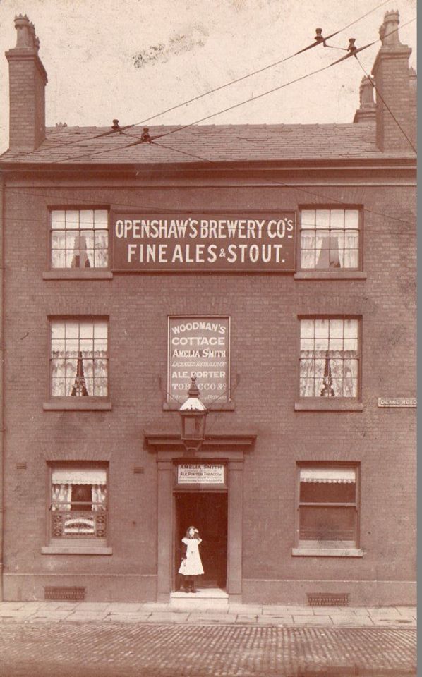
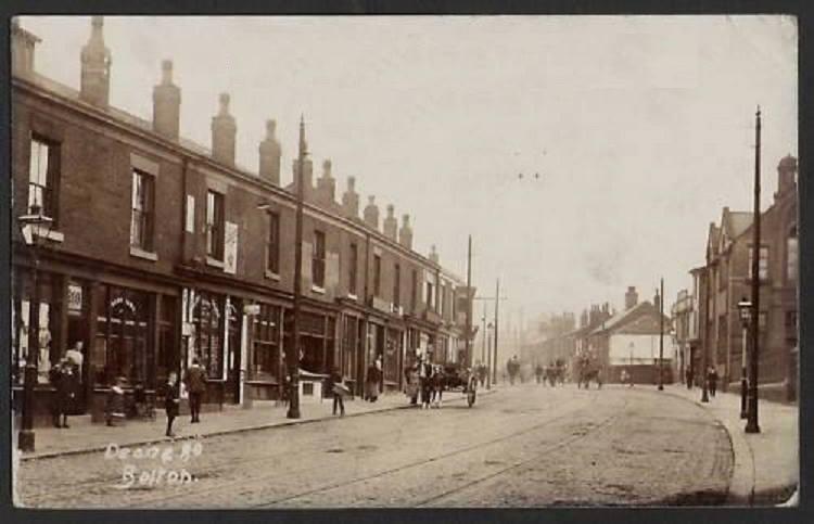
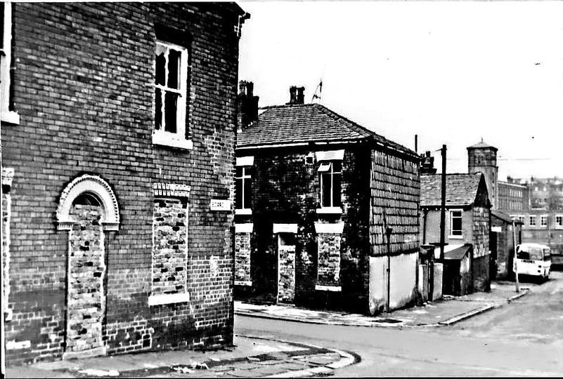
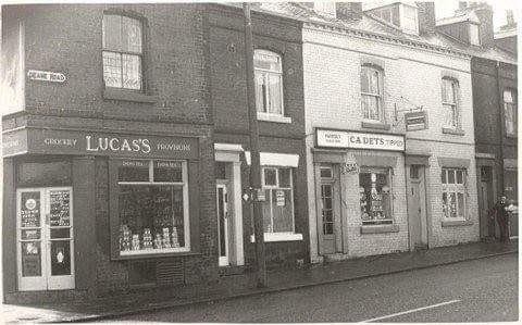
31 Deane Road
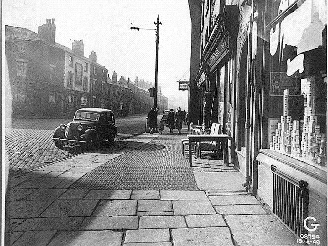
What is now Deane Road was called Blackburn Street from here to Cannon Street where it became Pikes Lane until it reached the then Borough boundary at Gate Pike, where Wigan Road now starts.
Behind us is Moor lane and to the left is Derby Street and Crook Street.
The sign is the Woodman's Cottage, 2 Deane Road which closed in 1959.
On the left the white building is The Milestone Hotel, 5-7 Deane Road, closed 1965. Next door to the left (no 3) was the White Swan, closed 1908. Immediately round the corner, off picture, on Derby Street, was the Britannia Hotel.
We look back into Moor Lane with Flash Mills and Flash Street off to the right.
The Woodman's Cottage is the first premises on Deane Road at number 2. It closed in 1959
To its right - This is Kay's Complete House Furnishers.
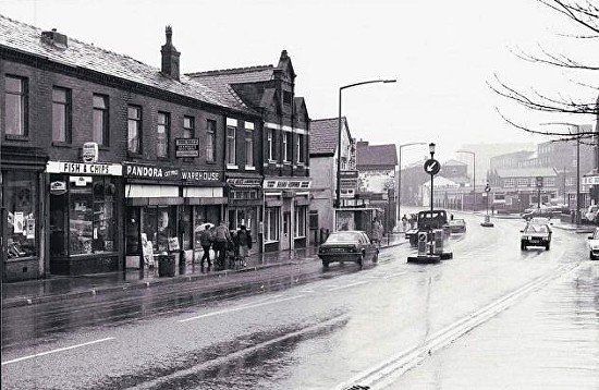
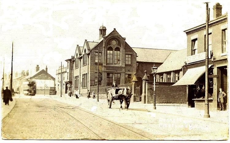
Picture below could be 1920s - it is certainly before 1947 and finish of tram service.
David Whenlocks pictures.
<<< On the odd side of the road The Milestone Hotel, 5-7 Deane Road, closed 1965. Next door to the left (no 3) was the White Swan, closed 1908.
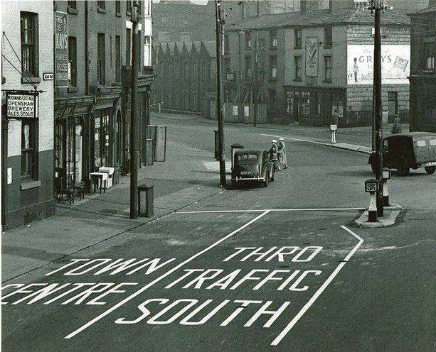
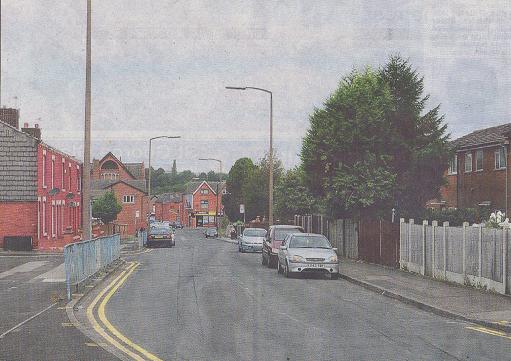
<<< experimental road junction April 1953
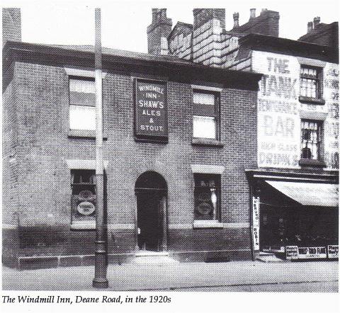
Yet another pub at the bottom of Deane Road.
The Windmill Inn, 60 Deane Road
Next door is "The Tank Temperance Bar"
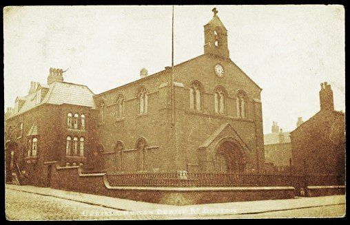
Christ Church on the corner of James Street and Deane Road. It was founded in 1841. (Apparently it was originally called Ebenezer Chapel and was renamed Christ Church on Sunday 2 May 1841.) It closed in 1933 (final service Sunday 31 July 1933, church demolished in May 1936). A football team was started here called Christ Church Football Club in 1874 by the Reverend John Farrall Wright and schoolmaster Thomas Ogden, and moved after a argument with the vicar, to Pikes Lane 1877 where the pitch was established which is regarded as Bolton Wanderers’ first home. It adopted the name Bolton Wanderer in 1877 because of the difficulty it had experienced in finding a permanent
place to play on, using three venues in its first four years of existence. Founder members of the Football League, Bolton have spent the highest number of seasons of any club in the top flight without winning the title (the 2011–12 season was their 73rd, non-consecutive year in the top flight). The closest they have come to the title is third in the First Division on three occasions (1891–92, 1920–21 and 1924–25). They played at Burnden Park from 1895 to 1997.
The above account may be slightly inaccurate. It seems that the argument with the vicar resulted in the management of the club moving its meetings (to which the vicar had right of attendance because it was an organisation in his church, indeed he was the president of the football club) to the Gladstone Hotel a couple of hundred yards further up Pikes Lane (Deane Road) (they later made the Britannia Hotel on the corner of Deane Road and Derby Street their headquarters.)
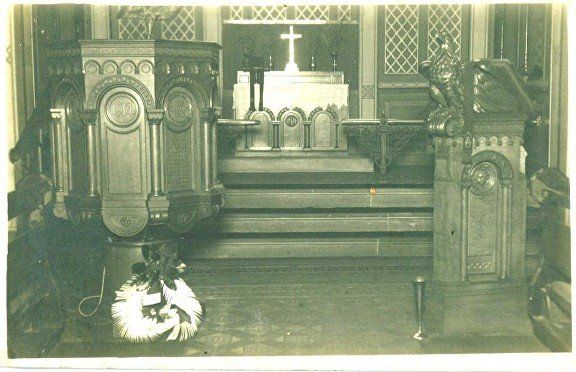
The interior of Christ Church, 1926
Posted on Facebook by Pam Smith
left: 1956. Christ Church has been demolished and the site is becoming Christ Church Gardens on the corner of Deane Road and James Street. What obviously was or had been a school on the left of the picture was at some point locally known as "The Band Room".
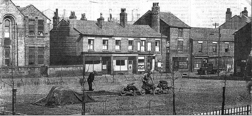
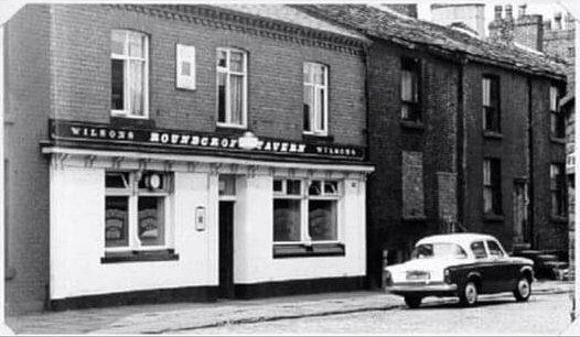
The Roundcroft Tavern at 50 James Street. It closed in 1965. The pub looks well-kept but the houses to the right are ready for demolition. The whole area was cleared to make way for the Bolton Institute of Technology.
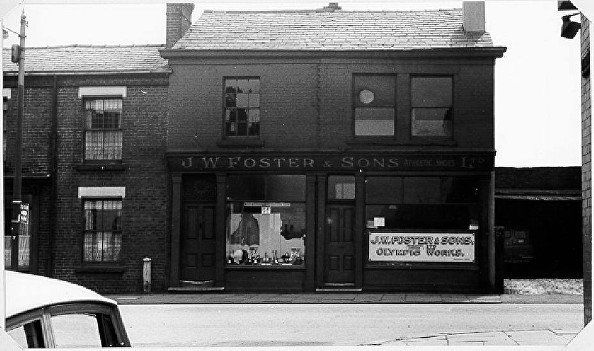
On left, Christ Church Gardens and Kirk Street, JW Foster is to the right of the next block before the lean-to. The Regent Cinema is visible to the right.
Picture from someone's album. Whose?
29th August 2013 (C) WDC
Christ Church Gardens
The sign points left along College Way, now University Way towards Derby Street.
To the right is the diverted Mayor Street towards Park Road and Chorley New Road.
It is thought that this had been the Horse and Vulcan 59-61 Deane Road.
At this time it is a site in the early history of the Reebok empire.
Another "album" picture.
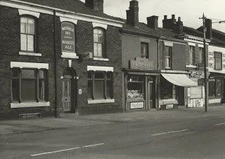
Back on the other side of the road, the Wheatsheaf Inn, 76 Deane Road.
Deane Road with John Street on the left which was a handy cut through from Derby Street especially if you had taken the trolley bus down from Daubhill on your way to the Regal cinema. For all our desires to preserve "our heritage" these premises really needed to go!
This picture has obviously been in an album and my not always sufficiently careful note keeping does not say whose picture it is. Yours?
John Street looking across to Kirk Street. Demolition here in preparation fo the building of College Way (now University Way) along the line of John Street. (Other pictures appear on the Derby Street page.)
The remaining houses would be demolished shortly afterwards and replaced by University buildings plus lawn and car park.
© John Westhead - included by permission.
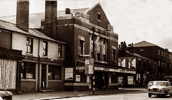
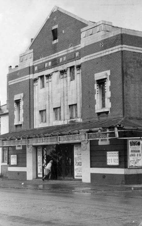
the Regent Cinema (apparently nick-named the Cosy). For a short while after film showing ceased, it did Bingo. It was demolished 1967.
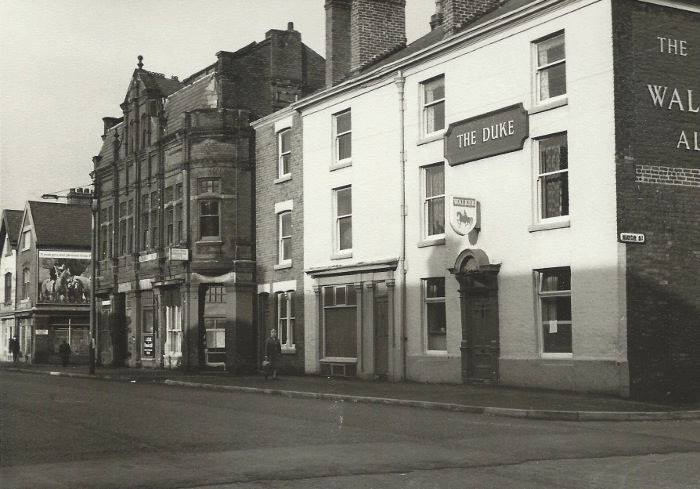
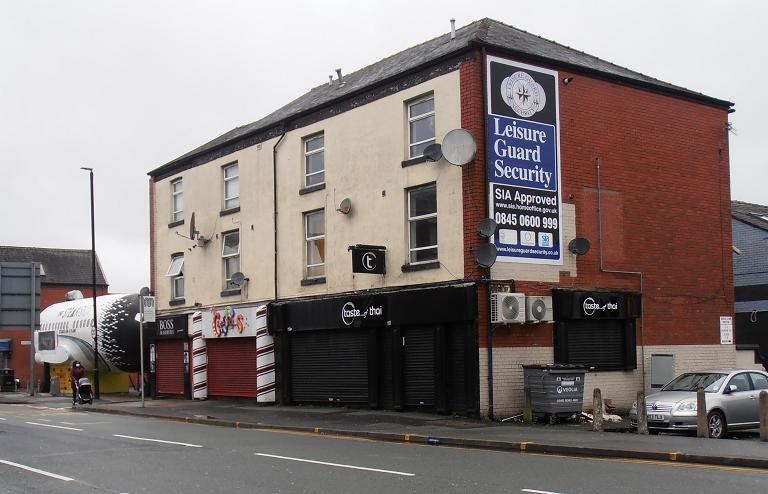
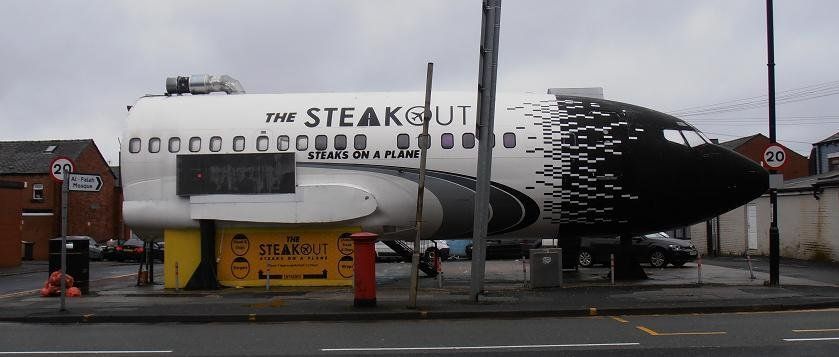
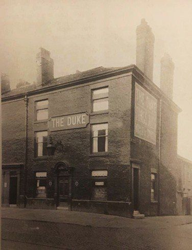
Left and below - The Duke (Archduke Charles, closed 1998 but the building still stands) on the corner of Mayor Street and the Conservative Club whose site is now occupied by steak on a plane (previously a bus).
<<<< January 2021 (C)WDC
The building now with the plane to its left.
The simple, clean lines of the pub have become an untidy jumble.
An imaginative use of an empty space.
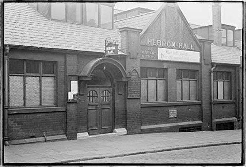
Just down Mayor Street, the Hebron Hall, a Brethren Assembly.
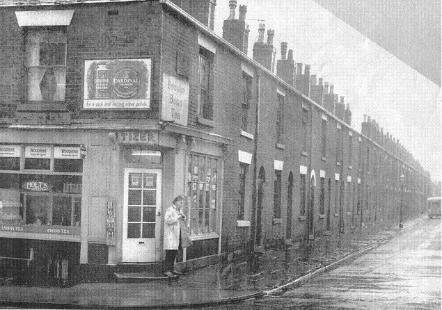
On the right as you go down Mayor Street is Mason Street with its corner shop typical of the area.
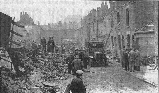
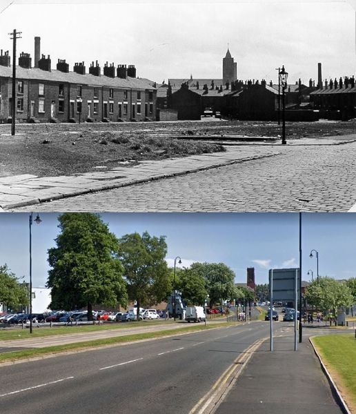
South of Deane Road roughly opposite Mayor Street was Punch Street. This is the scene of devastation on 12th October 1941 after a bombing raid. One bomb was dropped on each of Punch Street and Ardwick Street (quite close but nearer Moor Lane) killing eleven people and injuring 66.
(During WWI a zeppelin dropped 21 bombs on Bolton killing 13 people in Kirk Street on 26th September 1916.)
(Between 1st September 1940 and 14th April 1942, 64 bombs dropped on Bolton in ten raids, a total of seventeen people were killed, 29 seriously injured and 84 less seriously hurt.)
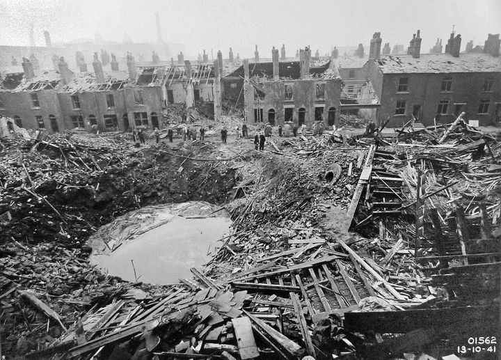
2 Picture dated 13.10.41 of damage done on the 10th.
Number 01562 and date 13-10-41 on bottom right in white. This image is from the Museum's Local History collection
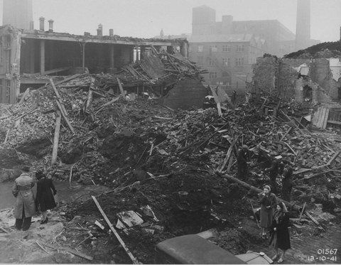
3 photograph of damage to Punch St works, 10 October 1941 depicts destroyed works building and large bomb crater.
Number 01567 and date 13-10-41 on bottom right in white. This image is from the Museum's Local History collection
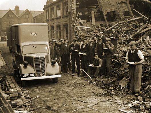
4 Punch Street Bolton Corporation Emergency Food Van 13 Oct 1941 - note the blackout headlights.
The vans were "provided by Mr Henry Ford & Mr Edsel B Ford and voluntarily maintained by Gordons Ltd" (from Bolton remembers the war).
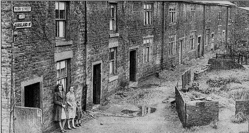
Back on the other side of the road, to the north of Deane Road and a few hundred yards west of Mayor Street was a small area known as "Pocket" or "The Pocket". Apparently that was where Mark Street was. I have not actually found this street on a map but on the 6 inch OS maps a few streets round that area are not named.
Picturesque and nostalgic but no doubt almost uninhabitable - though just imagine what COULD have been done with them.
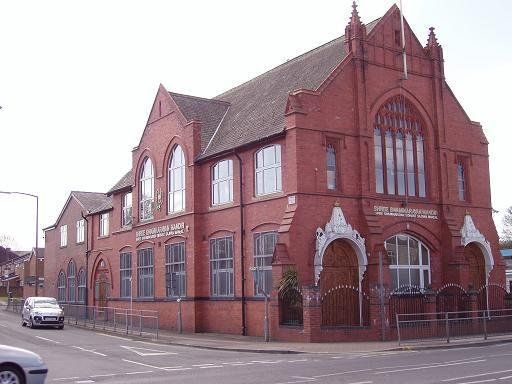
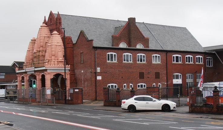
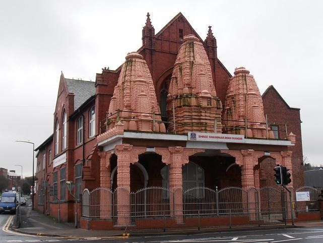
Deane Road, corner of Cannon Street. A now well established Hindu Temple in what was previously a Unitarian church which has on the exterior been subject to only minor, understated, quite attractive modification.
April 2010 (C)WDC
January 2021 (C)WDC
Bottom end of Cannon Street. The gable just left of centre with a just about discernable half-round window is the Unitarion Church. 1940. The coloured picture below was also part of the Then & Now article. The obliterated sign on the left had been the Cottage Inn (thank you Ron Hesford)
A more recent and slightly nearer view of the Cannon Street junction with Deane Road with the Unitarian clearly visible.
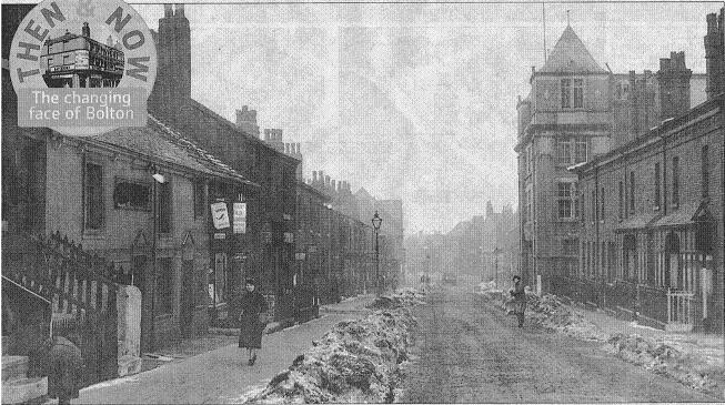
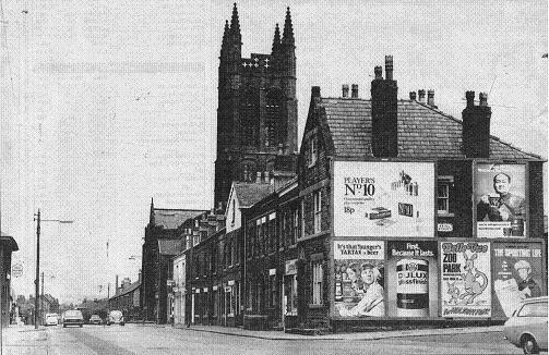
Looking down Deane Road to Cannon Street. The very pale grey block is the BIHE multi-storey building.
The building at the far end of the near block is recognisable by its style as a Co-op. This was Branch No 29
1900s
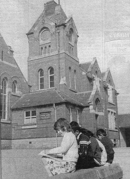
Deane Road looking away from town with Pikes Lane School on the right
Pikes Lane Board School c1910. The turning on the right is Board Street (as in Board School , administered by a Board, NOT Boarding School!)
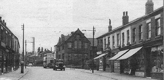
Probably 1940s Pikes Lane School, typical Victorian, now demolished and replaced by a health centre,
late 1940s. It is quite a magnificent building but apparently not what is required these days for a primary School. There is a new Pikes Lane School
behind the health centre.
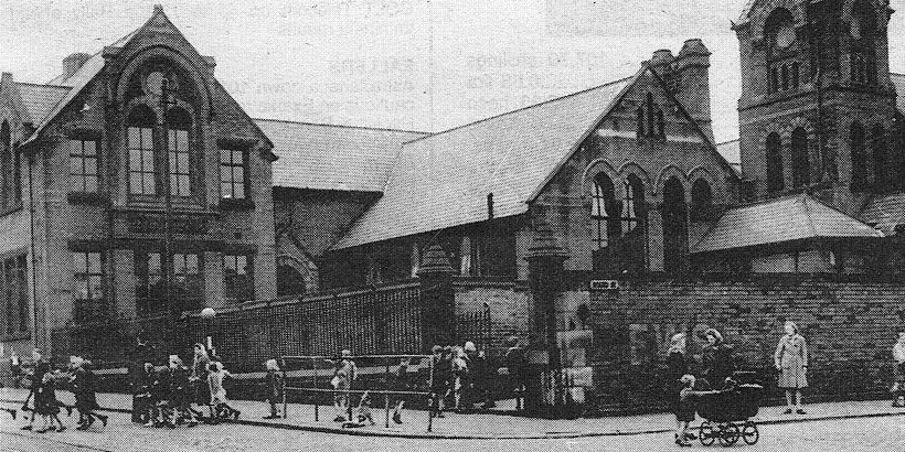
Pikes Lane School c1970
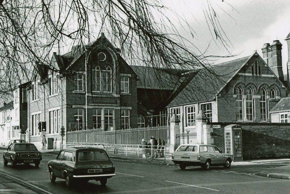
Board Street ready for demolition, presumably in connection with the building of the new school and the Health Centre.
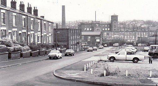
In the distance Gilnow Mill which is on the other side of the River Croal and the railway line.
Picture posted on Facebook by Michael Lever.
1949
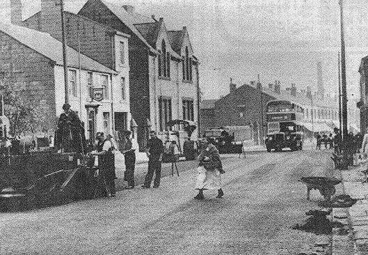
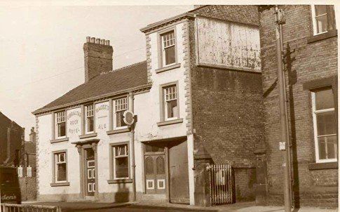
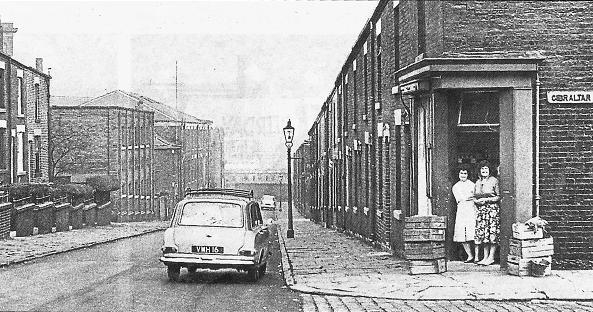
A few yards further up Deane Road looking back past the school towards town, Gibraltar Rock Hotel, lady with wicker basket, shawl, and possibly clogs
1975 picture from David Whenlock's collection. The Gibraltar Rock Hotel, now a convenience store.
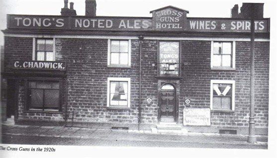
Slightly higher up Deane Road, again on the north side, The Cross Guns Hotel in the 1920s.
A view down Gilnow Lane with houses on the right still standing and a "corner shop" on the corner of Gibraltar Street.
Gilnow Lane somewhat later. Gilnow Mill is on the other side of the Middlebrook and the railway.
Recent demolition for the construction of the new Primary School. House on the left are still standing (2021)
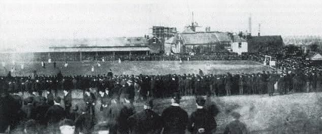
Pikes Lane football field - an early home of Bolton Wanderers. This was behind the houses on the other side (south side) of Deane Road from Gilnow Lane.
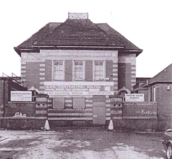
On the right off Deane Road the building which had been the Co-op laundry. At this time it is occupied by the Initial Swim School and a couple of other private businesses.
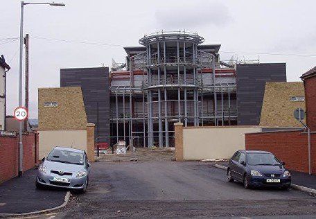
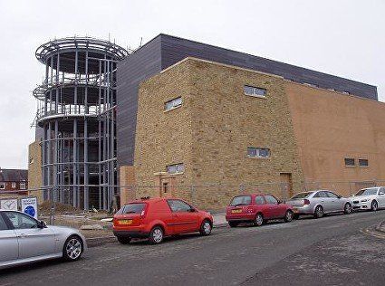
The laundry has been replaced by Amir Khan's "Wedding Venue". At the time of this picture February 2017 work has been paused and some discussions were on-going as to whether the building might ultimately have a different purpose.
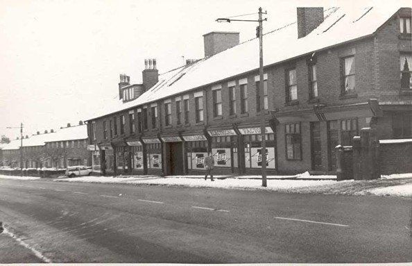
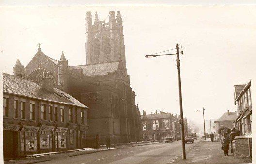
This block of shops on the south side of Deane Road (left hand side as you leave Bolton) is almost entirely occupied by Bolton Wholesale Electrical Factors. Different shops including carpet sales have occupied this block since.
Hove St at the left of the block, Saviour's Church was to the right.
Bolton Wholesale Electrical Factors and St Saviour's Church with Bankfield Street beyond it.
Picture posted on Facebook by Vince Wayne.
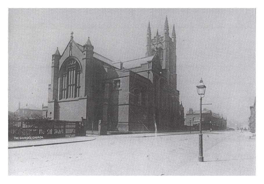
Saviour's Church was built between 1882 and 1885. It cost about £20,000 (£1,930,000 as of 2015), and was paid for by Thomas Greenhalgh, an Evangelical mill-owner. Thomas inherited the money from his brother Nathaniel, who had died in 1877, aged 60. It was one of two churches in the area financed from this inheritance, the other being All Souls Church. Both churches were designed by the Lancaster architects Paley and Austin. St Saviour's was demolished in 1975. The church was faced in red brick with Longridge stone dressings. It had a west tower with a stepped pierced parapet, and pinnacles rising to a height of 137 feet (42 m). The nave was 86 feet (26 m) long and 50 feet (15 m) wide, in five bays with large transepts on the sides of the eastern bay. The transepts led to aisles on the north and south sides of the chancel. The church provided seating for 804 people. It had a seven-light east window containing stained glass by Burlison and Grylls, and a west window with glass by Shrigley and Hunt. The architectural historian Nikolaus Pevsner referred to the church as "one of their [Paley and Austin's] noblest churches". (Wikipedia)
This picture was taken before the properties to the left (Wholesale Electrical) were built but the properties beyond Bankfield Street are already there. This is the Church of the Saviour, more usually called (The) Saviour's Church. It is sometimes, incorrectly called St Saviour's a title given to it in Wikipedia which also places it in Astley Bridge (confusing it with All Souls). There is a St Saviour's in Ringley, Stoneclough.
<<<<Junction of Deane Road with Bankfield Street, St Saviour's Church immediately down from Bankfield Street. Picture posted on Facebook by Linda Webb.

1971 Junction of Deane Road with Oriel Street. The Council had just decided that there were too many advertising hoardings defacing Bolton’s roads. The immediate intention was the removal of 61 displays on Deane Road and Wigan Road, said to be inappropriate and visually offensive. This is Deane Road’s most cluttered gable end on Oriel Street just above the Church of the Saviour. Ironically, the adverts are still there but the Church is long gone, as is Belle Vue, but adverts for beer and baccy have now also been removed.
The first street on the right is Gordon Avenue which is the dividing line between Deane Road and Wigan Road.
The hoardings are to the left of the garage - originally Aranda Garage - but now a Tesco local with petrol sales.
1949
Looking across Middlebrook to Saviour’s Church and Merton Mill
1939 BEN
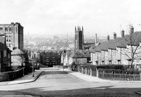
Looking from the start of Wigan Road into Deane Road, Deane Methodist church on left, Saviour’s Church on right.
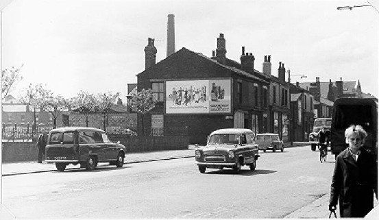
David Dawber supplied the following information: Chimneys left to right: Big Bertha (destructor chimney), Egyptian Mill, Cannon's Mill with smoke, Power Station twin chimneys (one hidden by the smoke), the cooling tower with the big power station chimney in front, Denvale Mill, St Helena Mill, Bark Street Tannery, Ryder Bros., Holdsworth's, Dart Mill, Carter's, Peel Mills, Flax Mill, Holt's, Victoria Mill (Dean Street), Tillotson's, Eagle Mill and Flash Mills. I think Slater's Bleachworks chimney must be behind Carter's chimney.
Churches visible are: St Paul's Deansgate, St George's, St George's Road Cong, and Emmanuel (in front of Holt's chimney).
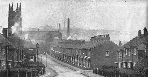
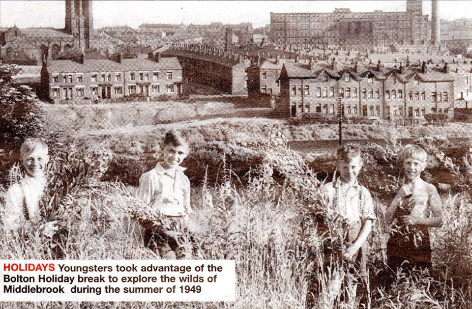
1949 To the south of Deane Road are a number of very steep streets leading up to Willows Lane. Streets the other side of Willows Lane then drop rather less steeply to St Helens Road.
The people are standing on what was locally known as Spion Cop. One version of this picture was labelled Nebo Street, the alternative "the top of Quebec Street/Horeb Street" is essentially the same place.
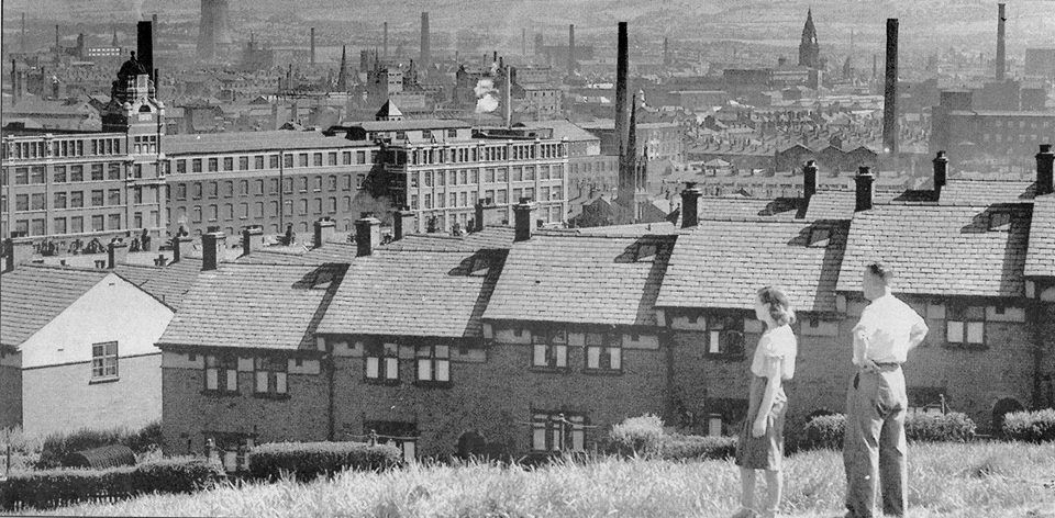
Church right in the middle is Emmanuel church, just off Cannon Street, converted into flats about 1999. The mills to the left mostly gone, but some parts left, facing on to Deane Road owned by Holt’s Hosiery (though a mill that has their name on is closer to Derby Street), where Damart was for a few years up to 2009. The many chimneys make a typical Bolton view. The moors are just visible beyond the town..
Bankfield Street, looking down to Deane Road.
1964
Bankfield St from the corner. We have lost the chimney but gained Saviour's Church viewing from this angle. Posted on Facebook by Gene Watts.
March 1963, Oriel Street, another steep hill down to Deane Road, the next one up from Bankfield Street.
Gordon Avenue with Deane Road to the left and Wigan Road to the right.
(C)WDC January 2021
On the next page we continue up Wigan Road.